Beartooth Mountains 2011
Ever since having seen the Beartooth’s topography while browsing 7.5’ quads some 3 years ago I have been itching to get in ‘em. Last year saw them still waaaay too packed with snow when July 4th came, and I was afraid that my date of July 25th was going to be problematic this year with still lingering snowpack from a crazy snow year. Turns out, it was just right.
Day One
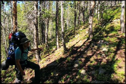
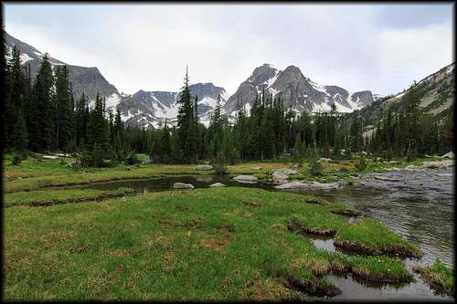
So after getting junior off the ground, picking up Mark in Salt Lake City, and spending a night at a quaint little hotel in Dubois, ID ( separate beds ), we found ourselves at the West Rosebud trailhead at Emerald Lake. The road being washed out at the true trailhead another mile & ½ up. Clear skies started us out and we made quick time to Island Lake and camp near its outlet, passing numerous fishers along the way, some w/ good strings meant for the frying pan. And just a couple miles in the 1st injury of the outing, a snapped leki ! So we stashed the injured pole and promised we would return. Night 1 was really warm, just the skivvies under a 15 degree bag opened as a quilt and still a little on the warm side. And mosquitoes were present but fairly light, repellent staving off what there was.
Day Two
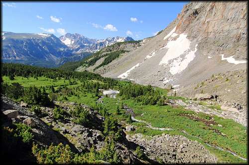
After waking we started up towards the valley bridging the gap of Mount Hague and Mount Wood, intent on gaining Mount Woods lower flanks from there and up and on to the summit. Going was straight forward down low along the stream which ran from the valley’s heights all the way to West Rosebud Creek below, but eventually terrain steepened and it wedged itself in a narrower gorge we wanted no part of. So we abandoned it for steeper slopes above, winding thru trees to find gentler slopes and the hanging valley we were aiming for. Very nice meadows greeted us here, and a very robust flow of water winding its way thru.
Upon 1st entering the valley we saw a grizzly bear print in the soft earth, a small one. But no bears. Flowers were in full bloom, as they would be everywhere we journeyed. Red and yellow and purple and orange carpeting the ground. Just beautiful.
We found a small creek flowing down from Woods flank and followed it up to higher, relatively flatter and more rock strewn ground above.
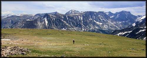
Views were fantastic as we trekked along the high plateau.
With the final scree and talus slope before us we paused for a break and assessed our route up. A large snowfield was still present and above that, rock steep and shifty. I thought Wood was a class 3 scramble, but it looked chossy from our vantage below and we decided the experience so far was worth it alone, so we enjoyed some big views and then headed down.
Tonight temps were more appropriate for a mountain trek and full sleeping regalia were in order, although as always the bag was splayed open as a quilt. I can’t abide the confines of being zipped up in a mummy bag, I’ve had too many panic attacks in the middle of the night, unable to get that damn zipper open quick enough to escape its claustrophobia inducing cocoon.
Day Three
Waking and breaking camp we headed now for Arrapooash Lake. First side hilling a pretty gentle trajectory up along the slopes above the West Rosebud, then striking a large rock slide, and after that the outlet stream from the basin above. So it was away from the narrow gorge and its raging torrent of snowmelt to a more directly uphill trajectory of the steep slopes
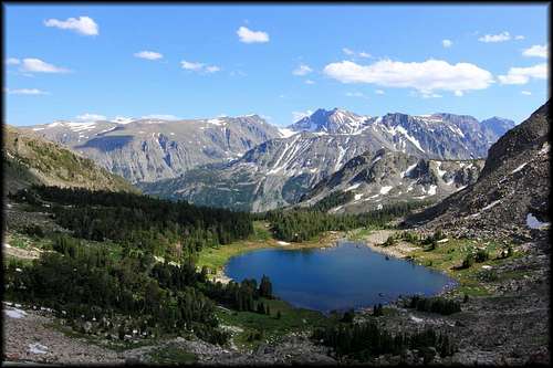
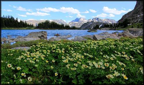
until the grade mellowed, the trees and downfall thickened, and a few small meadows were passed before breaking out at Arrapooash Lake. We found a good camp and staked our claims, then went to investigate the western nodule of the basin. A very nice waterfall was coming over short cliffs above Arrapooash, and a wandering stream then led us to Little Face lake.
We relaxed a bit then continued a circuit around the basin above Arrapooash, circling over to the east now thru rock and grass.
Along the way we scoped out our intended objective of the next day, the pass leading over to Woodbine Creek. I had wanted to climb Mount Hague but we decided the grassy slopes were still very steep from this high in the basin and decided to forego it. But the pass to Woodbine looked very reasonable and so we retired to a now mosquito thick camp, which would be the norm for the rest of the trip, hungry, aggressive little shits that barely took deet as a “no” in answer to their wandering proboscis.
Day Four
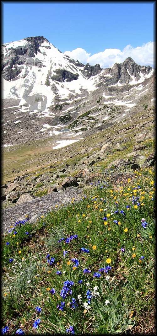
So we rose and made our way towards the pass to Woodbine Creek, 1st up rocky and grassy slopes to a beautiful, flat grassy bench w/ a small lake and many flowers, then the final, very reasonable talus slopes to the top.
Views from the pass were great, and we worked our way over to the west a hundred yards or so for the easiest way down the Woodbine side, which consisted of small, loose rocks in the middle flanked by larger, more stable rocks to the side. Eventually we made it down to a large snowfield and then began picking our way down benches of grass and forested slopes and rivulets to Woodbine Creek below.
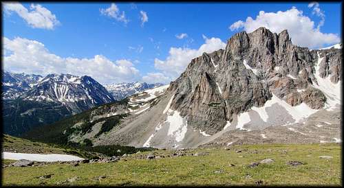
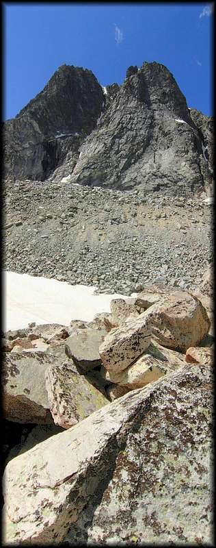
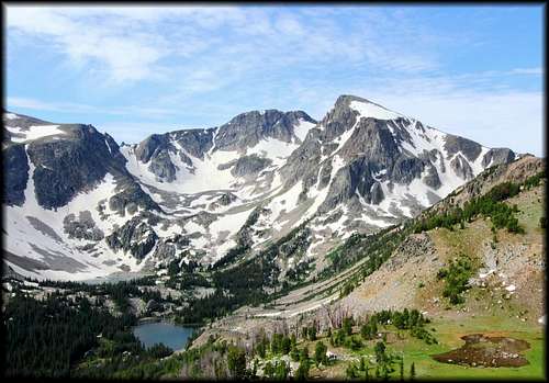
This was a great area, and one I had been eagerly anticipating. It did not disappoint. Twin peaks from this side is a jagged, drunken ridgeline culminating in the twin fangs of Twin Peaks w/ sheer cliffs falling into the basin below.
We wandered along Woodbine Creek and up to a lake dotted bench before turning around and heading back the way we came, up and over the pass again
and back to camp to make ourselves available to the hoards of mosquitoes which were depending on us to be able to feed their families w/ our sweet, sweet blood. I had hoped to be able to connect Woodbine Creek to Weeluna and Nemidji lakes basin, but it was obvious from Woodbine Creek that what was questionable on the topo, was not a possibility on the ground.
Day Five
So having decided to not ascend Mount Hague, we began a move to Weeluna and Nemidji lakes via the lake basin south of Arrapooash. The going was simple and the hike up to the pass was grassy but steep in places. Once up we had a fine view down into the West Rosebud Creek drainage, a green strip encased by towering and broken peaks and ridges, and up towards its headwaters.
We began traversing along the ridge towards Weeluna and Nemidji, but it became apparent there would be no simple way down. With packs on backs good options were absent, so we backtracked towards the mouth of Arrapooash basin and returned to the West Rosebud, intent to return to higher ground and camp at Frenco Lake for the evening. But the unmaintained trail up was missed and so we stayed at Silver Lake for the evening.
Day Six
Another morning of breaking camp and moving on, we started angling towards Frenco Lake through open understory and steep slopes until we gained the mouth of the basin and picked up trail. Here it became decidedly more dense and slower going, especially after our trail again disappeared all too soon after a stretch of cairns thru rock fall. Deadfall and thicker brush kept us at a more deliberate pace now. But we gained Frenco Lake and made a camp not far from its outlet in even more mosquito infested environs than we’d encountered so far.
We also were lucky enough to time it just right here for some sort of fly hatch. Yaaaay. It was still quite early in the day so up we went to the pass joining Frenco Lake basin w/ Storm Creek. More fine, fine views.
I wanted to gain the plateau above to access Storm and Little Park mountains, and a way presented itself but involved some uncertainties on scree and broken rock bands, so that option for another day we decided to forego as well. After watching the clouds move thru and dapple the lands below w/ mottled ever changing light, then becoming steadily more overcast, Mark returned to camp and I continued down to Nugget Lake, then Beckworth. Both fine destinations ringed by rocky ridges and peaks.
Nugget w/ a gushing waterfall from a cliff above, which then found its grassy borders before joining its stiller waters. This was a basin I had been eagerly anticipating as well and it also was not a disappointment. On returning to camp it was a hasty dinner to avoid being eaten by mosquitoes, and then a short rain storm before skies cleared up.
Day Seven
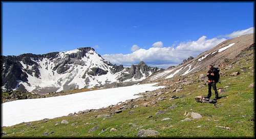
Today we day hiked up to Twin Peaks. Again, steep slopes and some talus to start, followed by a flat spot in a shallow, gentle basin w/ a lake ringed by grass and flowers, then more steep slopes to the rocky, grassy flower gardens of the plateau of Twin Peaks.
And a final push over talus to the summit. It commanded fine views, as had the entire trek, and we lingered in the strong and chilly wind as long as we could, and then a bit longer, before heading down and hugging the rim of the plateau that ringed Weeluna and Nemidji lakes below.
Weather started out clear, then steadily clouded up until arriving at camp and rains again, which persisted into the evening and night.
Day Eight
So today we again broke camp, and having already shaved some days off the itinerary due to topography decided to head back down to the West Rosebud at Silver Lake, and up to Star Lake via a good unmaintained trail we had followed a couple days earlier, mistakenly believing it the boot path to Frenco. Weather was still cloudy and rain began in earnest not long after camp was broke. Mark had developed a tender spot on the ankle as well, likely from all our side hilling under load of pack and all the twists and turns our feet and ankles had endured so far. By Silver Lake it had become apparent it was not going to work itself out today and he would need a rest day or 2 to avoid more debilitating issues. It also became apparent that rain was intensifying and now clouds engulfed everything, making the going one of moving through a glowing fog w/ no high peaks or ridges to be seen. So at Silver Lake we decided that given his ankle, the difficulty of moving through unknown terrain in steadily increasing rains, and the fact that already our original itinerary was nearly complete but for Huckleberry Creek drainage, we decided to say goodbye.
![Island Lake]()
I was honestly more concerned for Marks ankle, as benign as it was, than anything else. Also, I am not capable of staying static in a tent for a day, let alone an unknown amount of more time if weather did not clear. So we found ourselves back at the crowded trailhead by mid afternoon, and then the Cowboy Grill ( ? ) in Fishtail for real food again. Mountains stayed socked in for the rest of the day, and as we drove to and through Bozeman towards Idaho Falls, we hit big storm after big storm. At a gas stop the cashier told us forecast was for rain the next 24-48, then becoming less cloudy. So maybe coming out worked just fine. Better to end on as positive a note as possible than let a bad few days at the end buzzkill the whole experience. I am sure I’ll be back, this place enchanted me. The more time I spend in the northern Rockies the more I love it.


Comments
Post a Comment