
Viewing: 1-1 of 1

EastKing - Nov 23, 2012 7:22 pm - Voted 10/10
Beautiful!!!Can't wait until Part 3
Viewing: 1-1 of 1
|
|
Trip Report |
|---|---|
|
|
45.16267°N / 109.80972°W |
|
|
Jul 30, 2012 |
|
|
Hiking, Mountaineering, Scrambling |
|
|
Summer |
See Part 1 Here
After a nice stop in Red Lodge we began the drive north towards the small town of Roscoe and continued on the road to East Rosebud Creek Trailhead but stopped a mile short and turned off at the Phantom Creek Trailhead and pitched the tent for the night. When we woke the next morning there were a few cars in the small parking area and I overheard a couple families with kids getting ready for a nice backpacking trip. We slowly got up and packed up and got ready for the approach hike to Phantom Lake. Our visitors were off about a half hour before us but after only a few miles up the trail we caught up to them, along with various other day-hikers at the slough ponds. We talked awhile and we found out the family who woke us up were the owners of the outdoor shop in Red Lodge, which we had just purchased a few things at the previous day. He pointed out Mount Peal to me and I got more excited. Mount Peal was going to be the only peak we climb on this particular approach. We continued up the trail as it climbed gently rising more up from the valley floor until we hit the first switchback leading up to the Froze-to-Death Plateau. Here at a small cairn was a boot path that continued further up to the head of the valley. We followed it as it reached the base of a steep, loose talus slope and we climbed up towards a small saddle. Six hundred feel of elevation gain on horrible rock got us to the saddle and we made a nice walk through a small canyon and around a tarn before reaching Phantom Lake with lots of daylight to spare. We located a nice open place to pitch the tent and started fishing. Low and behold, the very first cast we caught a fish! I began the gutting process while Stephan continued fishing. We were shocked how easy they were to catch. Our previous fishing lakes we visited proved difficult to catch fish but here they were biting on every cast. So we made a small fire and cooked 6 fish in total. This was a great addition to our dinner since we had been lacking protein for the past couple weeks. Later in the evening the guys we talked with earlier got to the lake with their young kids and I was impressed with their effort climbing that talus slope. Right as it got dark we went to sleep full and ready for a nice climb the next day.
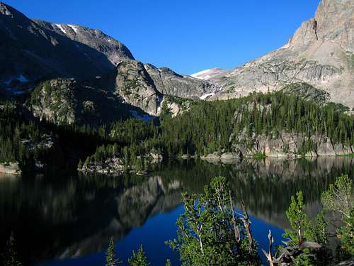
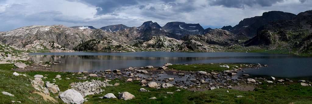
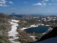
The next mornign Stephan decided to take the day off so I continued up myself. I made the easy hike around Phantom Lake and continued up the valley through some bushes and off the boot path at times but eventually got to treeline right at a nice waterfall. I searched for a way to mount the slabs above and walked very nice slabs along the side of the creek all the way to Froze-to-Death Lake. Man this lake is spectacular! A huge, deep blue colored lake stretching nearly a mile long. Walking around it wasn't too bad but due to a cliff I had to climb up and around a ways to avoid getting wet. I weaved through the valley on nice grass and crossed the small stream connecting Froze-to-Death and Turgulse Lakes. I was shocked to see these two giant lakes had only a few feet of elevation difference between them. I began climbing up a small ridge heading up towards a small green tarn at the base of the East Snowfield on Mount Peal about 800 feet above Froze-to-Death Lake.
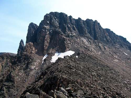
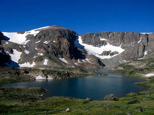 Froze-to-Death Lake Froze-to-Death Lake | 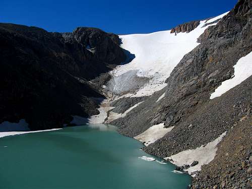 Looking to the E snow slope on Mount Peal Looking to the E snow slope on Mount Peal |
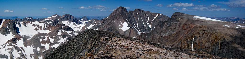
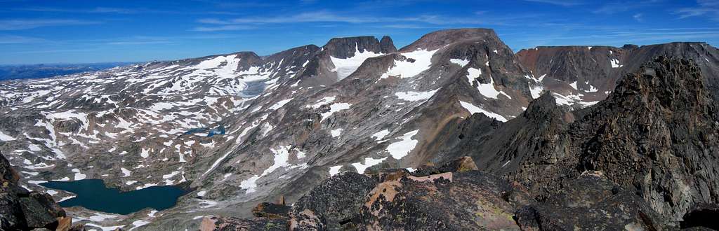
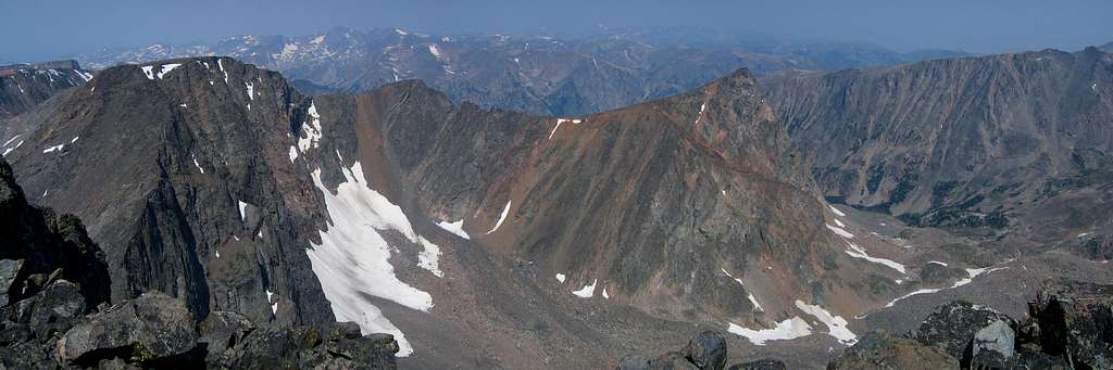
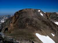
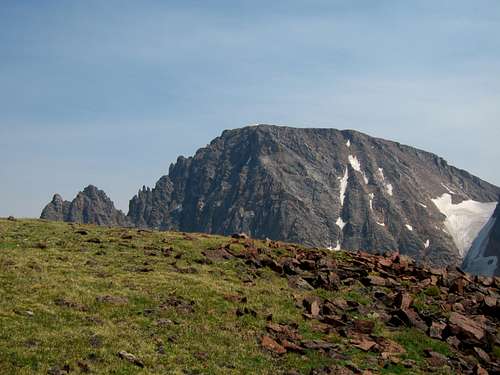
The photo at the right above shows the green tarn I came to at the base of the snow. I had to traverse around it on the right which was no easy task the way I went. I stayed too high and found myself traversing an ultra-loose ball bearing slab above a cliff...yikes! I managed to get across and reached the very wet and dirty snow shortly after. This used to be a glacier but I could easily tell it no longer was. Water was rushing below my feet under less than a foot of slushy snow. I ascended the very mellow snow and veered right as it steepened. I continued west directly towards Mount Peal and before I knew it I was at the top of the snow slope and I had a simple ridge walk to the summit where I got my very first look of Granite Peak up close. All I could think of was WOW! I was very excited to climb that and I knew the time was coming. Granite Peak was our next objective. The sun was out and it was warm and calm so I sat on the summit for over a half hour before leaving. Views of Granite Peak and Tempest Mountain were stunning.
 Climbing the Peal snowfield Climbing the Peal snowfield | 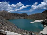 The small tarn The small tarn |  Froze-to-Death Lake Froze-to-Death Lake | 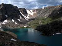 Turgulse Lake Turgulse Lake |
So I began the descent which was at first on the ridge but when I reached the snow once again the fun began. Many consecutive glissades brought me back to the small green tarn where I dried out my stuff. I continued back down to the lake and on to camp where Stephan was waiting. I took a nice long break and we packed up and made the hike out. We treated ourselves to a nice Burger at the Grizzly Bar and Grill in Roscoe. We noticed the entire town was there. The next place we headed was to the West Fork Resebud Creek Trailhead and Mystic Lake to climb the peaks around and including Granite Peak. We drove up close to the trailhead and found a nice spot to pull off and camp in the national forest.
We slept in late and got to the trailhead where I met someone else I knew! The same mountain guide lady who gave me a ride up the Yankee Boy Basin Road the previous summer as my car couldn't make it the whole way was here at the same trailhead in Montana. She was guiding someone up Granite Peak. She recognized me right away and we talked awhile and exchanged plans. They were off on the trail before us and by the time we started hiking towards Mystic Lake another hour had passed and we didn't see them again until the next day. We got to Mystic Lake around 1PM and noticed it was clouding up considerably. Little did we know this was going to be the wettest and stormiest day of the entire trip! We passed by numerous day-hikers at the enormous Mystic Lake, many of which were fishing. As we continued further west towards the other side we saw less people and shortly before reaching Huckleberry Creek we saw dark clouds quickly moving in. Just our luck though we saw a cave in the rocks just off the trail. Stephan and I both thought the same thing..."It's about to downpour!" and without even speaking a word we both made our way to the cave seconds before the rain started. Talk about perfect timing! We took the packs off and waited for over an hour for the heavy rain to stop. When it did we emerged and prepared to continue up the boot path up Huckleberry Creek.
As we hiked up the Huckleberry Creek Valley it began raining again...only this time even harder. We saw lightning strike very close to us on the ridges and peaks above us and the thunder was deadening. This was one of the worst storms I have been in. Staying dry at this point was impossible. We just kept pushing on and we finally reached Huckleberry Lake. We had to walk around it on wet talus and bushes as it continued to rain. This would be the only lake I hate during the whole trip and the only place I have no interest at ever returning. We agreed to pitch the tent at the first large enough place we find. Just as we reach the south end of the lake we find an area just big enough right on the trail so we make quick work of pitching the tent. Everything was soaked but we manged to keep the crucial things like sleeping bags dry and we simply ate a snack and west to sleep. There was nothing else to do even though we still have a couple hours of daylight left. We decided just to finish the approach to Princess Lake the next day. So that is what we did. We woke to sunny skies and brought everything out to dry. The nice thing about the Rockies is that stuff dries fast! Soon enough we continued up to Princess Lake which was a bit steep especially with packs but we got to the lake and decided to just relax the rest of the day. We fished all afternoon and managed to catch lots of great tasting trout. I'll have to say the money we spent on the fishing stuff and the license was well worth it. After another nice filling dinner and a long days rest we went to bed again. Just as it was getting dark we saw the mountain guide and her client coming down Granite Peak. They mentioned it was a great climb but long. My excitement was too much to get much sleep. I remember getting up to go retrieve the food bag to eat more in the middle of the night. The next morning we got up at 3AM and our biggest failure of the whole trip was about to go underway. We would have been just as well off if we got up at 4:30 as we wasted over an hour fumbling around trying to walk around Princess Lake. I walked across the narrow rock band in the middle of the lake after getting fed up whacking through wet bushes. Stephan continued around the lake shore and we never saw one another for the next hour. I reached the other end of the lake and stopped to change a sock as my foot slipped and got wet halfway across. I then continued around the lake too far and completely missed the waterfall way to the climbers left. I was completely turned around and once twilight came I finally was able to locate the inlet stream and waterfall. After thousands of calories burned whacking through bushes and talus I reached the base of the waterfall and found the boot path climbing up the right side of the falls. Stephan managed to go too far right up in the trees. It wasn't until the sun rose when we finally met up again above the waterfall near the first Snowball Lake. I had reached the top slightly before him and wisely stopped myself from going any further knowing he would hear my yells if he was in the large valley above me. Once we met up again we complained a lot and continued up past the Snowball Lakes and on to Avalanche Lake. From here we took a break and we agreed to split up once again. Since I was going to also climb Tempest right before Granite I went on ahead hopping the talus around Avalanche Lake and making great time towards the Granite-Tempest saddle. The remaining snow was nice to climb on since all the talus up this valley was dropped by glaciers and loose as hell.
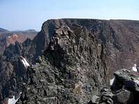
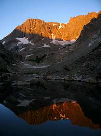 Mystic Mountain Alpenglow Mystic Mountain Alpenglow | The small tarn | Turgulse Lake | 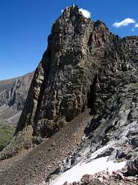 Tower above Avalanche Lake Tower above Avalanche Lake |
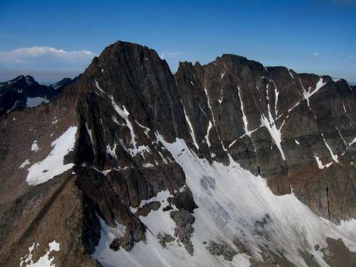
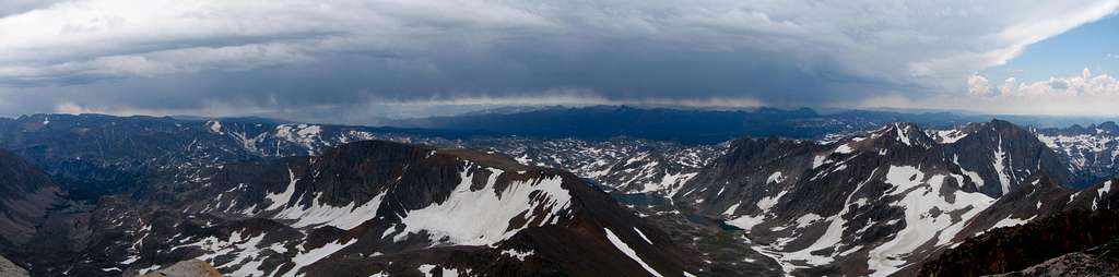
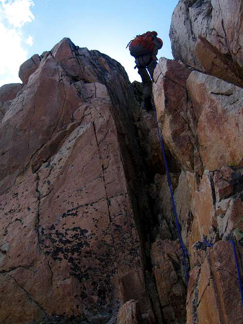
I decided to veer left and mount the west ridge of Tempest Mountain a little bit higher than the saddle. Here I left my pack and finished the ascent up to the Froze-to-Death Plateau and to its high point at Tempest Mountain where I saw only the second summit register of the whole trip. Views of Granite Peak were amazing. I was getting very excited. I descended back to the saddle where I waited for Stephan to finish climbing the snow. At this saddle we ditched some gear and began ascending Granite Peak. Initially the climbing was easy as we just followed the boot path to the "Snowbridge" which was nothing more than a snow crossing at the top of the SE Couloir. Just past this the meat of the climb started. A beautiful 4th class chimney lie just past the snow crossing. We ascended it but right as I got to the top we heard a clap of thunder. Clouds were building very fast and Stephan didn't want to continue so we went back across the snowbridge and waited under a big rock for awhile hoping the weather would improve. An annoying goat pestered us the whole time. I kept thinking to myself "I sure hope the clouds break up I made it all this way; I'm going to be one of the few who summit Granite Peak on the first attempt!" I know that many people going out to climb it get turned around but luckily after about an hour of waiting we noticed a break in the clouds that I thought was just long enough to climb the final 500 feet to the summit. So off we went, back across the snowbridge and up the first chimney.
 Mystic Mountain Alpenglow Mystic Mountain Alpenglow | 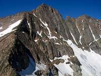 Granite Peak Granite Peak | 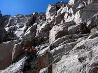 Stephan Scrambling Stephan Scrambling | 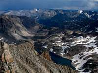 Avalanche Lake Below Avalanche Lake Below |
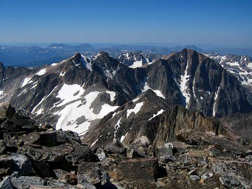
We continued on fantastic rock up one chimney to the next until we got to the upper part of the climb where it started snowing! A small amount of hail and snow making the rocks just wet enough to make the climbing harder. I kept a keen eye on the clouds and noticed they were not all that bad. The crux of our climb was making an exposed move from one ledge up to another with wet rock just below the final chimney to the summit. The hail stopped just as quick as it came and the rocks were drying quick. Just as we reached the summit we saw a big break in the clouds just to the southwest with blue sky! Confirming the direction the clouds were traveling we had a sigh of relief and was actually able to stay on the summit for about 15 minutes to sign the massive register and take in the beauty of being on top of Montana.
 The East Ridge The East Ridge | 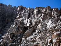 Upper part of the climb Upper part of the climb | 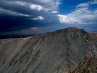 Tempest from Granite Tempest from Granite | 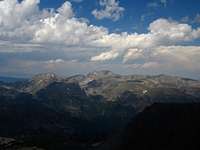 Mount Wood Mount Wood |
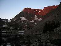
We began the descent and made a couple rappels on the bomb proof anchors on the route. We never used any protection climbing but we just felt safer rappelling some areas since the rock was still damp. We got a couple nice sun breaks on the way down which was nice. When we reached the saddle once again we prepared to glissade again and had a blast glissading the snow quite a ways back towards Avalanche Lake. Unfortunately the snow ended 600 feet above the lake and the remaining talus was very loose and sharp making tedious descending. By this point we both were very tired. I had also done Tempest and Granite itself was a long climb. We still had to walk all the way around Avalanche Lake and down back to camp. The afternoon glow was getting very nice and we got one final view of Granite Peak for the day just as the sun set behind the peaks to the west. We reached camp just as it got dark and went right to bed. We decided to take the next day off to rest before I would climb Mystic Mountain and Granite West.
 Stephan raps one of the 4th class chimneys Stephan raps one of the 4th class chimneys | 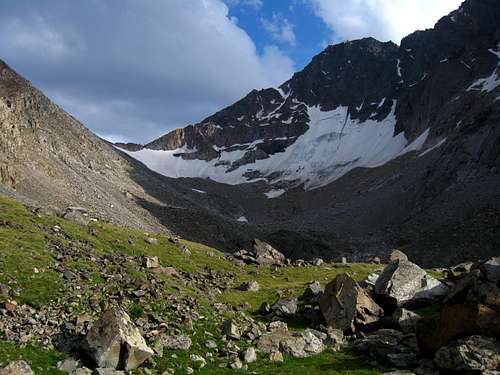 Looking back towards the saddle Looking back towards the saddle |
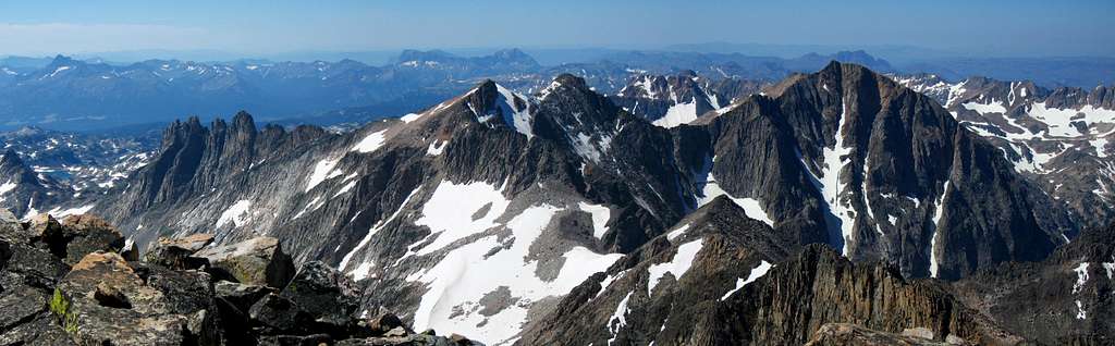
The next morning I knew the way around Princess Lake so getting around was much quicker. I continued the same way as the day before past Snowball Lakes but instead of heading to Avalanche Lake I climbed up the slabs further right towards Storm Lakes and started straight up to the North Ridge of Mystic Mountain. This long talus climb wasn't as loose as it looked. The easy traverse south to the broad summit was a nice morning walk. Once on the summit I had great views of Glacier Peak and Mount Villard across the valley. I looked across the Storm Lakes Basin to Granite West and studied the traverse and was off. The first part of the traverse was an easy descent to the first saddle. The climb up to unnamed point 11,908 was a short scramble but I had to stay to the right to avoid the cliffs dropping into Storm Lakes. From the summit of unnamed 11,908 (which lies halfway between Mystic and Granite West), the next part of the traverse was the crux. Staying just off the ridgecrest to the right towards Glacier Peak there was sustained third class scrambling up and down until the next saddle. Climbing to this saddle from Storm Lake would have been easy to do on moderate angle talus if you aren't interested in the traverse. I continued on the ridge as the terrain eased and I had the final talus climb to the summit of Granite West Peak. The view of the Granite Traverse from here was incredible and I knew I had to do this traverse someday.
 N Ridge of Mystic N Ridge of Mystic | 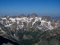 Mystic Summit View Mystic Summit View | 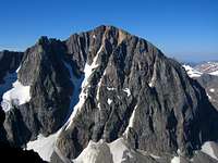 Glacier Peak Glacier Peak | 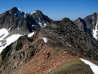 Mt Villard from Traverse Mt Villard from Traverse |
 Glacier and Villard from Granite West Glacier and Villard from Granite West | 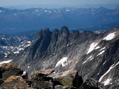 The Cathedral Spires The Cathedral Spires |
I began the long descent down the west face talus slope to Storm Lakes. I was able to fit in a glissade down part of the way on a lingering snowfield to help save my knees. After finally reaching Storm Lakes I hiked along their shores and retraced my steps once again back to camp at Princess Lake. Stephan and I then made the long hike back down Huckleberry Creek and then the Mystic Lake trail to the car which was very painful for me as the Mystic/Granite West climbs was over 10 miles all on rocks and talus. We decided a long break was in order since we had been out for over 2 weeks so we drove back to Red Lodge to meet up with a friend for a night in a house, some good food and a shower.
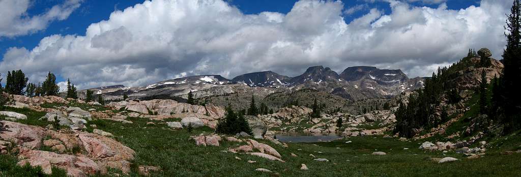
I didn't know it at the time but this next part of the trip would be the best of all. After an entire day of rest we made our way over Beartooth Pass for the first time since we arrived in Montana. We joked we were probably the only people to come to Red Lodge and the Beartooth Mountains and wait nearly 3 weeks before driving over Beartooth Pass! The pass was actually really nice and we saw the famous view of the Bears Tooth from the top. As we descended the other side the feel began to change. Just as we arrived at Beartooth Lake we turned off the highway and parked at the small trailhead for the Beartooth High Lakes Trail. Beartooth Butte lie just behind and is the only sedimentary rocks found in all of the Beartooth Mountains and have baffled geologists for some time. The trail first follows right along the shore of Beartooth Lake which was very muddy and swampy. Since we wanted dry feet more than anything else at the moment we whacked through the forest further to the east and headed around the swamp. We ended up wasting an hour trying to get around that stupid lake and it passed Huckleberry Lake as the lake I hated the most. We managed to find the trail on the other side of the lake and continued up the gentle slopes heading up the Beartooth Plateau. We reached the junction with the Clay Butte Trail (which we should have taken in the first place!) and continued to Native Lake where we saw some day-hikers. However we quickly continued up the trail which was obviously used a lot by horses passing one beautiful lake after another. We reached an unnamed lake just south of the state line. We had been hiking in Wyoming for this first part of the trail but we crossed the state line and didn't see a big line on the ground...but we marked the exact tree! We continued past Marmot Lake and found a great place to camp between Wright and Martin Lakes near the end of the trail. We tried fishing in Wright Lake but all the fish were tiny and not worth eating. We continued the next morning around Martin Lake and off the trail at this point. We climbed up over a small saddle and the views we saw from there had to be some of the best views of the entire trip without a doubt. The entire Castle Group was visible from Snowbank Mountain all the way east to Castle Mountain.
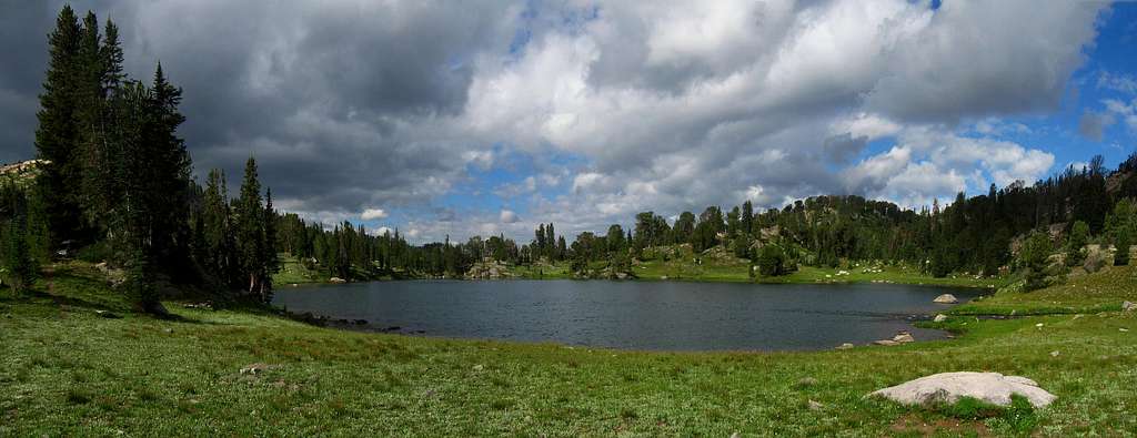
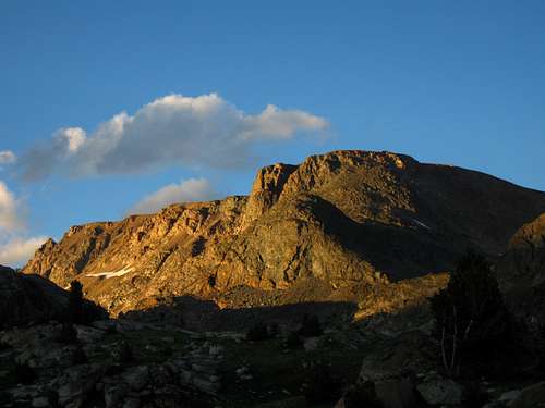
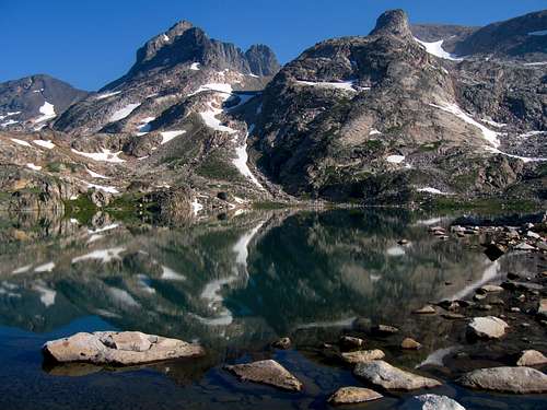
From this point it was a short walk around to the north and east to Crystal Lake where we decided to set of camp for a few days. This lake was hands down my favorite of the entire trip to Montana. One of the most beautiful alpine lakes I have ever seen. We hiked around it to its north side and set up the tent. We took the rest of the day to relax by the lake and caught a couple big fish which was very nice. We cooked these ones in the stove since we were above treeline. The sunset over Sky Pilot Mountain was beautiful and we went right to sleep.
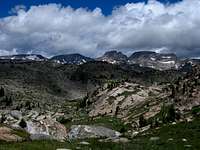 Castle Group Castle Group | 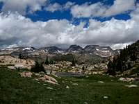 Castle Group Castle Group | 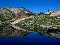 Crystal Lake Reflection Crystal Lake Reflection | 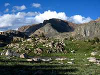 Sky Pilot Mountain Sky Pilot Mountain |
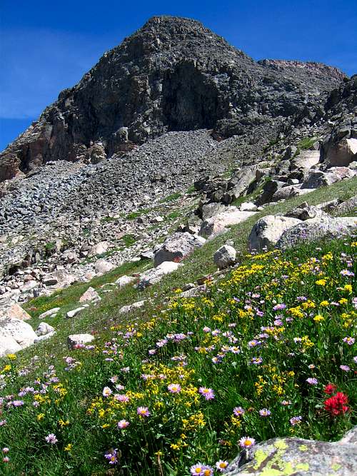
The next morning we woke and Stephan opted to wait out the easy climb of Sky Pilot Mountain so off I went. It was not very far and I simply walked up the easy grassy valley towards the peak. An easy talus climb brought me to the south ridge and a very gentle ridge walk brought me to the highest point at the north end of the ridge with fantastic views of the whole Castle Group, Varve Lake Below and all the way to Pilot Peak to the southwest.
 Sky Pilot Lake Sky Pilot Lake | 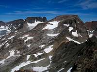 Castle from Sky Pilot Castle from Sky Pilot | 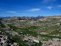 Distant Pilot Peak Distant Pilot Peak | 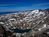 Varve Lake Varve Lake |
I made the quick return to camp to which Stephan was surprised I was back so soon. It really was a short ascent so we fished some more and relaxed in the sun the rest of the afternoon. Knowing the weather forecast we decided to try and tackle all 4 peaks in the Castle Rock Group the next day. Dinner that night was difficult because the mosquitos were the worst we had the whole trip at Crystal Lake. This was the only downside to this beautiful lake was that it was the only place so far in all the Beartooth Mountains we had been to where the bugs were unbearable. We had to down the rain gear to keep them away. After dinner we went to sleep and woke around sunrise the next morning. We started quickly towards Flat Rock Lake and on to Varve Lake. We finally got some sunshine at Varve Lake but the bugs here were the worst I have ever seen. I don't think they were mosquitoes because they were bigger and I really didn't get bit but I could hardly breathe they were so thick. We continued to Navajo Tarn and to an unnamed lake at 11,000 feet which was formed by the retreating Castle Rock Glacier.
 Varve Lake Reflection with Point 12,540 Varve Lake Reflection with Point 12,540 | 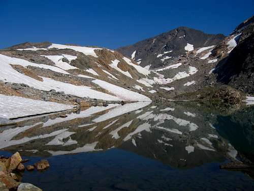 Navajo Tarn Morning Reflection Navajo Tarn Morning Reflection |
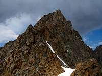
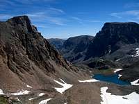
I went on ahead of Stephan so I could climb Point 12,540 but I was almost clueless as to what the route was. All I knew is that it wasn't 5th class and it wasn't on the east or north sides of the peak. So I studied it hard from Navajo Tarn and didn't see a feasible route on the south side so I figured it must be somewhere on the west side which was good as this would prevent backtracking as Castle Rock Mountain was the next peak to the west I had to also climb. I continued up on the talus at the base of the cliffs on the west face of Point 12,540. As I got closer and closer to the west ridge I began to worry I wasn't going to find the route since steep cliffs covered the whole side of the peak. However right as I got to the west ridge, I noticed a deep gully and broken terrain near the ridge crest and I saw a feasible route. See this page for the description. The summit of this peak was a very lonely place. It did have a flat top but it was a small area and only a tiny cairn marked the top. Only people wishing to climb all 26 of Montana's 12ers would climb this peak so I knew I was one of only a handful people to be there. Looking down on Castle Rock Spire was interesting as well. Unfortunately it was a very smoky day and the clarity was very bad so I snapped a few photos and continued on back to the Point 12,540 and Castle Rock Mountain saddle where I met Stephan. We then continued up the easy east ridge of Castle Rock Mountain. The view of the entire traverse to Point 12,090 was visible and I continued north on this class 3 traverse to another very lonely place. Point 12,090 lies off to the north of the Beartooth Crest only accessible from Castle Rock Mountain or Whirlpool Creek, and this creek is a real pain to get to.
 West side of Point 12,540 West side of Point 12,540 | 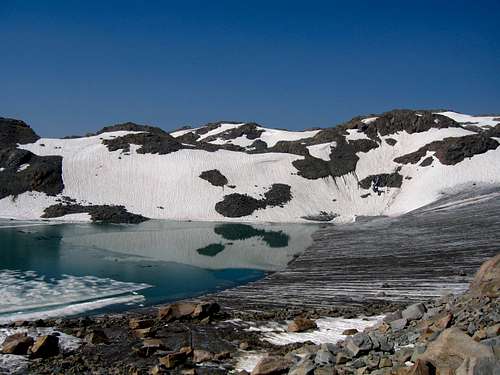 New lake at base of Castle Rock Glacier New lake at base of Castle Rock Glacier |
 Castle Rock Spire Castle Rock Spire | 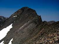 Castle Rock Mountain Castle Rock Mountain | 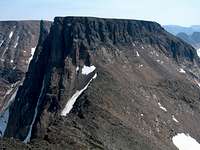 Point 12,540 Point 12,540 | 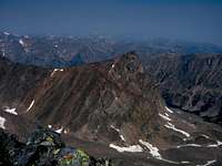 Point 12,090 Point 12,090 |
Views of the north faces of the Castle Peaks began coming into view and I was in awe at some of these aspects. Looking down into the Whirlpool Creek drainage knowing how few people come up there I felt more solitude on this peak than anywhere else the whole trip. The north face of Point 12,540 was so amazing and the couloir leading up the the saddle just to the east was the route taken by some of the best mountaineers to walk the northern Rockies many years before.
 Castle Mountain from traverse to Point 12,090 Castle Mountain from traverse to Point 12,090 | 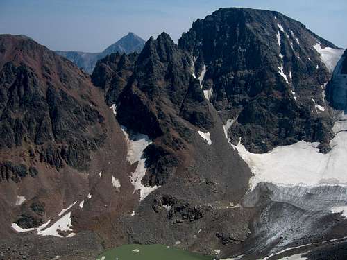 North face of Castle Mountain from Point 12,090 North face of Castle Mountain from Point 12,090 |
I returned to Castle Rock Mountain to meet with Stephan again and we continued the easy traverse to Darlene Mountain, another lonely place. We glissaded down the southeast slopes of Darlene Mountain and descended past an unnamed lake and then to bug infested Copepod Lake which eventually fed back into Flat Rock Lake (which has two inlet streams). I was shocked to see a big party of campers at Flat Rock Lake. We exchanged greetings and where we had been and was happy to have finished out big loop and finished the descent back to Crystal Lake where another mosquito infested differ awaited us. We went to sleep right away after a nice swim in the lake.
 Unnamed Tarn Unnamed Tarn | 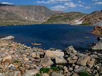 Copepod Lake Copepod Lake | 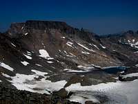 Sky Pilot Mountain Sky Pilot Mountain | 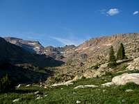 D'Cing back to Crystal Lake D'Cing back to Crystal Lake |
The next morning we had a cloudy and uneventful hike back out but instead of hiking back around that swampy Beartooth Lake we hiked the Clay Butte Trail along the west side of Beartooth Butte which went very smoothly and when we reached the trailhead, I ran the Clay Butte road and highway a few miles back to the car at the other trailhead. At this point we drove to Cooke City and had a very large meal and talked about what we wanted to do next. We ended up driving to the Aero Lakes Trailhead and camped the night but decided against climbing the Mount Villard Group as I wanted to save those peaks for another time of year. We decided to go climb the Grand Teton and Stephan would fly back home from Jackson, Wyoming afterwards. Stay tuned for my TR to come for out climb of the Grand Teton and part 3 of the Montana Beartooths Adventure which will come sometime next fall once we finish climbing the 12ers we missed this time around. Thank you very much for reading and I hope you enjoy the photos!
Can't wait until Part 3
Comments
Post a Comment