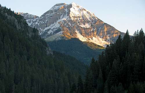
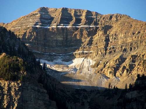
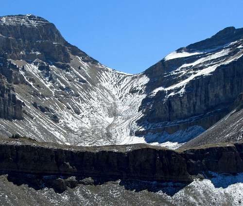
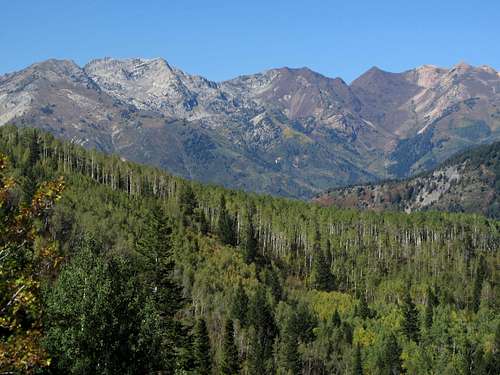
![North Timp Sunset]() North Timp Sunset
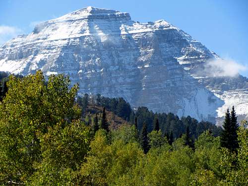
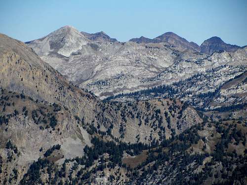
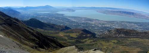
North Timp SunsetAs far as mountain views along the various scenic roads around the Wasatch go, in my opinion the most impressive peak in the range is North Timpanogos. Driving towards American Fork Canyon you can see how it towers over the surrounding area, and glimpsing it from anywhere along the northern part of the Alpine Loop or from Tibble Fork Reservoir will make you want to climb it. For all of you numbers geeks out there like me, its 11,383-foot sub-summit has a spire measure of over 400, securely placing it near the top of the steepest mountains list for the state of Utah (omnidirectional relief & steepness is one way to quantitatively measure a mountain’s steepness, and thereby infer how rugged and/or impressive it may appear from various angles). To put this in perspective it is worth noting that for all of the impressive mountains in the neighboring state of Colorado, none of them have a spire measure this high.
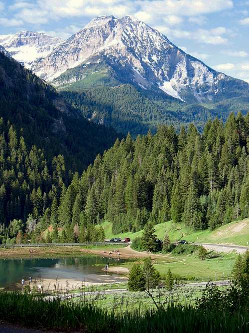
![North Timpanogos above Tibble Fork Reservoir]() North Timpanogos above Tibble Fork Reservoir
North Timpanogos above Tibble Fork Reservoir![North Timpanogos & Mahogany Mountain]() North Timp from Alpine ...
North Timp from Alpine ...![North Timpanogos from Pleasant Grove/Orem]() ... and Pleasant Grove/Orem
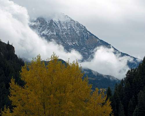
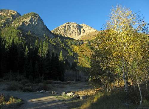
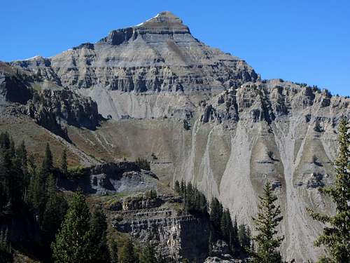
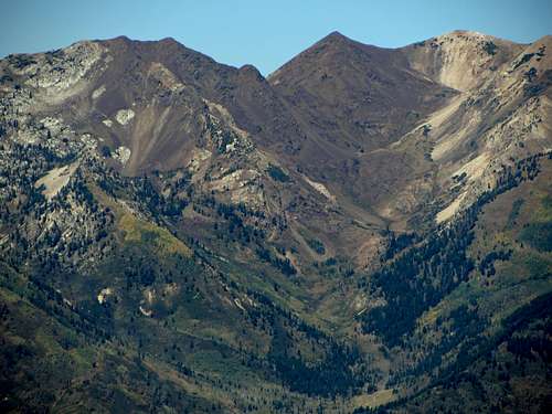
... and Pleasant Grove/OremDespite how eye-catching this peak is, it is seldom climbed, primarily due to the overwhelming popularity of its more well-known neighbor to the south (the main summit of Mount Timpanogos). While most people hike up to the saddle below the main summit, make the long ridge traverse to the north to get North Timpanogos, and then go back the way they came, I wanted to somehow hike it as a loop. I ordered Michael Kelsey’s “Climbing and Exploring Utah’s Mt. Timpanogos” and compared a few of the described routes to
PellucidWombat’s excellent route overview
map to come up with a plan.
![Snowy North Timp]() View from Alpine Loop
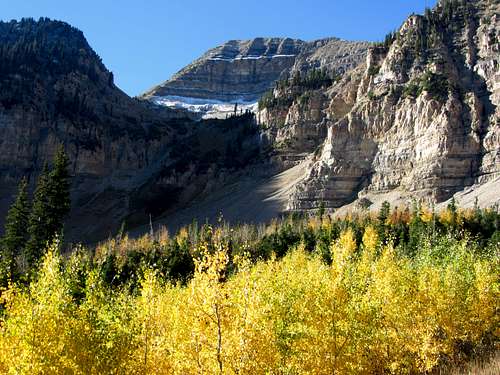
View from Alpine Loop![Fall colors under North Timp]() Fall colors ...
Fall colors ...![North Timpanogos from Alpine Loop]() ... under North Timp
... under North TimpTo do this as a snow-free loop hike without needing a car shuttle, it appeared that our best option would be to park at the Timpooneke Campground Trailhead, take the Pika Cirque Approach up to Woolly Hole, cross over to the northeast ridge and scramble to the top of North Timpanogos, hike along the main Timpanogos ridge summiting as many peaks as we felt like, and then come down the Timpooneke Trail, re-gaining a couple hundred feet of elevation to get from the Timpooneke Trailhead back to the car at the campground trailhead. This would also enable us to hit all of the major summits on the Timpanogos Massif in one shot if we felt up to the task. Some snowfall just a few days prior nixed my plans of first summiting South Timpanogos via Razorback Ridge and doing a variation of this hike in reverse using the Aspen Grove Trailhead as our starting point instead, since adding snow to the already difficult Razorback Terrace route would have made it much more dangerous. The nice thing about the main summit ridge on Timpanogos is that there are plenty of places to bail back down into Timpanogos basin, so if there was still any snow lingering in some awkward shaded areas then we could always change our route on the fly.
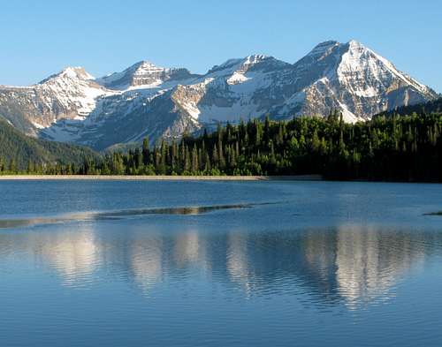
![Timpanogos Reflection]() Timpanogos Massif reflecting in Silver Lake Flat Reservoir
Timpanogos Massif reflecting in Silver Lake Flat Reservoir
Battle of the Bushwhack
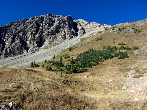
![Bomber Peak from road]() Bomber Peak from road
Bomber Peak from road
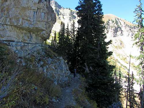
We met at a pre-arranged location and then drove my car up the canyon. I’d watched the snow melt off of the west-facing slopes of the mountain during the last couple days but wasn’t sure if there would still be snow on the east slopes we’d be hiking. After pulling over at the overlook just before where the Alpine Loop usually closes in the winter to take some pictures, we saw that fortunately most of the snow was gone. Just a short ways after passing the Timpooneke Trailhead (perhaps half a mile) we arrived at the North Timpanogos Trailhead within the Timpooneke Campground. We didn’t hit the trail until just before 8 am, but the temperatures were still cool enough (40’s) that I decided to bring my jacket along.
![North Timp from trailhead]() North Timp from the trailhead ...
North Timp from the trailhead ...![North Timp over bushwhacky terrain]() ... rising above some bushwhacking terrain
... rising above some bushwhacking terrain![Bushwhacky goodness]() After some bushwhacking ...
After some bushwhacking ...
![Cobblestone Corrider]() ... we found a "cobblestone corridor"
... we found a "cobblestone corridor"
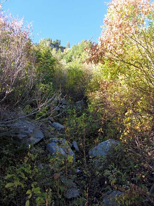
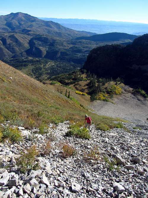
While the small dirt parking area (big enough for
three or four cars) and trailhead were easy to find, there wasn’t much of a trail to follow. Kelsey’s guidebook says that the trail is easy enough to follow past a stream crossing and then up the rocky drainage leading up toward Woolly Hole, but it disappeared much more quickly than that. I did my best to follow some game trails, but after just half a mile we were already in bushwhacking territory. Instead of initially going straight up the steep slopes to our southwest I started veering back to the west, and we soon came to a creek bed /drainage which I thought must have been the “cobblestone corridor” mentioned by Kelsey. We followed this straight up the slope to the southwest, quickly gaining elevation as we did so.
![Headwall above cobblestone corridor]() At the top of the cobblestone corridor below the headwall ...
At the top of the cobblestone corridor below the headwall ...![Steep dirt slope]() ... we went left up this steep dirt slope
... we went left up this steep dirt slope
![View right from top of cobblestone corridor]() View right from top of cobblestone corridor
View right from top of cobblestone corridor
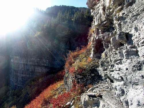
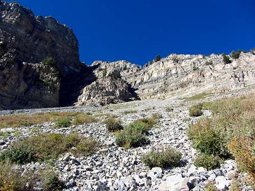
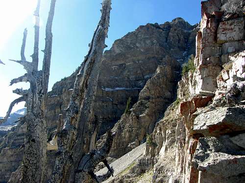
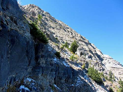
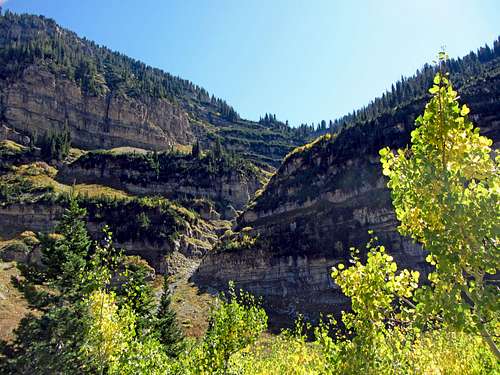
The higher we got up the drainage, the steeper and more difficult it became. The rocks became more loose, and the dirt underneath became more muddy and slippery. Despite my best efforts it was difficult to not occasionally knock down a few little rocks behind me, so David waited as I scouted up ahead. Climbing under/through some branches I saw the steep cliff walls just below Woolly Hole now right above us, so we continued up. Upon reaching the base of the cliffs however, our view looked nothing like the picture in Kelsey’s guidebook. After inspecting the topo map, my guess was that we’d been going up the slightly smaller drainage to the east of the main one (closer to the trailhead I probably should have tried harder to stay on one of the game trails to the right/north to find the bigger drainage). It didn’t appear safe or possible to go west (right) from here to find the other drainage, so I decided to improvise and head left (southeast) instead to find another way up onto the cliffs.
![Headwall traverse]() We traversed up around the headwall ...
We traversed up around the headwall ...![Headwall exposure]() ... past some exposed sections with thorny red bushes
... past some exposed sections with thorny red bushes
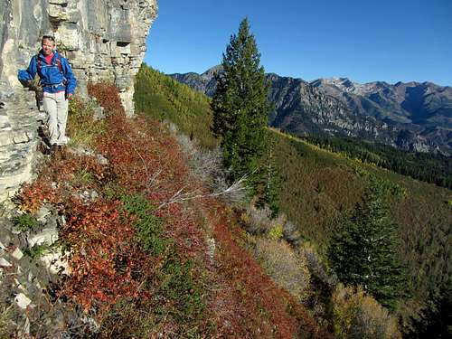
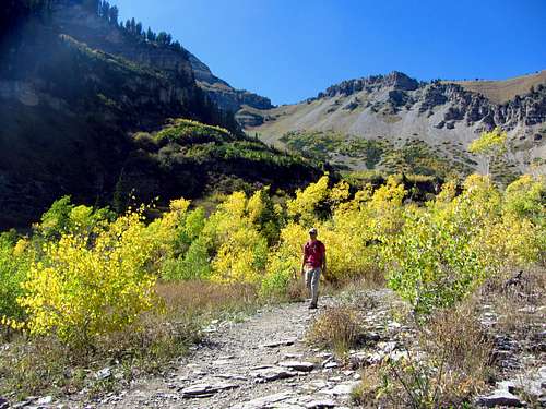
While we still had to bushwhack through some evergreen trees after this to get to some more open patches of brown grass, the more gradual slope made our progress much easier. After cutting back to the west the terrain began to open up, and pretty soon we made it to a scenic meadow at around 8,800 feet with some nice views of Bomber Peak to the south. With the sun now shining on us, I decided to shed my jacket to stay cool.
![Woolly Hole fall colors]() Along with some nice fall colors ...
Along with some nice fall colors ...![Route from Woolly Hole]() ... we could now see the remainder of our route to the top of North Timpanogos
... we could now see the remainder of our route to the top of North Timpanogos
![Woolly Hole view north]() View north from Woolly Hole
View north from Woolly Hole
From here we could make out the rest of our route to the top of North Timpanogos to our right. Since we’d already had our fill of bushwhacking for the day, I decided that it would be best to keep going south until we came closer to the scree field leading up to the Grunge Couloir, since that way we could stay near the boundary between the rocks and the grass/bushes and travel up whichever surface looked easiest at the time. Fortunately, going farther south into Woolly Hole led us to a nice-looking patch of yellow aspen trees that we wouldn’t have seen otherwise.
![Route above Woolly Hole]() Ascending some steep, rocky terrain
Ascending some steep, rocky terrain
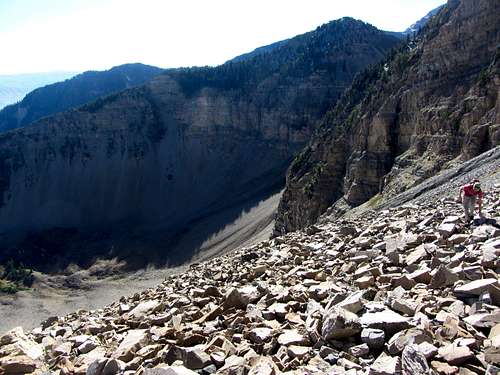
Even though it had been a bit more of a pain getting up here than I thought it would be, the scenery was worth the effort. Progress up the rock slopes to our west was relatively straightforward, but every now and then we’d run into a patch of smaller scree that was more loose (usually this would happen right after I’d jinx us by saying the slope was more solid than it looked). Having done the ridge traverse from Provo Peak to East Provo Peak the previous summer, we could always fall back to saying “At least this isn’t as loose as East Provo Peak,” whenever we came across some loose rock, which was at least somewhat comforting. For the most part we stayed away from the bushes on our right, since they seemed a bit thorny (the proof was in my hands, where I discovered over a dozen small splinters/thorns a few days later).
![Scree slope below North Timpanogos]() After climbing some loose scree ...
After climbing some loose scree ...![Talus field below North Timp ledge]() ... we came to some more solid talus
... we came to some more solid talus
Closer to the top of the slope, we transitioned from loose scree to larger and more solid talus, which was a nice change. In a couple of places where the rocks were loose though, we had to resort to what we liked to call “Smeagol scrambling”, where you basically just charge up the mountain on all fours as quickly as possible like a wild animal in an attempt to not lose any momentum due to sliding back on loose rocks. Luckily, acclimatizing on North Peak the previous Saturday had enabled me to do longer stretches of Smeagol scrambling before having to stop and catch my breath.
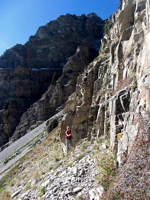
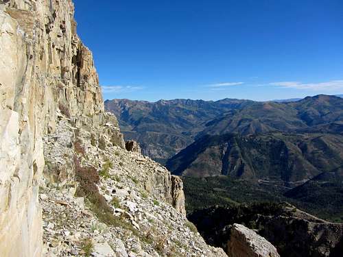
![Start of North Timp ledge]() Starting out along the ledge that would wrap around the east face of North Timp ...
Starting out along the ledge that would wrap around the east face of North Timp ...![End of North Timp ledge]() ... and lead us to to a place where we could go up the northeast ridge
... and lead us to to a place where we could go up the northeast ridge
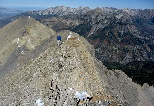
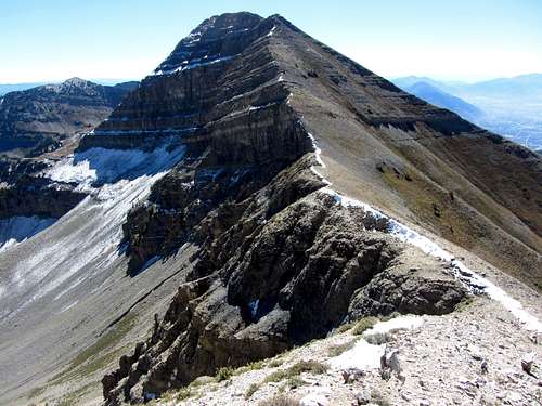
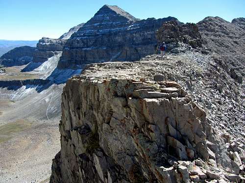
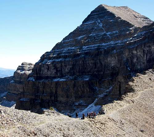
![North Timp from NE ridge]() The true summit of North Timp ...
The true summit of North Timp ...![North Timp NE ridge crest]() ... viewed from the crest of the northeast ridge
... viewed from the crest of the northeast ridgeAt the base of the cliffs above us where the Grunge Couloir began in earnest at around 10,200 feet, we cut to the right (north). The ledge we traversed had some loose scree, but was wide and easy to travel along. I climbed up onto a narrower rock ledge as we traversed north under the cliffs since I wasn’t sure if the one we started out on would end in a cliff, but upon rounding a corner I discovered that I should have stayed on the lower ledge, as the upper one disappeared. Nothing a quick little down climb facing into the rock couldn’t solve, though. After rounding the edge of the ledge underneath the cliff wall we were on the crest of the northeast ridge, which would take us straight to the top.
![Northeast Ridge views]() From the northeast ridge ...
From the northeast ridge ...![Peaks from North Timp NE ridge]() ... we had nice views of some other Wasatch peaks to the north
... we had nice views of some other Wasatch peaks to the north
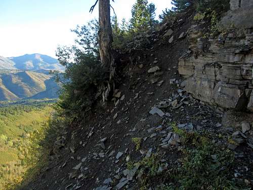
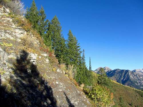
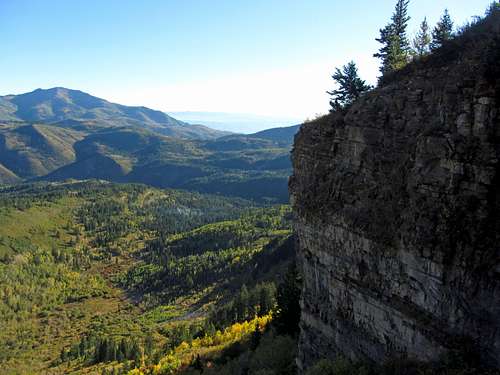
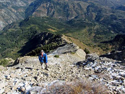
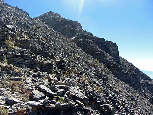
Along the northeast ridge, we stayed on the right (north) side of the ridge for the most part, as the crest of the ridge often had trees and more difficult steep sections. There was still some snow present in the shaded sections of this slope, but nothing too deep or that couldn’t be easily bypassed. Behind us were impressive views of Box Elder Peak and the Alpine Ridge, with American Fork Canyon far below.
![Steep northeast ridge]() We ran into a few steep sections with snow ...
We ran into a few steep sections with snow ...![View down northeast ridge]() ... as we made our way up the northeast ridge
... as we made our way up the northeast ridge
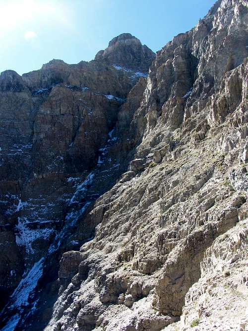
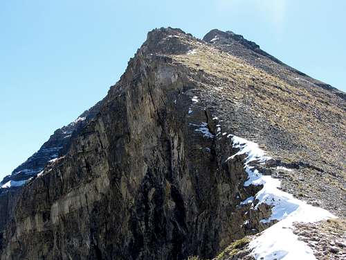
Higher up on the ridge we got a close-up view of the Grunge Couloir. From the grade, it would seem like only experienced snow/ice climbers would attempt going up that way, let alone skiing down (I think most who go up that way in the spring end up skiing down the more mellow Cold Fusion Couloir instead). Our route up was much easier though, even though in a couple places the rock was loose enough to make us zig-zag up the ridge in a sometimes indirect line. Usually we could tell by the fractures in the limestone rocks in front of us whether they were suitable for stable holds or not, and if not then there was usually a safer alternative just off to the side.
![Grunge Couloir]() Grunge Couloir
Grunge Couloir
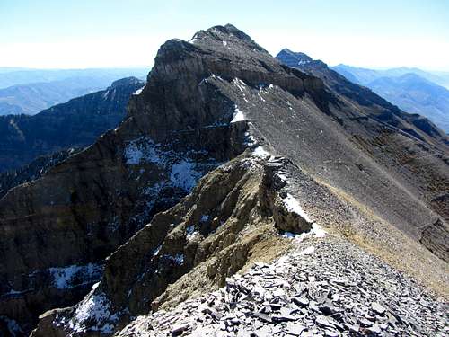
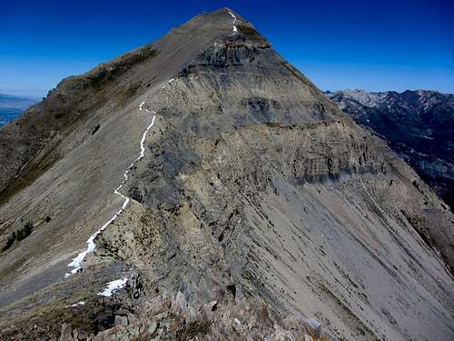
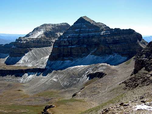
After a few more pitches of Smeagol scrambling through some light snow we arrived on the false summit (Point 11,383). The view was awesome, with Utah Lake down to the southwest, the Central Wasatch to the north, and the true summit of North Timpanogos to the southeast.
![Ridge north of North Timp]() From the false summit we made our way south ...
From the false summit we made our way south ...![North Timp from false summit]() ... towards the true summit of North Timpanogos
... towards the true summit of North Timpanogos
![Looking down Grunge Couloir]() Looking down Grunge Couloir
Looking down Grunge Couloir
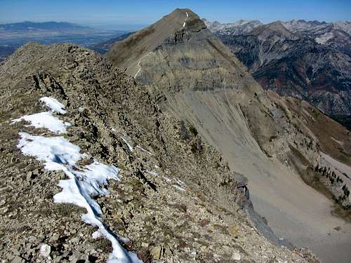
From here it was just a short ridge walk over a faint trail to the top. Despite the amount of effort required to gain 4,000 feet of elevation in just under two miles of off-trail hiking and scrambling, it took us just three and a half hours to make it up (probably just over an hour on each of the three progressively more enjoyable sections of the bushwhack up to Woolly Hole, the scree climb up to the northeast ridge access ledge, and the scramble up the northeast ridge).
![North Timp summit pic]() ... from the summit of North Timpanogos
... from the summit of North Timpanogos
![Utah Lake]() There were nice views of Utah Lake ...
There were nice views of Utah Lake ...Timpanogos Northern Ridge
Upon opening the summit register, we discovered that someone else had already been up here this morning (from their log they apparently came over from the ridgeline to the south), being the only other people to sign it in the last month. We rewarded ourselves with a big lunch, and then continued south along the ridge. The hard part was over, so the rest of the day would simply involve an enjoyable ridge walk and easy trail descent. There was still a thin band of snow on parts of the ridge, but we never had to cross it. It was cool enough though, that I decided to don my jacket again to be more comfortable. On the way down North Timpanogos, we spotted a couple mountain goats coming up from the west slopes. We tried hiking faster to get a close-up shot of them, but they crossed over the ridge down onto some cliffs on the east slopes before we could reach them.
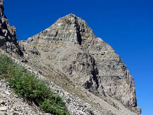
![Bomber from North Timp]() Some of the rugged but easy-to-cover terrain ...
Some of the rugged but easy-to-cover terrain ...![Bomber Peak north ridge]() ... as we made our way up towards Bomber Peak
... as we made our way up towards Bomber Peak
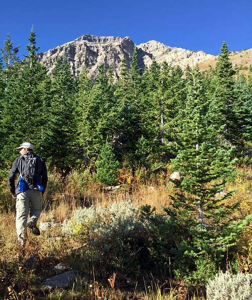
The views of Bomber Peak from this angle were quite impressive. There was no route-finding to speak of either, since whenever the ridge crest itself became steep there always seemed to be a faint trail through the rocks on the west (right) side of the ridge. As we re-gained elevation on our way up Bomber Peak going up from the North Timp / Bomber saddle, we caught some nice views of North Timpanogos rising abruptly from Wooly Hole as well.
![North Timp from Bomber]() Looking back to the north ...
Looking back to the north ...![North Timp from Bomber north summit]() ... were impressive views of North Timpanogos
... were impressive views of North Timpanogos
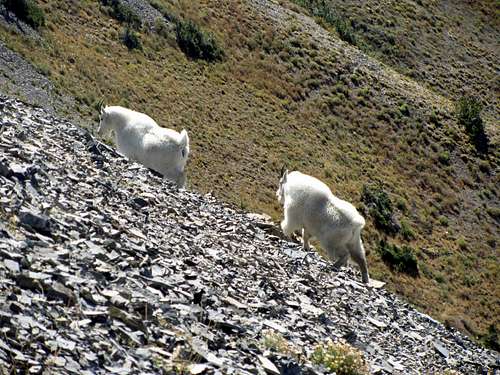
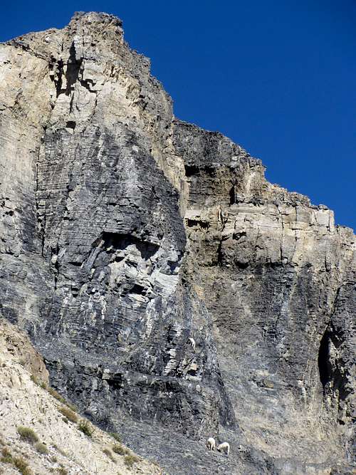
![Timp goats]() Mountain goats ...
Mountain goats ...![Stranded goat]() ... exploring the cliffs to the southeast of North Timpanogos
... exploring the cliffs to the southeast of North TimpanogosI caught sight of the two goats we’d seen earlier, and upon inspection of my photos after the hike, I discovered that what we originally thought was either a small patch of snow or a goat on one of the cliffs dropping down from the southeast side of the North Timp summit was in fact a third mountain goat. Maybe it had gotten cliffed out and didn’t know what to do, but it appeared that the other two goats had traversed onto the ledge underneath to give him moral support.
![Bomber northwest slopes]() Some steep terrain we encountered ...
Some steep terrain we encountered ...![Bomber north face]() ... along the north slopes of Bomber Peak
... along the north slopes of Bomber Peak
Upon reaching the top of the Bomber Peak we discovered a couple other points between us and the saddle below the main Timpanogos summit, one of which actually appeared to be higher than we were now (from the Bomber Peak SP page it sounds like the northern summit we were on was actually the highest). To play it safe, we decided to hit both points just to make sure we got it.
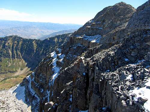
![Timp over Timpanogos Basin]() Traversing across the main Timpanogos Ridge above Timpanogos Basin ...
Traversing across the main Timpanogos Ridge above Timpanogos Basin ...![Bomber ridge terrain]() ... we obtained some exciting positions
... we obtained some exciting positions
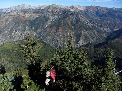
The farther we traveled south along the ridge, the more hikers we could make out coming up the Timpooneke Trail through Timpanogos Basin, who looked like little ants from our higher perspective. We continued along the scenic and enjoyable ridge, occasionally finding ourselves in some cool-looking positions.
![Trail near main Timp saddle]() Wrapping around the west side of the ridge ...
Wrapping around the west side of the ridge ...![Timp saddle party]() ... we arrived at the saddle below the main summit of Mount Timpanogos
... we arrived at the saddle below the main summit of Mount Timpanogos
After hitting the southern summit of Bomber Peak (from here the northern summit we previously hit looked higher, but I’m not sure if there’s much difference between the two) the trail wound around to the west before heading back to the ridge crest at the saddle below the main Timpanogos summit. As we approached, we could see several people stopped there (the first we’d run into all day), which is typical of what you’d see when hiking Timpanogos.
![Bomber north summit]() Looking north towards the southern summit of Bomber Peak ...
Looking north towards the southern summit of Bomber Peak ...![Timp ridge descent]() ... as we made our way down into Timpanogos Basin
... as we made our way down into Timpanogos Basin
I was still feeling really good and wanted to keep going on the ridge to get the other two summits, since I figured it would only add an extra couple hours to the hike. It was already 1 pm though, and since David had to get back to his family, we decided to head down the Timpooneke Trail and return to the car from here. Even though it would have been cool to finally finish the ranked Wasatch 11ers (of the 20 on the list, South Timpanogos was the only one left I hadn’t done), I conceded that since a happy wife equals a happy life, it was better to leave it for another time, even if that meant not doing it until sometime next summer (this thought process has saved me several times in the past and made it easier for me to convince the wife to let me do other hikes afterward).
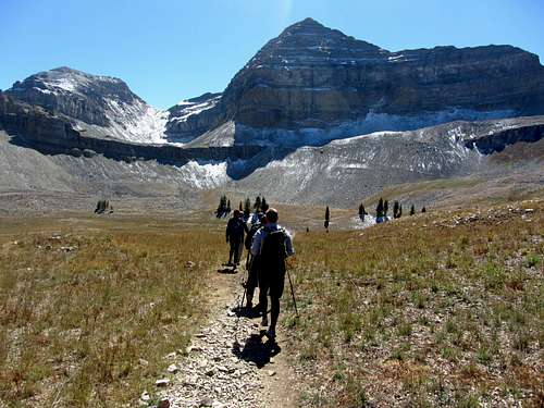
![Timp hordes]() As we joined the hordes descending the Timpooneke Trail ...
As we joined the hordes descending the Timpooneke Trail ...![Timp snowfield/glacier]() ... we discovered that we had probably made the right choice in leaving South Timpanogos for another time
... we discovered that we had probably made the right choice in leaving South Timpanogos for another time
Joining the hordes heading down the mountain, we made our way down the through Timpanogos Basin on the Timpooneke Trail. As the permanent snowfield section below South Timpanogos became visible from behind the main summit pyramid, it soon became obvious that we had made the right choice in coming down where we did. There were big, inconsistent patches of un-melted snow and verglas there, which made me think coming down that way would have been a bit dangerous and may have forced us to go all the way back over the main summit and trail after tagging the south summit. Since I still hadn’t been up the Aspen Grove trail anyways, I figured it would be fun to do that one to bag South Timpanogos next summer when all of the waterfalls and wildflowers were at their peak.
![North Timp from Timpooneke Trail]() On the way down we caught some nice views of North Timpanogos ...
On the way down we caught some nice views of North Timpanogos ...![Box Elder From Timp]() ... and Box Elder Peak
... and Box Elder Peak
Despite the fact that all of the wildflowers had expired, the descent was still rather scenic, with some nice fall colors apparent in the orangey grass and yellow aspens we occasionally encountered. At one point we were surrounded by some noisy teenagers, so we stepped aside to take some pictures and let the rest of their group pass us, affording us more peace and quiet.
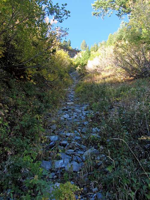
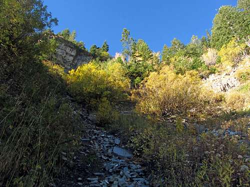
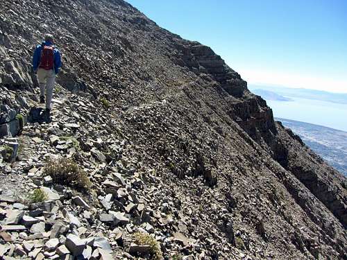
![Giant Staircase]() The scenery coming down the Giant Staircase was nice ...
The scenery coming down the Giant Staircase was nice ...![Timp Trail]() ... with much of our route being shaded
... with much of our route being shaded
![Timpooneke Trail yellows & greens]() As we got closer to the bottom of the Timpooneke Trail ...
As we got closer to the bottom of the Timpooneke Trail ...![Timpooneke yellows]() ... we ran into some nice yellow trees
... we ran into some nice yellow trees
The temperatures were perfect on the way down, and for the most part we were shielded from the afternoon sun by the slopes we descended going down the Giant Staircase. We made it down to the Timpooneke Trailhead in short order, and then walked a bit farther up the paved road to get back to the car at the Timpooneke Campground Trailhead.
![Giant Staircase from below]() Looking up at the Giant Staircase from below
Looking up at the Giant Staircase from below
All in all, it was an awesome hike. The initial bushwhack up to Woolly Hole was a difficult way to start the day, but after that the route was easy to follow and quite scenic and enjoyable (if there was a more defined trail leading to that point then I’d do the rest of the scramble up North Timp again in a heartbeat). The traverse up on the ridge that connects the various summits of the Timpanogos Massif was awesome, and if it wasn’t so hard to get up there in the first place then I’m sure many more hikers would venture that way instead of solely going for the main summit of Timpanogos. It’ll definitely be nice driving along the Alpine Loop next time to be able to look up at North Timp and think back on this day.
For some photos taken along the remainder of the traverse from the saddle below the main summit until the south summit, check out this
trip report.
![Alpine Ridge from Timpooneke Trail]() In the distance we could spot some of the peaks along the Alpine Ridge ...
In the distance we could spot some of the peaks along the Alpine Ridge ...![Red rock on Alpine Ridge]() ... such as Red Baldy (left) and Red Top (right) on the Bullion Divide
... such as Red Baldy (left) and Red Top (right) on the Bullion Divide
North Timpanogos Loop Stats
DISTANCE:
11 miles one way
TIMPOONEKE CAMPGROUND:
7,560 feet
NORTH TIMPANOGOS ELEVATION:
11,441 feet
BOMBER PEAK ELEVATION:
11,347 feet
TIMPOONEKE TRAILHEAD:
7,360 feet
ELEVATION GAIN / LOSS:
4,800 feet / 4,800 feet
DIFFICULTY (NORTHEAST RIDGE):
Class 3
TIME:
8 hours
![North Timp Loop route]() ... on our way across the Timpanogos Ridge and back down the Timpooneke Trail
... on our way across the Timpanogos Ridge and back down the Timpooneke Trail![North Timp Route]() Our route up North Timpanogos ...
Our route up North Timpanogos ...


Comments
Post a Comment