Welcome to SP!  -   
 
 New features are here! - Read More... 
Areas & Ranges·Mountains & Rocks·Routes·Images·Articles·Trip Reports·Gear·Other·People·Plans & Partners·What's New·Forum

Warning Sign on the "Via Concreta"

 
[ Sizes: Orig | Large | Med | Small | Thumb ]
Warning Sign on the "Via Concreta"
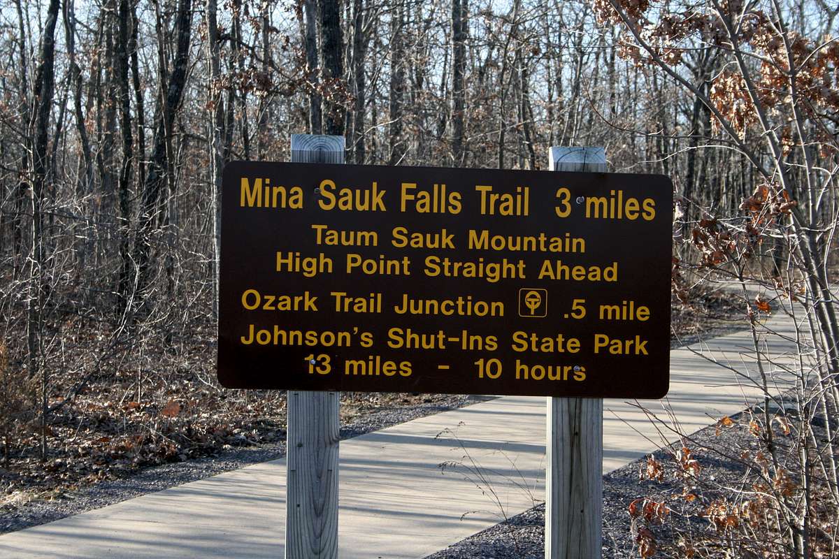
This is a sign at the start of the "Via Concreta" on the ascent of Taum Sauk Mountain, the Rooftop of Missouri. The summit is maybe 150 yards away on this obviously-challenging route.

Check out the time required to Johnson's Shut-Ins -- ten hours for 13 miles, downhill. They don't want you taking any unnecessary risks.

Actually it would be longer right now because the route was destroyed by the Taum Sauk Reservoir Disaster of 2005. It's being rebuilt -- call the park before planning a hike connecting these two state parks.


Comments

No comments posted yet.


Sign in to post!

Don't have an account? Register now.


Rate This Image
Current Score: 86.56

Log In To Vote
 Taum Sauk Mountain (Mountain/Rock)

Valley Views from the Sides of Taum Sauk
« PREV

Viewing
#5 of 45
GALLERY
View from the bottom of the...
NEXT »

 Arthur Digbee's Image Gallery

The Grand from Emma Matilda
« PREV

Viewing
#400 of 725
GALLERY
Rock of Ages Lighthouse
NEXT »


 Ozarks (Area/Range)


 Winter Ascent of Taum Sauk Mountain (Trip Report)


 Ozark Trail (Album)


Image Data

Arthur DigbeeSubmitted by Arthur Digbee
on Feb 1, 2008 6:26 pm

Image ID: 377554
Hits: 2570 

Lat/Lon: 37.56660°N / 90.7333°W

Image Type(s): Humor


"An ideal form of government is democracy tempered with assassination."   --Voltaire   

© 2006-2012 SummitPost.org. All Rights Reserved.