
|
|
Route |
|---|---|
|
|
38.39460°N / 110.2601°W |
|
|
Hiking, Scrambling |
|
|
Spring, Fall, Winter |
|
|
Half a day |
|
|
Class 2 |
|
|
Overview
This is a cross country route of only class 2 in difficulty, but a route that required routefinding. The route can be used to enter or exit the Main Fork Bluejohn Canyon.If you want to see some of the good parts of Bluejohn without any technical difficulty, this is your route.
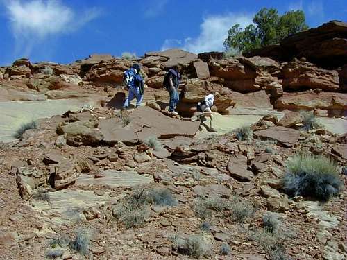
 West E/E Route to Bluejohn Canyon.
 Click for full size.
Getting There
Make sure to stock up with plenty of fuel and supplies when headed to the area. The nearest gas stations are in Green River and Hanksville and make sure to have a completely full tank of gas before leaving either town.Getting There from the North, East, or West and via Hans Flat Road
From I-70 11 miles west of Green River or from I-70 west of Highway 24, take exit 149 on Highway 24 southbound. Follow the highway south to the Hans Flat Road on the east side of the Highway, which is between mile markers 135 and 136. This is just south of the Goblin Valley State Park turnoff (west side of the highway).
Pull out the map and have it handy from here on. Follow the main gravel road (several forks are passed; stay on the main one) for 24 miles or so to a major junction (which will be referred to as “Horseshoe Junction” for clarity. Let’s stop here.
West E/E Trailhead
Turn right at Horseshoe Junction. Drive the road for about 6.9 miles to a small sandy 4wd track on the left (east). [This is just before a major junction in the main road, so if you hit the major junction, turn around and backtrack for about 0.2 miles]. Park here.
Getting There from South via Hans Flat Road
From the junction of Highway 95 and Highway 124 in Hanksville, drive north on Highway 124 for approximately 18 miles to the Hans Flat Road on the east side of the Highway, which is between mile markers 135 and 136. If you reach the Goblin Valley State Park turnoff, you have gone too far and need to backtrack a short distance. From the Hans Flat Road between mile markers 135 and 136, follow the roads to the trailhead as described above.
From the South, you can also get to the trailhead via Hite and the Maze, but the route is complicated, slow, and rough (4wd always required), though very scenic. Don’t even ask me to describe that route in detail. Buy a map.
Getting There From the North, East, or West and via Green River Road
This route is shorter than the one via the Hans Flat Road, but takes a bit longer because the road is gravel for a much longer distance. From Green River at Center and Main, turn south and follow the road signed for the airport. Stay on the roads signed for the airport until you get to a gravel road on the left with a sign for San Rafael Desert and Horseshoe Canyon.
Turn onto this road. This is known as the Green River Road. Follow the Green River Road south (crossing the San Rafael River at just over 19 miles) for about 39-40 miles to the turnoff for Horseshoe Canyon Trailhead (see above). Continue along the main road for 5.1 miles to Horseshoe junction where the trailhead is reached via the route described above.
Route Description
This is actually a collection of routes, and there are many variations. Pull out the map and compass and have it handy at all times.From the trailhead, walk or drive the sandy 4wd track north. After less than a mile, you will cross a fairly defined drainage (that drains into the West Fork). Leave the track here and head east. Stay fairly close to the rim of West Fork drainage (1/4 mile or so), keeping it on the left side. Don’t get too close though as there will be many drainages to cross. Up canyon from the Junction between the West and Main Forks, look for a route down in. There are many routes and variations possible.
Once down in, you will for sure want to make the hike up the Main Fork. You can also go all the way down Lower Bluejohn.
The West E/E route is a common way to exit all the following routes: Little Bluejohn, Main Fork, East Fork, and . In that case, just reverse the route above.
The route also makes a nice short loop with the West Fork.
I would recommend half to all day including a visit to the Main Fork.
 West E/E Route to Bluejohn Canyon.