
-
 6401 Hits
-
 13.4% Score
-
 3 Votes
|
|
Route |
|---|---|
|
|
39.33970°N / 106.1394°W |
|
|
Mountaineering, Skiing |
|
|
Spring, Summer |
|
|
Half a day |
|
|
Advanced Snow Climb; Extreme Ski Descent, D10 |
|
|
II |
|
|
Approach
Drive south on Highway 91 for nine miles from Interstate 70 or north for twelve miles from Leadville. 3/4 mile south of Fremont Pass is a sharp curve in the road. Park here or continue up a rough road on the right (west) side of the drainage between Mount Democrat and Mount Arkansas. At 1.75 miles and 11,520', you'll be directly in front of Mount Democrat's West Face.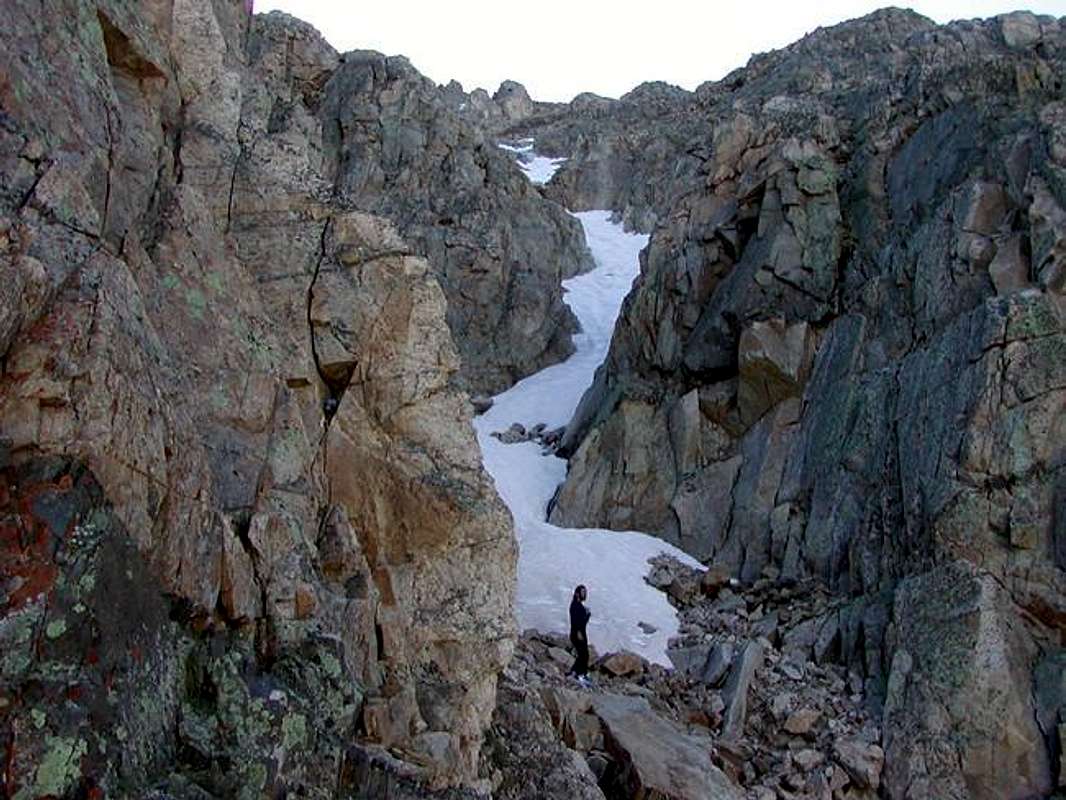
West Face Ascent of Mount Democrat June 20, 2004. Climber: Brian Kalet. Photo: Luke Kroiss.
Route Description
At the base of Democrat's West Face, cross the valley and climb up a gulley system which eventually leads to a saddle a few hundred feet north of the summit. This is a good line to ski. It never exceeds 45 degrees, but requires crossing above several cliff bands. It is rated as a D10 on the D Scale.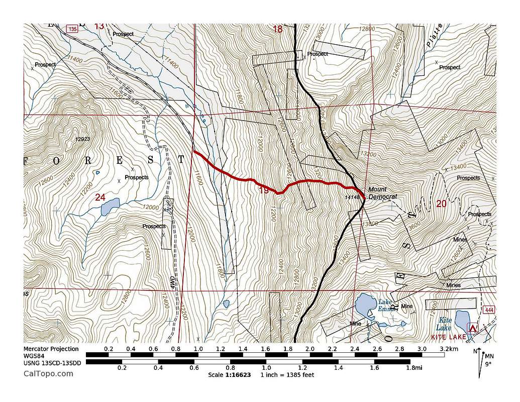
Mount Democrat's West Face snow route. ~45 degree snow, ~2.1 miles with ~3,000' of elevation gain.
Distance: ~2.1 miles roundtrip
Elevation Gain: ~3,000'