
|
|
Route |
|---|---|
|
|
39.33640°N / 106.1391°W |
|
|
Skiing |
|
|
Spring, Winter |
|
|
Most of a day |
|
|
Expert |
|
|
II |
|
|
Overview
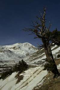 Mt Democrat
Lake Emma is a gorgeous high alpine lake south of Mount Democrat and west of Kite Lake. There is a popular hiking trail from Kite Lake to Lake Emma. There are several steep chutes suitable for backcountry skiing that dump into Lake Emma on Mount Democrat's south side. With good snow coverage, one can ski from Mount Democrat's summit on some fun slopes, ski through the chutes, and then back to Kite Lake.
Lake Emma Chutes are all expert skis. They are all very enjoyable - the walls of the chutes are quite high depending on snow coverage, giving that "alpine feel." Most are generally 40 degrees with a few spots that reach the 45 degree mark.
Getting There
Kite Lake Trailhead: 12,000 feet.Drive on Colorado 9 from the north or south to the town of Alma. In the center of Alma, look for a wooden sign that marks the Buckskin Creek Road (also called the Kite Lake Road, Park County 8).
Follow the Kite Lake Road for 6 miles to the pay parking area. Parking costs $3, and camping costs $7. This road can be done with a passenger car, but it can be very rugged and rutted after a hard winter. Most cars can make it to near the Sweet Home Mine.
Snow closure will vary on Kite Lake. Typically in winter, snow closure will be below the old mill at 4.0 miles from Alma. If you intend to snow climb and ski this route, chances are you will have to park below the actual Kite Lake parking area. Ensure that you factor this into your start time. It is 3 miles from this closure to Kite Lake.
Route Description
 Lake Emma Chutes
Gain the summit of Mount Democrat. If you want to ski what you climb, then climb the Lake Emma chutes and scout your line. If you prefer to skin to the summit, your best bet will be the standard summer route. With good snow, one could skin most of this route.
From the summit, point your skis south. After a few hundred feet of low-angled slopes, the run rolls over into the entrance to the Lake Emma Chutes. Slow down here and pick your line. It's easy to get too low and miss your chute.
Once you enter the chute you've chosen to ski, the angle should max out in the 40-45 degree range. After skiing a chute, you will exit into another broad, lower-angled slope that will feed into Lake Emma (which should be frozen over and covered in snow).
From here, you have a few choices. The easiest is to cut hard to the east and ski over a ridge back to Kite Lake (see this route photo). This way, you won't have to go uphill. If you continue to Lake Emma, you will have to go uphill at least a little bit.
Note: These slopes are definitely steep enough to produce a slide. One spot to watch is the far left chute. Above it is a large concavity that fills with snow. You will be able to see it from the Kite Lake Road, so preview before you launch.
One-Way Mileage: 1.2 miles (to Kite Lake Camping Area)
Elevation Loss: 2000 feet (to Kite Lake Camping Area)
Route Photo
Route TOPO!
 Skiing the Lake Emma Chutes