Comments
No comments posted yet.
|
|
Trip Report |
|---|---|
|
|
Mar 17, 2020 |
|
|
Skiing |
|
|
Spring |
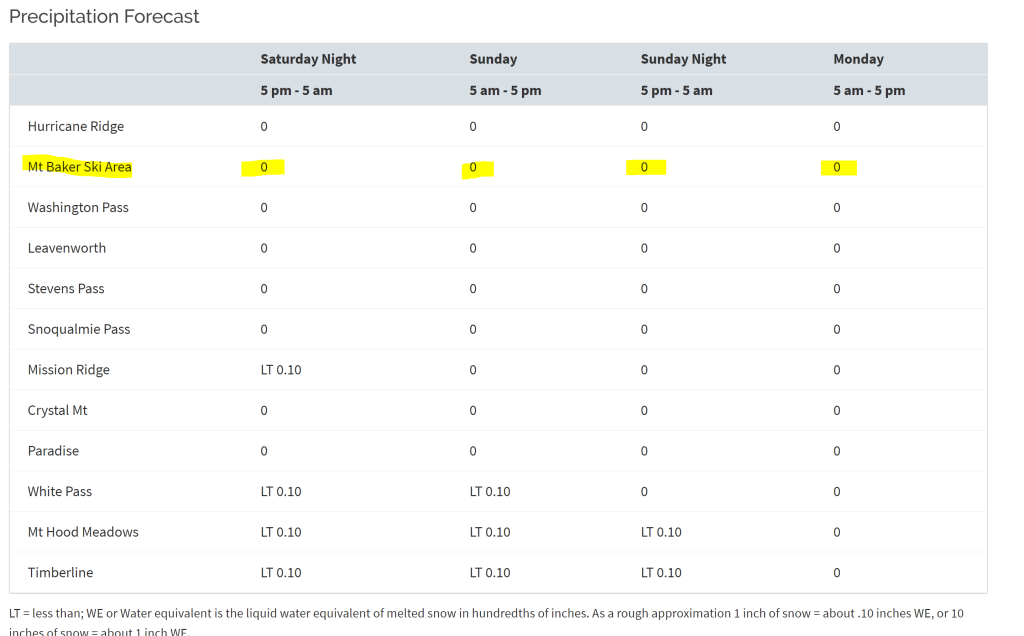
|| By the Numbers ||
Date: Sunday, March 15, 2020
Trip Duration: 8 hours car-to-car
Trip Statistics: 10 miles, 7500′ vertical gain
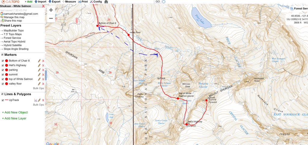
Caltopo/GPX: https://caltopo.com/m/N5KJ
The Team: Kyle McCrohan, Jon Holt, myself
|| Pre-Trip||
HIGH PRESSURE WEEKEND! My routine for most weeks consists of:
So come Wednesday, I was bouncing off the walls when I saw a forecast with high pressure for the North Cascades. Immediately, my mind raced to one objective: Mt. Shuksan.

Amazing people make for amazing adventures, so I was ecstatic when Kyle McCrohan (see his website, www.climberkyle.com) shot me a text message asking about Shuksan for Sunday. Soon, we had a team: Kyle, his friend from college, Jon, and me. I could hardly wait!
We started to put together a plan. We would head up to Bellingham Saturday night, crash at Jon’s place, and head out towards Baker Ski Area, the White Salmon Lodge parking lot in particular, at 6 AM. We would aim for a start around 7:30 AM.
We monitored the weather forecast and had a few major observations:

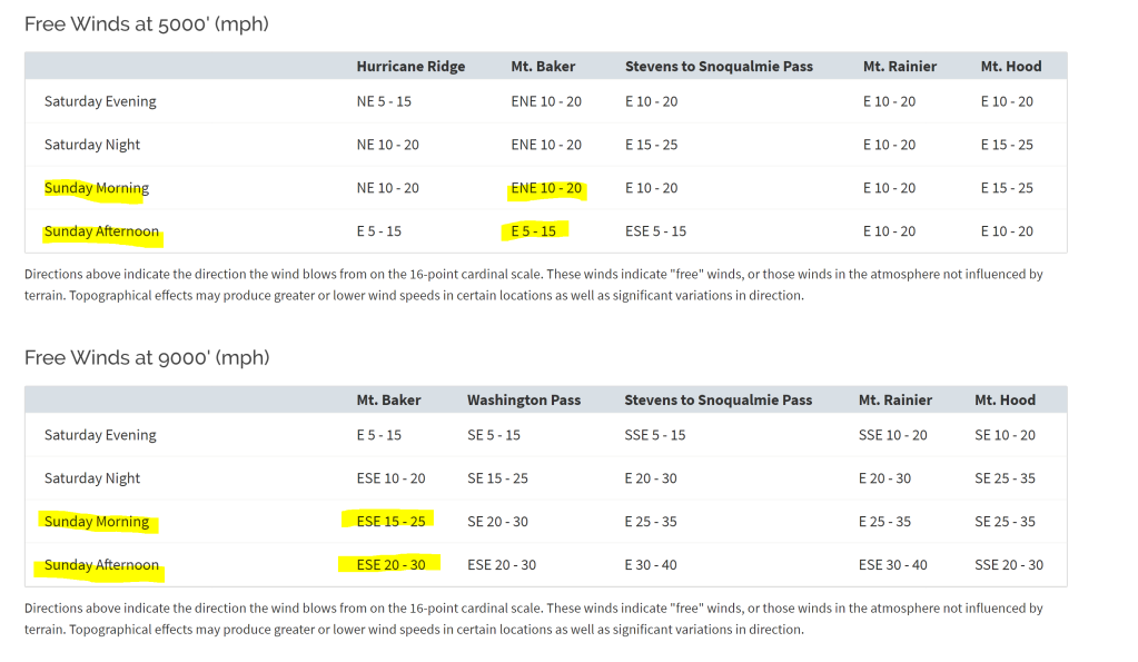
We prepared for a windy, cold day on the mountain. We did not feel that an alpine start was necessary, and predicted it would take us around 11 hours car-to-summit-to-car.
We set out with hopes of skiing the Northwest Couloir, one of the Fifty Classic Ski Descents of North America, but knew that it was unlikely given that conditions were likely to be firm and breakable crust. Kyle’s friend, Porter, had skied the White Salmon the day before, and had reported poor, firm conditions. Kyle, Jon, and I would be happy with a long day out together, regardless of what line we were going to ski!

|| Uptrack||
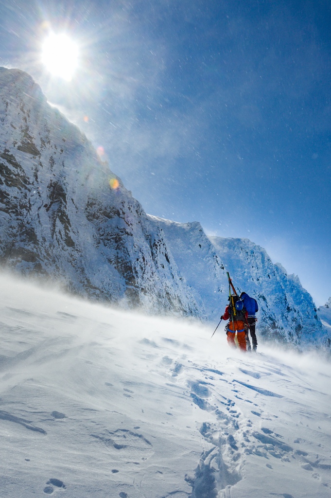
Alarms rang at 5 AM, and Jon treated us to a beautiful breakfast of eggs, coffee, and hospitality before we headed out. In the car, we jammed to tunes, getting ourselves ready for the big day ahead. Soft light rose on Baker and Shuksan on our drive in. . . we were STOKED.
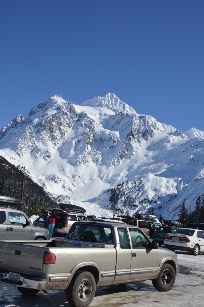
Pulling into the empty White Salmon Parking lot, the mountain stared down from above. We could see skiers already high on the White Salmon Glacier! We were glad we hadn’t started that early; in our opinion, there was no need!
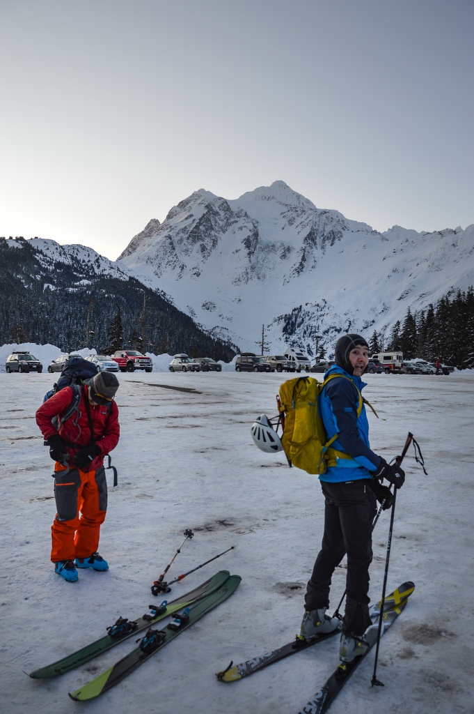
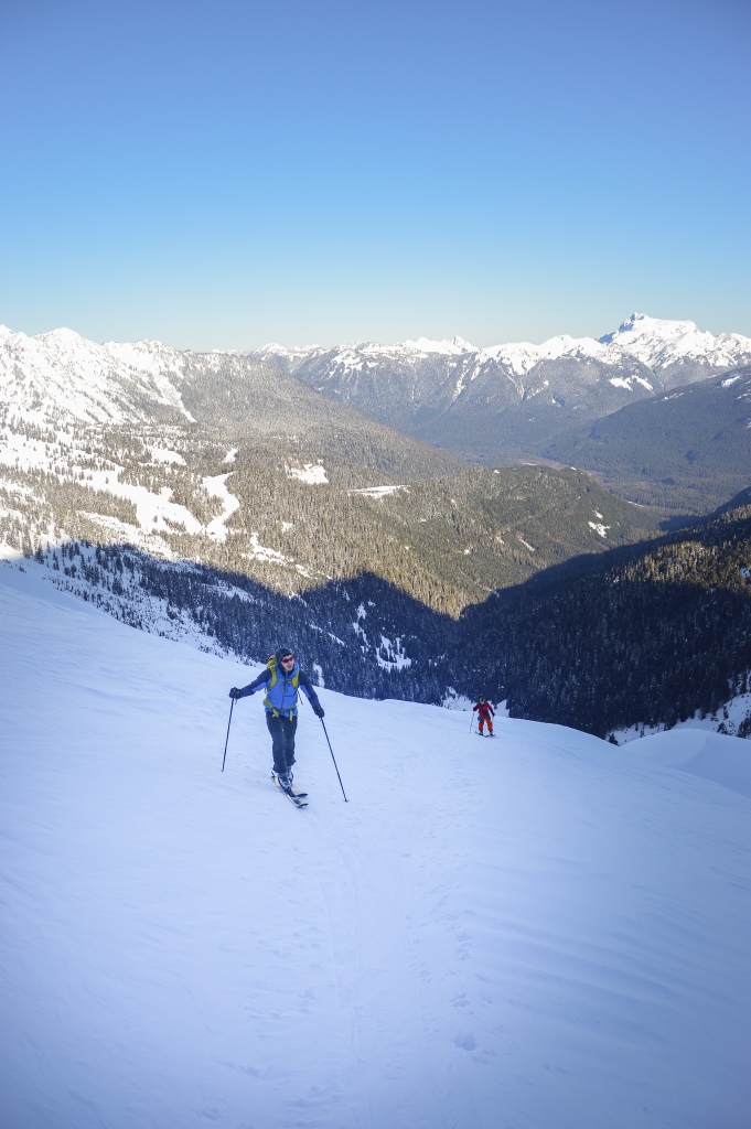
We left the parking lot at 7:25 AM and began skinning up the ski slope towards Chair 8 of Mt. Baker Ski Area. “It felt weird to be skinning on groomed corduroy”, as Kyle proclaimed, and I agreed. Soon enough, though, we would be back on backcountry ski slopes.

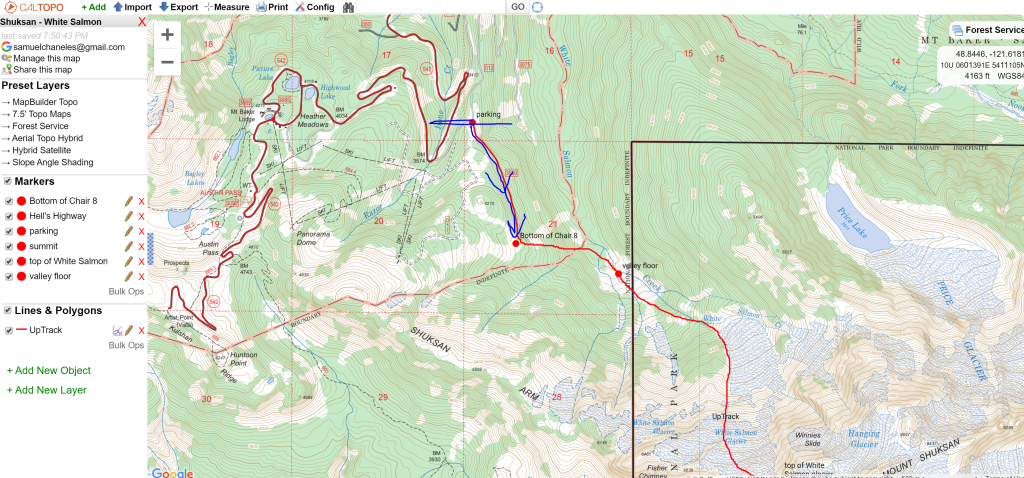
Once at the bottom of Chair 8, we ducked the ropes and began to traverse down to the valley floor. There were tracks from skiers that morning leading the way. Initially we tried to keep our elevation and stay higher to skier’s right on the slope, but we soon encountered a deep creek bed and dropped down towards the White Salmon drainage.

We were down at the valley floor by 8 AM and transitioned to begin our skin up. The morning glow over the mountain was incredible!

The skin track was a party! I knew three other skiers on the mountain that day: Joe and Ethan (who I skied with the previous weekend on the Slot, Snot*, and Crooked Couloirs) and Daniel (who was much further up the glacier, starting at 6 AM). We weren’t complaining! It meant:

We zig-zagged our way to the foot of the White Salmon Glacier by 9 AM and rested for a quick snack and water break. The surface was firm, but not icy, and our skins were gripping well! We were making good time and were optimistic about skinning conditions above.

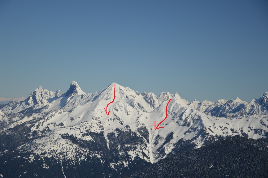
What we were not optimistic about was the condition of the Northwest Couloir, as it looked wind-blasted and thin.

We chatted with another group of skiers that initially were thinking of skiing the Hanging Glacier. After further investigation, though, they were hesitant, as the “keyhole” looked narrow and thin.


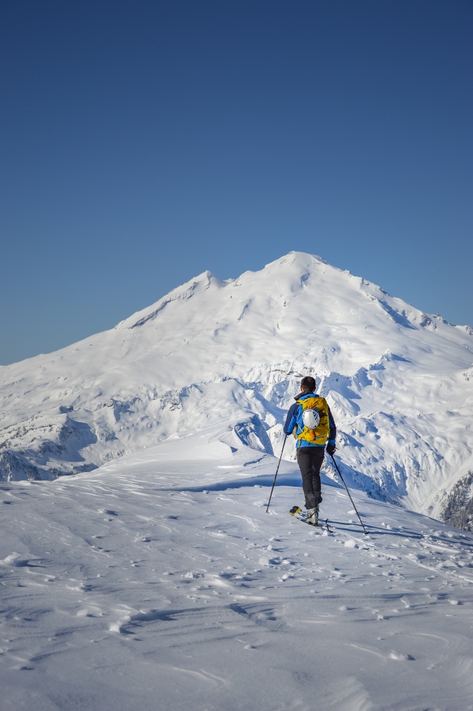
We kept on up, though, cruising through the morning climb. Kyle and Jon kept the mood lighthearted and fun. Every now and then, Kyle would point out an epic ski line on some peak in the distance; his knowledge of the area was encyclopaedic!
By 11 AM, we had reached a col on the ridgeline above the Curtist Glacier, and we finally found a pocket of sun! It was brutally cold in the shade, and Kyle immediately skinned over to a sunny spot with an amazing view of Mt. Baker.
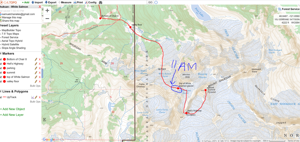

By 11 AM, we had reached 7,000′; starting at the parking lot elevation of 3600′, we had climbed 3400′ in 3.5 hours. Not too shabby!
From our sun spot, we skinned just to the base of Winnie’s Slide, which is mis-labelled on the FS Topo maps. We quickly transitioned to booting up the steep pitch for a few hundred feet.


Once on top of Winnie’s Slide, we continued our boot to the top of the Curtis Glacier, to a point where we could ski across to Hell’s Highway. The shortcut route towards the base of the summit pyramid, “The Hourglass” (also mislabelled on the topo), was filled with rime ice and seemed an unnecessarily risky route.


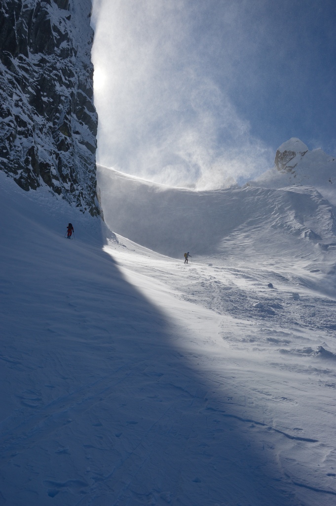
The wind began to WHIP, blowing snow and cold air on us as we traversed over the Curtis Glacier. It would only intensify as we neared Hell’s Highway.


We soon reached a point where we could ski down to the base of Hell’s Highway; we clicked in for a brief ski, anticipating hard crust. The wind continued to whip as we transitioned!

|| Hell’s Highway: A War of Wind ||
The battle began! Entering Hell’s Highway was like entering the test chamber of a jet plane. Hell’s Highway is a very low angle gully / ramp that transitions from the Upper Curtis Glacier to the Sulphide Glacier. On the FS Topo 13 map, it is mislabelled as “The Hourglass”, which in reality is further to the north towards the summit pyramid.

The Highway is nothing technical, scary, or really all that challenging, but today it was a wind tunnel. Winds were easterly and the Highway acted as an air compressor for the wind coming across the Sulphide transitioning onto the Curtis.
Once we reached the base of the Highway, we removed our skis and began booting. Jon and I hugged to the left of the Highway, which was a longer boot, while Kyle climbed steeper and towards climber’s right. We put on crampons and got out our axes, but in my opinion these were just precautions and not entirely necessary. Boot penetration was sufficient purchase, for me at least, and my crampons eventually slipped off anyway.

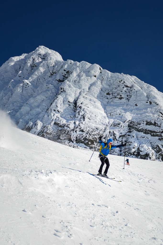
We were through Hell’s Highway by 12:30 PM, transitioning onto the Sulphide. Kyle waited for Jon and I for a few minutes, the wind still whipping him. We could tell he was cold!

We could see towards the summit pyramid, where 4 or 5 skiers waited at the base of the final ascent. The low-angle Sulphide Glacier climbs gradually to the base of the summit pyramid, which protrudes for 400-500′. From the base, there are numerous ways to the top, the simplest being climbing the face. Today, though, rime ice dominated the face, and whipped appeared to throw ice off every few minutes. There was no boottrack to the top, and we could tell the skiers ahead of us were turning around (soon enough, we would do the same).

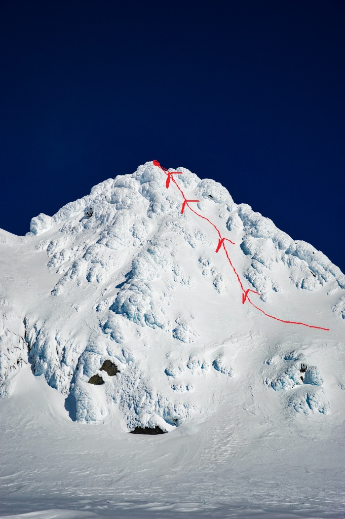
We had brought the equipment to go to the summit, but were hesitant based on the conditions we were seeing. First and foremost, though, we wanted to get out of the wind, and the first pair of skiers passing us told us that the ridgeline at the base of the pyramid provided some shelter. We kicked back into skinning mode, moving up towards the pyramid for a well-deserved lunch break.

Looking back down from where we had came, Baker was still stunning!

By 1:15 PM, we had made it to our lunch spot, and collectively we agreed, our high point for the day. We were happy with our decision not to climb higher, and Kyle set up a nice “ski bench” for us.

|| Down, Down, Down ||
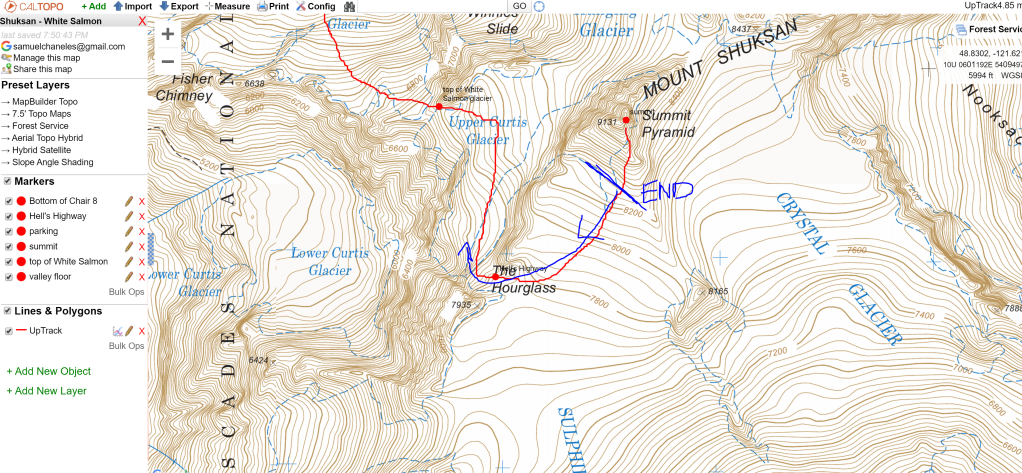
From our skin up the Sulphide we knew how horribly scoured the glacier was, almost like sastrugi in some places; the ski down towards Hell’s Highway was not going to be elegant, but the sun was out so my smile was full!
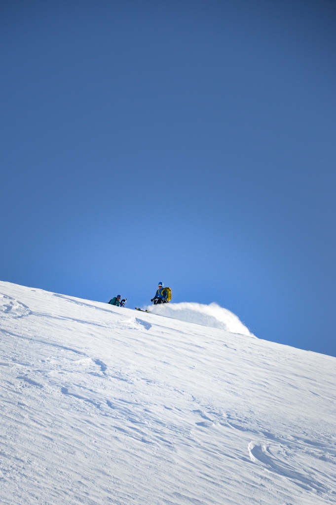
A few skiers went down ahead of us, and as a photographer I quickly reached for my camera when I saw this shot:

I knew the pictures would be good on the way down, so I asked Kyle and Jon if I could drop first to grab some of them coming down.


We followed our tracks back to the top of Hell’s Highway; Kyle suggested we ski the steeper pitch at skier’s left of the Highway, as it looked more protected from the wind than the lower angle ramp we had booted up.
Kyle led the charge down Hell’s Highway, throwing in a few jump turns for fun!


The skiing was actually kind of good! It was firm, sure, but Jon and I got in a few good turns on our way down to Kyle. At the base of the Highway we skinned back up for a brief climb back up towards the top of the Curtis Glacier (which we had traversed down and across on our way up).

Once at the top of the Curtis, we clicked in and began our ski down Winnie’s Slide towards the notch at the top of the White Salmon.

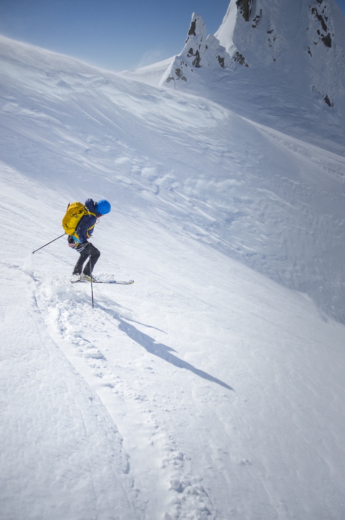
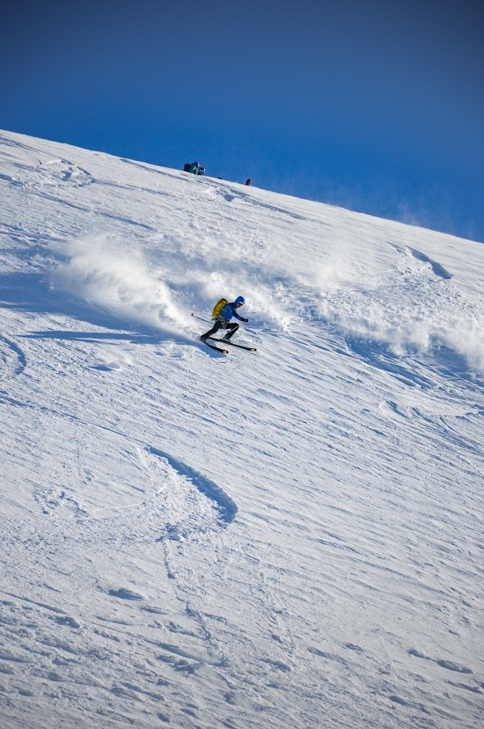
Again, I knew the pictures would be good when I stopped, got out my camera, and spotted my shot.

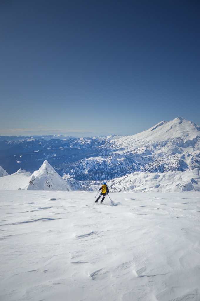
We were back at the top of the White Salmon by 2:15 PM, and we were EXCITED for the open tracks for thousands of feet. The snow was so much better than we had anticipated, the sun softening it throughout the day. The White Salmon was much more protected from the easterly winds than the Sulphide as well. We couldn’t wait to drop!
Next came Jon. . .
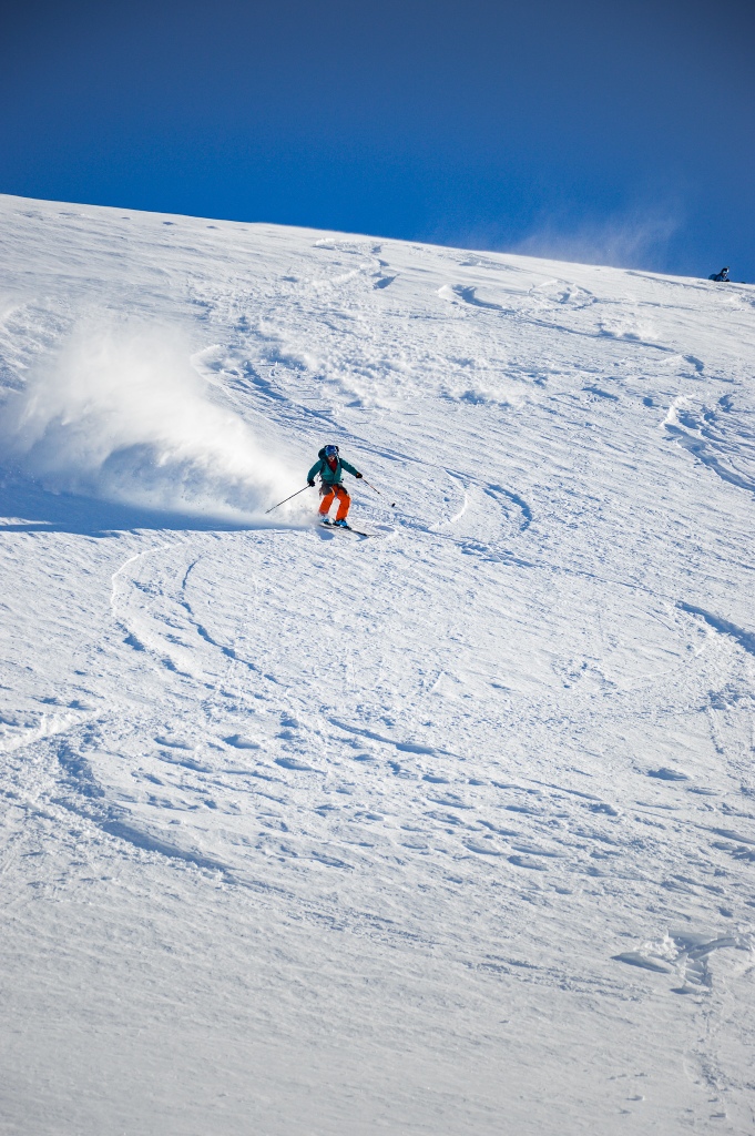

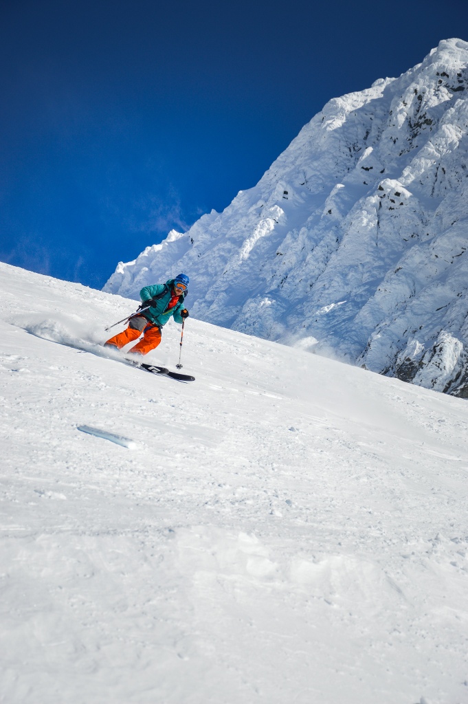
WOW! From our first turns, we were giddy for the rest of the ski. I asked Jon if I could drop further down and get a round of photos.

Jon and Kyle shredded the White Salmon: PARTY SKIING!

We were hooting and hollering all the way down. At one point, Jon turned to me and shared some brilliant wisdom: “Just ski man!” I stowed the camera and enjoyed the moment, making turn after sweet turn through soft, sun-baked powder.
Towards the bottom of the White Salmon, there were a few spots where the snow began to become variable, but for the most part the skiing was great all the way down. Kyle stopped us at the foot of the glacier, noting that we would want to traverse as high to skier’s left out of the White Salmon drainage as possible. His friend, Porter, had cut a skin track high through to the left the day before, and trying to follow it would save us time on the exit.
Porter’s skin track was easy to follow, but in general the route Porter took was just to stay high and to the left on the slopes above the drainage. Once near the base of Chair 8, Porter turned up the slope towards the ski area, and we followed suit. By 3:15 PM, we were at the base of Chair 8; looking back towards the mountain, each of us had a smile from ear-to-ear. That was a great adventure!
We skinned quickly along the groomed return trail to the parking lot, and once we crested the lone uphill we clicked in for a quick ski down to the cars. 8 hours round trip! We were proud of the work we had put in, and it was an amazingly rewarding day.
|| Final Thoughts and Notes||
First and foremost, awesome days are about awesome people, not just awesome objectives. This day was particularly special because of the amazing company of Kyle and Jon. Thank you boys for sharing this adventure with me!