
|
|
Mountain/Rock |
|---|---|
|
|
39.43280°N / 106.4731°W |
|
|
Mountaineering |
|
|
Summer |
|
|
13271 ft / 4045 m |
|
|
Overview
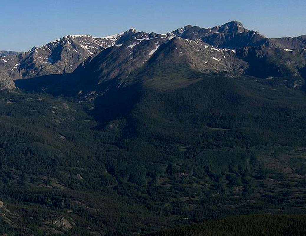
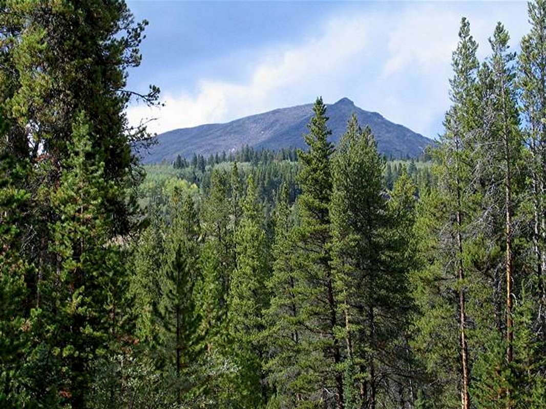
Whitney Peak is the mountain in front. To the right you can see Mt. of the Holy Cross and to the left of Holy Cross the peaks of the Holy Cross Ridge. This picture was cropped out of a wonderful panorama created by Colonelpyat who was kind enough to let me use it here.
Whitney Peak rises in the Holy Cross Wilderness in Central Colorado (For more information on the wilderness, refer to the Mt. of the Holy Cross Page). To the northwest, the 12580 ft Fall Creek Pass separates Whitney from the Holy Cross Ridge. Much of the area to the north and west of Whitney consists of high valleys that are bound by the Holy Cross Ridge and are dotted with beautiful alpine lakes. To the south and east, the slopes of Whitney drop 4000 ft to the bottom of the Homestake Creek Valley.
From Homestake Creek a very rough four wheel drive road follows the French Creek drainage up the Aspen and Pine forests to reach the remains of an abandoned mining town at 11400 ft known as Holy Cross City which was populated for just a few years in the late 1880s/early 1890s. This road is one of the roughest four wheel drive roads in Colorado. A sign at its beginning rates it at 8 out of 10 and warns of probable vehicle damage. While rough on the vehicles, the road is obviously easy to hike.
The USGS map shows that the southern slopes of Whitney that rise directly above the road just before Holy Cross City are steep/rocky and probably not suitable for climbing. From near Holy Cross City, you could potentially follow a trail up the French Creek past the Seven Sisters Lakes to the Fall Creek Pass where you will gain access to the very gentle northwestern slopes of Whitney (I have not done this). This, however, will require a very long hike. An easier option (which I have done) is to leave the road at around 10700 ft (just before the escarpments above the road begin) and bushwhack your way up the forest to above the tree-line. The “bushwhacking” is not hard but you must be willing to try to find your way for a short while in the forest where the trees obstruct the view making it difficult to plan your route ahead. Near the tree-line, you will find beautiful meadows that are covered by broken/fallen trees that are rotting away probably as a result of an avalanche many years ago. Fun boulder hopping will lead you to the summit.
An eastern approach via the 10956 ft Whitney Lake may also be possible. A four wheel drive road apparently goes from Homestake Creek to Whitney Lake.
The top of Whitney Peak consists of a 0.4 mile long flat area that runs east-west and is above 13240 ft. The official summit is on the far west end and is marked by a pile of rock but I could not find a register. The summit of Whitney will provide you with great views of the Mt. of the Holy Cross as well as the high 13ers on the Holy Cross Ridge. Many other mountains, near and far, will also be in good view. Whitney is a beautiful peak with 4000 ft of vertical that is probably rarely climbed (I saw no one the whole day). Solitude can be found on its wonderful slopes and summit.
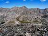 |  |  |  |  |
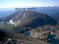
The True Summit of Whitney Peak
As seen in this picture, the summit of Whitney Peak is made of a flat 0.4 mile long ridgetop. The USGS Map marks the summit on the west end of the ridgetop and gives it an elevation of 13271 ft. SP member Kalet has informed me that there is a boulder several feet tall on the east end of the ridgetop which supposedly has an elevation of 13276 ft and is therefore the true summit of Whitney Peak (see pictures here). Reaching the top of this boulder apparently requires Class 5 climbing.Getting There
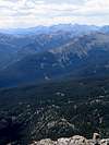
The summit of Whitney is behind the sharp high point to the right. Taken from the road to Missouri Lakes Trailhead
Take Exit 171 on I-70 to Route 24 South. Drive 12 miles to the junction of Homestake Road (Forest Road 703) on the right (north of Tennessee Pass). Drive the well-graded Homestake Road 7 miles to Gold Park Camping area. A short distance past Gold Park, before crossing French Creek, you will see a parking area on the right (9320 ft). This is the beginning of the Holy Cross City Road (Forest Road 759) and is well-signed.
Alternatively, you can continue on Homestake Reservoir Road a short distance past French Creek to a fork in the road. Turn right on Forest Road 704 and go up a few switchbacks a couple of miles or more till you see the Missouri Lakes Trailhead on the left and the Fancy Creek Trailhead on the right. From Fancy Creek Trailhead, a much rougher road (which I did not drive) heads back northeast without gaining much elevation, to reach the Holy Cross City Road at around 10300 ft. If you choose to park at Fancy Creek Trailhead, you will probably increase the total hiking distance slightly but decrease the total vertical by less than a 1000 ft.
 |  |  |  |  |
Red Tape
N/NW Face
At some trailheads in the Holy Cross Wilderness you need to fill out a self issued permit but I did not see any here.
 |  |  |  |
When To Climb
Easiest in summer.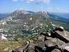 |  | 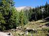 |
Camping
Gold Park Campground.
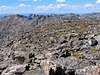
Whitney Peak on the right, SW face