Overview
After my trip to Tokewanna, the next logical step in my quest for winter ascents of Utah's 13,000 footers was another peak accessed from the East Fork Blacks Fork guard station. However, it was so unseasonably warm, that I couldn't bear the thought of slogging down the potentially muddy road for 11 miles to the cabin. First the weather seemed too hot, then it seemed too unsettled. Finally, a week after a 2' snow dump, it was just right.
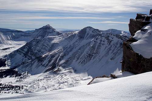
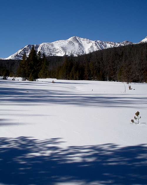
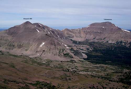
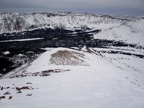
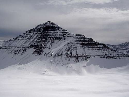
![Wasatch Benchmark]() Lovenia (left of center) and Wasatch BM (right of center) from Tokewanna
Lovenia (left of center) and Wasatch BM (right of center) from Tokewanna
I would try for either Mount Lovenia (13219') or Wasatch Benchmark (13156'). Wasatch Benchmark was a little closer but still would be almost 20 miles round trip from the cabin. Lovenia probably had an easier ascent once I dropped my skis. I say probably, because as far as I knew no one had ever climbed Lovenia in the winter or near winter. Wasatch Benchmark had been climbed in the near winter, but by a different route than I was planning. I had no winter pictures to look at to see if my proposed route for Wasatch was feasible. It was up a steep slope and I would only do it if there were enough rocks sticking out to eliminate the potential for an avalanche. I had been able to view some of the steep part of Lovenia from my Tokewanna trip and from what I could see, there was lots of exposed rock on that one.
Day 1, March-9-2015, Getting to Cabin
Stats
Distance: 11.4 mile ski to cabin over flat to gently rolling terrain
Start elevation: 8720'
Cabin elevation: 9340'
Time: 5 hours and 5 minutes
It was a very warm day. I could not start early because I had to pick up the key for the cabin at the Evanston, Wyoming ranger station which didn't open until 7:45am. Fortunately, daylight saving time had just started so I was able to start an hour earlier than otherwise. A ranger and I discussed my prior misadventure of not being able to unlock the door to the cabin. He said that in 30 years time the door had been mislocked twice, both times by the same person. After I reported the problem, the ranger had gone in to check things out and had "fixed" the door by putting tape over the lock which wasn't supposed to be touched. One other group had rented the cabin in the 7 weeks since I had been there, so of course, I worried that they had somehow screwed things up regardless of the tape.
Last time I had been optimistic and thought I could do Tokewanna in 3 days, 1 day to get to the cabin, 1 day to get to the peak and back to the cabin, and a third day to get back to the car. That turned out to be woefully over optimistic so this time I planned for a full 4 days at the outset.
The 11+ mile ski slog to the cabin, 10 of which are on a mostly plowed but snowpacked road, went fine. One vehicle, a pick up truck, driving by to check on the logging operation, passed me. I wished that driving for normal people was permitted, but the road is gated and locked. I was almost at the end of the plowed section or I might have asked him for a ride.
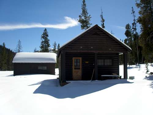
![East Fork Blacks Fork]() The East Fork Blacks Fork guard station
The East Fork Blacks Fork guard station
It took me 5 hours and 5 minutes to get to the cabin with lots of sit down/my pack's too heavy breaks. I arrived at the cabin at 2:50 and to my great relief unlocked the door with no difficulty. Last time it had taken over an hour to get in. There was one minor snafu as this time I couldn't get the door to the outhouse open. I was mad. However, after shoveling, it was revealed that the concrete pad had a 1/4" layer of ice, just barely thick enough to prevent the door from opening. That, I could deal with. Trying to crack it with my heel or the shovel had no effect so I retrieved my ice axe from the cabin and whacked away just enough so that I could squeeze in. Having my ice axe serve some useful purpose made me happy as last time it was just extra weight.
I had some chores to do before I could relax. I split enough wood for all 3 nights, packed down the knee deep snow to the outhouse, unearthed (unsnowed) some more unsplit wood to dry out, and scooped a bunch of snow to melt.
The inside of the cabin was 42F and felt warm with the afternoon sun streaming through the window. I saw no reason to start a fire until it felt cold as the more wood I used, the more I had to split to replace it. I got the fire going about 7PM when the sun descended behind a ridge and instantly it felt cold.
Day 2, March-10-2015, Trailbreaking
Stats
Distance: 6.11 miles one way skiing over very gently rising terrain
Time going: 4 hours and 41 minutes
Time coming back: 2 hours and 52 minutes
Vertical gain: 820'
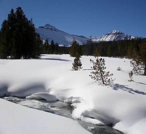
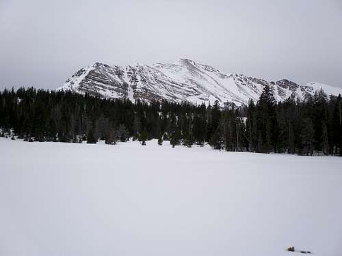
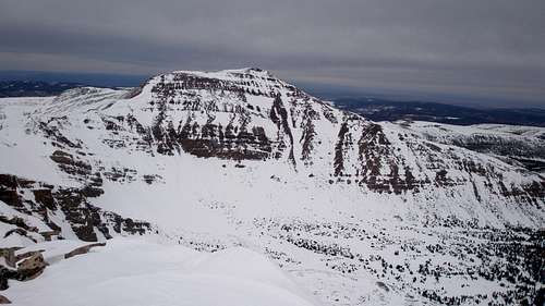
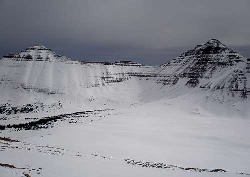
![East Fork Blacks Fork]() Mount Lovenia and Wasatch BM
Mount Lovenia and Wasatch BM
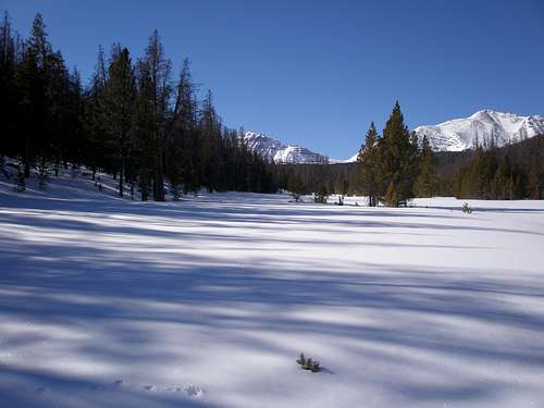
The strategy for this day was to break as much trail as possible and then return to the cabin without wearing myself out. The temperature at the start at 6:52AM was 6F, nippy, but not totally terrible. It was to be sunny and warm with a high in the 40's. I worried that if I stayed out too long, then the snow that was firm in the early morning would be mushy and I'd be doing myself a disservice rather than a help as I'd be making a deep, hard to ski in trough on the way back.
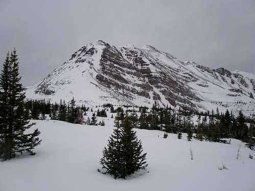
![The Lovenias]() East Lovenia and Mount Lovenia
East Lovenia and Mount Lovenia
I turned around at 11:33 after breaking trail for 6.11 miles. On the way back, I tried to double pole as much as I could to sink in as little as possible. All in all, trail breaking was as expected, with the snow being mostly supportable, but with enough knee deep collapses to be tiresome. Most of the skiing was up a wide gentle valley along side a creek bed. There was just one annoying part where I had to gingerly sidestep down a steep snow free bank. On the way back, I tried to avoid it by staying low, but found the creek not frozen well and had to make a very sketchy crossing, followed by repeatedly sinking in to my knees going up the steep bank on a snowy section. After making it up about a tenth of the way, I retreated and found a shorter bare section to sidestep up.
I caught some glimpses of Wasatch BM before I turned around. The route is up the steep ridge at the left. It was hard to tell from 3 miles away how much snow was on it, it could go either way.
![Wasatch Benchmark]() Wasatch Benchmark
Wasatch Benchmark
I got back to the cabin at 2:25, split some more wood, making absolutely sure I wouldn't have to split any the next day, and vegged out.
Day 3, March-11-2015, Summit
Stats
Ski distance one way: 8.9 miles
Ski vertical gain: 2080'
Ski time up: 6 hours and 21 minutes
Ski time down: 3 hours and 56 minutes
Hike distance one way: .9 miles
Hike vertical gain: 1736'
Hike time up: 2 hours and 15 minutes
Hike time down: 1 hour and 31 minutes
Total time: 14 hours and 3 minutes
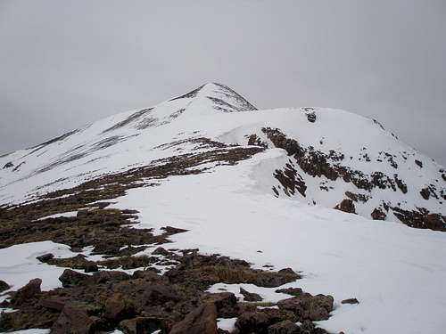
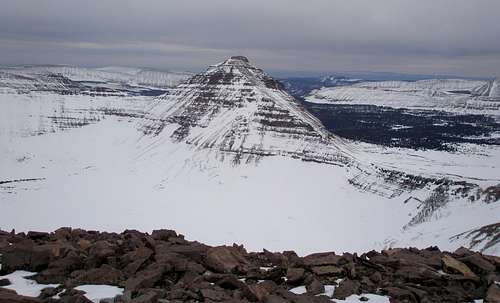
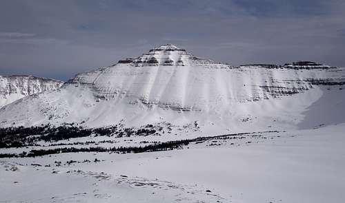
![Wasatch Benchmark]() Wasatch Benchmark under gray skies
Wasatch Benchmark under gray skies
I was underway at 6:14 and skied an hour in the dark. Unlike the day before, it was overcast and gloomy, but much warmer, with a 20F degree start. I was dismayed at first because my skis seemed too wide to fit the previous day's track! Uh oh, things were going to be slow, but after I skied down the hill to the bottom of the valley, it got better, but the sides of the track were still pretty rough. I thought I was making good time, but I was getting worried as I hadn't yet passed a major landmark. No, I will not look at my GPS. No, I will not look at my GPS. Surely it's just past that clump of trees. About 10 clumps of trees later I gave in and discovered it was 1 and 1/3 miles behind me. I don't know how you can not notice a major creek crossing followed by a 1/2 mile stretch of open meadow, but I managed. It must have still been dark. I had been depressed, but now I perked up.
I reached the previous day's turn around point in 3 hours and had only 1/3 mile to go to where I would leave the creek valley and start climbing. I wasn't sure how that part was going to go. Would the trees be annoyingly thick, would there be a lot of deadfall to step over, would there be rocky steps on the steeper part, would the gentle part near the peaks have snow or be scoured by the wind, and would there be a breakable crust making for a difficult descent? Well, the skiing in this section turned out to be as good as it could be. The trees were spaced wide enough apart without too much deadfall, the slope rose evenly, there was lots of snow cover everywhere, and there was still soft powder on most aspects.
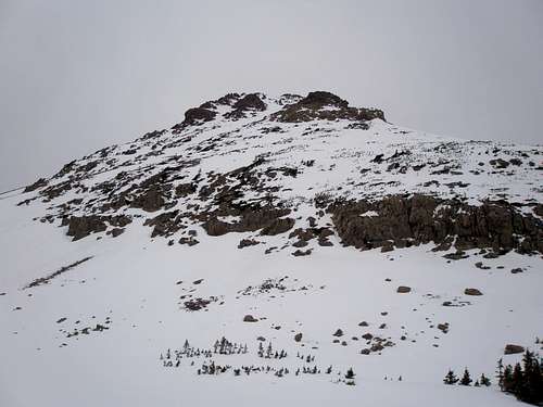
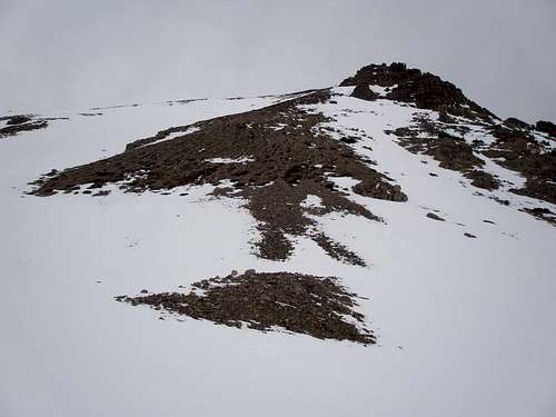
![Wasatch Benchmark]() The tip of the east ridge of Wasatch Benchmark
The tip of the east ridge of Wasatch Benchmark
I was tired though and hoped that Wasatch BM would work out as I didn't think I had the energy for Lovenia. As I got closer, it looked harder and harder. I was hoping to ascend on the north side of the east ridge on rocks that were hopefully going to be sticking out. I hoped this and I hoped that, but hopes did not match reality or my memory from a summer trip 5.5 years ago. It wasn't exactly a ridge, it was more like two rocky ribs with a couloir loaded with snow in between. In the summer it had merely been steep, but now it looked particularly unappealing with most of the exposed rock being a series of small cliff bands. Nevertheless, I thought if I skied to the right to reach some rocks, I could perhaps make my way mainly on rocks to the left rocky rib, and hopefully I could scramble up it. I suspected this was another case of wishful thinking, but I would follow it through until it became too difficult or too dangerous. That only took about 5 minutes as the snow was so hard that I couldn't keep my skis from sliding sideways and I was having a very hard time even getting to the rocks. Also, it was unpleasantly windy, with much snow blowing and the dark clouds just added to my increasing feelings of anxiety. There were some very dense small trees holding back a 6' wall of snow with a nice flat sheltered spot in front of them. I retreated to there and took my skis off thinking I'd boot over. I didn't even take a single step before I decided it was nuts and "knew" I would never climb Wasatch BM in the winter as I was only willing to do it if I perceived it as being completely safe and I didn't. The bottom line was I was chicken and it didn't take much for me to abandon my attempt. It is easy when you are following in the footsteps of a strong confident person, but when you are by yourself, not so much.
It was only 11:46am and I had skied 8.4 miles. I couldn't bear the thought of turning around now and facing a slow slog back to the cabin on mushy snow. If I waited for the snow to refreeze, I'd have a nice glide back. I looked at the map to see if it was still possible to try for Lovenia without backtracking. It was, but I didn't have the energy for it. However, since it was too early to turn around, I thought I'd make my way slowly towards the saddle between Lovenia and Wasatch BM and turn around at 2 and take my time on the way back.
I rounded Wasatch BM's east ridge and skied up a very nice wide treeless valley towards the saddle. I kept looking up at the steep, south side of the ridge at the varying terrain thinking, "not something I would do".
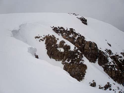
![South side of east ridge]() The south side of the east ridge
The south side of the east ridge
The picture above makes it look not so bad, but the slope angle is 40 degrees here. It's too rocky to ski, but enough snow to make booting tiresome, not to mention being steep enough to avalanche and the occasional small cliff.
I skied on and lo and behold, there appeared a swath almost completely bare of snow, all the way to the top of the ridge on an even slope that was south facing. It was steep, but it looked quite doable. I was amazed as this was totally unexpected. Until now, my mental model of Uinta snow patterns has north and west sides bare and south and east sides loaded with snow.
![Bare swath]() The bare swath
The bare swath
My first thought was how I'd have to check it out in the summer and maybe come back and do it next winter. But it was only 12:35!!, I had plenty of time to do it now even at a slow pace. I skied my way over to the roundish bare patch at the bottom where I dumped my skis and poles. I didn't know at this point if I was looking at the top of the ridge, or merely some intermediate rocky obstacle that would turn me back. It seemed too good to be true that there was such a straightforward way up.
![Winter Route]() What the route looks like in the summer
What the route looks like in the summer
It was tough going up as the rock was loose and unstable. I resorted to all 4's several times. Occasionally I'd hit a vegetated spot that was a piece of cake, but mostly it was slow going, two steps up and 1 step sliding back. As I got closer, it seemed more and more likely that what I was seeing was really the top of the ridge and I could indeed make the summit. I topped out on the ridge about 1:40PM at 12,240 feet elevation.
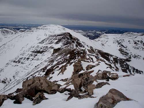
![East ridge]() On the east ridge, looking at the summit
On the east ridge, looking at the summit
I had 916 more vertical feet and .65 miles to go. Piece of cake, it looked easy. There was only one steep spot at 12400 feet and the rest was moderate.
![East ridge]() Approaching the steep spot. I stayed well to the left.
Approaching the steep spot. I stayed well to the left.
Just before I got to the steep spot I debated putting crampons on but it was pretty windy and I didn't feel like stopping. I thought the snow was soft enough to leave them off. A few minutes later I regretted my decision but it was now too steep to stop. I made it up to a more mellow and slightly less windy spot and put them on. I walked about a tenth of a mile and noticed that my left crampon was loose so I stopped to tighten it and noticed that my right crampon wasn't there at all! I'd worn these crampons lots of times, but never with these boots. I think I just had the length too long. The terrain didn't look that bad so I decided to continue with just one crampon and look for the other on the way back. I went about another tenth of a mile and my left crampon started coming off again so I said to heck with it and quickly attached it to my sternum strap, wearing it like a necklace, and kept going. It was all pretty easy terrain, the last little bit I had a choice between rocks or snow and without the crampons went for the rocks.
I got to the summit at 2:50. I was thrilled and felt like I had pulled this one out of a hat. I did some quick taking of pictures and left. I wished it hadn't been so overcast, but at least it hadn't snowed since even the tiniest speck would slow the glide out.
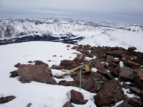
![View from Wasatch BM]() Summit area
Summit area
![Mount Lovenia]() Mount Lovenia
Mount Lovenia![NW Wasatch]() NW Wasatch
NW Wasatch![Tokewanna Peak]() Tokewanna Peak
Tokewanna Peak
The first part down on the ridge was very easy. I was a little worried I wouldn't find my crampon because I couldn't follow my tracks in the bare spots, but eventually the bare spots turned to snow and my track clearly showed one foot with a crampon and the other with a boot tread and voila! there it was.
![East ridge]() The easy part of the ridge down
The easy part of the ridge down
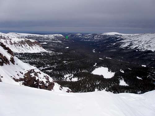
![East Fork Blacks Fork]() The cabin is at the x
The cabin is at the x
Then came the super tedious 800 vertical feet of descent down the side. On the way up I was on all 4's occasionally, but going down, that was pretty common as were small rock slides. I had to be very careful. It seemed like it took forever, but I was back to my skis at 4:21, with 8.9 miles to ski back to the cabin. I was hoping to get there by dark at 8pm, but if not, once I got to the valley bottom, it would be no problem to ski out by headlamp.
![East Lovenia and Mount Lovenia]() East Lovenia and Mount Lovenia
East Lovenia and Mount Lovenia![East Lovenia]() East Lovenia
East Lovenia![Mount Lovenia]() Mount Lovenia
Mount Lovenia![East Fork Blacks Fork]() Easy skiing on the river bed
Easy skiing on the river bed
I didn't quite make 8, but I was pretty close, arriving at 8:17, thankful that no wood needed splitting. It took me over an hour and a half to get dinner down. I felt like throwing it in the fire and just going to bed, but thought I should eat it. I'm allergic to soy and virtually all commercially prepared freeze dried dinners are loaded with soy protein which is the worst for me. I had two choices, the lasagne I brought last time or Santa Fe rice and beans. The lasagne had been overly messy so I went for the rice and beans for all three nights. Each night it got progressively harder to eat. It had virtually no fat and not much salt, and I was craving both.
Day 4, March-12-2015, Returning to Car
Stats
Distance: 11.4 miles skiing
Time: 3 hours and 19 minutes
I didn't get to bed until after 11, and didn't wake up until it was already daylight and was spared having to go through the rigamarole of lighting the propane lights. (Exiting cabin, walking around the side, turning valve, coming back inside, standing on chair, turning 3 valves, lighting with match.) I'd wanted to get an early start, but that wasn't going to happen and finally left at 9:15, amid light flurries. That was great as there were some icy uphill sections and even though there was not even a solid 1/8" of new snow, it was still enough to improve grip immensely without sacrificing glide. The road had melted considerably while I was gone, but most of it still had adequate snow cover and I usually made fast time. Occasionally I'd have to ski on the snow banks along the sides or some very choppy snowmobile tracks. The snow changed from flurries to moderate, and I got back to the car just as it was changing to rain and my skis were starting to stick. It only took 3 hours and 19 minutes to go over 11 miles.
Woohoo! I made it and very much enjoyed my victory Coke and my fatty fries loaded with salt at the Evanston McDonalds on the way home.
Trip Topos
![Wasatch BM Topo 1]() Wasatch BM Topo 1
Wasatch BM Topo 1![Wasatch BM Topo 2]() Wasatch BM Topo 2
Wasatch BM Topo 2


Comments
Post a Comment