Account of Events
![Devil s Backbone]() Connection of Register Ridge with the Devil's Backbone
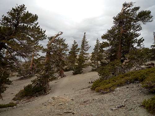
Connection of Register Ridge with the Devil's Backbone![Descent to Dawson Peak]() Snow fields on the descent from Mount Baldy to Dawson Peak
Snow fields on the descent from Mount Baldy to Dawson Peak![Hellcat Plane Wreck]() Hellcat Plane Wreck in Good Canyon
Hellcat Plane Wreck in Good Canyon As a last “big” hike of the season – before the peaks are covered in deep snow – we planned initially to ascend Mount Baldy via the Register Ridge and then continue further to Dawson Peak and Pine Mountain. However, uncertainties about the snow conditions after the first snow storm had delayed our plans and we decided to hike up Rattlesnake Peak instead. Being on the summit of Rattlesnake Peak we saw that the conditions on Baldy looked quite promising – at least from that distance. Encouraged by a good weather forecast we agreed to attempt our “big” hike the following week. Since our schedules were quite flexible we decided to meet on Friday morning at Manker’s Flat to avoid the usual weekend crowds at Baldy. The forecast predicted clouds in the morning and partial sun in the afternoon. Since I hiked up
Register Ridge a few weeks ago I know that we would be on Baldy in about 2.5 hours allowing us enough time to continue to Dawson and Pine as planned. So, we started on the fire road from Manker’s Flat sharply at 8am. It was a chilly morning with temperatures in the low 40s and dark clouds in the sky.
Part 1: We made very good progress on the steep Register Ridge. The use-trail was washed out at times but was still in good conditions. However, the dark clouds got thicker by the minute and I was wondering about the conditions at higher elevations. The Register Ridge probably is my favorite way up to Mount Baldy, as it is relentlessly steep but relatively short. In about 2 miles you connect to the Devil’s Backbone trail skirting the south slope of Mount Harwood. Shortly before we reached the Backbone it started to snow and hail. It was quite an amazing sight. We were not discouraged, however, since the visibility was still very good and patches of blue sky were not too far away. In fact the winds seemed to chase the storm clouds further east. There were no clouds at all over the Mojave Desert. Once on the Backbone we decided to hike up Mount Harwood, which greeted us with freezing temperatures and strong winds. However, the views were amazing with patches of precipitation virtually all around us. The north side of Harwood had considerable snow cover. From its summit we hiked west towards Mount Baldy but decided to stay more on the northeast face of Baldy instead of hiking up the usual trail. We traversed into the northeast face for about ½ mile, sometimes over snowfields, before we decided to climb straight up to its summit area. The views down the northeast slope into Lytle Creek Canyon were breathtaking. The ~700 feet ascent was strenuous over loose scree and snow; but we all enjoyed it. After about 3 hours after we left Manker’s Flat we were standing on Mount Baldy and had the summit for ourselves. We had to seek shelter behind the stone circles because of the strong and ice-cold winds. We had a quick snack and regained our strength. At that time the winds chased all dark clouds away and we had a sunny, blue sky above us.
Part 2: We started to descend about 250 feet down the north side of Mount Baldy towards Dawson Peak just to find ourselves very quickly amidst foot-deep snow. Worrying about worsening conditions further down and the possibility of the snow freezing over given the ice-cold winds, we decided to not continue and return up to Baldy. It was certainly a difficult but ultimately the right decision as none of us carried ice-axe or crampons. Being on top of Baldy again we decided to head over to West Baldy. There were some snow patches on the trail but they posed no difficulties. The views down to the Fish Fork and Coldwater Canyon were great. We continued to descend about 200 feet from West Baldy on the San Antonio Ridge, which is on top of our list for quite some time. As always, the ridge looked quite menacing and challenging, but we know that sooner or later we will be on it. We headed back. Since we planned to take the Ski Hut trail down we decided not to hike all the way back up to Baldy but to traverse Good Canyon until we connect with the Ski Hut trail. The traverse was a fun cross-country hike through beautiful, scattered pine trees and after about 30 minutes we were on the Ski Hut trail. We paused for a bit and had some snack on top of the Baldy Bowl, enjoying the views down. We then continued on the trail for a short time and then headed down into Good Canyon to find the two
Hellcat plane wrecks that crashed there in 1949. We read about those wrecks but never spotted them before. This time we took our time and spotted some reflecting metal parts from the Ski Hut trail. We descended into Good Canyon a few hundred feet and shortly after were standing next to several smaller and bigger parts of the two crashed airplanes. The wrecks are at about 9,200 feet elevation (34°16.972’ N; 117°38.912’ W). It was a somewhat eerie feeling considering the fate of the two pilots. Many parts seemingly have been removed from the site as there were many fewer parts than on older photos from that location. We scrambled through most of the remains and then traversed Good Canyon to the east knowing that we will connect with the Ski Hut trail eventually. Since we all were in the mood of more exploration we decided to continue south on the ridge after the Ski Hut trail turns east down into the Baldy Bowl. We scrambled less than half a mile on the ridge before the terrain got fairly steep. Since we did not want to climb all the way back up to the trail we traversed the east slope on the ridge back north high above San Antonio Canyon. That part was more challenging as the terrain was steep and covered with loose rocks. Further down, the slope dropped almost vertically down to San Antonio Canyon. After some scramble we connected with the Ski Hut trail again shortly before it traverses the Baldy Bowl. Quite happy with what we have accomplished today we decided to stay on the trail this time and in a little bit over one hour we were back at Manker’s Flat. Although we were not able to hike to Dawson Peak and Pine Mountain as originally planned, I felt good because we made the right decision and enjoyed a beautiful and challenging hike exploring areas I have never been before. Overall, the loop totaled to a little over 9 miles and ~5,200 feet of elevation gain.
Disclaimer: The track was recorded on a Garmin GPSmap 60CSx with coordinate savings every 30 seconds. Mileage- and elevation readings were calculated after importing the gpx file into National Geographic’s Topo 4.0 software.
Comments
No comments posted yet.