
-
 11331 Hits
-
 81.03% Score
-
 13 Votes
|
|
Mountain/Rock |
|---|---|
|
|
45.33549°N / 110.55325°W |
|
|
Hiking, Mountaineering |
|
|
Spring, Summer, Fall, Winter |
|
|
9122 ft / 2780 m |
|
|
Overview
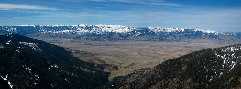
Arrow Peak is a striking mountain towering above the Mill Creek Road, just east of the Paradise Valley in south-central Montana. The small town of Livingston is the nearest settlement and the entire area is very remote with few people. Highway 89 heads north-south in the aptly named Paradise Valley following the Yellowstone River and although Arrow Peak itself cannot be seen from many places within the valley, it provides a fantastic view of Mount Cowen and the surrounding high peaks of the Western Beartooths (AKA Montana Absarokas). This peak is a good winter or late spring ascent as long as the Mill Creek Road isn't blocked by snow. The closure gate along the Mill Creek Road is a short ways beyond Arrow Peak so it is accessible the majority of the winter, and offers a couple decent ridges to scramble up allowing you to avoid most avalanche hazards. With good routefinding, most of the awful, loose andesite volcanic rock can be avoided.
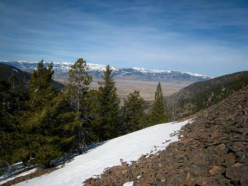
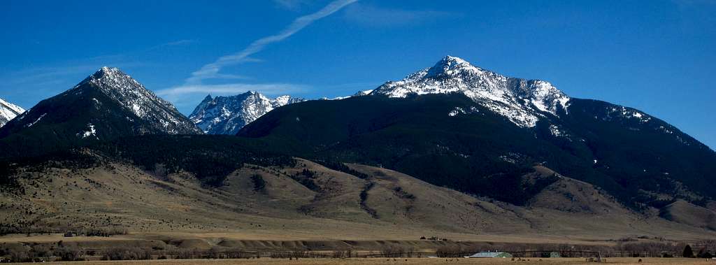 Absarokas from Paradise Valley Absarokas from Paradise Valley |
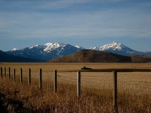 View from Paradise Valley View from Paradise Valley |
Getting There
For quick directions from Livingston see this page. From Livingston, Montana head south on Highway 89 through the Paradise Valley. If coming from I-90, take exit 333 and follow Highway 89 south for 16 miles and turn left onto the Mill Creek Road. Cross the bridge over the Yellowstone River and continue straight through the junction with Road 540. Continue about 8 miles on Mill Creek Road (pavement ends at about 4.5 miles) and park alongside the road next to a wooden fence, right at the bottom of a large rocky gully dropping down the west face of Arrow Peak at 5,490 feet. There is no approach for this climb, the route begins ascending steeply directly from the road.
Southwest Ridge Route - Class 2+
From where you park, do not begin hiking up the broad gully but instead, locate a wooded area directly to climbers right of the talus/gully and enter the trees. Ascend soft ground through the trees and follow along or inside a small narrow trench. At roughly 5,900 feet, begin angling right (ESE) and climb steep dirt to reach a flat spot in the SW ridge at 6,150 feet. This spot marks the true beginning of the SW ridge and makes a great place to rest and enjoy the forest. From here, continue northeast up the ridge, following an excellent game trail. Stay on the ridge only leaving it briefly to hike around trees or to follow the game trail. The talus you will see on either side of the ridge is awful and can be quite dangerous. Most talus slopes we touched off the ridge crest was ready to slide and awful to ascend. Staying in the sparse trees also provides softer, comfortable and more solid footing which makes the steep ascent much more enjoyable.
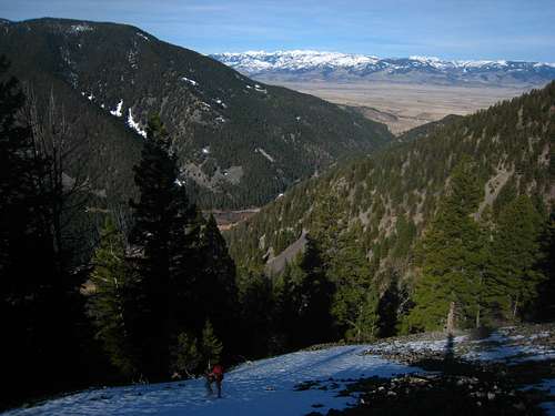
The ridge broadens at 7,200 feet so make sure you are still on it and avoid deviating onto the talus on either side. There is a short section where the trees disappear on the ridge between 7,270 and 7,360 feet where you'll have to hike on loose talus, but you can enter the trees once again and continue to 7,900 feet where the trees abruptly end. If you are here in early season, snow will likely cover nearly everything but in summer, the worst part of the climb begins here, at treeline. The next 700 feet on the now broad ridge ascends loose, dinner plate talus which slides out from under your feet, so take it easy. Aim for the obvious buttress looking feature and scramble up slightly steeper, but more solid rock to where the ridge narrows considerably at 8,600 feet. The rest of the climb is easy scrambling on the narrow crest to the summit at 9,122 feet. Your reward for the hard work is the views of Mount Cowen which appear as you crest the summit. There is also a large cairn on the top. For the descent, retrace your steps down the ridge making sure to stay on the ridge. The total elevation gain for the climb is 3,630 feet with a round trip distance of only 2.4 miles (which means you gain over 3,500 feet in just over one mile!!)
 Hiking up the SW Ridge Hiking up the SW Ridge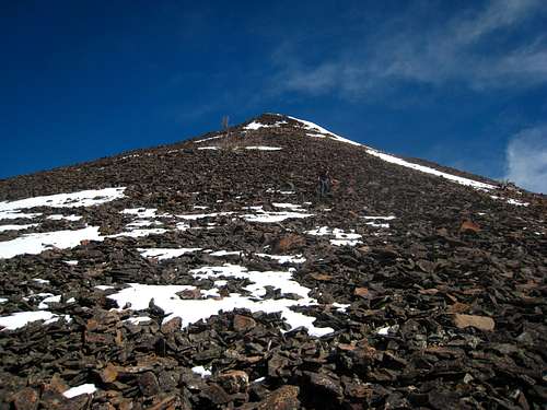 Looking up the talus from treeline at 7,900 feet Looking up the talus from treeline at 7,900 feet |
 View from treeline at 7,900 feet View from treeline at 7,900 feet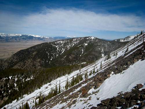 Ascending the SW Ridge Ascending the SW Ridge |
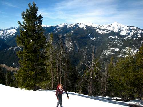 Crossing some snow at treeline Crossing some snow at treeline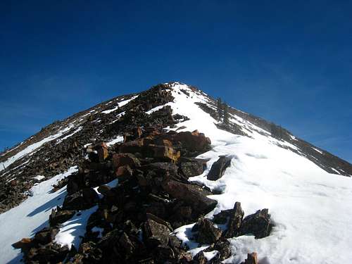 Narrow section of ridge leading to the summit Narrow section of ridge leading to the summit |
Camping/Red Tape
None! Practice LNT policies and make sure you park on the side of Mill Creek Road to allow others to pass. There are no feasible places to camp on this mountain, however it is a day hike anyways. Dispersed camping can be found in many areas along the Mill Creek Road. Just avoid the private property. This peak can be climbed at any time of year. In Winter or early spring, be prepared for very cold/windy conditions and note that snowshoes might be required. Even though the route follows a ridge, it is fairly broad in a few areas so you could still be caught in an avalanche. Check the snow conditions and plan accordingly. In summer, watch out for the typical afternoon thunderstorms and plan to be on your way down by noon.
Summit Views
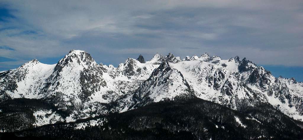 Arrow Peak summit view north
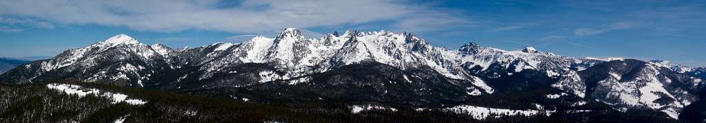 Arrow Peak summit pano with Mount Cowen
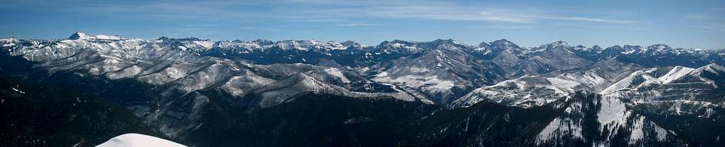 Arrow Peak summit view east
 Arrow Peak summit view south
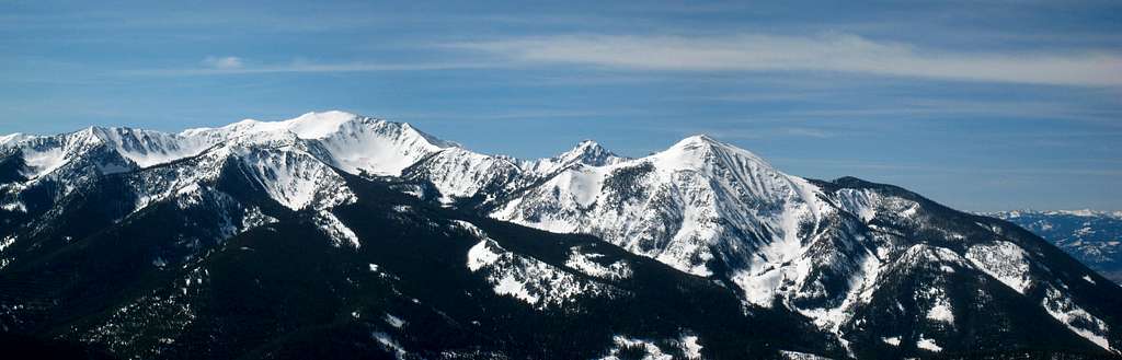
 Arrow Peak summit view west looking at Paradise Valley
Map
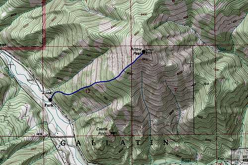 Arrow Peak Topo Map