
|
|
Mountain/Rock |
|---|---|
|
|
57.51197°N / 5.40053°W |
|
|
Hiking, Mountaineering |
|
|
Spring, Summer, Fall |
|
|
3038 ft / 926 m |
|
|
Overview
Pronounced – Ben Lee Vhor
Summit height - 926 m (3,038 ft)
Meaning – Big grey mountain
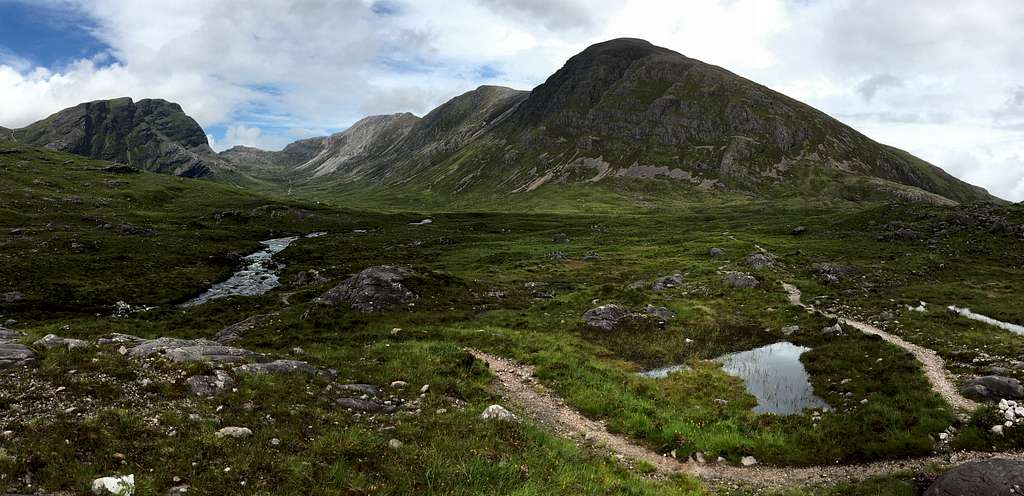
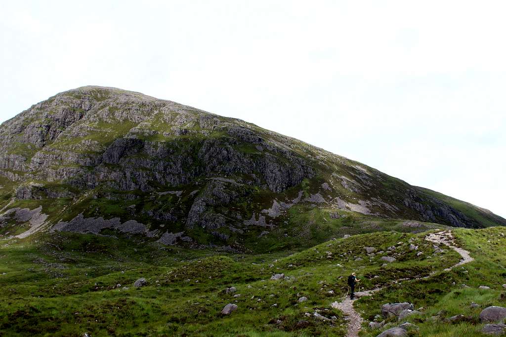
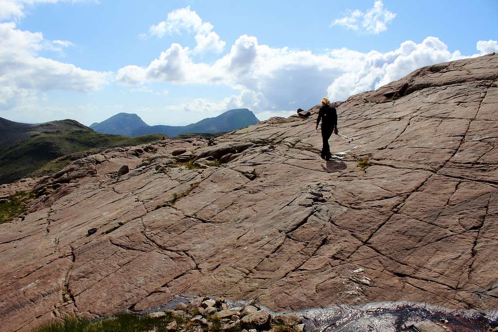
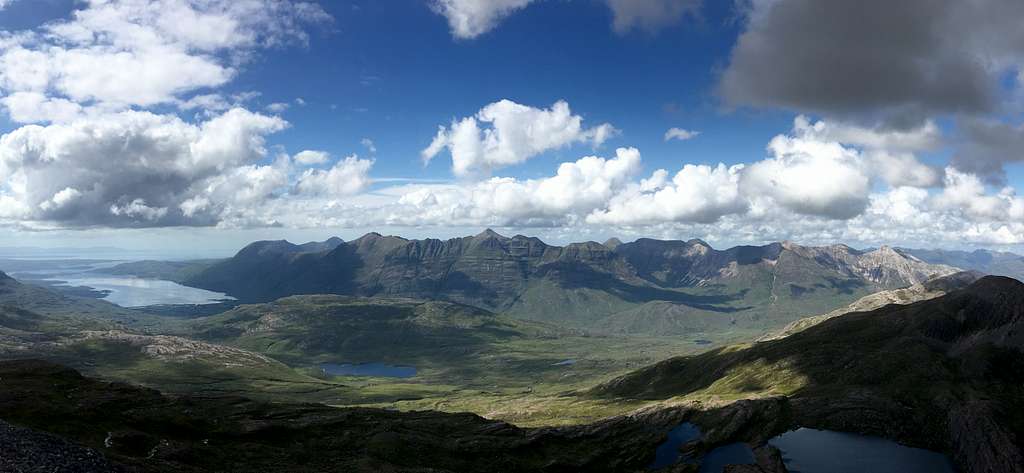
Beinn Liath Mhor sits alongside Sgorr Ruadh, in the rough, mountainous, ice sculpted land between Glen Carron and Glen Torridon in the Northwest Highlands of Scotland. Whilst trees enjoy the shelter of the valleys, it is mainly grass and heather that inhabits Coire Lair and these become scarce once we climb the mountain sides before rock and scree take over the high ridges.
Like its Torridonian neighbours, Beinn Liath Mhor is made from a mixture of red/brown Torridonian sandstone and white/grey Cambrian quartzite. This gives the mountain a striking look of dual, light and dark colouring in the right light. I think it would be wrong to refer to its shape as a “whale – back” mountain as it has three distinctive humps – perhaps “monster – back” would therefore be more appropriate?
And it is a bit of a monster!
Although its summit is only around 38 feet (26m) above the magic 3000 feet mark which makes it a Munro, any hiker starting from Achnashellach in Glen Carron – the nearest trailhead – will be starting virtually from sea level, climbing steeply northwards up to Coire Lair before a steeper climb is needed to gain and traverse the mountain’s three topped ridge which is over a mile in length (2km) and is frequently covered with its characteristic quartzite scree.
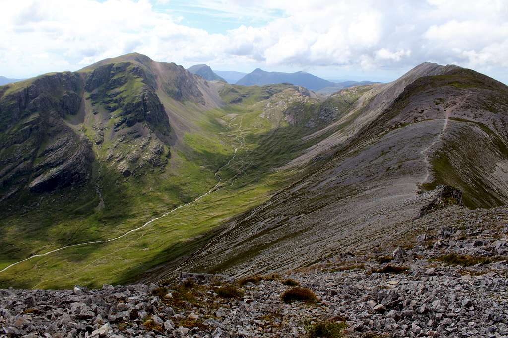
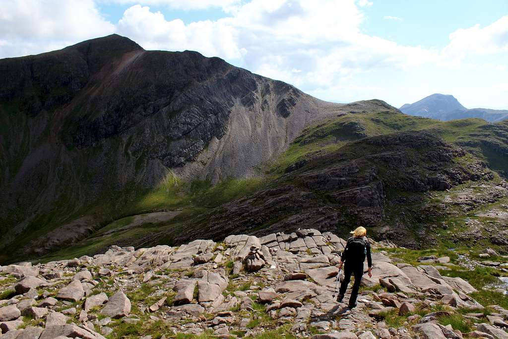
Having said that, the views can be terrific. Northwards, the monolithic shapes of Beinn Eighe and Liathach preside over Torridon whilst Beinn Alligin looks over Liathach’s shoulder and down onto Upper Loch Torridon. Westwards lies nearby Maol Chean – dearg and further away, the Isle of Skye. The view southwards is dominated by Sgorr Ruadh and Fuar Tholl and beyond these, a multitude of hills south of Glen Carron. Eastwards, the wild country towards Inverness is laid out with dark and misty mountain silhouettes in the distance.
Getting There
By road:
The easiest trailhead is from a layby on the A890 road at Achnashellach railway station where there is limited parking.
From Fort William, the A82 and A87 roads head up towards the northwest highlands. The A890 runs from Auchtertyre near Kyle of Lochalsh, northeast, through Glen Carron to Achnasheen.
From Inverness it’s possible to head north then west on the A9, A835 and A832 roads towards Achnasheen. From here, the A890 heads southwest.
By rail:
Achnashellach station is a railway station serving Scotrail’s Highland line which runs between Dingwall (north of Inverness) on the east coast and Kyle of Lochalsh on the west coast. Achnashellach is a request stop station.
See the Scotrail website for service information:
https://www.scotrail.co.uk/plan-your-journey/stations-and-facilities/ach
Note – It is also possible to climb from the northside of the mountain from a trailhead at the Ling hut in Glen Torridon but this is a longer route.
Routes
Starting point:
Achnashellach railway station - There is limited parking in a layby on the A890, opposite a private road leading to the station itself. Grid reference: 005483
Route from Achnashellach station up into Coire Lair – Black route on map
Walk up the private road, through the woods to the station and the west end of the platform, here there is a crossing point. Follow the instructions to cross the railway line to the other side. Continue up the track to a crossroads, turn left here.
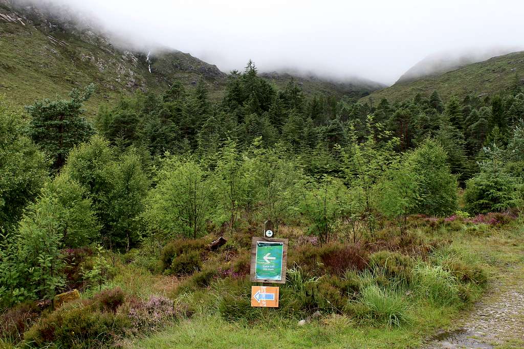
The forestry track heads northwest, follow this for about 500m and look for a path on the left heading down towards the river. (When I was there in 2023, there was a prominent signpost to show the way), Do not continue on the track as it ends in the woods higher up.
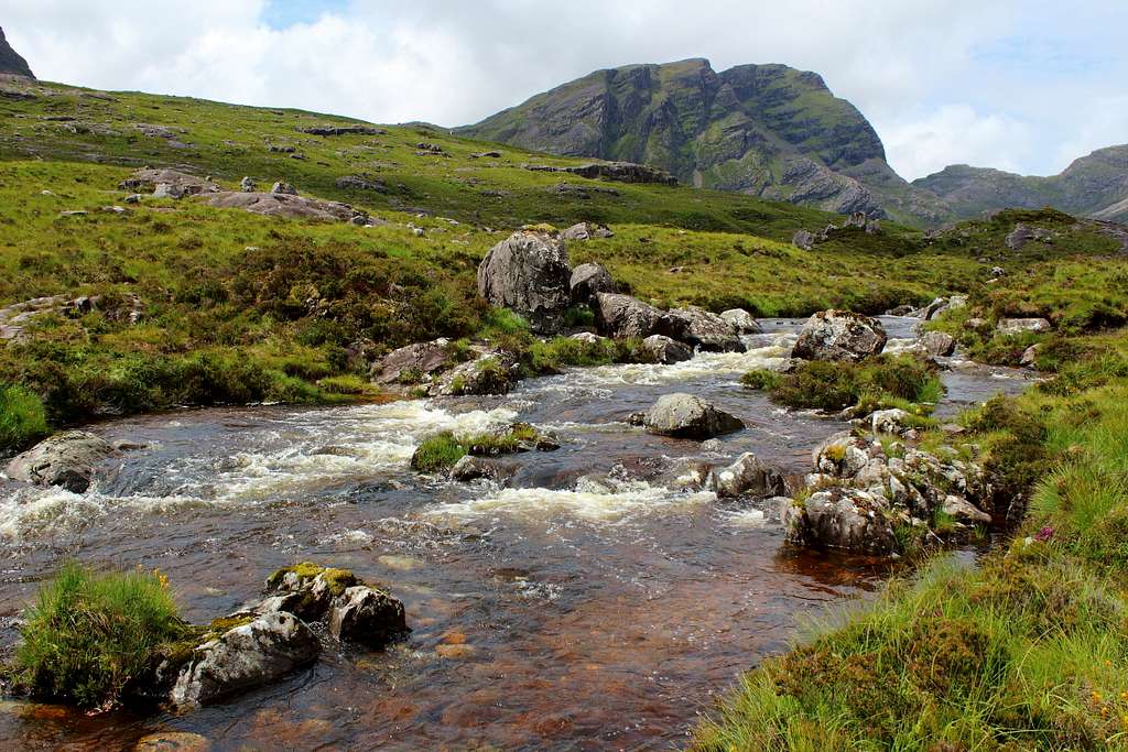
Follow the path to the deer fence where there is a gate through to the other side. Follow this path rightwards, parallel to the River Lair and uphill. At first the path is in pine woodlands but as height is gained, the woods thin out and soon the open hillside is reached. Ahead, the first mountain seen (on a clear day) is Fuar Tholl (907m), a Corbett situated just off our main route.
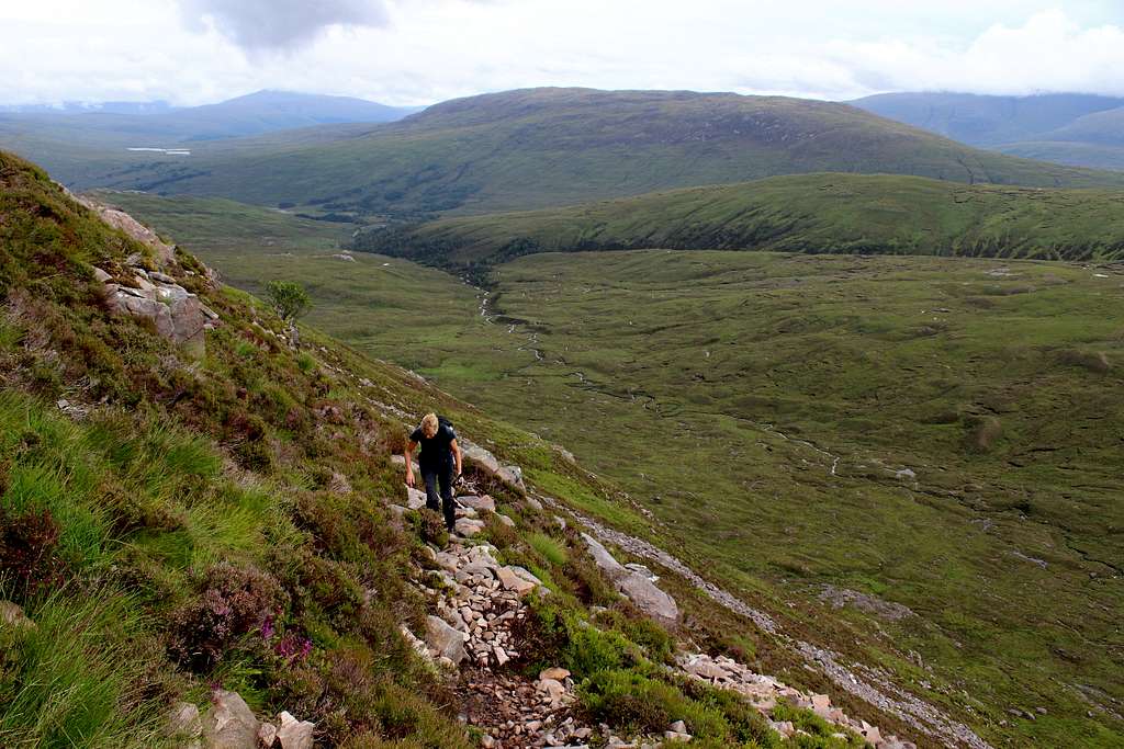
Continue on the well-defined footpath and gain more height. The route stays parallel to the River Lair on the left and weaves a way through the rocky patches amongst the grass.
Beinn Liath Mhor becomes visible as height is gained as does Sgorr Ruadh and the whole of Coire Lair and about 1 hour after leaving the car, there is a clear path heading off to the left and down to the river.
If you are thinking of descending from Sgorr Ruadh to this point later in the day, it is important to walk down to the river to check if it is possible to cross it now. After heavy rain it may not be possible to cross the river. There is no bridge here and this is the only fording point, the next is higher up at Loch Coire Lair.
Return to the Coire Lair path and continue for about 100m to another junction. The path to the left, heads up into Coire Lair.
It is possible to follow this route all the way up to Bealach Coire Lair, the bealach between Beinn Liath Mhor and Sgorr Ruadh (and onwards, north to Torridon if desired) and this path is a good descent path if needed later. Near the bealach, there is a small lochan to the right of the path.
Route to ascend and traverse Beinn Liath Mhor – Blue route on map
At the path junction at the start of Coire Lair mentioned above, take the right-hand path and after about 250m, the next junction is reached. Take the left-hand path which leads onto the shoulder of Beinn Liath Mhor ahead.
Looking upwards, the route is clear as it zig-zags steeply up through the heather. Unfortunately, as height is gained the path deteriorates. The way is a mixture of loose scree and gravel and probably running with water. (Depending on the recent weather!)
This part is hard going and slowly but surely, the steepness relents. As this happens, the heather is replaced by sparse patches of grass and an increase in the quartzite scree.
Head towards the large cairn for the eastern top of the mountain at 876m. From here, the summit can be seen, 2km away to the west.
The way along the ridge westwards, is pretty obvious and a path exists most of the way. Annoyingly, you have to lose some of the height gained to descend to the lowest point of the ridge at around the 800m mark. There is some easy scrambling as well but you can see the summit in the distance, getting nearer.
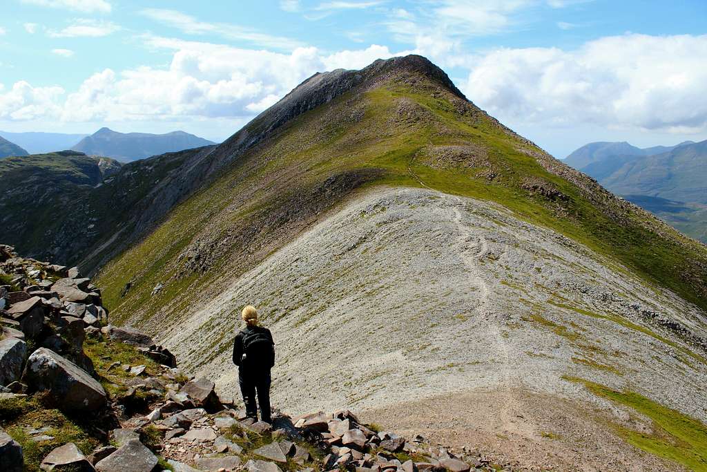
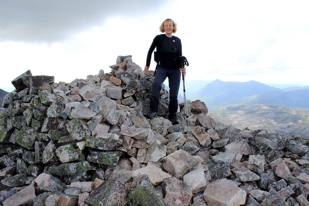
Follow the ridge back up to the next high point, then a short descent again before the final climb along the ridge towards the even larger summit cairn. The ridge here is composed of broken quartzite scree and is rough going underfoot.
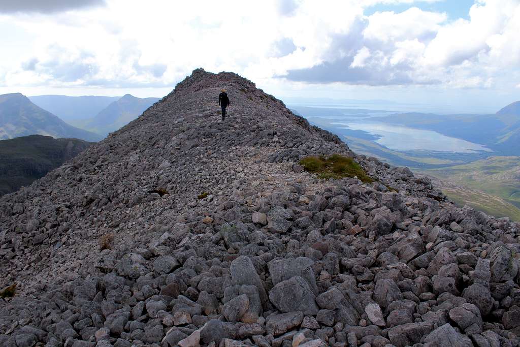
The summit is reached after about 3 hours 30 mins and the views from the summit can be amazing in good weather.
Care is needed in the descent, especially in poor visibility.
Descend west through a boulder field, then towards the southwest to where the white, quartzite rock changes to the red sandstone slabs. In 2023, there was a line of cairns to mark the way.
Cross the sandstone slabs and descend to a rough gully (again marked with a cairn).
Descend the gully towards a small lochan below. It is better than it looks although care is needed.
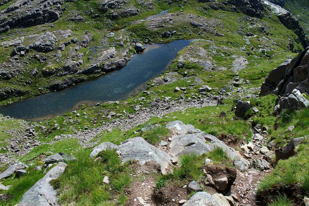
Follow the path past the near end of the lochan and again across rocky ground around a small hill and towards a larger Lochan with the footpath beyond. Descend to meet the path coming up Coire Lair (Black route on map).
Route to descend Coire Lair – Black route on map
From here, it is easy to descend Coire Lair if desired, down the well-maintained footpath and eventually to the junction left earlier beneath Beinn Liath Mhor’s eastern top.
For those wishing to continue onto Sgorr Ruadh, see the route description on that mountain page: https://www.summitpost.org/sgorr-ruadh/1081395
Notes on the route descriptions:
For those wanting to continue the route to traverse Sgorr Ruadh, see the description on that mountain page.
According to Irvine Butterfield’s book “The High Mountains of Britain and Ireland”, it is possible to climb up to Beinn Liath Mhor’s most easterly col from the Coire Lair path. I have not included this as I have not done it myself and I saw no evidence of a path when we passed or from my photos.
Of course, it is possible to do this route in reverse. By that I mean, ascend Coire Lair by the path, climb up to the summit. Then, descend eastwards along the ridge – possibly descending from the last, lowest col back to the path. Again, I have not tried this so I can’t recommend it.
Red Tape
Scotland has an Outdoor Access code, see link:
https://www.outdooraccess-scotland.scot/practical-guide-all
The area is popular for Deer stalking and Grouse shooting. These activities may impact on any plans for hiking. However, it is still possible to hike during these events with a little extra effort at the planning stage.
This is a useful page on the Outdoor access – Scotland website
https://www.outdooraccess-scotland.scot/practical-guide-all/heading-scottish-hills
When to Climb
Spring, Summer or Autumn (Fall) depending on conditions.
Warning: The above descriptions are for use in reasonable summer conditions. Winter conditions can occur at almost any time of the year. In winter condition, this mountain is a much more serious proposition. Any paths may be covered by snow and ice and gale force winds are common.
Ice axe, Crampons, the knowledge of how to use them allied with excellent map reading and compass skills are essential.
The proximity of the west coast and the sea means that mist often forms and can cover the mountain.
Accommodation
There is limited hotel accommodation in the town of Lochcarron and further away in Kyle of Lochalsh. There are also campsites around both of these towns and in Kintail.
It is possible to wild camp in Scotland. See the Outdoor access code (above) for more details.
There are many types of self-catering accommodation in these areas but it is best to book these in advance.
External Links
Walk highlands - https://www.walkhighlands.co.uk/
SMC - https://www.smc.org.uk/
The Munros – (SMC Hillwalkers guidebook)
The High Mountains of Britain and Ireland – I. Butterfield
Ordnance survey map OS 429 Glen Carron and West Monar 1: 25 000