|
|
Mountain/Rock |
|---|---|
|
|
57.49849°N / 5.40759°W |
|
|
Hiking, Mountaineering, Trad Climbing, Ice Climbing |
|
|
Spring, Summer, Fall, Winter |
|
|
3156 ft / 962 m |
|
|
Overview
Pronounced – Sgore Roo-add
Scottish Gaelic – An Sgurr Ruadh
Summit height - 962 m (3,156 ft)
Meaning – The red mountain
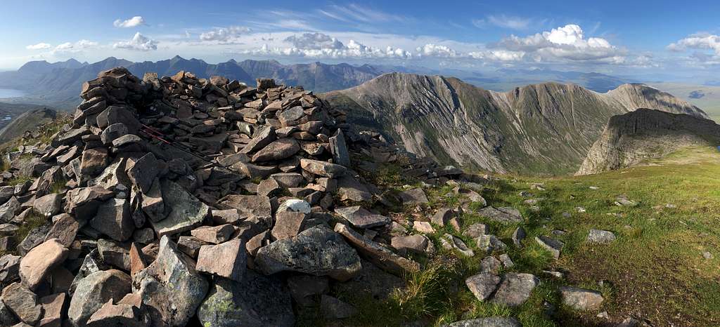
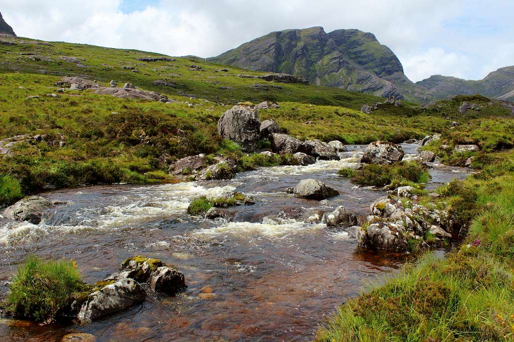
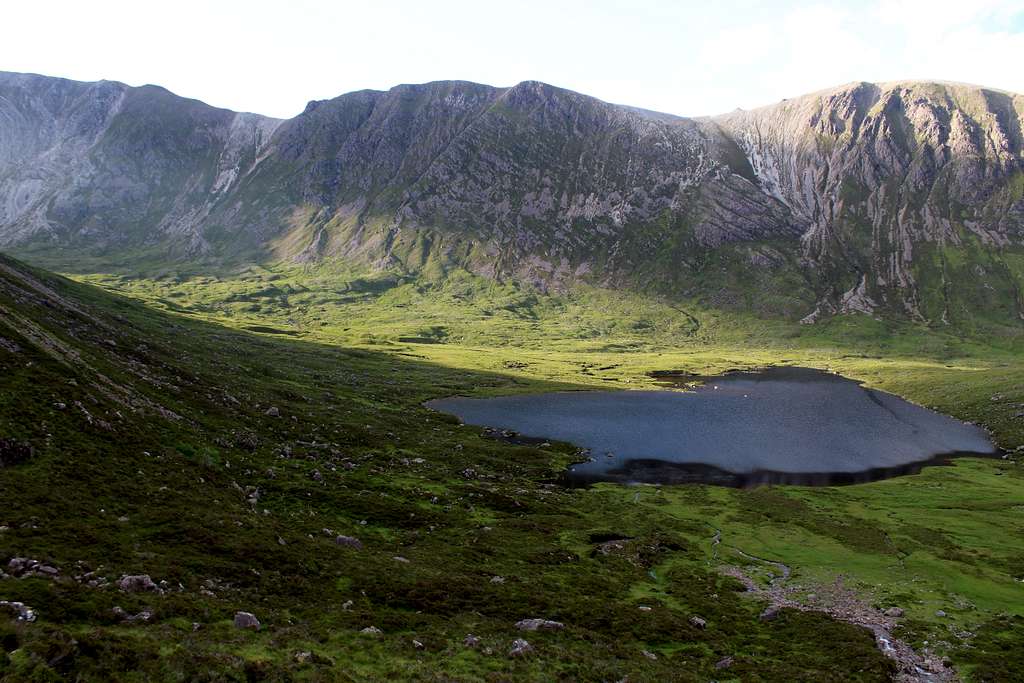
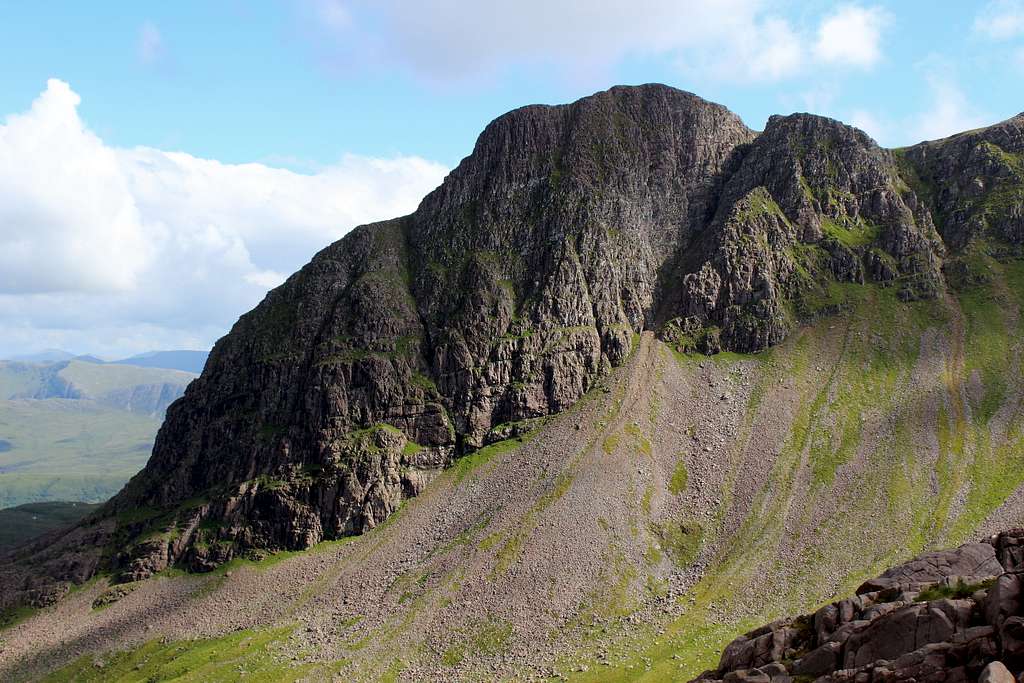
Sgorr Ruadh sits alongside Beinn Liath Mhor in the rough, mountainous, ice sculpted land between Glen Carron and Glen Torridon in the Northwest Highlands of Scotland. Whilst trees enjoy the shelter of the valleys, it is mainly grass and heather that inhabits Coire Lair and these become scarce once we climb the mountain sides before rock and scree take over the high ridges.
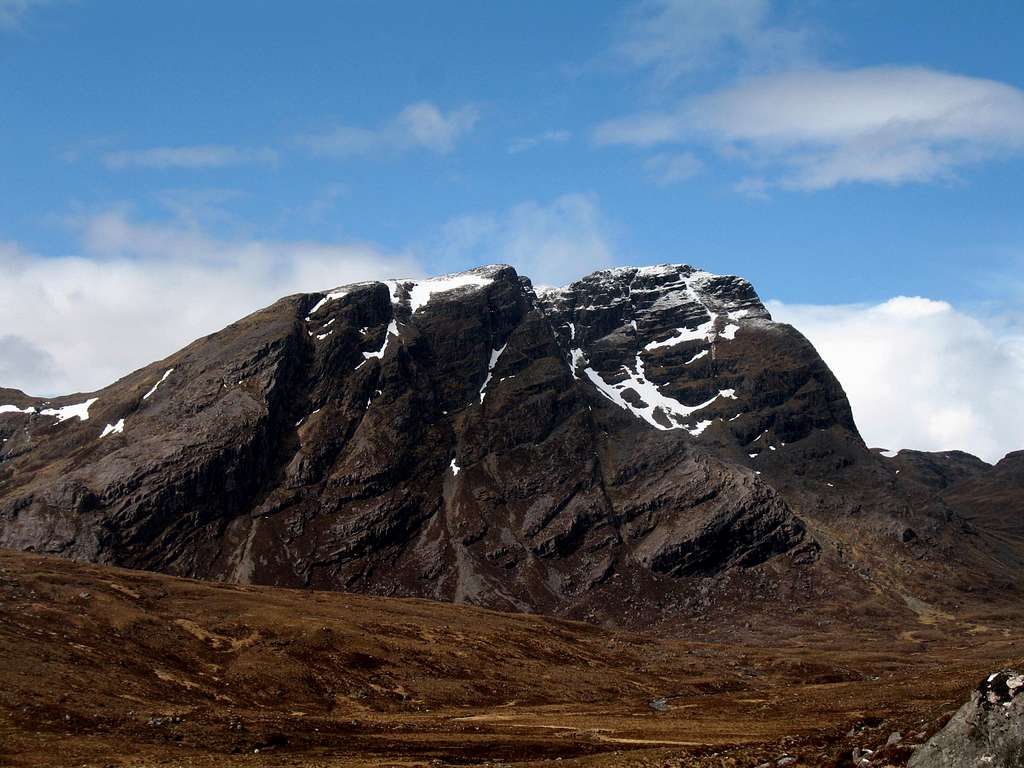
Sgorr Ruadh is called the “red mountain” because its rock is primarily made from the red/brown Torridonian sandstone that was formed during the late Precambrian geological period. However, like its neighbours, it too has deposits of white/grey Cambrian quartzite added to the mix, mostly as broken crags and scree.
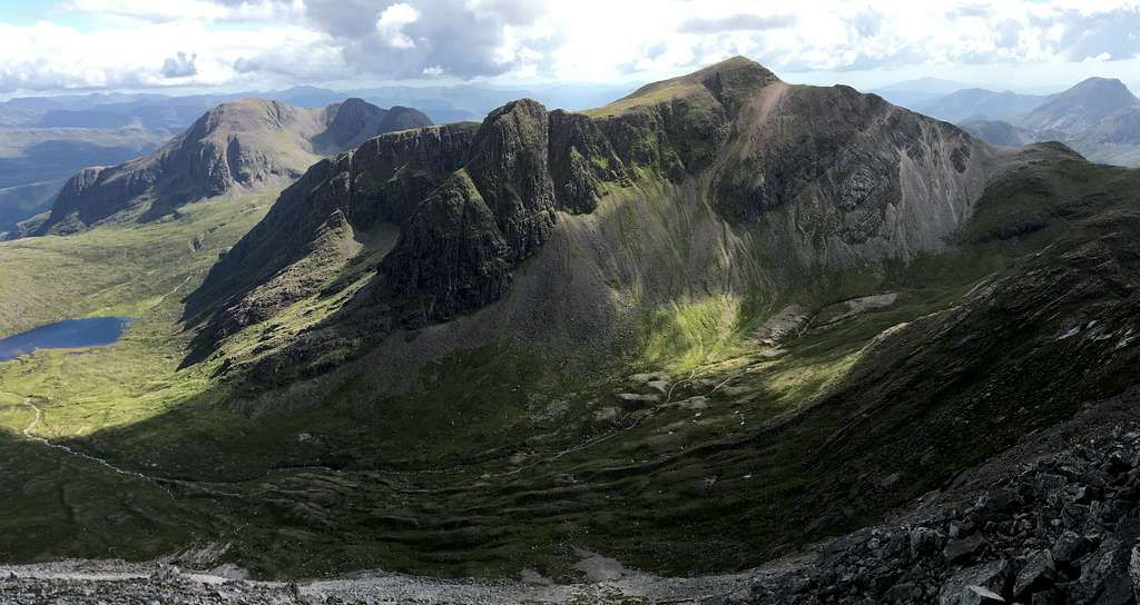
The sandstone is most noticeable on the northeast faces of the mountain where tiered sandstone buttresses rear up steeply from Coire Lair giving options for winter climbing aficionados and (a few) rock climbs but not for hikers. The winter routes tend to be better than the rock climbs although, there is plenty of loose rock to contend with.
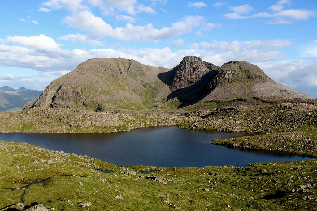
The buttresses of Sgorr Ruadh create a shapely and complex mountain, the highest of the three in the immediate area south of Glen Torridon.
Like Beinn Liath Mhor, the views from the summit to the west and south are far reaching but to the north and east they are dominated by its nearby neighbours, Beinn Liath Mhor (to the north) and Fuar Tholl (to the east).
Getting There
By road:
The easiest trailhead is from a layby on the A890 road at Achnashellach railway station where there is limited parking.
From Fort William, the A82 and A87 roads head up towards the northwest highlands. The A890 runs from Auchtertyre near Kyle of Lochalsh, northeast, through Glen Carron to Achnasheen.
From Inverness it’s possible to head north then west on the A9, A835 and A832 roads towards Achnasheen. From here, the A890 heads southwest.
By rail:
Achnashellach station is a railway station serving Scotrail’s Highland line which runs between Dingwall (north of Inverness) on the east coast and Kyle of Lochalsh on the west coast. Achnashellach is a request stop station.
See the Scotrail website for service information:
https://www.scotrail.co.uk/plan-your-journey/stations-and-facilities/ach
Routes
Starting point:
Achnashellach railway station - There is limited parking in a layby on the A890, opposite a private road leading to the station itself. Grid reference: 005483
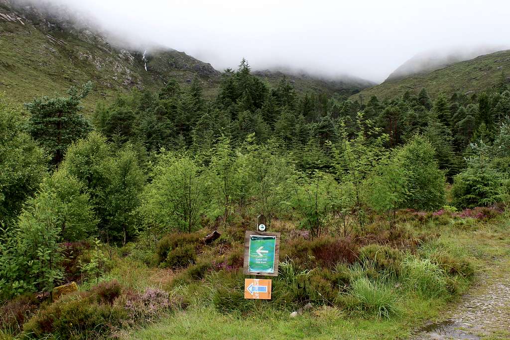
Route from Achnashellach station up into Coire Lair – Black route on map
Walk up the private road, through the woods to the station and the west end of the platform, here there is a crossing point. Follow the instructions to cross the railway line to the other side. Continue up the track to a crossroads, turn left here.
The forestry track heads northwest, follow this for about 500m and look for a path on the left heading down towards the river. (When I was there in 2023, there was a prominent signpost to show the way), Do not continue on the forestry track as it ends in the woods higher up.
Follow the path to the deer fence where there is a gate through to the other side. Follow this path rightwards, parallel to the River Lair and uphill. At first the path is in pine woodlands but as height is gained, the woods thin out and soon the open hillside is reached. Ahead, the first mountain seen (on a clear day) is Fuar Tholl (907m), a Corbett situated just off our main route.
Continue on the well-defined footpath and gain more height. The route stays parallel to the River Lair on the left and weaves a way through the rocky patches amongst the grass.
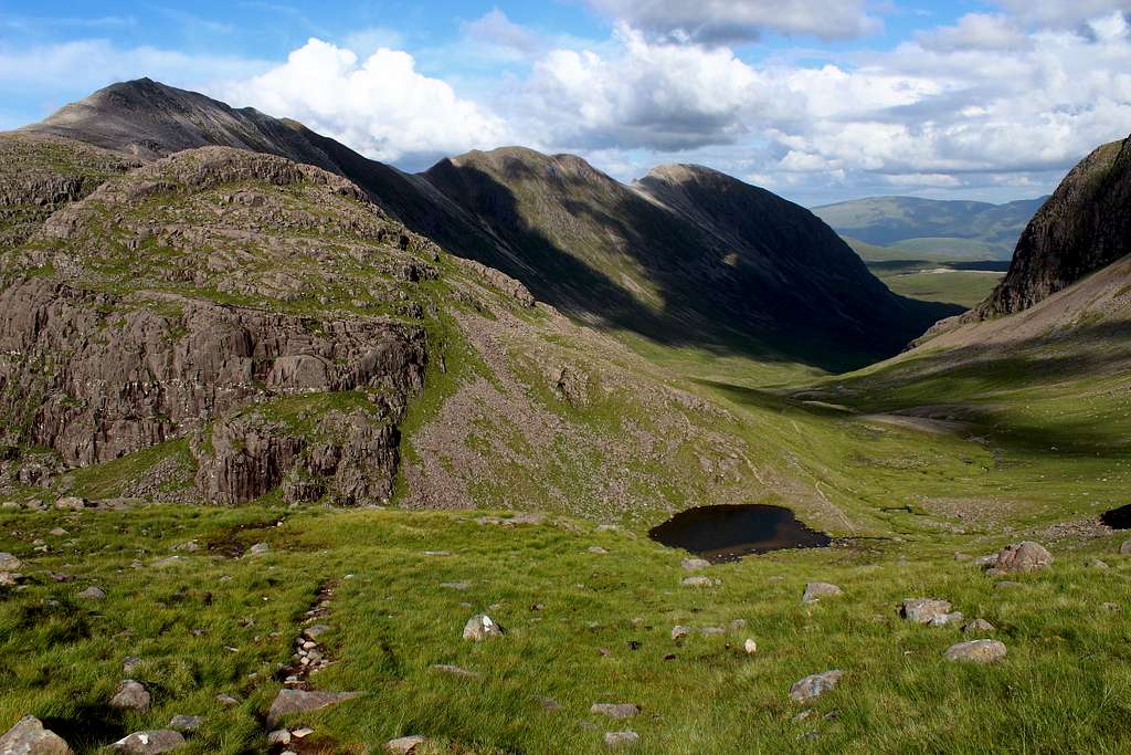
Beinn Liath Mhor becomes visible as height is gained as does Sgorr Ruadh and the whole of Coire Lair and about 1 hour after leaving the car, there is a clear path heading off to the left and down to the river.
If you are thinking of descending from Sgorr Ruadh to this point later in the day, it is important to walk down to the river to check if it is possible to cross it now. After heavy rain it may not be possible to cross the river. There is no bridge here and this is the only fording point, the next is higher up at Loch Coire Lair.
It is possible to cross the river now and ascend Sgorr Ruadh from here but I am going to describe what seems to be the most popular route.
Return to the Coire Lair path and continue for about 100m to another junction. The path to the left, heads up into Coire Lair.
It is possible to follow this route all the way up to Bealach Coire Lair, the bealach between Beinn Liath Mhor and Sgorr Ruadh (and onwards, north to Torridon if desired) and this path is a good descent path if needed. Near the Bealach, there is a small lochan to the right of the path.
For those wishing to ascend Beinn Liath Mhor first, see the description on that Mountain page. https://www.summitpost.org/beinn-liath-mhor/1081376
Route from Bealach Coire Lair up the northwest ridge of Sgorr Ruadh – Red route on the map
From the Coire Lair path, by the side of the lochan, walk a short distance upwards (westwards).
Leave the path and head up the slope of grass and rocks, again to the west, to reach the broad crest of the ridge.
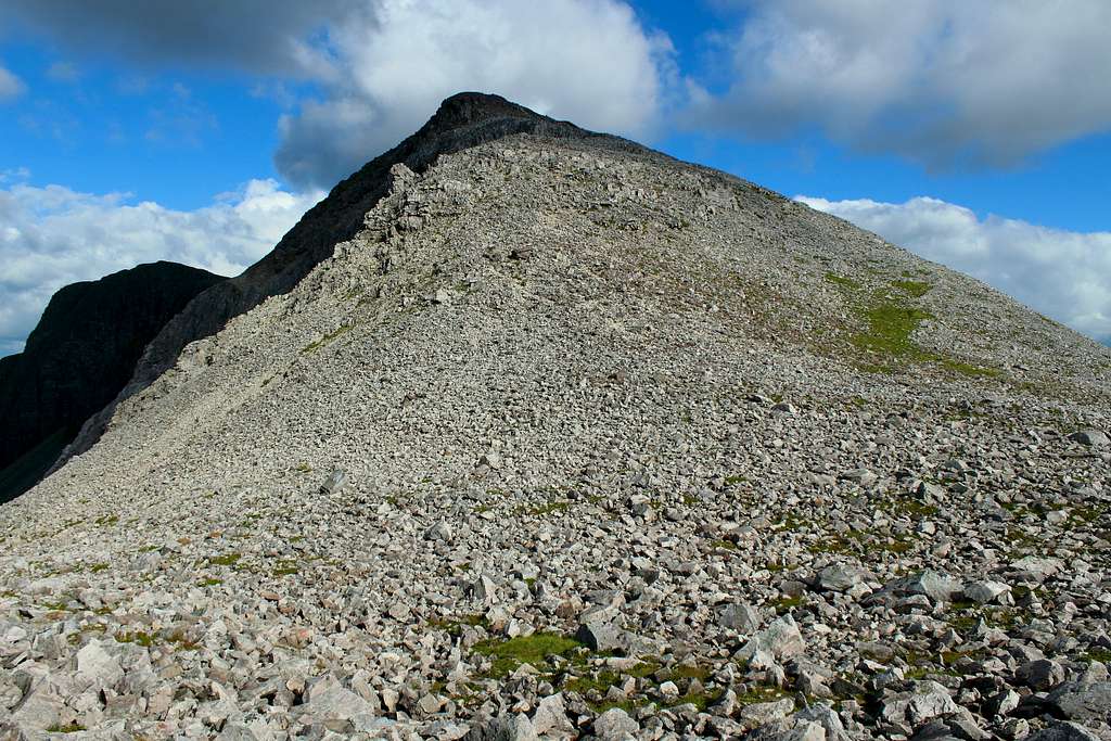
Here, turn right to the southeast. There is a feint, cairned path which sticks to the grassy areas and weaves a way through the patches of quartzite rock.
As the ridge steepens, the grass vanishes and continues across the scree filled slopes. Follow it as best you can! This part is quite arduous, the scree is unstable and slippery in the wet.
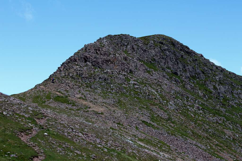
The final summit ascent requires some easy scrambling before reaching the large cairn on the grassy hilltop. This should take around 45 mins – 60 mins from the Bealach Coire Lair.
The view north is dominated by Beinn Liath Mhor and the view east by Fuar Tholl.
Descent from Sgorr Ruadh to Coire Lair and Achnashellach station
From the summit, you now have to decide which way to descend. Realistically, you have three options:
1 – The first thing to consider is the state of the River Lair at the fording point. I mentioned earlier that you needed to check that you can cross this on the way up. Assuming you did this and feel you can cross it, descend from the summit in a southeast direction. (Red route on the map).
This is a quite steep slope of loose rocks and grass. I searched for a path on my descent but couldn’t find one. In poor conditions, the slope can take a longer time to descend than may be thought. Head towards Loch a’ bealaich Mhoir, the largest loch at the bealach. The Corbett of Fuar Tholl lies behind the loch.
Pass to the west (right) of the loch and find a way through the wet, boggy ground towards Fuar Tholl, heading southeast still.
A good stalkers path crosses the bealach in a west – east direction. When this path is reached, turn left (east) and follow the path down, in front of the buttresses of Fuar Tholl and down to the River Lair fording point.
Cross the river and join the Coire Lair path (Black route on the map). Turn right and follow this down to the station.
Expect this route to take around 2 hours to descend from the summit to Achnashellach station.
2 – It is possible to descend from the summit in a northwest direction (the ascent route described above). (Red route on the map).
If you have checked the River Lair earlier and feel you cannot cross it at the fording point, this may be a good option.
Descend from the summit – there is some easy scrambling before a more definite path is reached. Descend this to the steeper screes and continue carefully. This can be arduous and slippery in the wet, you wouldn’t want an accident here!
Continue down the ridge on the path, then head east (right) to join the Coire Lair path at the Bealach Coire Lair.
Head east, down the Coire Lair path (Black route on the map). At the path junction, turn right to descend to the station.
I am not certain how long this route would take. This is a longer route but if the river is difficult to cross, it avoids the River Lair crossing and is possibly the best option in this situation.
3 - If you have checked the River Lair earlier and feel you cannot cross it at the fording point, there is another option which is recommended in several publications.
I have tried it and whilst it is possible to do, I would not recommend it but I include it here for consideration.
Descend from the summit in a southeast direction. (Red route on the map).
This is described in option 1 above. Descend to the Loch a’ bealaich Mhoir, the largest of the many lochans.
At the loch, turn left (east) to descend by following the exit stream from the Loch which continues in an easterly direction before turning towards the north. (Yellow route on the map).
You will be aiming towards Loch Coire Lair below. The stream finds the easiest way down so, it may be necessary to cross the stream several times to avoid the rocky outcrops encountered along the way.
There is no path and as well as the small outcrops which need to be avoided, the ground is a mixture of loose rock and super – saturated turf and moss. There are holes which could easily turn an ankle. Care is needed for every step.
When Loch Coire Lair is reached, pass it on its left side (west) until the River Lair is reached. This will be easier to cross here, find a good point and continue ahead (north) until the Coire Lair path is reached.
Turn right here (east) and continue down (Black route on the map). At the path junction, turn right to descend to the station.
I descended this route in 2023, the care needed on the descent meant it took me 3 hours 15 minutes from the summit to reach Achnashellach station.
Climbing on Sgorr Ruadh
The rock on the north and northeast faces of Sgorr Ruadh is almost exclusively composed of the local hard, red/brown Torridonian sandstone. The composition of the rock strata originally laid down in the late Precambrian era, means that there are many horizontal ledges and quite a lot of loose broken rock.
Linked to this, the well-known Scottish wet weather means that the faces and gullies are often streaming with water. The rock is often wet and slippery which means that to the modern eye, the routes can be better tackled during the winter. If it is cold enough, the wet rock surface turns to snow and ice for a whole different experience.
As the first Scottish mountaineering pioneers walked up Coir Lair, they were presented with several obvious climbing options.
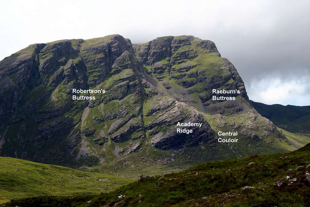
The mountain skyline is formed by the most northerly of the buttresses – now named “Raeburn’s Buttress” – whilst to the left of this lies the “Central Couloir” and then a long, rocky, concave shaped ridge – “Academy Ridge” – with a broken rocky buttress high up to the left of this, now named “Robertson’s Buttress”.
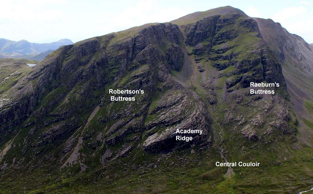
The first recorded climbing on these faces was on “Robertson’s Buttress” in 1898. A.E Robertson – the mountaineer generally accepted to be the first man to complete ascents of all the “Munros” – climbed a mixture of the left-hand buttress rocks and the gully to the right of this to make it up to the summit.
A few years later in 1904, Harold Raeburn and E.B. Robertson took to the highest buttress and established the first route on the eponymously named “Raeburn’s Buttress”
The route named “Raeburn’s Buttress”; 1200 feet (Difficult) was climbed in April in wintry conditions.
The route on “Academy Ridge”, 1000 feet (Very Difficult) was established by the Inverness Academy Climbing club in 1948 by scrambling up the lower portion of the ridge, followed by a steeper finish.
“Frivolous Pinnacle” (Very Difficult) First ascent unknown had been climbed on Raeburn’s buttress.
Two more climbs were later created on Raeburn’s buttress, “Upper Buttress” 700 feet (Very Difficult) by I.H. Ogilvie and P.M. Francis in 1955 and “Splintery edge” 350 feet (Very Difficult) by T.W. Patey in 1961.
Tom Patey’s ascent of “Splintery edge” in 1961 seems to have marked the end of the rock climbing first ascents, the age of adventurous climbing on wet and broken rock was coming to an end.
Around the same time as this, an advance in the technology used for climbing equipment created new climbing techniques and a boom in Scottish winter climbing. The traditional rock climbs were quickly superseded by routes in the new, harder, winter style.
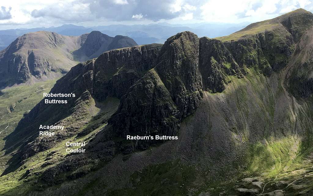
The gully on Robertson’s Buttress mentioned above is now named “Robertson’s gully”. A direct route was climbed in the winter of 1976 by A Nisbet and N Spinks. (Grade IV)
“Raeburn’s Buttress Direct”, 600feet (Grade IV) was climbed by W.D. Brooker and S.H. Wilkinson in 1967.
“Academy Ridge” (Grade II) is now considered a better route in winter than summer.
The original winter ascent of “Upper Buttress” by P. Nunn and A. Riley in 1972 was graded as Grade III. Nowadays this is shown as Grade VI.
“Splintery Edge” is Grade III in winter.
In addition to these, over 40 new winter routes have been established on Sgorr Ruadh from the 1960’s until the present day. They are at all levels of difficulty up to Grade VI.
Whilst Sgorr Ruadh cannot be considered as one of Scotland’s premier winter sites, it can offer a fine day’s climbing in the right winter conditions.
There’s no doubt that Robertson, Raeburn and the other pioneers would be pleased to see where their original explorations have led.
For more details of all climbing routes on Sgorr Ruadh, see the link to the UK Climbing website in the “External links” section.
Red Tape
Scotland has an Outdoor Access code, see link:
https://www.outdooraccess-scotland.scot/practical-guide-all
The area is popular for Deer stalking and Grouse shooting. These activities may impact on any plans for hiking. However, it is still possible to hike during these events with a little extra effort at the planning stage.
This is a useful page on the Outdoor access – Scotland website
https://www.outdooraccess-scotland.scot/practical-guide-all/heading-scottish-hills
When to Climb
Spring, Summer or Autumn (Fall), Winter depending on conditions.
Warning: The above route descriptions are for use in reasonable summer conditions. Winter conditions can occur at almost any time of the year.
In winter condition, this mountain is a much more serious proposition. Any paths may be covered by snow and ice and gale force winds are common.
Ice axe, Crampons, the knowledge of how to use them allied with excellent map reading and compass skills are essential.
The proximity of the west coast and the sea means that mist often forms and can cover the mountain.
Camping
There is limited hotel accommodation in the town of Lochcarron and further away in Kyle of Lochalsh. There are also campsites around both of these towns and in Kintail.
It is possible to wild camp in Scotland. See the Outdoor access code (above) for more details.
There are many types of self-catering accommodation in these areas but it is best to book these in advance.
External Links
Walk highlands - https://www.walkhighlands.co.uk/
SMC - https://www.smc.org.uk/
https://www.ukclimbing.com/logbook/crags/sgorr_ruadh-3443/
The Northern Highlands – Tom Strang (SMC District guide)
The Munros – (SMC Hillwalkers guidebook)
The High Mountains of Britain and Ireland – I. Butterfield
Ordnance survey map OS 429 Glen Carron and West Monar 1: 25 000
Climbers guide to the Northern Highlands area – DG and RWL Turnbull (SMC Climbers guide)
Torridonian, Northern highlands of Scotland – British Geological survey