
-
 45017 Hits
-
 80.49% Score
-
 12 Votes
|
|
Route |
|---|---|
|
|
38.99400°N / 77.2478°W |
|
|
Hiking, Scrambling |
|
|
Spring, Summer, Fall, Winter |
|
|
Half a day |
|
|
Moderate |
|
|
Class 3 |
|
|
The Best Trail in the D.C. Area
Overview and Route Information
If there's such a thing as a hiking testpiece, the Billy Goat Trail in the C&O Canal National Historical Park is the hiking testpiece of the Washington, D.C. area. Although the best section of the trail is less than two miles long and does not entail much elevation gain/loss, it has sections of Class 3 scrambling that provide an invigorating outing for experienced locals keeping in shape for the mountains, and a true test for "regular" hikers and beginners interested in graduating from simple walks.
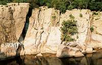
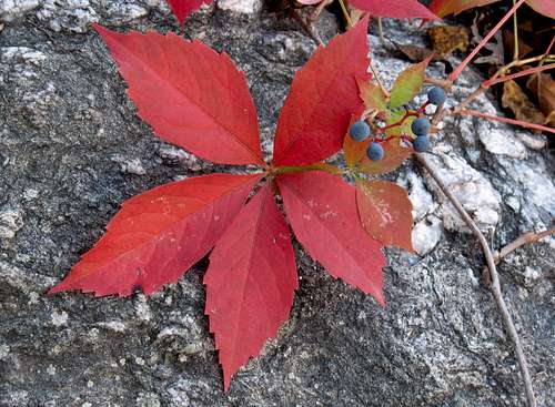
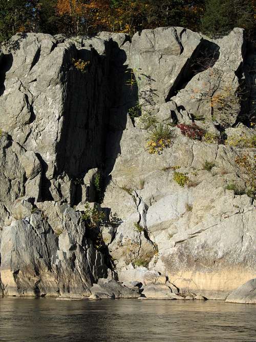
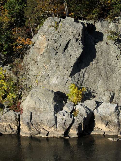
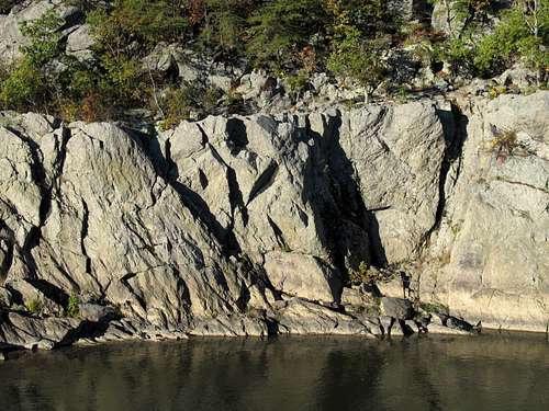
In addition, the trail showcases some of the most beautiful and best-preserved "wilderness" left in the D.C. region-- Mather Gorge of the Potomac River. Here, the river rushes through a canyon of sheer cliffs that make for the area's best technical climbing. Great Blue Herons, vultures, hawks, ospreys, and the occasional bald eagle perch on the outcrops and ride the air currents, and closer viewing reveals a vibrant world of turtles, lizards, snakes, toads and frogs, insect species, and wildflowers. In autumn, gold, red, and orange leaves contrast with the stark cliffs and make a sublime scene. This is not the deep wilderness of the mountains, but it is a dazzling jewel in an otherwise-uninspiring urban setting.
The trail also offers access to some of the climbing crags on the Maryland side of Great Falls: The Bulges, the Greek Wall and the Atrium, the Trojan Wall, Spitzbergen, Purple Horse, Crag X, Cupids's Bower (all accessed from Section A), and Carderock (accessed from Section C).
There are three sections to the Billy Goat Trail. They are not contiguous but are close together, and all are linked by the towpath that runs through the park.
Trail Map
Near Purple Horse Beach
Section A
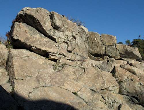
Section A, which runs across Bear Island, a small, unique ecosystem containing several endemic or endangered species, is the westernmost and most popular section, and it is the one known for its scrambling sections. The National Park Service gives it a strenuous rating, but experienced hikers will consider it moderate. The trail itself is 1.7 miles long, but it requires up to half a mile of hiking to reach either end. Using the nearby towpath (which is also the way to reach the trail) for one leg of the trip makes the RT distance about 3.7 miles. The hiking is overall mostly level, but it is frequently rocky and there are some ups and downs, a few of which are moderately steep. The scrambling is Class 3 and is easy for experienced scramblers, but wet conditions can make the rock, much of which is slick to begin with, treacherous.
Blue blazes mark the route, and the blazes are sometimes vague on the rocks. There are many opportunities to scramble on cliffs and outcrops along the way. Respect signs that prohibit off-trail travel in certain spots (usually in wooded areas), as the wooded islands of the Potomac are ecologically fragile.
 Photo by silversummit Photo by silversummit |  Photo by CharlesD Photo by CharlesD |
Section B
This section is rated as a moderate hike by the National Park Service, but experienced hikers will find it easy. It is 1.4 miles long and can be accessed from the towpath at Anglers Inn or from Carderock, further downstream. The trail follows forested terrain through the river's floodplain, and there is some easy scrambling encountered.
Section C
This section is just a pleasant hike with nice river views. There is a very small waterfall near one end of the trail, which is 1.6 miles long. Access is from Carderock.
Getting There
To reach the upper end of Section A: From I-495, take Exit 41, just north of the Virginia line, heading west on the Clara Barton Parkway and then onto MacArthur Boulevard. MacArthur leads directly to the park entrance at Great Falls Tavern.
Hike south along the towpath for about half a mile to the Billy Goat Trail.
To reach the lower end of Section A or the upper end of Section B: From I-495, take Exit 41, just north of the Virginia line, heading west on the Clara Barton Parkway and then onto MacArthur Boulevard. About 3 miles from the interstate, look for Old Angler's Inn on the right side of the road. Across the road from the inn is a parking area. Park. The parking area fills early on weekends. Do not park at Old Angler's Inn. If the parking area is full, look for roadside parking along the south side of the road.
Cross a footbridge onto the towpath and turn right for Section A or left for Section B. It is about a quarter of a mile to either trail.
To reach the lower end of Section B or either end of Section C: From I-495, take Exit 41, just north of the Virginia line, heading west on the Clara Barton Parkway. In about a mile, take the exit for Carderock. Go left over an overpass and turn right at the stop sign to reach the lower end of Section B or the upper end of Section C. Drive to the last parking lot and look for a sign near the restrooms indicating the way to the Billy Goat Trail.
To get to the lower end of Section C, turn left at the stop sign and go to the last parking area.
Precautions and Essential Gear
Bring sturdy shoes and sunscreen. Much of Section A is on bare rock with little shelter. Also, be aware of poison ivy, as this region has a championship crop! Copperheads live in the park, so remember to check where you're going to put your hands before you put them there. Gnats and mosquitoes can be bad here May through September, and insect repellent is a good idea. Dogs are not allowed.
Views Across the River
The Dr. Needlepoint Area
The Degree 101 Area
Unnamed Crags