
-
 2163 Hits
-
 70.36% Score
-
 1 Votes
|
|
Mountain/Rock |
|---|---|
|
|
39.15613°N / 111.51514°W |
|
|
San Pete |
|
|
Hiking |
|
|
Spring, Summer, Fall, Winter |
|
|
10922 ft / 3329 m |
|
|
Overview
Black Mountain is another flat-topped peak in the southern Wasatch Plateau that extends westward toward Mayfield from the crest of the range. The view from the summit is one of the best in the range and the hike is fairly short.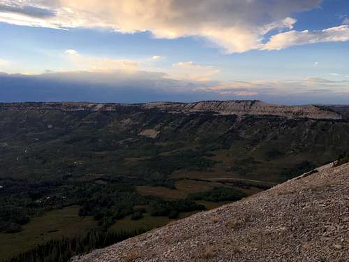
Southern Flanks
Getting There
From Mayfield, drive east on East Canyon Road that turns into Forest Road 0022. Take a slight right after 5 miles onto Forest Road 0023. Drive for 0.6 miles and turn right onto FR 0290 or continue straight onto FR 0022. This is a well-maintained dirt road that veers northeast toward Skyline Drive at Twelve Mile Flat Campground. However, a couple miles before the campground on the southern flank of the peak, take another dirt road north toward Sixmile Pond. The road isn't much worse than FR 0022. Park at the large fence in the meadow to the east of the peak.Route
Follow the fence westward until it ends when the slope gets steeper. From here, ascend in a traversing fashion northwest, which will require some routefinding skills and occasional bushwhacking. There are several game trails that provide easier passage. Take care on the bare slopes as they can be quite slippery. Ascend to the saddle southeast of the peak. Take the easy ridgeline to the summit from here.Round-trip Distance: 2.1 miles
Elevation Gain: 690 feet