|
|
Trailhead |
|---|---|
|
|
44.13238°N / 113.83595°W |
|
|
Spring, Summer, Fall |
|
|
7200 ft / 2195 m |
Overview
The Borah Peak Trailhead is primarily used to access the standard (Southwest Ridge) route on Borah Peak, the state highpoint for Idaho, in the Lost River Range. This page provides a summary of the amenities at, and directions to, the trailhead.
Amenities
Camping: There are 5 FEE campsites each with a picnic table and fire pit. There is a self-service fee box on site. It's first come first served. Each campsite has a designated space for 1 tent but 1-2 additional tents may be set up in the parking area in front of your car if necessary.

Season: May 22 - October 15
Permit required: No
Fee: $5 per night
Water: No
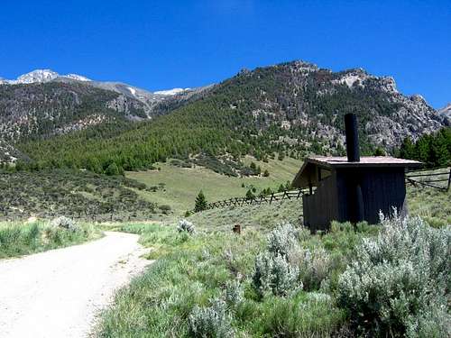
Toilets: 1 (handicap accessible)
Trash cans: No
Trailhead parking: Free. There is plenty of room for 20+ cars.
Nearby: The town of Mackay is 25 miles away and it has a gas station, small grocery store, restaurant, inn and ATM machine.
Alternative campground: If the trailhead campsites are full, there is a fee campground just north of Mackay on the Mackay Reservoir.
Directions
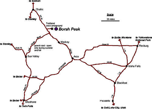
From Mackay: Take US Highway 93 20 miles north of Mackay to Birch Springs Road. Follow the road 3 miles to the trailhead.
From Challis: Take Us Highway 93 south of Challis to the Birch Springs Road. Follow the road 3 miles to the trailhead.
From Sun Valley/Ketchum: Take Highway 75 (main street) to Sun Valley Road. Turn northeast onto Sun Valley Road. This road turns into Trail Creek Road (closed in winter). Follow this road to Highway 93. Turn left on Highway 93. Follow this road 4.5 miles to Birch Springs Road. Follow the road 3 miles to the trailhead.
** Birch Springs Road is located between mile markers 129 and 130 off of Hwy 93. A brown trailhead sign for Borah Peak identifies Birch Springs Road.
