
-
 11233 Hits
-
 76.66% Score
-
 7 Votes
|
|
Mountain/Rock |
|---|---|
|
|
39.08171°N / 77.90143°W |
|
|
Clarke |
|
|
Hiking, Scrambling |
|
|
Spring, Summer, Fall, Winter |
|
|
1301 ft / 397 m |
|
|
Overview
Buzzard Hill is one of the countless topographic features in the United States with the word “buzzard” in its name. This one is just off the Appalachian Trail (AT) in northern Virginia. There is a popular overlook very close to the top, but I know of no one else who has actually bothered to stand on the true summit of Buzzard Hill.
This hike is almost entirely on the AT. Buzzard Hill is only about 3.25 miles from the Bears Den trailhead as the buzzard flies, but due to the meandering nature of the AT, the round trip via Bears Den is about 9.0 miles. There is a gain of about 3,000 vertical feet, which is spread over three separate ascents (plus the same three ascents on the way back), as this particular section of the AT in Virginia is sometimes referred to as “The Roller Coaster.”
Getting There
Take Route 7 west from Leesburg, Virginia, then turn left (south) onto VA 601. Drive about 0.5 miles, then turn right at the sign for Bears Den and continue a short distance to the Bears Den parking area.
Alternatively, immediately after turning left (south) from Route 7 onto VA 601, turn right and park in the very large AT parking lot there. This adds about 0.6 miles each way, making the round trip hike about 1.2 miles longer than if you started at Bears Den. Note: One could also use this large parking area as the start of a northbound AT hike toward Raven Rocks, since the small parking area at the AT trailhead on the north side of Route 7 fills rather quickly.
Route
Route from Bears Den:
Starting at the parking area at Bears Den, walk up a dirt road until you find a blue-blazed nature trail. Follow this trail to a junction with the white-blazed AT and then turn left (south) on the AT.
The AT will descend for about 0.6 miles to the first of several (easy) stream crossings.
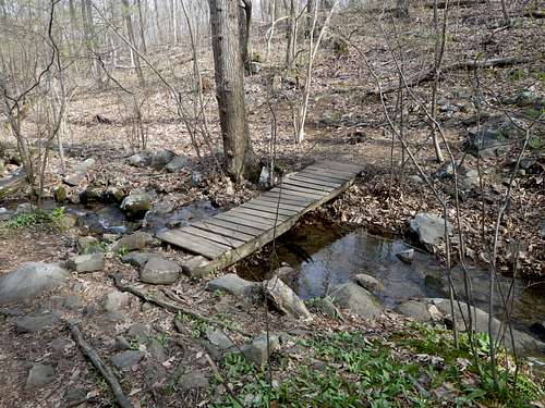 Stream Crossing in Spring
Just stay on the AT southbound as it ascends and descends Peak 1326 and Tomblin Hill (1,220+ feet), and then finally ascends Buzzard Hill, crossing pleasant streams along the way. Remember that Buzzard Hill is the third ascent of the hike.
Near the top of Buzzard Hill, the AT begins to bear slightly left. Watch for a use trail on the right, just before the AT begins to descend. This side trail leads to a rock outcrop with a nice view and some spacious, comfortable boulders suitable for a lunch break. A gnarly old tree at the outcrop also serves as a landmark.
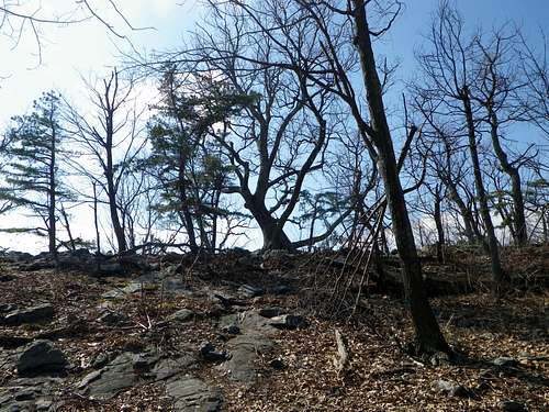 Landmark Tree
To return to Bears Den, just retrace your route.
However, if you’re determined to bag the true summit of Buzzard Hill, turn away from the view at the overlook, and notice the higher ground to the north. Don’t head for it directly, as dense thorny vegetation will resist your advances. Circle around to the west side, where the vegetation is less dense. It’s an easy scramble, and eventually you will find the unusual boulder that is the true highest point. The views are better at the overlook, but if you don’t stand on this boulder, you did not climb Buzzard Hill!
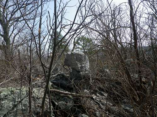 A Peek at the Summit
Now, carefully climb off the summit boulder, circle back around to the overlook area, find the AT again, and head north back to Bears Den.
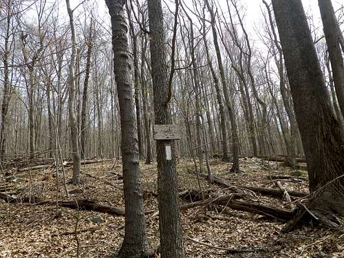 You Are Bearly There
Red Tape
None.
When to Climb
Buzzard Hill can be climbed year round, but I would not advise a summer ascent of the true summit, as it is surrounded by a dense wall of thorny vegetation. The nearby overlook does not suffer this problem, however.
Camping
External Links
Bears Den Information
Buzzard Hill on Lists of John
Information on the "Roller Coaster" of the Appalachian Trail in Virginia
Information on Buzzards