-
 24410 Hits
-
 85.87% Score
-
 21 Votes
|
|
Mountain/Rock |
|---|---|
|
|
41.37694°N / 122.57601°W |
|
|
Hiking, Scrambling |
|
|
Spring, Summer, Fall |
|
|
8551 ft / 2606 m |
|
|
Overview
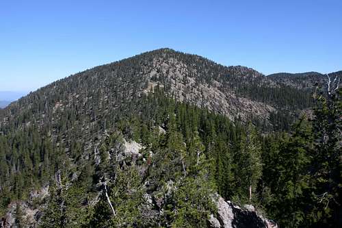
Like the prow of a mighty ship, China Mountain stands vigil over two subranges of the Klamath Mountains. China Mountain is the fourth highest summit in the Mount Shasta region (after Mount Shasta, Shastina, and Mount Eddy). The peak is also the eighth highest named summit in the Klamath Range, the second highest named peak in the Trinity Divide and the highest point in the Scott Mountains. Nonetheless, like so many other peaks in the Klamaths, China Mountain is essentially unknown to all but a very few intrepid hikers. Although visible from throughout the Shasta Valley, the mountain does not present a particularly enticing spectacle. What remains hidden are vibrant meadows, clusters of lakes, soaring rocky cliffs and deep sense of isolation despite the proximity to Interstate 5.
Like the rest of the Klamath Mountains, China Mountain has a complex geology. The Scott Mountains, which run west from China Mountain, are generally composed of serpentine and peridotite. These ultramafic rocks (particularly peridotite) are rare and do not occur anywhere else in great quantity except the Brooks Range in Alaska. Much of the Trinity Divide, which extends south from China Mountain, is composed of the same rock. Both ranges have isolated intrusions of shist and granite. China Mountain represents one of the shist intrusions. This has several consequences for the mountain. First, its appearance is different from the eastern end of the Scott Mountains and the northern terminus of the Trinity Divide, both of which have the red and russet color typical of peridotite. Second, the mountain hosts more vegetation than surrounding peaks. While the sheer portions of the mountain, notably the headwall of the Caldwell Lakes basin and the basin containing the West Park Lakes is devoid of trees, the rest of the mountain is covered by stunted lodge pole and white bark pines. Other nearby peaks, such as Chilicoot Mountain and Cory Peak are composed of peridotite, a rock type that is not very conducive to vegetation.
China Mountain is very nearly a triple divide peak. The headwaters of the East Fork of the Scott River and the Shasta River flow off of the west and east sides of the mountain, respectively. A knife-edge ridge extending 0.6 miles south of China Mountain separates the peak from the headwaters of High Camp Creek, the northernmost tributary of the Trinity River. If China Mountain were a triple divide peak, it would be unusual that two such peaks would be in close proximity to each other; Mount Eddy, 6.5 miles south is the divide between the Trinity, Shasta and Sacramento Rivers watersheds.
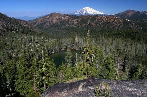
Three lake basins are located on the flanks of China Mountain. Crater Lake is found on the north side, in the Scott River watershed. The West Park Lakes and the Caldwell Lakes are found on the east side of China Mountain. Both lakes feed the Shasta River. All of the lakes see very little visitation and trails and roads leading to the lakes are not in particularly good shape. Although the mountain can probably be climbed from all three lake basins, the best route bypasses the lakes altogether, thus reducing their visitation even further. Additionally, the lakes found on the east side are not deep and are thus not as attractive destinations as the nearby Deadfall Lakes, Bluff Lakes or even Dobkins and Durney Lakes, which are themselves remote and difficult to reach.
China Mountain is most likely named after 19th century Chinese immigrants who worked in the area during the Gold Rush era. While this is not officially confirmed, it is probable, since the Yreka Ditch, more commonly known as the “China Ditch” runs along the lower flanks of the mountain. The Chinese workers built the ditch, an old irrigation canal that took water from Parks Creek north to the village of Gazelle.
Regional Geography
China Mountain is the meeting place between the Trinity Divide and the Scott Mountains. Additionally, it is the northernmost peak of the Eddy Range, a subrange of the Trinity Divide.Trinity Divide
China Mountain is second highest peak in the Trinity Divide. This region is the eastern most subrange of the Klamath Mountains. Sometimes called the Trinity Mountains, the Divide is not to be confused with the Trinity Alps, which lie directly to the west of the Divide and compose much of the views from the PCT between the Seven Lakes Basin and Mt. Eddy. Two rivers, the Klamath and the Trinity, as well as their various tributaries dominate the Klamath Mountains. The Trinity Alps provide the bulk of the water that flows in the Trinity River. On the other hand, while the Trinity Divide does provide some water to the river it is even more important sense it forms the divide between the Trinity River’s watershed and watershed of the Sacramento River. The waters on the west side of the range ultimately find there way to the Pacific Ocean by way of the Klamath River while the waters on the east side reach the sea through the Sacramento River at San Francisco Bay. The Trinity Divide is topped by Mt. Eddy, the highest peak in the Klamath Mountains.
The Eddy Range
The Eddy Range extends 14 miles in a gentle arc along the northern stretch of the Trinity Divide. The range stretches north from Gumboot Saddle to China Mountain, where the Eddys merge into the Scott Mountains. The obvious highpoint, in both literal and figurative terms is Mt. Eddy itself. The massive bulk of this ultra prominence peak is visible from all over the Mt. Shasta region and is a constant presence from much of the high country of the Trinity Divide. Six of the ten lakes in the Eddy Range are found in the glacial cirques nestled beneath the summit. At 9,025 feet, it is the highest peak in the Eddy Range, the Trinity Divide, the Klamath Mountains, and interestingly enough, the highest peak in the United States, west of Interstate 5, which winds its way along the foot of Mt. Eddy.
The Scott Mountains
The Scott Mountains are another subrange of the Klamath Mountains. Like most of the other ranges in the Klamaths, its boundaries are determined by river watersheds. While the Trinity Divide is the range separating the Trinity, Sacramento and Shasta Rivers watersheds, the Scott Mountains are the divide between the Trinity River and Scott River watersheds. Both rivers eventually flow into the Klamath River. The western boundary marks of the range marks the shift into the Salmon River watershed, while the eastern boundary of the range is identified by the area drained by the Shasta River.
Highway 3 divides the Scott Mountains at Trinity Summit. The western half is encompassed in the Trinity Alps Wilderness. Only three named peaks are found in this area, most of the range in this stretch consists of a long, rugged crest. There are, however, over 20 lakes, some of which are quite large and deep. East Boulder Lake, the largest, is 32 acres in size and has one of the best naturally reproducing trout populations in the Trinity Alps. This area is accessed by several great, though seldom used, trails. The eastern half of the Scott Mountains has fewer lakes, of which only the gorgeous Kangaroo Lake is of particular note. This side, however, is craggier and has more peaks, of which China Mountain is the highest. The Pacific Crest Trail winds 40 miles through the length of the Scott Mountains.
Routes
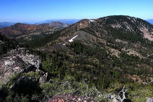
No trails lead to the top of China Mountain. The only regularly maintained trail in the vicinity is the Pacific Crest Trail, though this lies almost 1.5 miles south of the summit. There are faint trails leading into the West Park and Caldwell Lake basins but they see little use and are not even on the radar when it comes to trail maintenance. In spite of the lack of trails, there are four ways to reach the summit of China Mountain. The first three involve hiking into one of the lake basins surrounding the mountain and then climbing the headwall up to ridges that radiate out from the summit like spokes. While these are attractive options, particularly because of the lakes, the best route departs from the Parks Creek PCT trailhead and bypasses the lakes as it travels the crest of the northern edge of the Trinity Divide all the way to the top. While this route is waterless, it is the most direct route, has the easiest climbing and has outstanding views for the entire trip.
A detailed description of the PCT route can be found here.
Current Conditions
-Current NOAA / National Weather Service Forecast for China MountainGetting There
From Mount Shasta City, drive north on Interstate 5, through the town of Weed. Exit at the Edgewood/Stewart Springs exit. Turn left and drive under the freeway, then turn right onto Old Stage/ Old 99. Continue north for a couple hundred yards and then turn left onto Stewart Springs Road. After 4 miles, Forest Service Road 17 splits off to the right. Follow this road to the Parks Creek trailhead.
Red Tape
While China Mountain is not in an official wilderness area, it is nonetheless, a wilderness. Consequently, normal wilderness rules and ethics should be abided by.
Shasta-Trinity National Forest
3644 Avtech Parkway
Redding, CA 96002
(530)226-2500
Mount Shasta Ranger Station
204 West Alma
Mt. Shasta, CA 96067
(530)926-4511
Klamath National Forest
1312 Fairlane Road
Yreka, CA 96097
(530)842-6131
Salmon & Scott River Ranger Districts
11263 N. Highway 3
Fort Jones, CA 96032
(530) 468-5351
Camping
There are no established campgrounds near any of the trailheads to China Mountain. The nearest one in linear distance is the fantastic campground ant Kangaroo Lake, but this is only convenient if one is going to attempt the rugged drive up to Crater Lake. The Parks Creek trailhead is easily reached from Mount Shasta City, which has numerous campgrounds. The Forest Service’s Eagle Creek Campground, on the Trinity River, is about 25 minutes west, along Highway 3. Perhaps the best option for camping is at the Deadfall Meadows trailhead, only a 1.5 miles beyond the Parks Creek trailhead. Water is available from Deadfall Creek, though there are no toilets. Bluff Lake is another good, undeveloped, nearby camping option.
External Links
-Shasta-Trinity National Forest-Klamath National Forest


