
Comments
No comments posted yet.
|
|
Trip Report |
|---|---|
|
|
28.73960°N / 17.74453°W |
|
|
Feb 9, 2023 |
|
|
Hiking |
|
|
Winter |
During our time on La Palma, the weather on the mountains was not as settled as it could have been so some of our time was spent exploring the scenery of lower altitudes. Consequently, we spent quite a bit of time walking on the GR 130 footpath.
The GR 130 is the designation given to this long-distance footpath, it is also known as the Camino Real de la Costa (the Royal Coastal path) and it runs for over 140 km around the coastline of the island.
That said, titles can sometimes be a little misleading. The path often deviates away from the coastline and once on it, you can easily find yourself up in the cloud covered hills, hundreds of metres above the coast. Also, the path passes through many built up areas as well as using some quite busy roads. However, there are some very enjoyable sections which are well worth exploring. The routes can be walked as A – B walks with the bus services being utilized to return to the starting point.
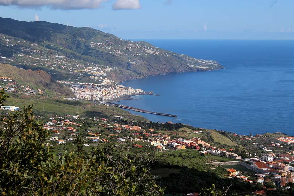
The weather forecast said that the best weather was on the north coast of the island so that is where we wanted to go. Unfortunately, it was Saturday, so the bus service was reduced by around 50%. Eventually, we arrived in the town of San Juan de Puntallana around 11.00 am and although it was sunny, it was windy too.
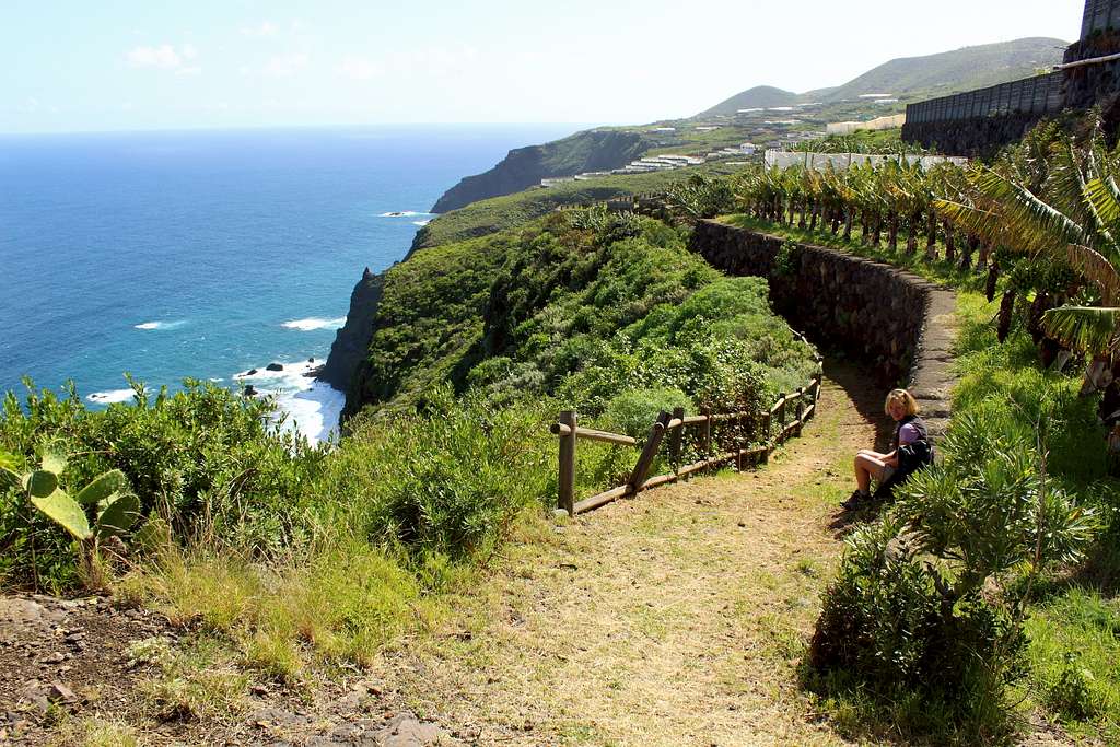
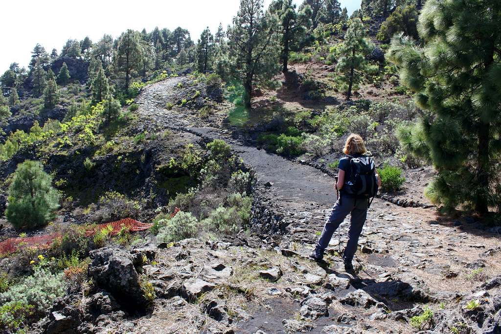
The town sits at 400m above the sea, on the top of one of the island’s many volcanic ridges. Our route for the day was to head northwards along the coast on the GR 130 and our first leg of the walk involved descending to sea level over the first 6km.
We left the town on a well-marked trail that descended in parallel to the main road. The views north were far reaching over the cliffs to the sea but were not particularly inspiring at first.
It wasn’t long before we lost sight of the main road and soon after that, our path moved away from the nearby minor road that served the farmhouses we had passed.
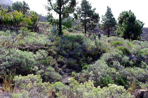
A path crossed over ours and a signpost showed the route down to the Playa de Nogales. We continued straight on and found ourselves on a succession of footpaths and tarmac or concrete tracks that found their way through the huge banana plantations that lined the clifftops on the northeast coast.
It was lovely in the sunshine and the wind had dropped to a pleasant, cooling breeze on the sea cliffs. Many times, we watched the Canarian Kestrels careering through the groves, no doubt looking for lizards.
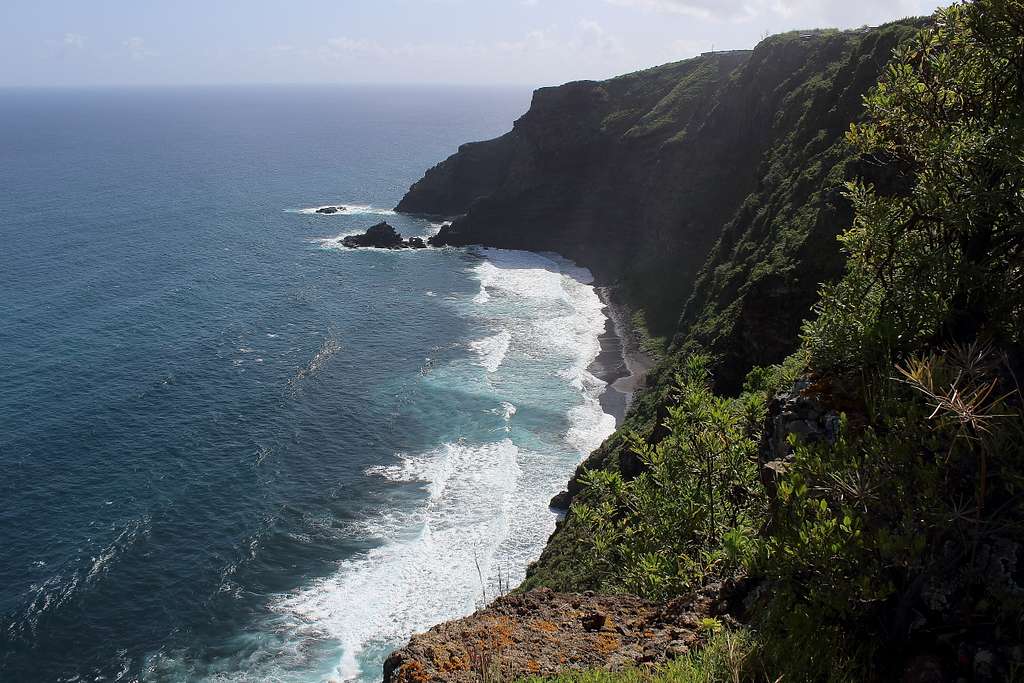
We had great views down to the Playa de Nogales below. The turquoise blue sea crashed against the rocks below us.
“With these views, you could believe you were on the north coast of Cornwall.” I said.
Marie looked a bit skeptical.
“If it wasn’t for the banana plantations!” I added.
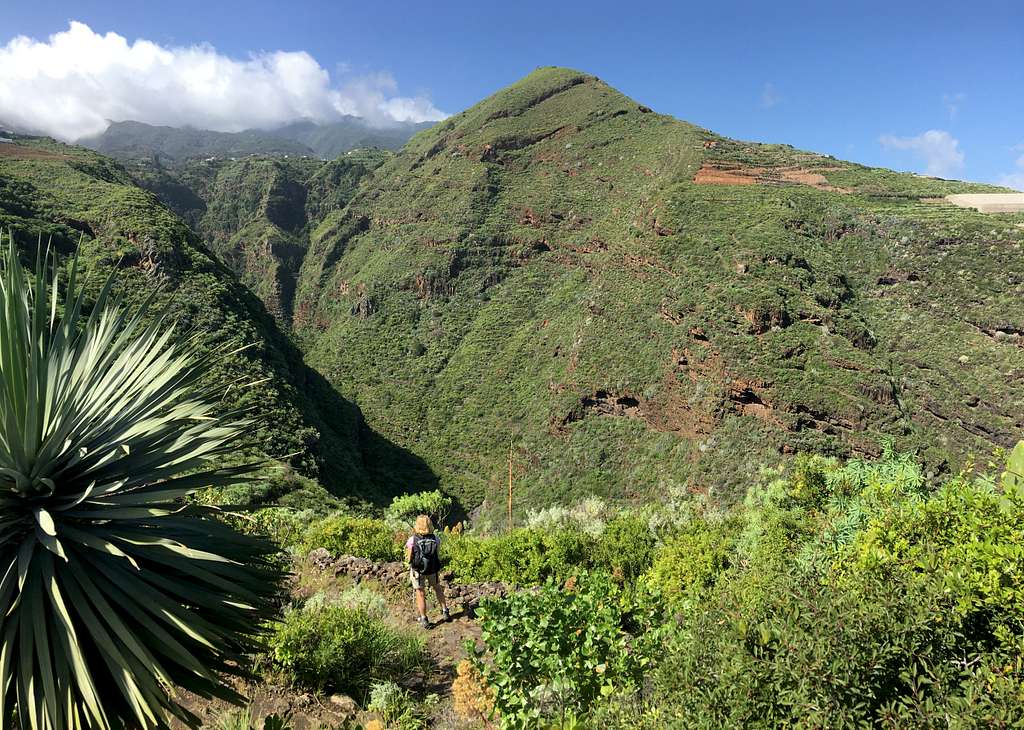
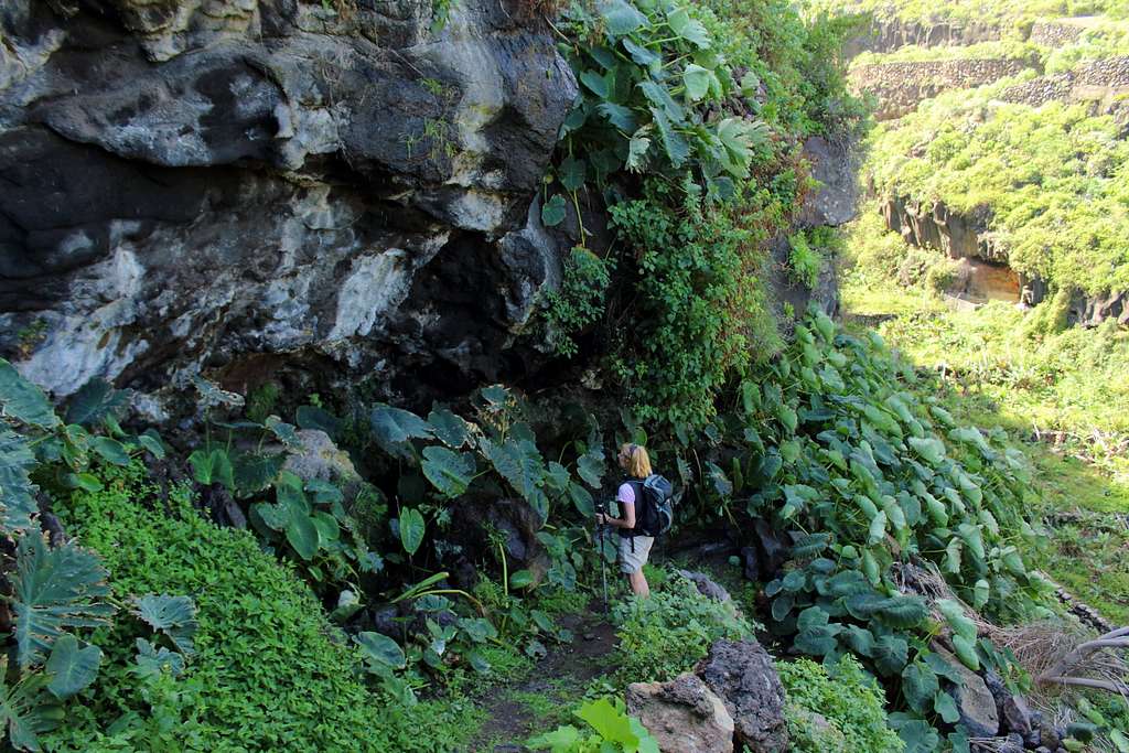
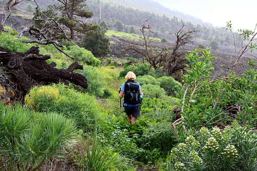
After a little over two hours, we reached the final descent into the Barranco de Nogales. Our path dropped steeply down – about 100m in height – to a stony beach at the bottom. The path dropped dramatically through a jungle of vegetation growing in the shade of the rocks. Huge Euphorbia plants clung to the overhanging cave roofs on the cliffs like giant spiders and there was plenty of damp slippery rock to contend with.
At the bottom we crossed the narrow barranco bottom and started on the ascent… straight back up!
On the way up, we met our first walker of the day. An Englishman doing the route in the opposite direction. He told us we were nearly halfway along – I had thought we had passed halfway so was disappointed to hear this!
At the top, we continued our way through the banana plantations to an excellent lunch stop sitting on a wall looking out to sea.
After lunch we carried on, walking through a mixture of bananas and wonderfully fragrant orange groves alongside what we decided must be mangoes.
Then, it was time to drop again into the Barranco de la Galga, a barranco filled with bananas!
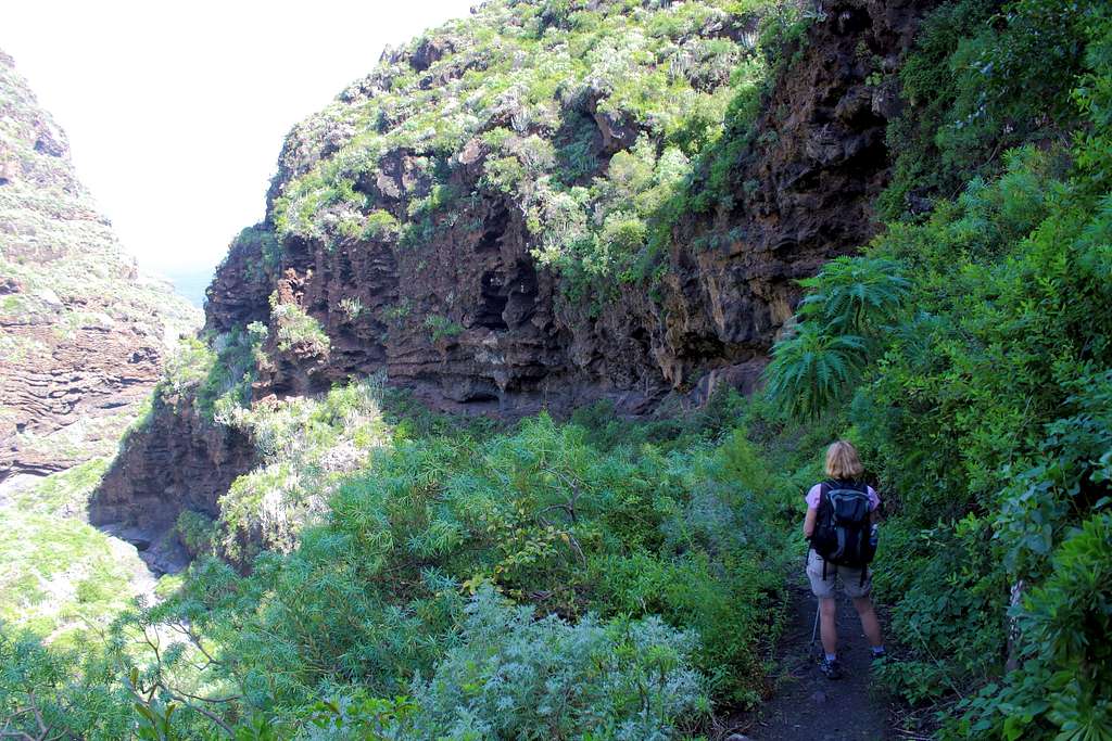
Then, it was up again, along the cliffs for a while before dropping into the damp (and of course steep) barranco de San Juan.
The rock walls ran with water and huge green plants crowded the path. It smelt like a tropical greenhouse. We passed through carpets of Nasturtiums and many butterflies flitting from flower to flower. Then, it was a steep climb up again to a rest stop at the San Andres cemetery. We were both pretty tired by this point after 12 km of up and down.
After a short rest, we continued on, this time through the outskirts of the town of San Andres before the last descent for the day to the beach side hamlet where the GR 130 turns inland.
We only had 2km more to go and I thought we were nearly there. I hadn’t realised we had to climb up to the town of Los Sauces, over 260m above us!
La Palma is known as the “steepest island in the world”. I don’t know if that is scientifically correct but I have never walked up tarmac streets as steep as here… and this was one of the worst!
We finally made it to the town square and in plenty of time for a rest and a drink before the long bus journey back.
A lovely part of the island, this route of over 15km on the GR 130 has fabulous views and spectacular scenery along with 900m of descent and nearly 800m of ascent overall. A straightforward, beautiful but tiring route.
We had walked the section of the GR130 from San Pedro to Montes de Luna as part of excursions over several different days. From San Pedro southwards, the path passed through the outskirts of several towns and villages set at about 500m above sea level. The route is quite quiet although, it does cross some busy roads and there are plenty of local dogs to herald your approach. It is pleasant walking if the weather is good and can be strenuous but not really mountainous.
We had enjoyed good views from Montana de la Brena, a hillside just above the GR130 which overlooked Los Cancajos and the nearby La Palma airport. The route followed pleasant tracks southwards to the higher outskirts of Mazo where we had some lunch at a lovely picnic site above the town. We watched a Kestrel hunting below us and then fly into the tree just above us in the woods.
From here the path started to descend through farms and lanes towards the LP 206 – which is quite a busy road - and the town of Tigalate. The path here - between Mazo and Tigalate - is not great and is worth avoiding unless you really want to complete it.
On another day, we had spent the morning on this rather uninspiring section of the GR130 from Mazo to the village of Montes de Luna. It had rained quite heavily along the way and we had regretted leaving the road at one point to fight our way through soaking wet undergrowth only to find the path returned us to the same road farther on.
At lunch time, we found a picnic site and some warmth from the sun as the weather improved. After lunch, we struggled to find the correct path at first – I think some recent road works had destroyed the signs – but after some searching, we found the route. Once again, this was a steep (straight up) path to take us around 150m above the town of Montes de Luna.
Once we had struggled to the top of the ascent, the path contoured along the mountainside heading southwards. By now, the sun was out and it was much warmer than earlier. We passed through areas of overgrown shrubs on the hillsides with old dry-stone walls and flowering Almond trees showing evidence of farming in the past.
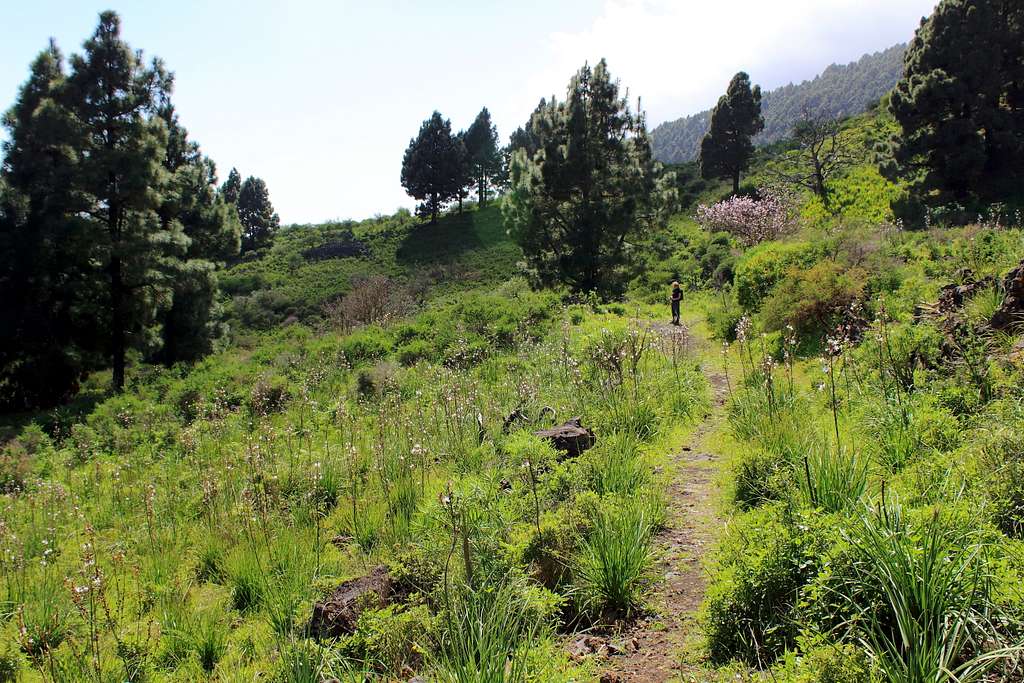
We had some far-reaching views down to the coast a long way below and after a while, the rough path joined an old Camino. The scenery changed from green hillsides to the blasted rocks of a lava field – Volcan Martin and Montana Pelada were above us in the clouds. Luckily our route through the rough ground was eased by the Camino which almost had a feel of a cobbled street through the mountainside.
The Camino ended as we joined a tarmac road through a beautiful forest of Canarian pine trees. The GR 130 followed this for a while before we turned downhill on the GR131 to take us into the town of Los Canarios and our bus back north.
A good afternoon’s walk through some lovely scenery in lovely, sunny weather. Shame about the morning!
Having enjoyed the walk on the southeast of the island, we wanted to try out the parallel walk on the west side. We knew that the GR 130 path from Los Llanos to the village of Jedey was closed as it was covered with lava from the 2021 eruption but from Jedey onwards seemed to be open.
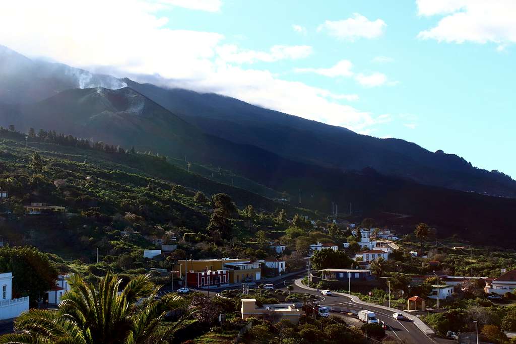
The forecast was for sunshine but the mountains were covered in clouds from sunrise so we had stopped believing the forecasts. We got the bus to Los Llanos travelling into the clouds and through the tunnel to the west side of the island, the weather here was a bit better but not promising. We changed busses here to head south towards Jedey. I wondered how the bus would avoid the lava flow from the 2021 volcanic eruption – now called Volcan Tajogaite – but I was surprised at what we saw.
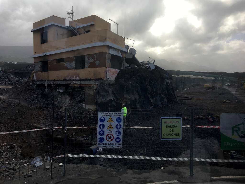
A track has been cut through the lava flow for traffic to use. There is a restricted speed limit and the surface is compressed ash rather than tarmac, I’m not sure if it follows the course of the original road or is a new one but the route passes the remains of houses and businesses that have been dug out from the lava.
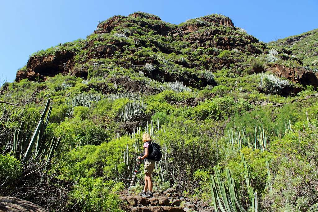
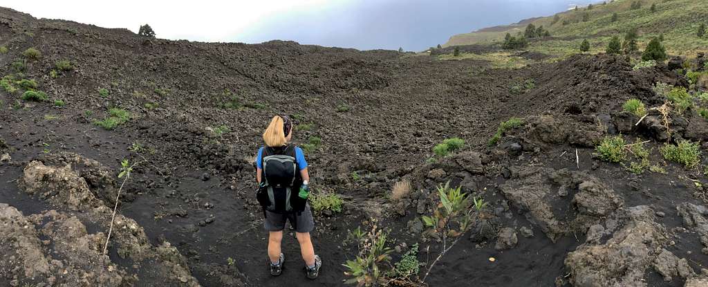
At Jedey, we found the GR 130 route heading south and started our walk. All around us the ground was covered with the black, fine volcanic dust deposited from the nearby, still visibly smoking, volcano.
As we descended, the sun came out and we became fascinated by the landscape around us. Lava flows from previous eruptions have shaped this part of the island and are only just being reclaimed by vegetation. We passed a ravine which descended the southwestern slopes – was this the fault line from the 1949 eruption that gave birth to the mega Tsunami theory? (See the main La Palma page on SP).
Suddenly, we realised that we hadn’t seen any markers for the GR 130 for a while. After consulting the map we realised we had been beguiled by the landscape and wandered down a farm track instead of the path. There was no way we could head upwards across the ravaged landscape so we retraced our steps for a while and noticed a cairn by a dried up river bed.
We took a chance and followed it for 20 minutes until we came upon the feint track of the GR130. We were lucky, the path here is in a poor condition and we passed through lots of overgrown vegetation before stopping for lunch at a ruined farmhouse.
|
|
After lunch, the weather had clouded over again and we passed through more old lava fields before the path started going up steeply through the Canarian pine forest, to cross the road.
At the road we found a large team of road workers completing a new road after the old one was covered by a landslide, there was no footpath! They indicated to us to walk up the road!
We did this for a while until we found the way across and on to the GR 130 again. By now, we were getting the odd waves of drizzle as we climbed the hillside – a height of around 300m overall – to reach a track taking us further south and eventually down into Los Canarios.
To be honest, the main attraction for this part of the footpath was the fascinating landscape that we passed through. The relatively recent volcanic activity on La Palma has created an environment we haven’t experienced anywhere else we have visited. The walking was quite tough and the changing weather adds some further hardships although none of it was too arduous. A very interesting place.
The GR 130 is a route that encompasses La Palma and passes through many different environments on the island. It’s possible to complete the whole route (the parts that are open) in about a week but from what we saw of the eastern and southern parts, I think for most visitors it’s better to dip into sections of it whilst exploring the island as a whole. In pleasant weather, it’s possible to enjoy the unusual landscapes the path passes through.