-
 18268 Hits
-
 86.37% Score
-
 22 Votes
|
|
Mountain/Rock |
|---|---|
|
|
48.11635°N / 113.91094°W |
|
|
Mountaineering |
|
|
Spring, Summer, Fall, Winter |
|
|
6787 ft / 2069 m |
|
|
Overview:
Layout designed for best viewing on a "1024 x 768" screen.
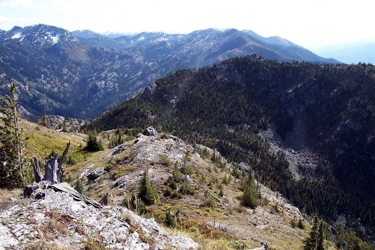
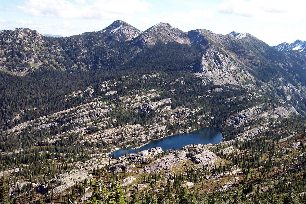
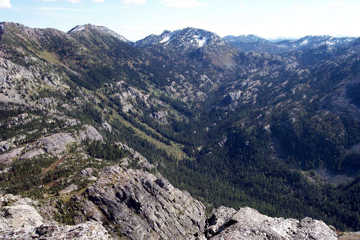
Crater Mountain is an enjoyable scramble above a glaciated valley that holds Crater Lake. Crater Lake is one of the true gems of the Jewel Basin as it is a fantastic place to spend the day fishing or exploring. There are massive boulders around the lake that are enjoyable to scramble on.
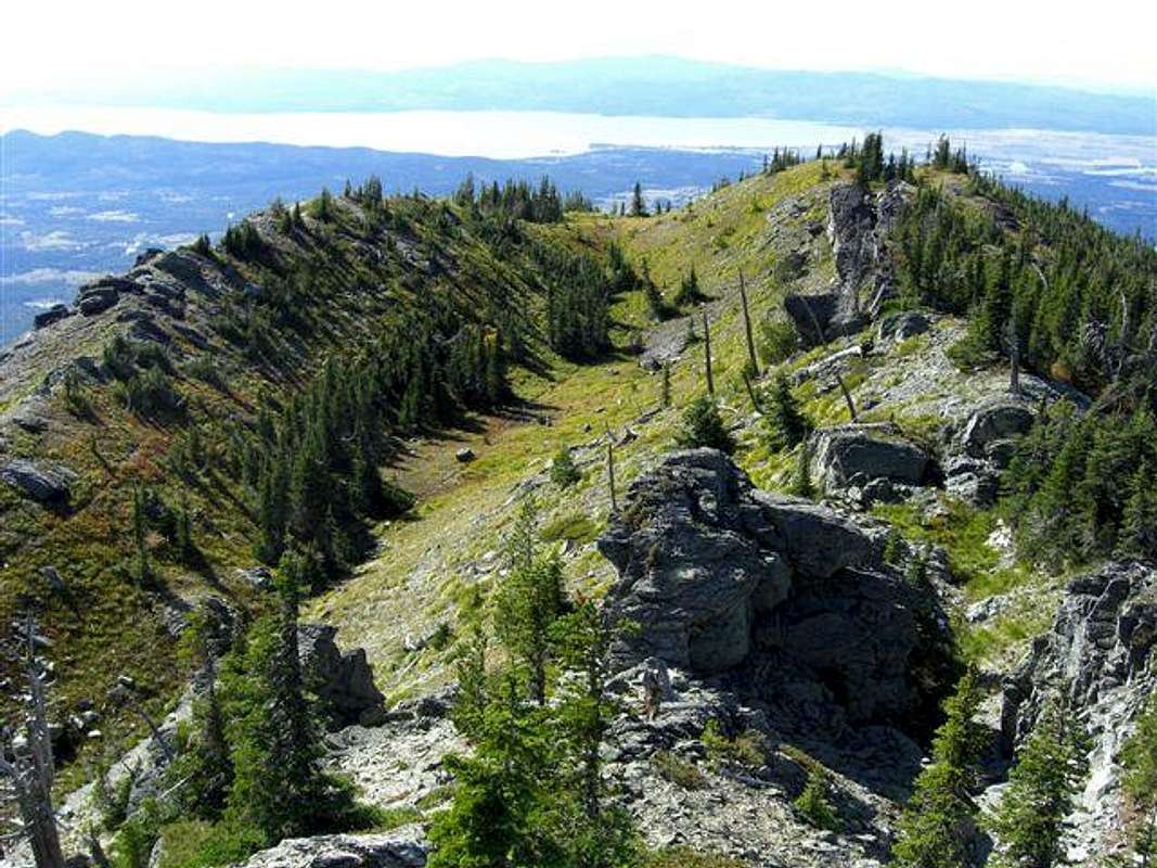
The Flathead Valley can also be seen from Crater Mountain. A few miles in the distance lies Flathead Lake and the village of Bigfork Montana. Bigfork is home to the Wild Mile and every May Bigfork hosts the White Water Festival where at least 200 kayakers from across the continent come to challenge themselves on the Swan River’s class V rapids. The dates of the 2009 festival are May 23 and 24.
The trip to Crater Mountain can include climbing Squaw Point as well. By including this ridge walk the distance is no further but there is a little more elevation gain and loss. One of the beautiful things about climbing in the Jewel is that ALL elevation gain is mild compared to many other climbing options here in NW Montana.
Getting There:
Crater Mountain is located along the western boundary of Montana’s Jewel Basin Hiking Area, an incredible portion of Montana’s backcountry that has been preserved for future generations by farsighted friends of the wilderness. Please see the Jewel Basin Area page for more details.
The Jewel Basin is open all year but due to massive amounts of snow the roads close sometime in late October to mid November and open again some time between the middle of June and the first week or so of July.
During the winter season some backcountry enthusiasts snowmobile to the trailheads and either snowshoe or ski into the Jewel Basin. Please keep in mind motorized vehicles including snowmobiles, motorbikes, four wheelers and even mountain bikes are prohibited in the Jewel Basin.
The Jewel Basin is also closed to pack stock and all dogs must be on a leash.
Red Tape:
There is little red tape with the exception of a 12-person maximum group size on all trips.There is a strict "Leave No Trace" policy here as should be expected. Stay on designated trails.
Follow all guidelines for camping in bear country if you plan to camp as black bear and grizzly bear call this area their home. There are also mountain lions in this area.
As with all hiking and climbing in Northwestern Montana use caution and practice good manners with the wildlife. You are in bear country. Carry your bear deterrent, don’t hike alone and make some noise. For more information please go to the Glacier National Park's website for Bear Information. The U.S. Forest Service also has helpful information on Grizzly Bear Management.
Route Information:
Total distance about 12 miles with 10 miles on good trails if ascent from Crater Lake is chosen. Total elevation difference between trailhead and summit is 1,070 feet. There are elevation gains and losses on all routes so total elevation gained is greater.
Directions to the trailhead:
Please visit the Camp Misery Trailhead information for directions to the start of the route.
On Trail Directions:
Upon arriving at Camp Misery take a quick look at the map that is posted on the Information Board and take off up the Jeep Road to the right of the sign that is next to the gated road. Follow that road through a few switchbacks until breaking up onto the ridge above Camp Misery. An interesting side trip can be had by following a trail that takes off to the right. It goes up to a knob and there are nice views there. Continue on the road for another ½ mile or so where you will find another enlarged parking area. Back in the 1970’s we could drive to this point, since then the US Forest Service has closed this road hence the gate at the bottom of the road.
By looking south the foot trail will be seen. Follow that trail to a junction. There are actually 5 trails that meet at this junction. From the trail you are on take the second trail. The sign says Birch Lake. Do not take the Switchback Trail which heads off below the trail you just walked.
Walk on Alpine Trail #7 to Birch Lake. While en-route Martha Lake can be seen below the trail and Point 6948 (Birch Peak) can be seen above Martha Lake.
Upon reaching Birch take a quick break and then cross the log bridge at the outlet of the lake. Continue on Alpine Trail #7 for another mile until reaching the next junction with trail #187. This junction is about ½ mile beyond the south end of Burch Lake. It is difficult to see the trail marker but the trail to the west (right) is obvious. If you reach the trails turning left to Squaw Lake you have missed the turn.
At this junction a decision must be made. Continue south on Alpine Trail # 7 to Crater Lake for a direct approach or turn west on Trail # 187 for the Squaw Ridge Approach.
Squaw Ridge Route:
Take a right turn (west) and follow this trail to the saddle between Birch Peak and Squaw Ridge. A few extra yards of walking will reward you with views of the Flathead Valley, but there are better views on the ridge.
When reaching the saddle the route to Squaw Ridge continues south off trail. We found it easiest to head up the east side of the ridge just before reaching the saddle. After just a few yards we located a descent game trail which in turn helped us skirt the slabs of rock on the north end of the ridge and followed it to the ridge.
Upon reaching the ridge it is an uncomplicated enjoyable walk to the top of what we have called Squaw Ridge.
From Squaw Ridge continue south and descend to the saddle below Crater Mountain. We found a nice gully on the eastern side of the ridge to use in our descent. There are numerous options to get to the saddle. After reaching the saddle continue south and bushwhack through the low subalpine growth aiming for the cliffs that can be seen below Crater’s northern slopes. A game trail will be found on the east side of those cliffs. This game trail basically leads all the way to the final summit dome.
After reaching the rock capped summit a quick enjoyable scramble up the last 30 feet leads to the summit.
Crater Lake Descent/Approach:
This is definitely a more difficult approach but is an easier descent since it generally is downhill to return to Alpine Trail #7. The difficulty here lies in the numerous rock ridges as well as the large amount of what we call snowbrush and huckleberry plants. The snowbrush will make it difficult to route find and the huckleberry plants will slow you down as no one can eat just one!
It is also possible to get turned around here but keep in mind that Alpine Trail traverses North and South here from Birch Lake all the way to Crater Lake. Just keep heading down hill and you will eventually hit the trail. Upon reaching the trail make sure to hike North on Alpine Trail # 7 to return to Birch Lake and Camp Misery.
We followed the obvious well worn game trail from below Crater’s summit down towards the lake. It literally is like a trail that has been constructed by humans. I have researched to see if there was a trail there at one time and
did not find any conclusive evidence that a human trail existed there. Perhaps it was used by the Salish, Kootenai and Flathead tribes as they traveled to the Great Plains to hunt buffalo. They used this area as a thoroughfare and certainly have been here. From the summit this trail generally heads in a northeastern direction and eventually we lost the trail in the lower meadows. We then followed a streambed, which lead us back to the trail after negotiating a few of the rock ridges.
Other options would be to set a heading for the northern shores of Crater Lake and pick up the trail back to Birch Lake from there. We chose a more direct route since we feel comfortable with route finding in the Jewel Basin.
Probably the best approach is to hike all the way to Crater Lake and then head west through the rocks that are along the North shore. Eventually a meadow will be reached above the jumble of rocks and from there head up hill until meeting the game trail that crosses Crater on the east side of the mountain. Follow the game trail to just below the summit on the eastern side and then scramble to the summit.
Special Considerations: The rock in Glacier Park is widely varied and it is not unusual to find several different types of rock on any given route. Know your rocks and be certain of your safety. J. Gordon Edwards has an excellent section in his guidebook on rock and climbing safety. Be safe and know your limitations as well as those who are climbing with you. Also refer to the following links for further details: GNP Rock and Grading System and the GMS Climbing Guidelines.
When to Climb:
This climb can be done at any time of the year. If the preference is for no snow plan on doing Crater Mountain anytime between June 15th and the end of October.
Weather Link:
Montana gets its share of interesting weather. In June of 2008 we had over 2” of snow in the Flathead Valley and up to 24” inches of new snow in the high country. The winter of 2008-2009 deposited a snow pack that was 130% above normal precipitation which will help keep the forest fires ay bay in northwestern Montana in 2009.In Montana it is said “If you don't like the weather just wait a half hour” or you can check out what’s up with the local weather.
Essential Gear:
Bear SprayHiking Poles
Water
Camera
GPS or compass (for those who are navigation impaired)
Hiking boots
Sun screen
Fishing Pole and Montana Fishing License
Camping:
It certainly is not necessary to camp to do most climbs in the Jewel Basin, but if desired there are some designated campsites.The nearest Campground is located at Birch Lake. There is a pit toilet there as well. It is located on the north end of the lake about 200 yards from the trail. A use trail leads to the outhouse.
Fires are not allowed within 500 feet of Birch Lake. Play it safe and take a stove if you plan to camp overnight.
Links:
Visit MontanaMap of the Jewel Basin
Flathead County Search and Rescue
USFS Official Jewel Basin Site
Glacier Avalanche Center


