

-
 4272 Hits
-
 71.06% Score
-
 1 Votes
|
|
Trailhead |
|---|---|
|
|
47.15095°N / 115.16489°W |
|
|
Mineral |
|
|
Spring, Summer, Fall |
|
|
5373 ft / 1638 m |
Eagle Cliff Peak Trailheads
The easiest way into the area is via Dry Creek Road.Take Exit 43 from I-90, just 3 miles west of Superior, Montana.
Go south on Southside Road, crossing the river and railroad tracks.
After few miles, a road takes off to the right (west), and is signed 342. Turn onto 342, which soon turns into gravel but is in excellent condition for passenger cars.
Depending on which way you chose to climb Eagle Cliff Peak, after nine(9) miles, you turn off at the junction of road 7843 and drive about 4 miles to the parking/camping area at Diamond Lake.
If you prefer, you could continue to Dry Creek Saddle by staying on 7843 for another 4 miles to where the State Line Trail 738 crosses the road.
External Links
For information about the climbers' route accessed from this trailhead, see the link included in the picture's description.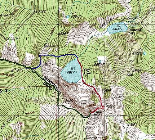 Topo of routes to the summit of Eagle Cliff Peak.