
-
 8653 Hits
-
 84.26% Score
-
 20 Votes
|
|
Mountain/Rock |
|---|---|
|
|
38.21185°N / 111.2067°W |
|
|
Wayne |
|
|
Scrambling |
|
|
6120 ft / 1865 m |
|
|
Overview

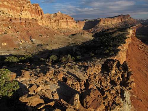
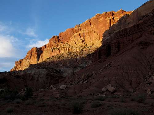
Don't bother looking for this "peak" on a map; you won't find it. If there's such a thing as an "unofficially named unofficially named peak," then this might be it. Only a small NPS sign or a Google search is likely to point your attention to this formation by name. Also, don't think that the Egyptian Temple is a major Capitol Reef formation. It isn't. The Temple itself is really just the impressive southern end of a nearly two-mile long escarpment of red cliffs paralleling the park's Scenic Drive and is not the actual highpoint of the formation, and the "climb" to the highest point is only about 300'. Views aren't really any different than those found from various points along the road; they're just higher up and a little more sweeping. So why bother? Well, you do get those higher-up views, and it's also a way to get away from the road without sharing a trail with lots of other people. It also serves as a good Plan B. The day I "climbed" this peak, my actual plan was to go into the Cathedral Valley area and go after an obscure peak out there. Unfortunately, my plans fell apart when I discovered my right rear tire was rapidly losing air. The owners of a tire shop in Hanksville claimed that by law they weren't allowed to work on a rental without authorization, and several attempts I made to patch the leak all failed, causing me to lose precious hours in the process. Finally, I put on the spare but knew I had to restrict myself to paved roads lest I get another flat somewhere really remote and find myself in big trouble. So by the time all that had happened, I had only a couple of hours and very limited choices for summits, so Egyptian Temple called.
Getting There
At the Visitor Center in Capitol Reef National Park, turn south on a paved road that passes by the campground and then becomes the Scenic Drive. After about 10 miles, the pavement ends and dirt roads fork left and right. Shortly before this spot, look for the Egyptian Pyramid on your left. There is also a small NPS sign pointing to it. Park at the closest pullout.
Route
There isn't much to say about the route. Find a way up on the southeast side of the formation. I was pleasantly surprised to find the scrambling more challenging than I expected, and I had to work to keep it at Class 3 and 4. There seemed to be easier terrain coming up from the east side, but it would have wasted time to head all the way around there. Up top, you can simply go to the tip of the Pyramid, or you can hike north along the crest of the formation, enjoying the views and interesting rocks and rock formations. If you do that latter, either go back the way you came or scramble down an easy gully at the north end and then follow a wash back to the road. Please do use the wash; otherwise, you will be trampling the delicate soil which is the basis for life out here.
 North end
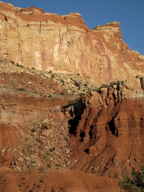
Then it's an easy walk back to the car. You can do this in reverse, of course, but going the way I describe it, the return hike is mostly downhill.
Red Tape
You have to stop and pay a fee at the beginning of the Scenic Drive unless you have a pass. If you are like me and love to collect cool rocks you find, remember that in a national park, it is illegal to do so. Settle for pictures.
When to Climb
Summer temperatures regularly top 90 degrees. Do this one very early or very late in the day if going in the summer.
Camping
Fruita Campground is large and shaded. Reservations are not accepted.