Overview
![Golfen / Monte Calvo]() The summit of Golfen / Monte Calvo as seen from the north-east The summit of Golfen / Monte Calvo as seen from the north-east |
is an unimpressive mountain on a side ridge of the
Riepenspitze Group of the
Villgrater Berge Subgroup of
Hohe Tauern. The side ridge is composed of four mountains,
Hochhorn / Corno Alto,
Golfen / Monte Calvo,
Roßzogel / Monte Cavallo and
Hühnerspiel / Dosso Gallina. The area is famous for its views, thanks to the location immediately above
Pustertal / Val Pusteria with the
Sexten / Sesto Dolomites and
Prags / Braies Dolomites just across the valley. However, it takes an early start on a perfect to enjoy these views as the mountain ranges are located in the south. During noon and early afternoon you'll see shadowscapes only.
While not one of the tallest mountains of the region,
Golfen / Monte Calvo still is a formidable destination. The summit may seem like a grass-covered hilltop (which indeed it is) but to reach it you have to scale 1200m from the closest trailhead. Starting from
Toblach / Dobbiaco you have to add another 200m to the score. On the other hand the ascent is easy. It follows narrow mountain roads for its first third, then heads up on well-kept hiking trails which aim for the gap between
Roßzogel / Monte Cavallo and
Golfen / Monte Calvo. There are no rocky passages on this route so that it can be done by anyone with enough stamina.
An even more picturesque route is the ridge traverse from
Toblacher Pfannhorn, which climbs
Gaishörndl / Cornetto Fana and
Hochhorn / Corno Alto before reaching our summit. From
Hochhorn the traverse heads down all the way to
Golfen / Monte Calvo, not necessarily an ascent route. This traverse is part of
Toblacher Höhenweg, a two day trekking trail, which traverses the complete southern part of the
Riepenspitze Group. Starting from
Toblach / Dobbiaco you have to account for a very long day with some 1600m elevation gain for the Pfannhorn - Golfen Traverse.
The
Riepenspitze Group Main Ridge has been the borderline between Austria and Italy ever since the end of World War I. For quite some time - until the 1960s - the border was patrolled and you can find numerous customs buildings all across the ridge. Today they are more or less ruined but they are the cause for the easiest ascent routes to the mountains of the area. Especially from the Italian side several support roads lead to the customs ruins.
Golfen / Monte Calvo is not part of the border ridge but stands aside by only one kilometre. Still to the immediate north-east of its summit plateau you can find a trench with the remains of one of those buildings. Today, after the treaty of Schengen, the border is open and it is hard to imagine the tough old times.
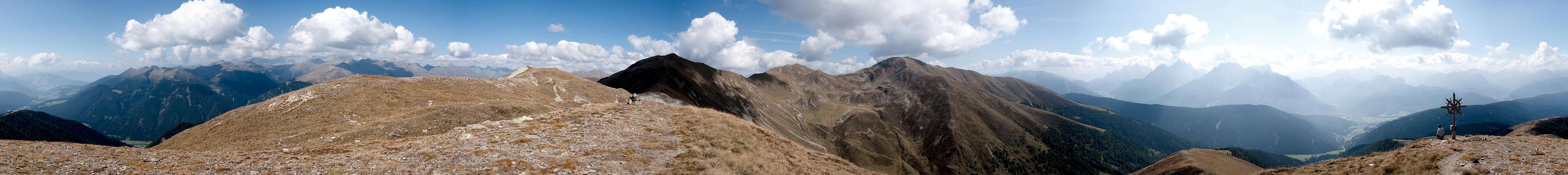
360° Summit Panorama
360° summit panorama as seen from Golfen / Monte Calvo |
Getting There
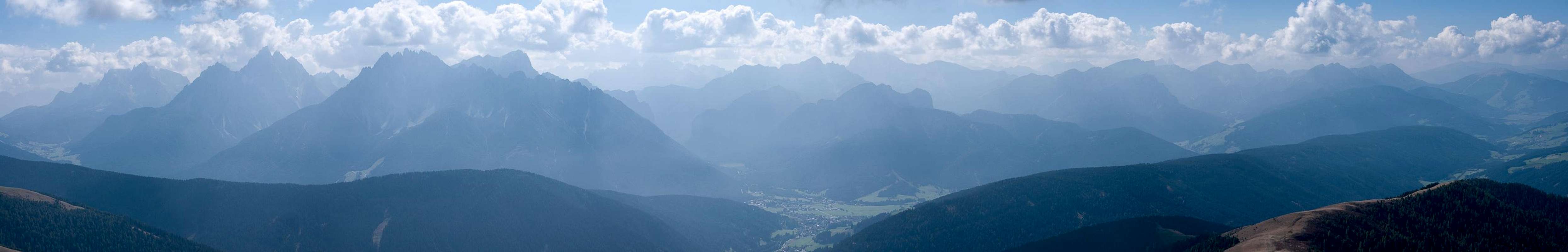
Shadowscape of the Sexten / Sesto and Prags / Braies Dolomites from Golfen / Monte Calvo |
The best starting points for an ascent of
Golfen / Monte Calvo is at
Toblach / Dobbiaco in its south.
From the West (Brenner Motorway A22)
- Leave the Brenner Motorway near Brixen / Bressanone and follow SS49 to the east through Pustertal / Val Pusteria.
- At Toblach / Dobbiaco turn northwards for Silverstertal Valley / Valle San Silvestro
- Park your car at the bridge across Silvesterbach Creek
From the North
There are two possible roads:
- From Kitzbühel over B108 through the Felbertauern Tunnel to Lienz
- Then southeast to Oberdrauburg (B110)
- Turn on to B100 west into Pustertal.
- Go through the city of Lienz until you get to Sillian.
- For Toblach / Dobbiaco stay on B100 / SS49. Later turn right for Silvestertal.
- From Salzburg along motorway A10 to Spittal.
- Turn west on B100 to Oberdrauburg, Lienz, Sillian and Toblach / Dobbiaco.
Red Tape
![Golfen / Monte Calvo and Hochhorn / Corno Alto]() Golfen / Monte Calvo and Hochhorn / Corno Alto
Golfen / Monte Calvo and Hochhorn / Corno AltoAccommodation
Weather Conditions
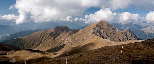
![Golfen / Monte Calvo]() Golfen / Monte Calvo seen from Roßzogel / Monte Cavallo
Golfen / Monte Calvo seen from Roßzogel / Monte Cavallo
Maps & Books
Maps
- Sextener Dolomiten / Dolomiti di Sesto
1:50000
Kompass Map WK58
Kompass Verlag
ISBN: 3-87051-065-X
- Bruneck - Toblach / Brunico - Dobbiaco
1:50000
Kompass Map WK57
Kompass Verlag
ISBN: 3-85491-064-9
Books
- Osttirol Süd / Tirolo Orientale Sud
W. Mair
Rother Verlag
ISBN: 3-7633-4132-3
ISBN: 3-7633-4307-5 (Italian)
- Pustertal
E. Hülsler, M. Kostner
Kompass Verlag
ISBN: 978-3-85026-015-2
- Rother-Skifuehrer "Pustertal"
Rudolf and Sigrun Weiss
Rother Verlag, 2004
ISBN-3-7633-5911-7

 5501 Hits
 82.48% Score
 15 Votes
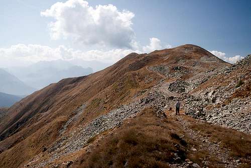 The summit of Golfen / Monte Calvo as seen from the north-east


 Golfen / Monte Calvo and Hochhorn / Corno Alto
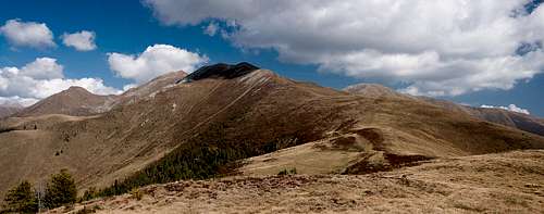 Golfen / Monte Calvo seen from Roßzogel / Monte Cavallo