
-
 23480 Hits
-
 87.57% Score
-
 25 Votes
|
|
Mountain/Rock |
|---|---|
|
|
34.28560°N / 118.1538°W |
|
|
5558 ft / 1694 m |
|
|
Overview
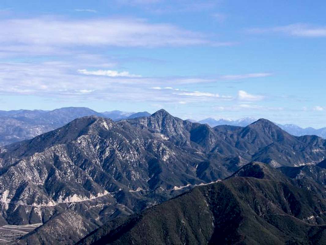 Josephine Peak stands just under two miles due west of the more impressive-looking Strawberry Peak. Both may be reached from the same trailhead, and combining an ascent of both peaks makes for a fine outing. The summit views are impressive on clear days.
 There is really only one sensible way to the top; a fire road that switchbacks up the south side, then swings around and switches back up the north side to the top. John Robinson's 100 Hikes in the San Gabriels says this road is about 3 miles long, but it traces out on my Topo! at more like 3.9 miles. Based on walking time, I'd say 3.9 miles is closer to the truth. The road is popular with mountain bikers and hikers alike. No matter what your mode of transportation, be on the lookout for the others.
Given its low elevation, this peak is best climbed in the cooler months. If you insist on trying it in the summer, bring plenty of water (there is none en route) and head up either early in the morning or late in the afternoon.
From 1937 to 1976 the summit sported a fire lookout (still labeled as such on some maps), but the Big Tujunga Fire wiped it out. All that is left of it now are decaying concrete footings. A small cinderblock shed sits just below the summit, with a couple of spindly communications masts on the roof, and a noisy wind speed measuring device. The contraption is still too high to allow unimpeded views to the west, but it beats the pants off a huge lookout tower.
Getting There
From the City of La Canada/Flintridge head north up Angeles Crest Highway (SR2) for nine miles to Clear Creek Station and the junction with Angeles Forest Highway. There is a small ranger kiosk on the right, where you may purchase an Adventure Pass (see Red Tape below) if you don't have one. Parking for the fire road is along either side of Angeles Forest Highway. The fire road is on the north side of the street about 50 yards west of the SR2/Angeles Forest intersection. A variation on the standard fire road route starts a mile east on SR2 on the north side of the road at the Colby Canyon trailhead. Once the Strawberry-Josephine ridge is gained, head west until reaching the fire road, then continue to the summit.