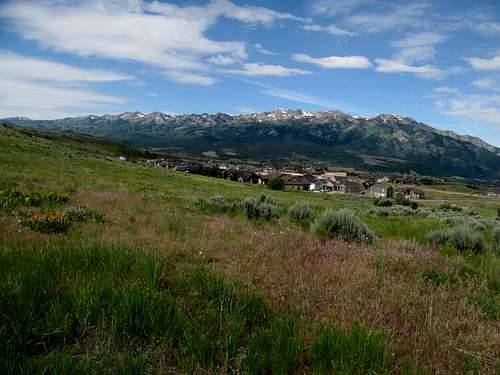
Stevens Benchmark - May 3rd, 2014
I wanted to keep working on my Utah Prominence Top 100, but I also wanted to catch Saturday’s crucial Game 2 matchup between the Bruins and the hated Habs. The problem was that the game was at 1 PM Eastern time, which meant I needed to be in front of a TV by around 11 AM out west. Which meant that not only would I need a quick, short morning peak, but the peak has to be close enough to a town with TV’s and whatnot. Indian Peaks in the west desert was a short peak on my short list, but for that reason (the long drive back to SLC from the peak) I was out.
Stevens Benchmark it is. It seems like a waste to get a motel room in Salina, with the town being so close to home, but the fact was that what amounted for civilization in these here parts was also less than 30 minutes away from Stevens, which I could hopefully knock out quickly in the morning. An added bonus was that it would be a logical stepping stone to get San Rafael Knob Sunday.
The problem with these weird sketchy Utah towns is that something as simple as a hockey game on TV is made infinitely more complicated when there’s pretty much no bars, much less a sports bar, in town. I called up a cheap motel in town and arranged it so I could check in early to be able to watch the game. They were friendly and amenable enough for me to finalize my plans.
The tiresome predawn drive over Point of the Mountain, through Utah County, getting gas at the usual Flying J or Love’s station, followed by speeding through the equally sketchy little town of Scipio…all shadows and phantoms in my memory now. Even Stevens remains but a blur, most recollections mostly involve how shitty the brush occasionally was and which podcast I listened to during the brief ascent.
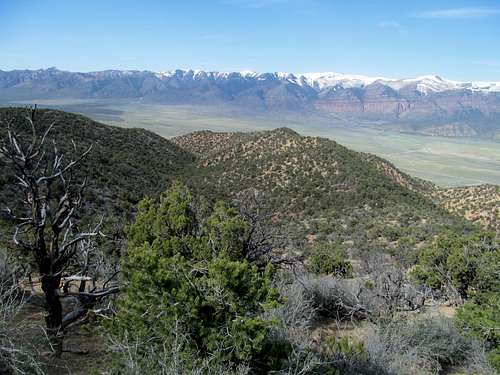
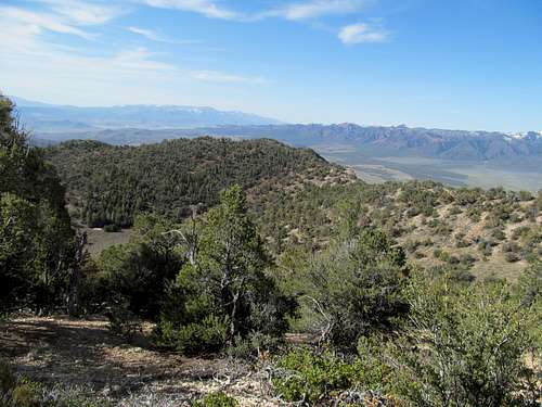
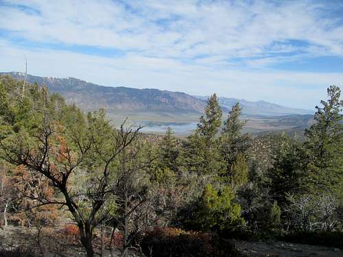
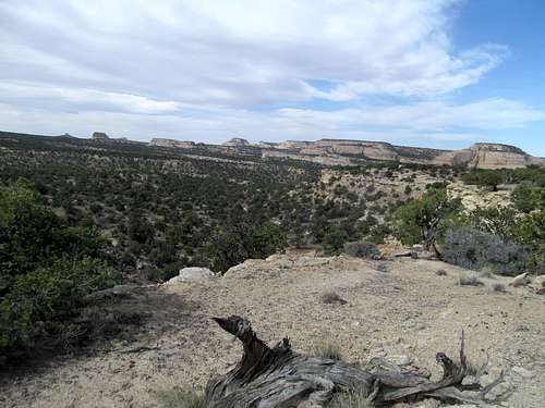
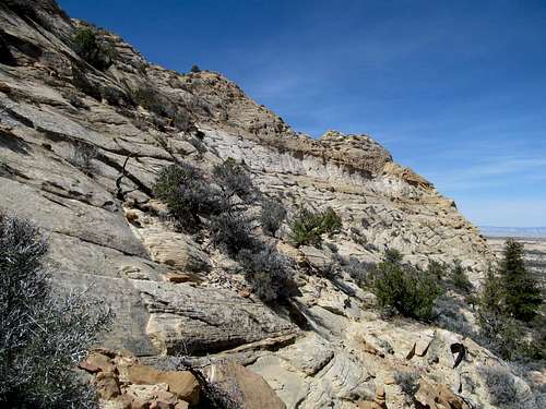
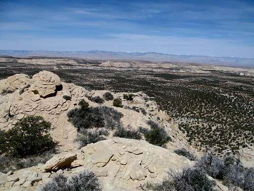
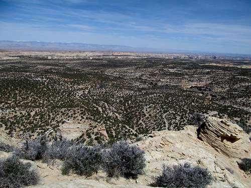
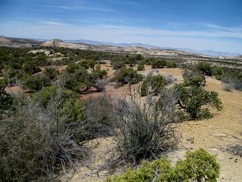
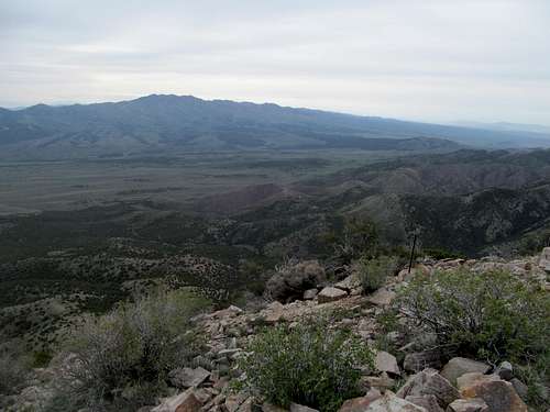
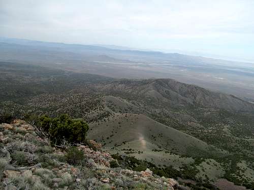
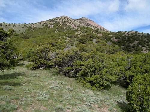
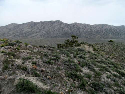
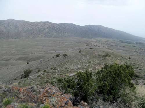
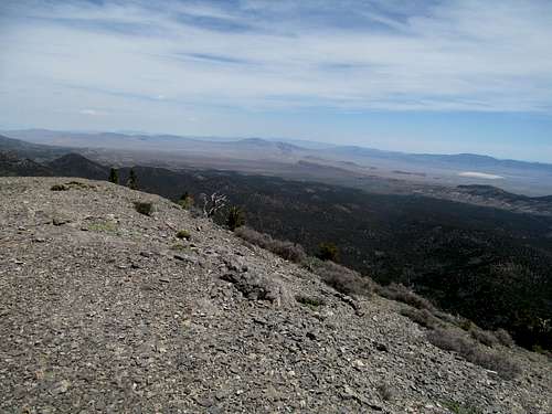
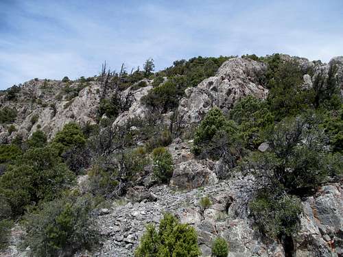
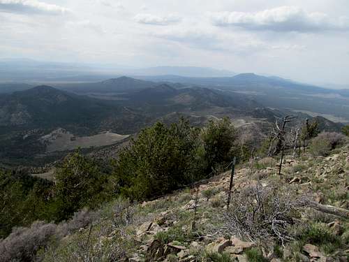
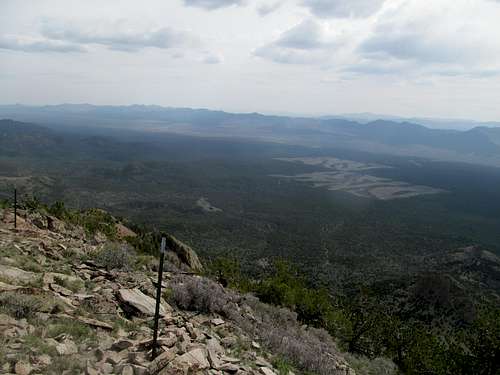
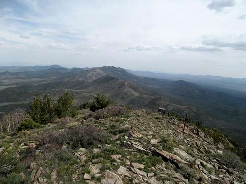
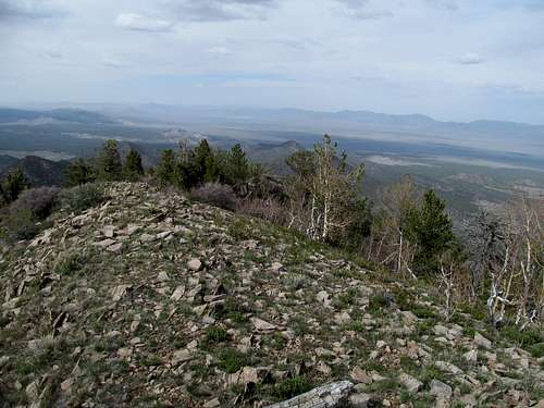
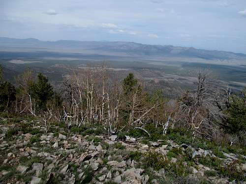
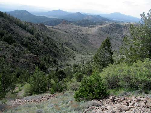
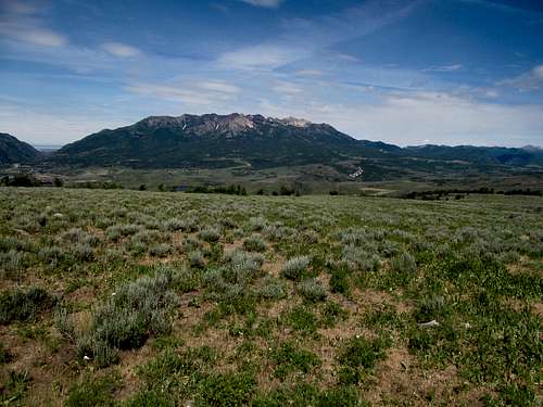
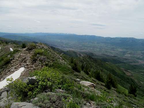
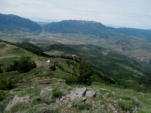
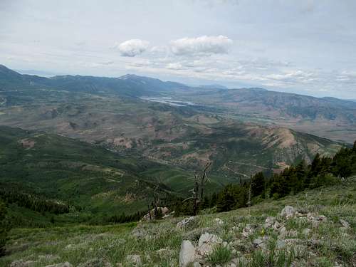
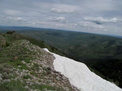
The seasonal Scipio Lake was filled in and made for a good sight, as were the high Pahvants still covered in snow opposite the valley. I parked on the highway and made my way through flat sagebrush to the first low ascent ridge to the left of a large wash. It was steep and shitty, with some mild scrambling where the ledges had yet to erode into scree.
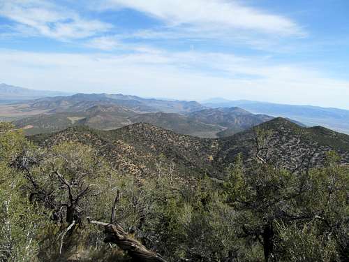
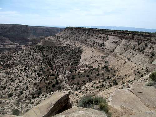
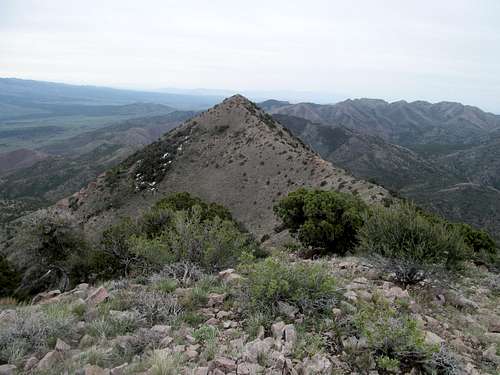
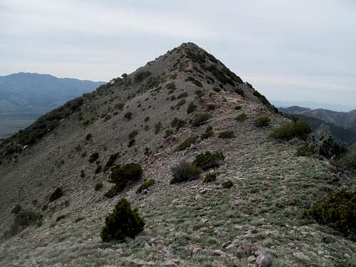
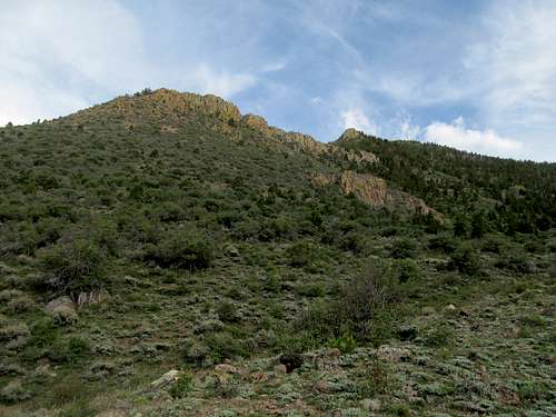
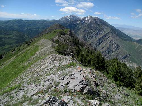
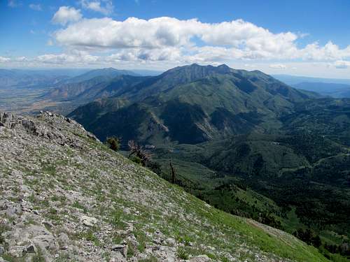
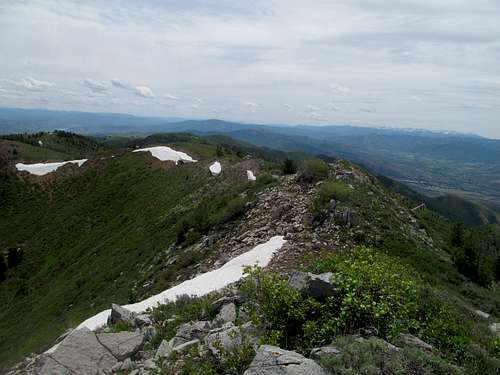
I gained a small ridge with trudged north north east ish. Perhaps it was a trick of the lighting, the morning sun casting an intimidating visage of the peak down towards me, but my destination seemed to loom higher and further than the route stats would indicate, and I had to remind myself that the peak stood no more than 2,000 or so above the highway. Such is the nature of these minor desert peaks; were I still GPS-less I’d be hard pressed for any confirmation that I was aiming for the right slight bump amidst all its homogeneous neighboring shrubby bumps. Even with my waypoints I still questioned myself. Still I trusted the GPS and my topo, following the ridge as it swung northeast then east to join very steeply with the main summit ridge. The brush was thick at times, but the summit was near.
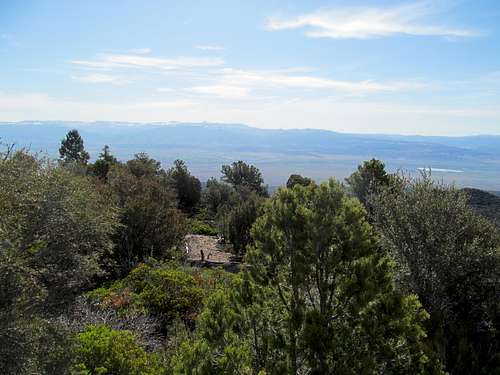
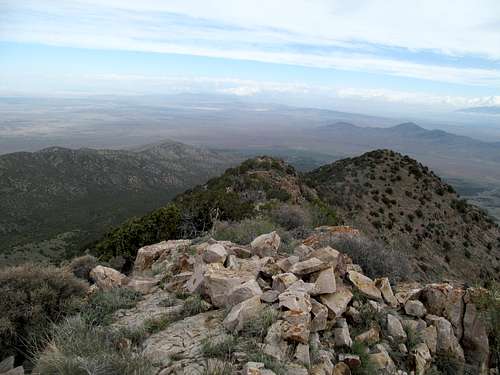
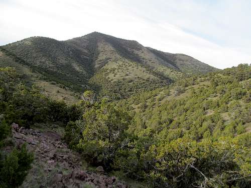
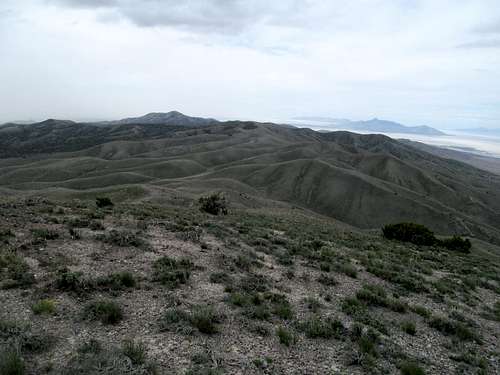
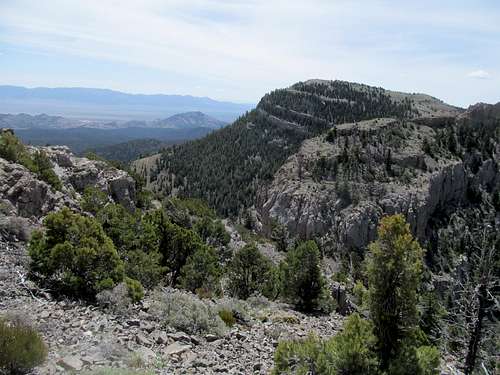
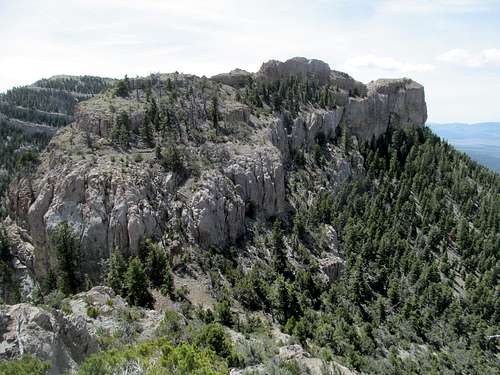
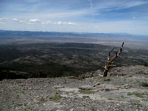
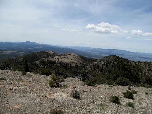
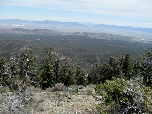
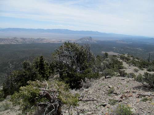
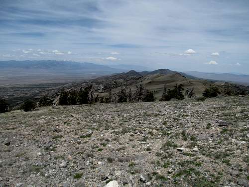
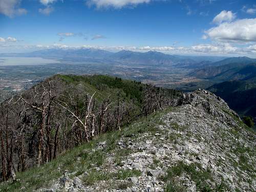
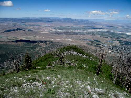
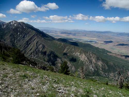
I wandered around both of the twin summits to try and get a 360 vantage point. The views of the Pahvants are spectacular throughout the hike, and you get good views north towards Nebo and south at the Fishlake Plateau and Mt. Monroe; a good shot of the Wasatch Plateau to the east was more fleeting, especially in the harsh light of the morning sun.
I charged through the brush and hopped down the rocky slopes as quickly as possible, making it to town and checking in to my motel in time for a most thrilling Bruins overtime win, and one of the few highlights of a doomed series against our despicable archrivals.
Swell Weekend in the San Rafael - May 4th, 2014
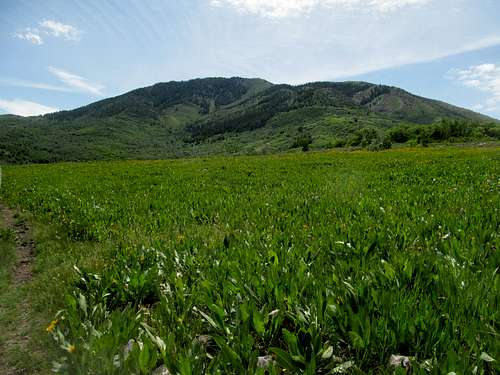
I got some fast food and slept early, leaving near the crack of dawn the next morning. An impressive visage of Mt. Musinia greeted me for a fleeting second along I-70, and following the highway I stopped at all the viewpoints along the highway as it dropped from the heights of Fishlake National Forest down into the San Rafael Swell.
Not wanting to risk the 4Runner I parked at the main Justensen Flats lot; the road beyond was sandy and immediately had some pretty big slabby rocks making driving a chore.
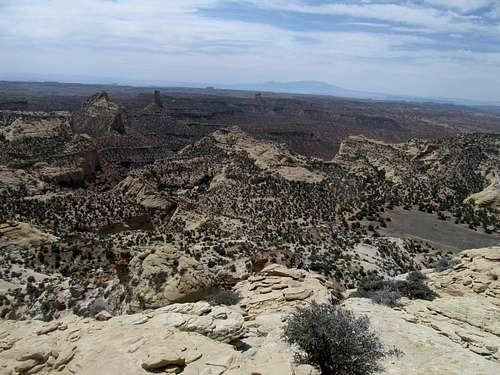
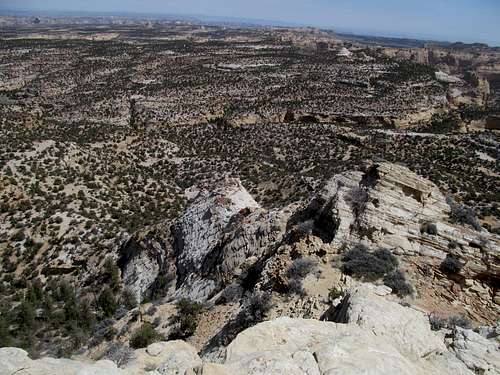
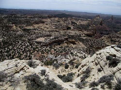
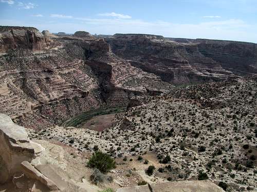
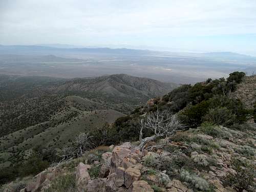
The parking lot was crowded but away from the road much less so. Routefinding wasn’t straightforward for this one, and I probably would have had a lot of trouble were I still pre GPS. Because though you can see the Knob ahead of you most times, the terrain in between can be complex, and what seems like a straightforward plateau is often broken up by washes, ridges and canyons, and other obstacles. Heading back, especially, would’ve been difficult, without the guiding presence of the knob itself.
With the GPS and the topos it was hard to avoid the temptation of gain optimization, trying to find the most efficient route with the least gain and distance. This was made hardest by Devils Canyon, which I had shortly after I veered right from the jeep road. I walked along the edge of the ravine for awhile searching for a suitable crossing, eventually contouring further than east than planned before finding a weakness.
Backtracking southwest I hopped up some finger plateaus between the washes, trying to minimize more elevation loss for the duration of the approach. The knob was a prominent landmark from afar but now was hidden by more immediate ridges near me.
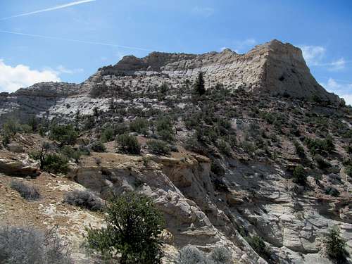
Eventually the not yet trusty GPS brought me to the wide dirt road running to the Knob. I kept a watchful eye on the right side of the road, looking for a small cairn which would mark the turnoff for the climber’s trail. It wasn’t huge, but nevertheless hard to miss as long as you keep a lookout for it.
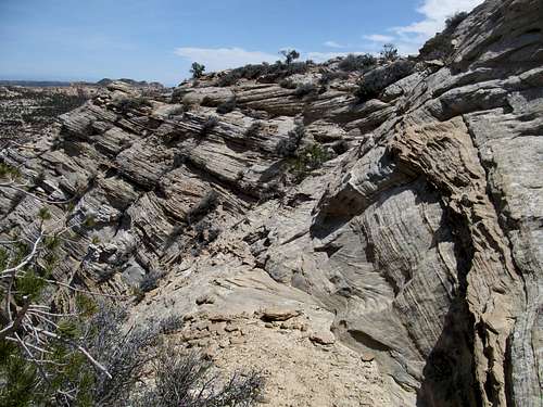
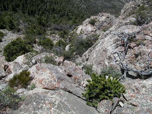
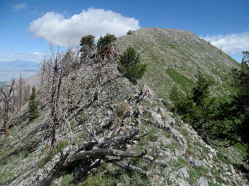
I did my best to follow the trail up until the crux. Some areas it is very clear, a few others vague, though altogether not tough to keep track of as long as you’re willing to do a slight bit of back tracking.
The exposed crux wasn’t too bad, the scrambling was fairly easy, with marginally better holds if you descend maybe three or four feet down.
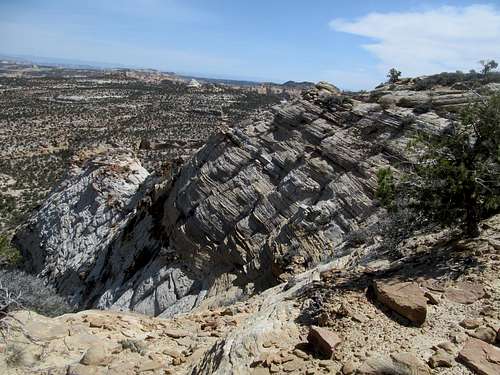
As for the exposure, it required enough concentration for me to place my camera in my pocket when I wasn’t busy snapping pictures, and overall just to be wary enough to try and stay low, keeping as many points of contact on the rock as possible.
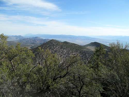
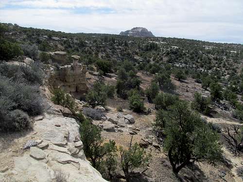
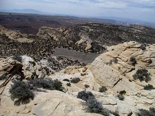
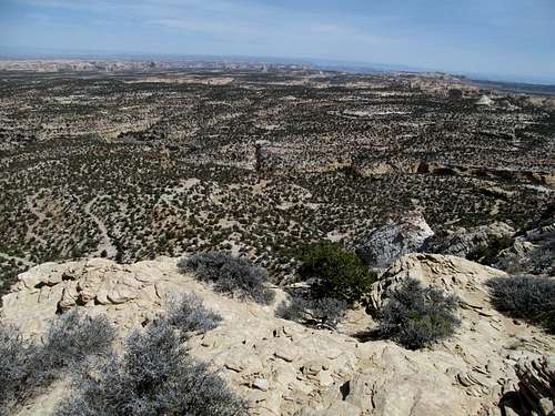
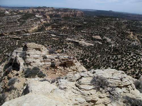
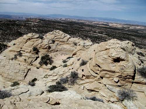
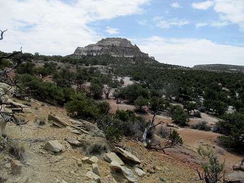
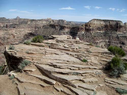
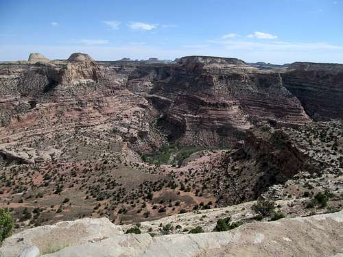
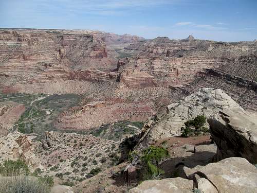
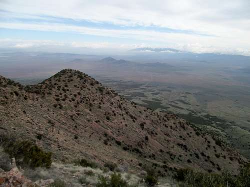
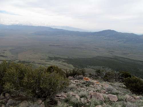
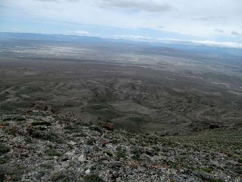
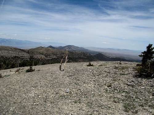
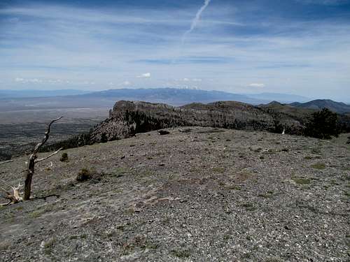
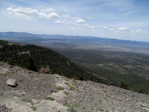
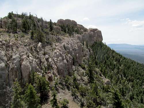
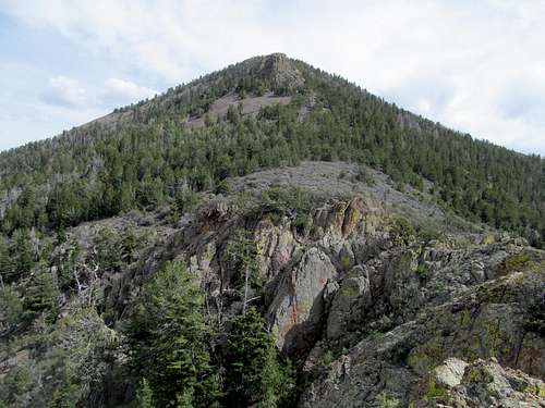
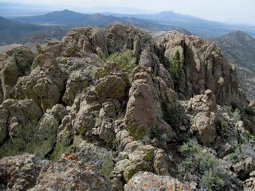
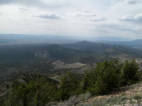
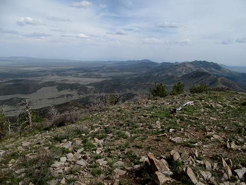
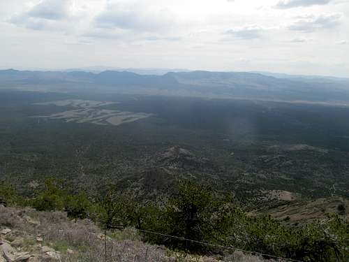
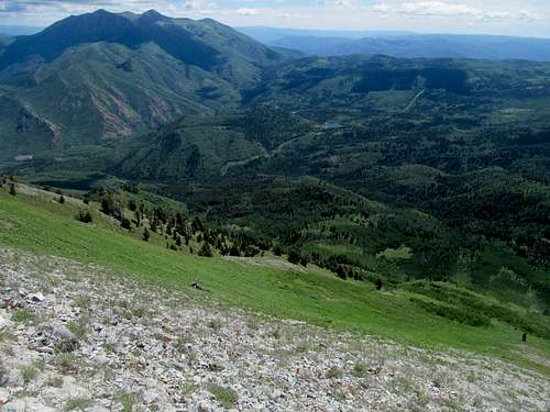
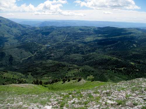
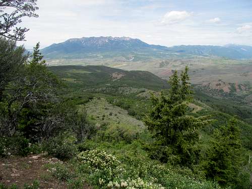
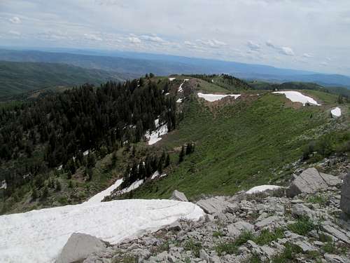
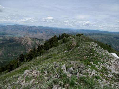
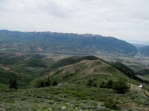
The route continues, circumventing like a corkscrew up to the cool little entrance ramp to the summit. The views were beyond entrancing, especially of the canyons to the south.
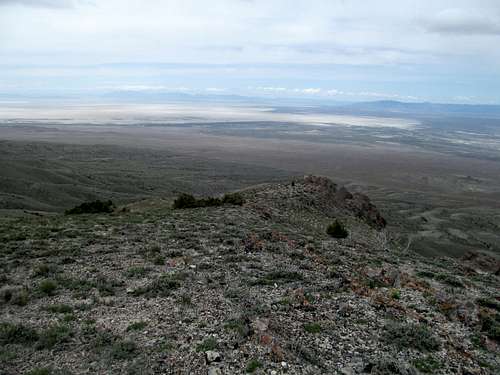
The summit area is composed of a few clumpy groups of rocks, and it’s worth visiting each to see the views from each vantage point.
I tried to sight a straightforward route back to the parking spot from the summit, but it was hard to translate that sentiment into real life.
The crux was the same on the way down, but the last few miles started to heat level muggy, especially when I was trudging up some of the washes and canyons on the return trip.
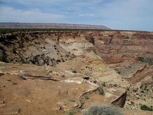
I was glad to be back in my car and on my way, not for any lack of love for the Knob, but because I wanted to get in a visit to Buckhorn Draw, a quick hike down the San Rafael River and the Wedge Overlook. They made for great, relaxing afternoon sidetrips, and it was odd to see several crowded areas on the Swell.
A few hours later a different, cold and frozen road across Scofield Reservoir and the high reaches of the Wasatch Plateau greeted me on my way back, reminding me that summer had not quite arrived yet.
Indian Peaks - May 10th, 2014
The Bruins continued their slide towards playoff ignominy vs the Habs, but I was not aware of the ultimate futility of their struggle when I blocked off yet another Saturday for the playoffs. With inclement weather sliding in a few hours before puck drop, I decided now was finally the time for Indian Peaks
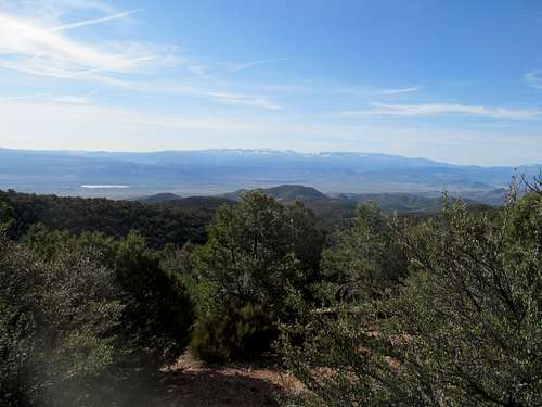
Lookout Pass was further than I had ever ventured on the Pony Express, and it was startling to drop into this barren landscape with all of the West Desert in front of you. I’m certainly no stranger to the area of course, having climbed many of the neighboring peaks; yet Indian Peaks has always had a slight allure due to its clandestine location tucked behind several higher peaks and ranges.
The final miles of the access road were as brushy and rocky as described. I parked near a waypoint with the peak visible to the northwest, and started in straight through the brush.
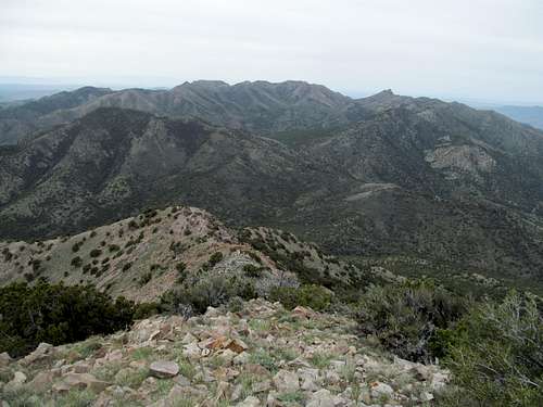
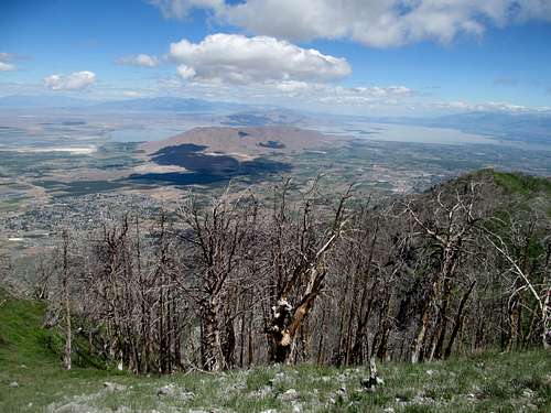
It was nice to be on schedule for once; I crested a ridge, dropped slightly into a small drainage, then started up the main southeast ridge. Slightly steep but the mountain didn’t overdo it with the gradient like so many similar desert peaks, and I soon found myself atop the windy southern summit.
I had skimmed over any beta which mentioned which summit was higher, and had trouble getting 3G to be able to verify online. Not that the north summit was too far from me, but I was lazy you see. I called Greg and could barely get a signal, but seemed to discern after several dropped calls that I had to traverse over to the north summit and back to claim the peak.
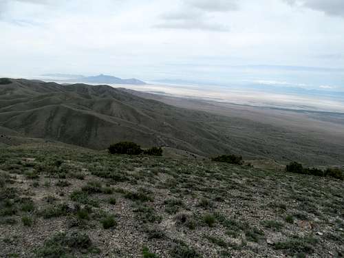
Oh well, at least they afforded me some good views of the Salt Flats, lying unencumbered to the west.
The descent was just as easy, and I drove the highway through Iosefa to enjoy the closeup views of the western Stansbury Range in the Skull Valley. Despite the dire forecast and a windy and cloudy summit stay, the sun was shining in the West Desert by the time I had dropped back my car, and it would shine one last time on the Bruins season before the good guys would go on to drop the last two games of the series the following week.
Off on a Tangent - May 11th, 2014
Sunday was forecast to be windy as well. I decided on Tangent Peak along the remote northwestern corner of the Great Salt Lake, with the possibility of either the Goose or Grouse Creek Highpoints depending how I was doing on time.
Rather than schlepping all the way to Snowville, I decided the most efficient way to reach the peak was perhaps to leave the highway near Corinne, drive through the Golden Spike area, then taking the fascinating dirt road across the salt marshes lining the northern tip of the Lake, rejoining the SP route description down to Big Pass.
The route up is pretty direct from the pass. A strong northerly wind blew violently through open areas and I tried to take refuge in a small ditch leading up to Tangent’s southeast slope.
Some of the lower ridges were shielded from the gales by Tangent’s higher reaches, but the wind was tough to avoid on the last steep three hundred or so feet below the summit.
As a result I didn’t linger much at the summit, which afforded good views past the Hogup foothills into the Salt Flats and a striking visage of Desert Peak and the Newfoundland Range. Race Benchmark, a long ridge on the other side of Big Pass, provided a cool backdrop but blocked any real views of what consisted of the lake up here.
Some kind of fire or dust storm that I had actually driven by rounding the lake made for hazy conditions running east of the peak, but the afternoon sun shone brightly on the barren reaches of Utah’s northwest panhandle. Despite this I decided the weather was too much to endure for nearby Red Butte, and instead took a sidetrip to check out Golden Spike as well as the Willard Bay bird refuge on the way back, the latter an underrated and tranquil setting on a Utah spring evening.
Mountain Home Delight - May 22nd, 2014
Fast forward a few weeks, which included a six peak Nevada weekend, to Memorial Day. I really would have loved to repeat a variation of my New Mexico getaway from a year prior, but was obliged to yet another Vegas trip with some friends that were flying in.
They were arriving Thursday night from Boston; with a vacation request I figured I could get in a couple West Desert peaks on the way down, specifically the Mountain Home Range Highpoint, also known as Needle Benchmark, and Indian as well.
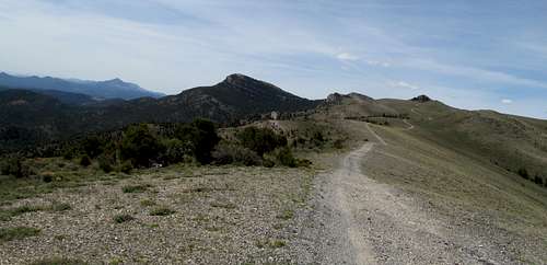
My last stop was at the gas station on the Nevada border on US-50, where I indulged in a delicious homemade rice kripsy treat, before backtracking down UT-21. Dean and Ken Jones’s directions took me through the high desert range and into the delightfully forested hills. The road was rocky and steep at times, beyond what a Camry could handle but not too bad on the 4Runner. The final crux stopped me though. The trailhead lies at the edge of a bump along the crest of the range, but about a half mile away a small rocky downhill section was too much for me to risk, and I parked and walked the rest.
My main worry was the trailhead itself. All accounts of this peak involved meeting some sort of drifter/off-the-grid squatter guy who lived at the end of the road, and was uber creepy to boot. Greg and Kadee described an unnerving meeting with this masked oddball a few years ago on a hike with Dean, and Ken Jones's TR mentions him as well.
Apparently the dude was off kilter but cordial…enough so at least not have turned the aforementioned into skinsuits. But never one to underestimate the effects of years of self imposed solitude on someone who may or may not be already a few footsteps past the rocker, I was more apprehensive about potentially encountering this self imposed pariah.
I walked past the truck/trailer, parked maybe ten or twenty yards off the road; there was no activity, so maybe the guy was probably still asleep. Past that the road turned to a rocky outcrop, where some scrambling and scree chute hopping got me down through a face that looks scarier from the bottom than it actually is.
I dropped into the saddle between the trailhead and the long cliffy ridge between it and the highpoint.
Greg and Dean’s route directs a sidehill along the right side of the cliffs. I descended way too low and had to deal with brush. On the way back I stuck closer along the edge of the cliffs; the latter was better, more breathing room, and even a climber’s trail at times. (Once again Ken Jones’s beta proved correct).
Having strayed low on the ascent, I had a shitty climb through some scree and brush to gain the last saddle before the summit. The last few hundred feet were easy climbing through beautiful grassy slopes, and the views from the top pretty damn good too.
I would have liked to have kept a watchful eye towards the trailhead, but alas the middle pinnacle blocked my views, and I could only hope that the resident recluse was leaving my car alone. On the other hand, I was really enjoying the fresh smell of the high pine forest, and the area reminded me of the ponderosa forest up on the Seaman Range in Nevada, a place I had visited about a year prior.
I enjoyed the traverse back in the shade by the cliffs, then was able to scramble my way back up to the trailhead without much difficulty.
I spotted some movement by the rando dude’s truck, but only caught a glimpse of his back as he walked around his campspot/home. I shied my eyes away from his abode as traversed by, trying to avoid undue attention yet sneaking a peek over my shoulder every few minutes on the half mile walk to the car to make sure no one was sneaking up on me with a machete. Having survived the peak, eccentric squatters who took the name of the mountain range wayyyy too seriously and all, I cruised perhaps a little too cockily down the sharply rocky roads.
Indian Peak - May 22nd, 2014
Next on the list was Indian Peak, but little did I know that I had likely pierced my tire before returning to the pavement from Needle. I had some trouble finding the right dirt road towards Indian, and by the time I neared the trailhead along the slabby and painfully rocky roads on the Wilderness Management Area my front passenger tire was painfully flat.
Well this was a frustrating setback, both in relation to my timetable and my actual situation in the middle of nowhere. I had my tire plugs, but had never used them before, and had no clue how/if they would work, assuming I could even figure them out. I took out the plugs, screwed a hole through the leak, stuck the adhesive in, then refilled the tire with my compressor. The only issue was that I didn’t have scissors on me, and as a result half an inch or so of the plug was still sticking out from the tire.
Part of me wanted to play it safe and head back to civilization as quickly as possible, but part of me rationalized the fact that I was already here near the trailhead, and anyhow I’d have to drive the same shit roads to make it back pavement, much less civilization. It was more of a peace of mind thing…I couldn’t hear any leakage, but didn’t feel entirely comfortable that the few hours I’d spend climbing Indian would be enough for the air to sap itself back out of the tire, if somehow it was still inperceptibly leaking; it'd be safer for me to devote what time I had let to getting back to civilization as soon as possible. An additional stressor was that rather than cutting my losses now, I’d have to continue up a bad road that I wasn’t even 100% was the right access route.
But I was so damn close. So I kept on trucking. The tire thankfully held for the moment, and I parked at around 7,900 feet before the road turned north away from the peak.
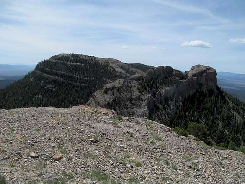
What can I say, except it was steep. Real steep, starting from the sagebrush, to some light boulders and scrambling midway through the ascent, and talus interspersed with woods the latter half to the summit.
Hopping the fence near the summit was a pain, but the giant cairn and sign at the top was pretty cool.
I had followed the north ridge on the way up. Looking down I saw a slightly more viable routes angling a little further left (northwest) to descend the slopes directly down into the adjacent drainage, saving me a few minutes from the mid route rock hopping.
It was a smooth ride back to the car, and a smooth ride in the car, driving through barren roads, narrow ravines, and the apocalyptic wastelandic landscape of the Utah West Desert for, as I realize now for the first time while writing this, one last time. Can’t say that despite the lack of towns or bars, or TV’s or nightlife that, for the amount of time I’ve spent there, that I don’t miss it just a bit. Good thing I have a few peaks left out there.
The plug was good, but the lack of scissors to cut off the remaining adhesive was the fatal flaw. The tire was flat by the time I hit Mesquite because the road had pulled the plug out via the sticky residue. I could easily change a tire in my old Camry, and never really realized how different it was in a 4Runner. Despite watching several videos I couldn’t get the angle just right through the back hole to lower my spare out of its spot below the car, so I had to call for roadside assistance. My plan had been to hang out with the old roommate for a few hours while awaiting my friends’ planes to land, but I was way behind schedule and afterward this went straight to our rooms at the Encore.
It wasn’t a bad weekend, what with pool parties and raging a few feet away from David Guetta and the DJ booth at Encore Beach Club, but in the back of my mind I kept thinking a. I’m getting too old for this shit and b. I’m missing out on a perfect weekend to get some New Mexico peaks. I thought about maybe getting Canaan Peak near Bryce Canyon on my driveback day, but instead spent most of that Monday hanging out with the old roommate instead before trying to salvage something taking the scenic route through the Panguitch Valley and Richfield before dark.
Drying Up - June 14th, 2014
Several weeks and several excursions in several different states later I had my last real dedicated weekend for peaks in Utah. The weekend was driven more by Greg’s plans to (hypothetically) do Durst Sunday, thus completing for him all but the 2 Granite’s on the Utah top 100 Prominence List (one technical, which he did a month or so ago actually, the other located on a government bombing range).
My own personal goal Saturday was initially Loafer and Santaquin, but a cold and windy morning and the sight of clouds hanging off the top of the peaks triggered my innate laziness, and I decided to go for the shorter and easier Dry Mountain instead.
Accessing Dry took me through the morbid little town of Santaquin, but the road through the very narrow Santaquin Canyon between Dry and Nebo was a nice surprise…steep, scenic, and unexpectedly crisp and wet as it wound along the bustling creek.
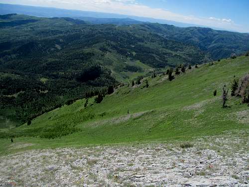
The rest of the peak was pretty basic below average Wasatch terrain, sparsely green, scrubby, and non alpine in character. There was a good trail leaving the trailhead, a short narrow steep dirt section, then the saddle south of the peak. The remaining ridge ascent was pretty aesthetically pleasing, if occasionally plagued by brush.
I was surprised at the remaining length of the traverse upon cresting near the top, but had no complaints about the views, familiar now as they were.
A few minutes up, then down early enough for the rare full Saturday to hang out and do nothing at a home so unmemorable that I have no recollection of what I did for the rest of the day.
Durst Mountain - June 15th, 2014
The rest of the hypothetical pictures that may or may not have been taken on a hypothetical ascent of Durst Peak will be presented with minimal comment.
The hypothetical summit
The (Hypothetical) Descent
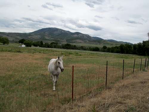
Pretty picture of Durst & horsey:
Footnote: Durst wouldn't be my last Utah peak, but it was nearing the end. Summer meant more and more trips up north. While I planned one last sweep through Southern Utah in the fall, it wasn't meant to be. Rehabbing from getting hit by a car by Savannah put me a week behind, which was spent in the Pacific Northwest by October rather than cleaning up some peaks like Fishlake and Abajo. Alas, though I don't see myself ever living in Utah again, I still have a few peaks left to climb there.
Comments
No comments posted yet.