|
|
Mountain/Rock |
|---|---|
|
|
46.92756°N / 121.83865°W |
|
|
Pierce |
|
|
Scrambling |
|
|
6454 ft / 1967 m |
|
|
Overview
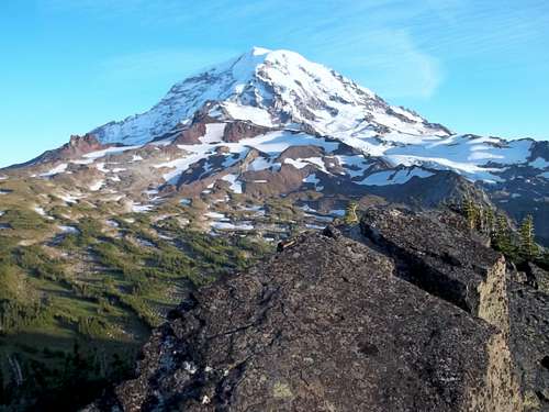
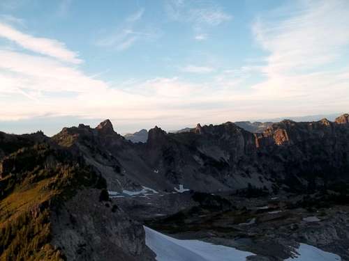
Mount Pleasant, an Irish Cabin Peak located at Mount Rainier National Park is a classic of trail scramble in the Mowich Lake/ Spray Park area of Mount Rainier National Park. This moderately popular summit is an excellent peak for close up views of Mount Rainier as well as distant views of Mount Stuart, Glacier Peak, and Mount Baker along with hundreds of other mountains in this region. Mount Pleasant is taller than neighboring Hessong Rock but not nearly as dramatic or dynamic as Hessong Rock. Therefore it does not get as much attention.
To get to this summit only requires an offtrail bootpath and from what I see I would classify it is a bootpath at Class 1 and a walk up. To say it is off-trail is kind of pushing here because the bootpath here is well pernouced here with exception to the col between Mount Pleasant and Hessong Rock. To get to Mount Pleasant from Mowich Lake you will want to take the well built Spray Park Trail three miles to the the very beginning of Spray Park. Once in Spray Park you will notice a large rocky peak to the left of you and the majestic Mount Rainier to the right of you. Stay on trail until you see a well organized boot path on the left of you. Once on the boot-path take the boot-path all the way to the col between Hessong Rock and Mount Pleasant. At the mark tarn on top of the col make a right on faint bootpath. From here take the bootpath all the way to the true summit of Mount Pleasant.
It should be noted that there is also another way through Knapsack Pass. This YDS Class 2 off trail way to the summit of Mount Pleasant also opens up other summit options in the region including Fay Peak. The route is usually though snow covered until late August and in 2011 there was a lot of snow on the route in late September so if it is a heavy snow year an ice axe might not be a bad idea.
Also if on Mount Pleasant be sure to visit the nearby Hessong Rock. Hessong Rock is on the same ridge as Mount Pleasant and the Rock also features excellent views. Beware though that Spray Park is home to a large bear population. It is not uncommon to run into two or three bears while heading up to both peaks. It happened to me and lucky a lot of noise kept the bear away from us.
Getting There
VIA THE MOWICH LAKE AND TOLMIE PEAK TRAILHEAD (RECOMMENDED IN SUMMER. KEEP IN MIND THAT THE MOWICH LAKE ROAD IS CLOSED USUALLY TO AT LEAST MAY AND MANY TIMES MUCH LATER!!!!): Take Route 165 South. It will soon intersect with Route 162. Continue on Route 165 south through the towns of Wilkeson and Carbonado. You then go over an older bridge ove the Carbon River. This bridge is beginning to look unsteady and would not be a good place to be during an earthquake. Roughly a half mile over the bridge you will run into an intersection with one road veering right and head up Mowich Lake Road. You want to head up 17 miles up the road. You will run into the self pay area up at the Paul Peak Trailhead about 11 miles up the road. Don't forget to stop here because there are plenty of ranger at the Lake Mowich Campground and they will ticket you if you don't pay.Red Tape
Mount Rainier National Park Pass is required at the trailhead. It is $15 for the day and $30 for the year.Camping
Backcountry Permit Required for Camping while in Mount Rainier National Park. For more information please click hereExternal Links
A good trip report on Hessong Rock and other summits in the regionInformation on the Backcountry Hiking and Camping at Mount Rainier National Park


