|
|
Mountain/Rock |
|---|---|
|
|
31.92588°N / 107.06314°W |
|
|
Doña Ana |
|
|
5905 ft / 1800 m |
|
|
Overview

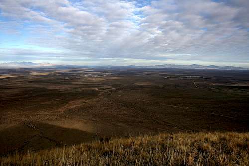
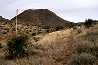
Located about 30 miles southwest of Las Cruces in the midst of the Potrillo volcanic field between the East and West Potrillo Mountains, Mount Riley has an elevation of 5,905 feet and a prominence of 1,113 feet. Along with neighboring Cox Peak (elev. 5,936 ft., prominence 1,541 ft.) and Point 5782 (elev. 5,782 ft., prominence 634 feet), this isolated cluster of peaks rises prominently above southern New Mexico’s Chihuahuan Desert landscape and is visible in every direction for many miles. These peaks are part of the Greater Potrillo Mountains Complex, managed by the Bureau of Land Management. There are no maintained trails in this area that sees very few visitors.
From the summit, numerous mountain ranges come into view. Cinder cones, craters, and lava flows make the views truly unique. Seven miles east of the summit lies Hunts Hole, a maar volcanic crater over 1,500 yards wide. Kilbourne Hole, a maar volcanic crater that measures in diameter between 2,600 yards to more than 3,700 yards at its widest point and is more than 300 feet deep, lies 6 miles to the east-northeast of Mount Riley. Hunts Hole, also a maar volcano, measures over 1,500 yards in diameter and is 1.9 miles south of Kilbourne Hole. These are two rare examples of volcanic action void of a mountainous rim. There is a summit register enclosed in a jar, secure in the confines of a small cairn. Although topographic maps show a benchmark on Riley, I could not find it. Early entries in the summit register indicate previous searches for the benchmark to no avail. The register, placed there on January 3, 2001, shows that my daughter (kelster) and I were the only visitors to Riley’s summit during 2007...unless someone else makes it up there in the few remaining days of the year. The summit saw visitors on only 3 days of 2006. Despite its unpopularity -- probably due to a combination of its isolated location and sub-6k summit -- Mount Riley is a very worthy summit objective that won’t leave you disappointed.


technicolorNH - May 28, 2019 7:54 pm - Hasn't voted
Additional directionsOn Highway 9 the junction to County Road A-005 is slightly east of mile marker 123. Once you go through the white gate on the forward right make sure you close the gate behind you. The dirt road to the 4WD road was passable to even a Honda Civic Hybrid in May of 2019, while the 4WD road was clearly visible to the right as you pass by the base of Cox Peak.