
-
 13615 Hits
-
 86.85% Score
-
 23 Votes
|
|
Mountain/Rock |
|---|---|
|
|
34.21580°N / 117.5426°W |
|
|
San Bernardino |
|
|
Hiking |
|
|
Spring, Summer, Fall, Winter |
|
|
6433 ft / 1961 m |
|
|
Overview and Routes
To be perfectly blunt, the main attraction of this peak in the San Bernardino National Forest is its vantage point affording awesome views of Cucamonga Peak and Etiwanda Peak to the west. Another reason a local hiker might want to visit Buck Point is that a challenging route can be used to get there along a beautiful undulating ridge (see Route 2 below).If you consult the relevant Cucamonga Peak 7.5 USGS topo, you will see that the Buck Point shown on the topo is actually a locale about 2/10’s of a mile northwest of the peak. The peak is identified on the topo only by its elevation of 6,433 feet.
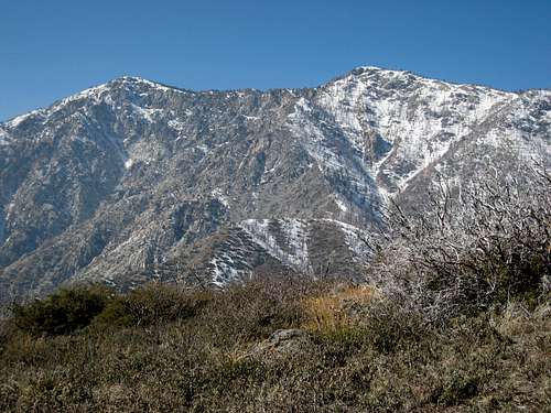 Cucamonga Pk (L) and Etiwanda Pk (R) from summit of Buck Point
The origin of the name is unknown although a good bet would be reference to good deer hunting here. The approaches to the summit are as mundane or adventuresome as the hiker wants as described below.
A hike to Buck Point is usually combined with an ascent of San Sevaine Lookout, a peak at the easternmost end of the San Gabriel mountains.
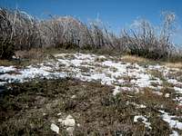 Summit of Buck Point, 1.20.08
Route 1
The Sierra Club’s Hundred Peaks Section website for
Buck Point provides hiking directions for a 1.5 mile round trip route from a starting point along the eastern end of Forest Service Road 1N34. However, it appears that the gate at the start of this road for the route described is closed most of the year and thus you would be looking at a near 9 mile hike along dirt road to do this route. The route below is a more interesting option.
Route 2
This is a challenging route, because of some brush and the elevation gain, along a ridge coming in from the south. It is fully described in the route page Etiwanda Ave. Ridge.
The beginning point for this route is the gate at the paved end of Etiwanda Ave. in Rancho Cucamonga. To get to the bottom of the ridge, you will need to either hike or drive (high clearance vehicle only recommended) approximately 1.5 miles with 600 feet of gain along a rough, choppy dirt road from the end of Etiwanda Ave. Once at the bottom of the ridge, it is approximately 3 miles, with 3,700 feet of gain, along a sometimes brushy firebreak, to reach Forest Service Road 1N34. At his juncture, the peak will be west (left) of you about ¾ of a mile.
 Part of the Etiwanda Ave. Ridge
  Buck Point (middle) showing evidence of recent fire activity
Here is a GPS track for this route.
Getting There
Route 1For driving directions to the start of this route coming in from Sierra Ave., see the HPS website for Buck Point.
Route 2
From the 210 freeway, exit at Day Creek Blvd. in Rancho Cucamonga (one exit west of the I-210 and I-15 interchange) and go north. Follow Day Creek Blvd. north and then east through a new housing tract until it dead ends into Etiwanda Ave. Turn left (north) onto Etiwanda Ave. and proceed about ¼ mile to where the road ends at a locked gate. If you have a high clearance vehicle, there are some trodden avenues around the gate. If not, start hiking at this point. It is about 1.5 miles with 600 feet of gain from the gate to the base of the ridge. From the gate, proceed up the dirt road to a nature preserve sign at a 4-way junction. Take the left fork as it climbs onto the ridge. The cleared area on top of the ridge is the beginning of the route. If you have driven, park your vehicle and off you go.
Red Tape
No permits are required to hike to Buck Point along the routes mentioned.Camping
There is a campsite along Forest Service Road 1N34 called the Joe Elliot Tree Memorial campground. It is about 2 miles west of the point where the Etiwanda Ave. ridge connects with 1N34.When to Climb/Mountain Conditions
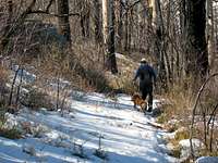 SPers Bechtt and Coco en route to Buck Point 1.20.08
The peak is accessible year round, although in winter you may need snowshoes and/or crampons.
Driving to the start of the route at the end of Etiwanda Ave. should present no problems even in winter because of the low elevation there.
Other Information
There are water no sources along the routes mentioned.A high clearance vehicle is recommended if you want to drive to the base of Etiwanda Ridge from the top of Etiwanda Ave.
USGS topo Cucamonga Peak 7.5