
|
|
Mountain/Rock |
|---|---|
|
|
33.42380°N / 111.4092°W |
|
|
Pinal |
|
|
Hiking |
|
|
Spring, Fall, Winter |
|
|
4869 ft / 1484 m |
|
|
Overview
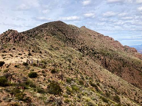
Peak 4869 is the unnamed forgotten middle child of the Superstition Ridgeline. It is sandwiched between two popular destinations – Flatiron and Ironview Peak to the west and Superstition Peak (aka 5057) to the east. It actually has a prominence over 500’ despite being relatively unknown.
Peak 4869 can be bypassed when hiking the popular Superstition Ridgeline hike, and most people do that instead of taking the trail up to the summit and adding elevation gain.
Peak 4869 has a good trailhead/route to the summit via a dedicated trailhead (Lost Goldmine TH to Hieroglyphic Canyon) leading up to its summit in less than four miles. This hike can easily be combined with Superstition Peak.
A hike via the Superstition Ridgeline or via the Hieroglyphic Canyon should be done when temperatures are moderate. Both hikes start at lower elevations, so encountering rattlesnakes is possible during any time of year. Generally, November-March are ideal for hiking up to Peak 4869. There are times when the higher elevations have some snow, so try and avoid after a winter storm. However, snow melts quickly.
Getting There
For the Superstition Ridgeline, typically people shuttle, parking one vehicle at the Carney Springs Trailhead and the other at Siphon Draw and starting from either of those trailheads. More details are on the Superstition Ridgeline page.
However, to reach Peak 4869 along the Superstition Ridgeline, you to take the trail leading up towards the Peak 4869 instead of the trail that bypasses it to the north side.
The Superstition Ridgeline is a 10+ hour hike requiring more than one person and two vehicles. If wanting to do this hike by yourself, the best trailhead is the Lost Goldmine Trailhead in Gold Canyon, AZ. That is reached by driving through the community of Gold Canyon off of US 60 – 44 miles drive from downtown Phoenix. There are a bunch of turns and junctions in town, but with phone GPS as long as you pay good attention, you won’t miss these turns once in town.
Route
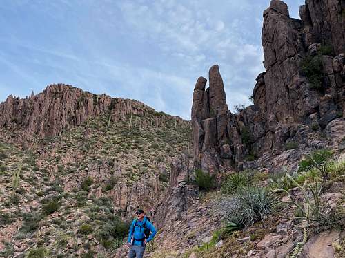
The information below is from the Lost Goldmine Trailhead. From the trailhead there’s quickly a junction sign pointing to the Hieroglyphic Canyon. The trail is pretty good for the first 1 ½ miles leading towards popular pools by a spring along the side of the trail. Afterwards, the trail continues, but gets hard to follow at some spots, with some rock scrambling needed at times. The trail is on the right side of the canyon floor. It’s rocky with unstable footing at times, but not too hard to follow if paying good attention.
The saddle between Peak 4869 and Superstition Peak is reached after about 3.1 miles. A trail then leads up towards Peak 4869 in about 0.6 miles. It isn’t completely obvious from the saddle, but easy to get back to after a short walk. It’s generally to the right of the ridge and then goes on top of the ridge. The final 0.6 miles to the summit is very gentle and easy compared to the challenging walk up to the saddle, which requires over 2,300’ of elevation gain. The last 0.6 miles to the summit gains 520’, which is still steep, but quite manageable. The total distance to the summit is 3.7 miles. Once back at the saddle, Superstition Peak can be done by hiking another 2.1 miles round-trip, adding about 800’ of gain to the hike.
Red Tape
There is a group size limit of 15 people, but otherwise there is no notable red tape.