
-
 3173 Hits
-
 83.1% Score
-
 16 Votes
|
|
Mountain/Rock |
|---|---|
|
|
44.68580°N / 108.3337°W |
|
|
Big Horn |
|
|
Hiking |
|
|
Spring, Summer, Fall, Winter |
|
|
4890 ft / 1490 m |
|
|
Overview
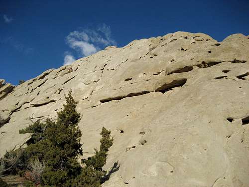
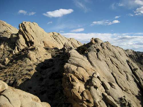 Sandstone formations above the gully near Peak 4890
The unnamed mountain known as Peak 4890 near Lovell, Wyoming is far from being the most spectacular mountain around, but the area surrounding it holds some beautiful gems of scenery that make a visit to this spot more than worthwhile. The summit is located on the north end of a long sloping plateau that runs through a large section of BLM land in the Big Horn Basin; views from the top include a great panorama of the Big Horn Range to the east and more distant views of the Absarokas and Beartooths to the west.
While exploring this area, I descended a gully about a mile east of Peak 4890 and found some beautiful and rugged sandstone formations that are unlike anything else in the immediate vicinity. While it is out of the way of the most direct route to the summit, I would highly recommend a visit to see this place if you are driving around out here on these 4WD roads.
 Formations near Peak 4890
Getting There and Hiking Information
From Lovell, Wyoming, travel south on Highway 310 for 11.0 miles past the place east of town where the highway forks. Turn right on the onto the good dirt road that heads into the badlands and the small oil field. Drive straight for 0.8 miles as the road heads up a short hill and look for the 4WD road that turns left to go up a steeper hill. At the top of this hill, the main road turns off to the right, while the smaller road stays straight along the ridge before petering out; from here walk along the ridge and descend to the right to reach the interesting sandstone gully described above.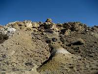 On the way to the summit
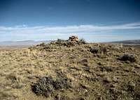 Summit cairn
To reach the mountain itself, follow the main road around the bend to the right and descend through a small valley. I parked here at the bottom rather than subject my vehicle to the rough washout on the ascent up the hill on the other side. Walk the road for about 1.3 miles through a couple of gullies before reaching the main plateau of the peak. Leave the road to the right and walk for almost another half mile along the easy ridge to the cairn that sits on the summit.
The total one-way hiking distance on Peak 4890 is about 1.8 miles with 200-300 feet of elevation gain.
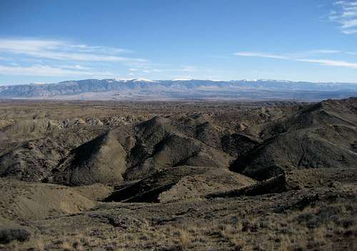 Summit view east to the Big Horns
Red Tape and Camping
Peak 4890 is located on BLM land and there are no fees or permits required to access this area. There are some oil wells and other development that you have to drive through between the mountain and the highway, but access is not a problem (unless you don't have a 4WD with high clearance in order to get close to the peak). Be sure to watch for rattlesnakes if you are out here in warm weather, as this is prime habitat for them.For camping rules on BLM land, visit this site.
 Sandstone Wall