
-
 8592 Hits
-
 79.04% Score
-
 10 Votes
|
|
Route |
|---|---|
|
|
39.47840°N / 106.1054°W |
|
|
Hiking |
|
|
Summer, Fall |
|
|
Half a day |
|
|
Overview
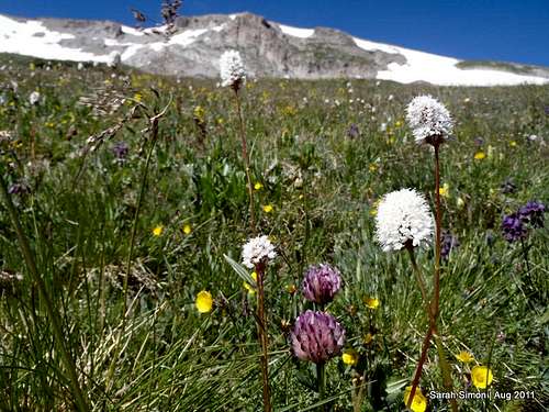 Riot of wildflowers
This route is a nice way to enjoy Peak 9, Peak 8 and Peak 7 when the Breckenridge Ski Resort is not “in season.” Certainly these peaks can be enjoyed in snow season, but when the resort is live and the lifts are in operation, the entire experience is different than what I will describe here. Parking is virtually non-existent, special restrictions apply, and the route will be either a very long slog from the resort base or a relatively benign hop from the top of a lift to access the backcountry ski area.
In the summer, the length of this route and elevation gain required can vary greatly according to your preferences and the abilities of 4x4 and driver. Choose the combination that makes you the happiest and enjoy the bountiful wild flowers.
Roundtrip Distance* (From Beaver Run parking): 14.5 miles
Elevation Gain*: 3,400 feet
YDS Class: 2
*If starting from the parking lot at the Peak 9 restaurant, decrease roundtrip mileage by 5.25 miles and decrase elevation gain by 1,500 feet.
Getting There
 Ski area signage
This trailhead can be a bit tricky to find. By following directions to the Breckenridge Stables, you will get where you need to be. Accessed from the east side of the Beaver Run resort parking lot, follow the signs to the Breckenridge Stables and continue up the road toward Briar Rose Mine as high as you wish (and as high as is suitable to your vehicle given road conditions, even above timberline. This road is not accessible during ski season.
• Follow Park Avenue / Hwy 9 in Breckenridge to Village Road. Head west on Village Road for .2 miles to the Beaver Run parking lot. Drive across the lot, looking carefully for a very non-descript access to County Road 751. Turn onto this dirt road. The Beaver Run parking lot is roughly 1 hour and 45 minutes from the Denver International Airport in dry summer driving conditions. In the summer, you may park here in the Beaver Run lot or continue (preferable) vehicle further up the road.
• Pass Breckenridge Stables at roughly 1 mile from the Beaver Run parking lot. Continue on the main road toward the Peak 9 Restaurant. More parking is available in this vicinity.
• At the top of the ski lift, the road turns roughly and requires 4x4. With a stock 4x4, you can continue toward the Briar Rose Mine and readily make the drive to the junction with the Wheeler Trail if you so desire.
Visit the Breckenridge resort website for summer trail maps maps and more area information.
Route Description

 Typical footing
 Wildflower lunchbreak
 Slope of mules ears
 At the saddle
From the junction of the dirt 4x4 road and the Wheeler Trail…
• Begin ascending the obvious east ridge of Peak 9, heading nearly due west. The footing remains moderately steep through tundra to the summit of Peak 9.
• From the summit of Peak 9, head northward for .5 mile descending toward the saddle with Peak 8 and the junction with the Wheeler Trail.
• Pass over the Wheeler Trail and continue northward through the tundra, ascending toward Peak 8.
• Reach the summit of Peak 8 after about 1 mile of travel from the saddle.
• Descend from the summit of Peak 8 and trend north-northwest to reach the humble summit of Peak 7, less than .5 mile away.
• Depart the summit of Peak 7 and return southward toward the saddle with Peak 8. Here you have the choice of resummitting Peak 8 or side-hilling across the western slopes of Peak 8 to regain the 12,460 saddle between Peak 8 and Peak 9.
• At the saddle, head southeast on the well-worn Wheeler Trail. The wildflowers along the Wheeler Trail in the summer will knock your socks off!
• Approximately 1 mile from the summit of the saddle, return to the junction of the Wheeler Trail and the dirt road which continues to the Briar Rose mine.
• Descend the main road on foot or via vechicle.
 North along the Tenmile Range North along the Tenmile Range |  Peak 8 from the north Peak 8 from the north |  Descending Wheeler Trail Descending Wheeler Trail |
Essential Gear
 Wildflowers with Briar Rose Mine area in background
 Wildflowers and Peak 9 in background
• Hiking gear and outerwear appropriate to the season, including raingear and weather for sudden weather changes.
• A good topographic map and compass and / or GPS.
• Trails Illustrated #109: Breckenridge | Tennessee Pass or other general area map.
• Ample water, as much of this hike is in a dry area or above timberline.
• Ample sun protection.