
|
|
Mountain/Rock |
|---|---|
|
|
39.88429°N / 119.94945°W |
|
|
Washoe |
|
|
Hiking |
|
|
Spring, Fall, Winter |
|
|
5352 ft / 1631 m |
|
|
Overview
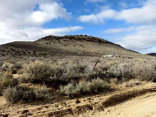
Porcupine Mountain southeast side
An otherwise non-descript hill, Porcupine Mountain rises 600’ above the road between it and Seven Lakes Mountain. Surrounded by homes and private land, Porcupine Mountain is literally the hill in people’s back yards. But the sheer rise of it makes it a worthwhile summit to visit in the Red Rocks area.
It is best approached from the north from undeveloped access sites. The east, west, and south sides have houses next to the mountain.
Reaching the summit involves a short hike and is best combined with other Red Rocks area hikes. You can use the same parking spot to hike Porcupine Mountain and Seven Lakes Mountain 6,060’.
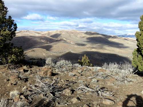
View of Seven Lakes Mountain from Porcupine Mountain
The best time to hike in the Red Rocks area is late October through April. Avoid the area after rain storms; it is better hiked in dry conditions. The summer is too hot, and snakes can be an issue in rocky areas.
Getting There
The best way to reach Porcupine Mountain is from Gymkhana Road. This road runs along the north side of Porcupine Mountain. While there are a few spots to start from, I found an ideal route and parking spot northeast of Porcupine Mountain that I knew was a safe bet legally to park. To get to Gymkhana Lane, drive three and half miles down Red Rock Road from US 395, and turn left on Gymkhana Lane. Take this well-graded dirt road for a little over a mile and a half where it ends and meets Chokecherry Lane. Take a left on Chokecherry and park on the side of the road near the Gymkhana Lane sign. This parking area is at 39.89425, -119.94406.Route
Hike down Chokecherry Lane for a little less than ¼ mile. You’ll see a sign showing Cowboy Way, noting a “Dead End Private Drive”. While this is private land, it bypasses an adjacent house and leads directly towards Porcupine Mountain. I saw no signs indicating hiking this road was off limits and it provides an obvious path to Porcupine Mountain.Hike up the road to its end and then walk south through the brush towards Porcupine Mountain. You can hike straight up the ridge leading to the rocky south summit of Porcupine Mountain, or along the east side of the ridge. Either way gets you to the summit of Porcupine Mountain in about a mile, gaining 650’.
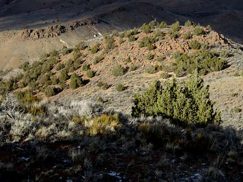
View north down to the lower summit