
|
|
Mountain/Rock |
|---|---|
|
|
39.89997°N / 119.99122°W |
|
|
Washoe |
|
|
Hiking |
|
|
Spring, Fall, Winter |
|
|
5184 ft / 1580 m |
|
|
Overview
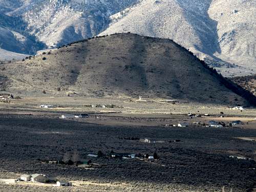
Red Rock from Porcupine Mountain
Located in the Red Rocks area of Lassen County, CA/Washoe County, NV, the summit called “Red Rock” is actually located across Red Rock Road from the “Red Rocks”, towering nearly 600’ straight up above the road. It isn’t particularly red in color like it neighbor to the north, but has the name anyway. It is located across the state line in Nevada.
Red Rock is approached best from the south face. At 5,184’, it seems quite paltry in size compared to its immediate southern neighbor, the long Petersen Mountain ridge, which rises to 7,864’ with many high summit bumps in between. It only has a prominence of 274’ above the saddle between it and the Petersen Mountain. Although it rises steeply on all other sides.
Although it takes only about 10-15 minutes to reach the summit from the primary parking area, Red Rock is a landmark deserving of attention due to its abrupt rise from the road and local scenery. Also, it shares a trailhead with the north end of the Petersen Range. It is a good combination summit with a hike up into the Petersen Range as well as a combination with a hike in the Red Rocks area north of Red Rock Road.
The best time to hike in the Red Rocks area is late October through April. Avoid the area after rain storms; it is better hiked in dry conditions. The summer is too hot, and snakes can be an issue in rocky areas.
Getting There
There are two ways to reach the Red Rocks area. From Reno, head up US 395 towards Susanville. Enter California and drive about 17 miles to the Red Rock exit. Drive for about 2 miles on Red Rock Road and turn right on Rodeo Drive. Drive 1/3rd of a mile to the end of the road. You can also take a longer scenic route up Red Rock Road from the south. This is only slightly longer, but probably takes 10-15 minutes longer to drive. In this case, you turn left on Rodeo Drive.The end of Rodeo drive is on BLM land, but only has space for a couple cars. 4WD is recommended to get up the road, where you can have a few cars. This is recommended for those wanting to hike Red Rock and into the Petersen Range.
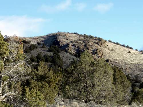
Red Rock seen from above Red Rock Road
Reaching the summit itself is pretty self-explanatory. Just take the road up a little less than ¼ mile and then take a right and head up to the summit.
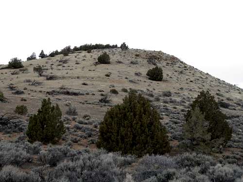
Looking up at the back side of Red Rock
The elevation gain is about 480’ and the total distance to the summit is a little over ½ mile. I meandered around and my round trip was closer to 1.25 miles.