
-
 6089 Hits
-
 78.27% Score
-
 9 Votes
|
|
Mountain/Rock |
|---|---|
|
|
47.31116°N / 10.42869°E |
|
|
Hiking |
|
|
Spring, Summer, Fall |
|
|
7421 ft / 2262 m |
|
|
Overview
 Rotwand as seen from Balschtesattel (26-07-2009)
This peak is a subsummit which can be “pocketed” easily while being up to some other peaks of the Hornbach range in the Allgäu mountains.
Branching off from the main ridge to the south, there are several subridges standing high above Lechtal valley and bearing some interesting “minor” summits, a grazing ground for peak baggers. Rotwand, culminating south of Balschtesattel, a col in the southern subridge Kreuzkarspitze - Söllerköpfe, is marking the southern end of this subrange. The subridge divides the huge southern cirques of Balschtekar (to the west) and Noppenkar (to the east).
It is a rock summit, built up of Oberräthkalk, a limestone and a former coral reef in the long gone Tethys ocean. As the sediments in the basins between the reefs are nowadays marls and claystones, erosion had the chance to shape out Rotwand as a 50 m high rockface above Balschtesattel. If you look closely, you can find nice fossilized solitary corals near the basal limestones of the Oberrhätkalk.
The main and steep ascent winds itself up from the town of Elbigenalp in Lechtal valley. With a short detour and some easy rock scramble, secured with fixed steel ropes, you reach this tiny and nice summit from Enzensperger Weg, the grant trail between Hermann-von-Barth Hütte and Kaufbeurer Haus, too.
Getting There
 Rotwand, Balschtesattel and Südlicher Söllerkopf (16-08-2009)
The main trailhead for Rotwand is Elbigenalp in the Lechtal valley.
You reach Lechtal valley
Follow Lechtal valley road number 198 from Reutte or from Lech / Warth until you reach Elbigenalp. The trailhead is at the western end of Elbigenalp where the Geierwally parking area (you´re reading right - Elbigenalp is home of famous Geierwally) is signposted. Leave your car here (2009: free parking).
Red Tape
No red tape as far as I know.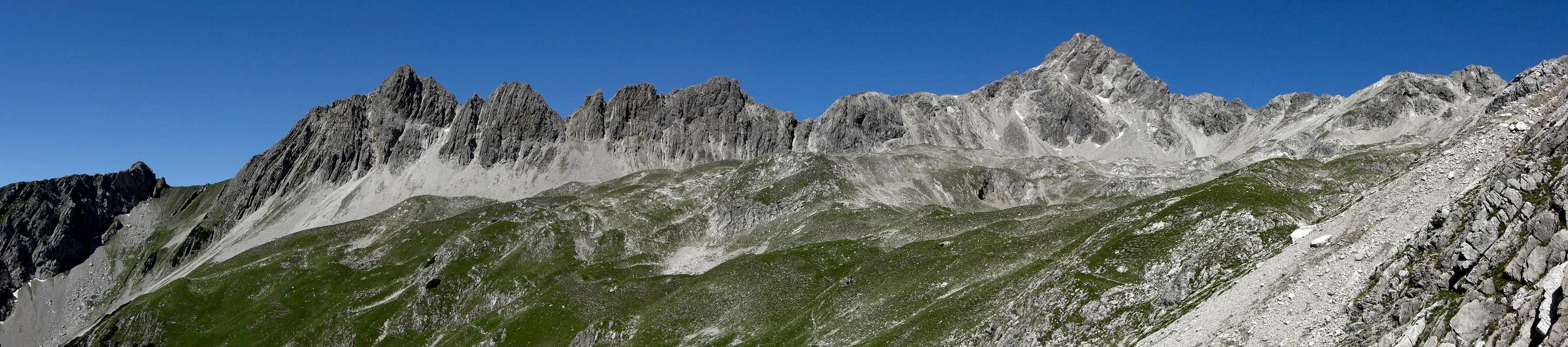  |
Main Routes Overview
 Rotwand summit block (26-07-2009)
From Elbigenalp follow the mountain road to Kasermandl mountain Inn and to the resupply cableway of Herrmann-von-Barth Hütte.
At the end of the road Rotwand is signposted and the trail branches off from the hut ascent to the right. Follow this narrow and steep trail up to Göllner hut (hunting log cabin) and to Rotwand summit block.
From Hermann-von-Barth Hütte follow trail number 432, traversing the huge Balschtekar to Balschtesattel. Rotwand is standing south of Balschtesattel. There is a narrow trail leading from Balschtesattel alongside the Rotwand rockface down to the trail junction with the above described ascent trail from Elbigenalp.
The summit block trail is secured with fixed steel ropes. The route wents up steeply to a frist steep rock chute and up to the summit meadows. Then the route follows the west ridge, traverses into another rock chute and finally reaches the summit arête and the summit cross.
Accomodations
 Rotwand summit view(26-07-2009)
 Ascent from Balschtesattel to summit trail (16-08-2009)
In Lechtal valley there are all sorts of accomodations: Hotels, Inns, private Bed & Breakfast and Camping areas.
For general infomations please refer to: Lechtal tourist page
More detailed informations about accommodations in the nearest villages can be found on the homepages of
Nearby mountain huts (alpine club or private huts) are:
Gear & Mountain Conditions
 Rotwand as seen from Balschtesattel (26-07-2009)
Rotwand is a summer and autumn hike. As far as I know there are no winter and spring ski hike activities. It is a moderate to strenuous day hike from the valley trailheads or as a “secondary summit” during a more extended hike onto Söllerköpfe and / or Kreuzkarspitze. Rotwand can easily be summated from Enzensperger Weg, too.
You need normal hiking gear with good shoes. As the more difficult passages below the summit are secured with steel ropes you need no rope or special gear for belaying. You should be used to exposed rock scramble up to UIAA grade I.
Check the current weather here.