

-
 28291 Hits
-
 90.48% Score
-
 32 Votes
|
|
Route |
|---|---|
|
|
45.92546°N / 7.82858°E |
|
|
Mountaineering |
|
|
Summer, Winter |
|
|
Most of a day |
|
|
ZS / AD (II-III) |
|
|
II |
|
|
Overview
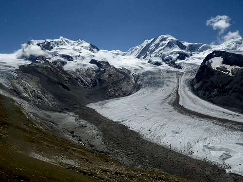
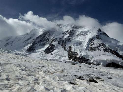
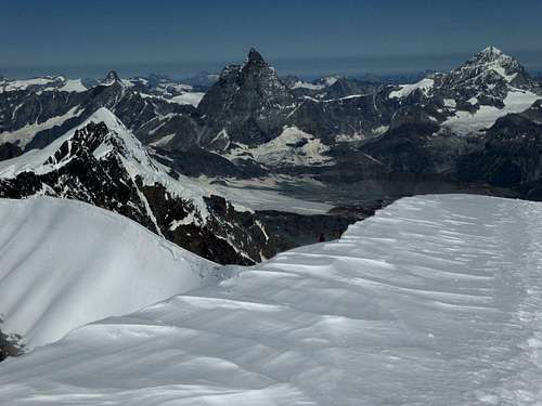
One of the most spectacular views of the Alps: Liskamm (right) with Grenzgletscher and Dufourspitze
The traverse of the Lyskamm ridge is for sure one of the most interesting outings of Monte Rosa – Breithorn range and of Valais Alps.
For the experienced mountaineer there are not many technical difficulties – the traverse is rated AD (fairly difficult) and has a short rock climb with grade II+ moves and on the east and west side of the two summits some steep ice and snow slopes and ridges up to 45 degrees.
But the ridge is high – mostly above 4400 m – and in long parts razorblade sharp with – depending on the snow conditions – sometimes huge cornices on both (!) sides, to the south and to the north. A winter and spring rich with snow helps to moderate the difficulties – this is how I get acquainted with the ridge – a hot summer with poor snow stimulates icy conditions and the ridge can be a nasty piece of work. The same goes with fresh snow cover.
Don´t underestimate the traverse. A good beaten snow track helps to get from the west to the east summit (or vice versa) in 1 – 1,5 hours. With bad conditions the traverse may last about 3 hours, plus the ascent and descent time from the adjacent huts to the summits of Lyskamm.
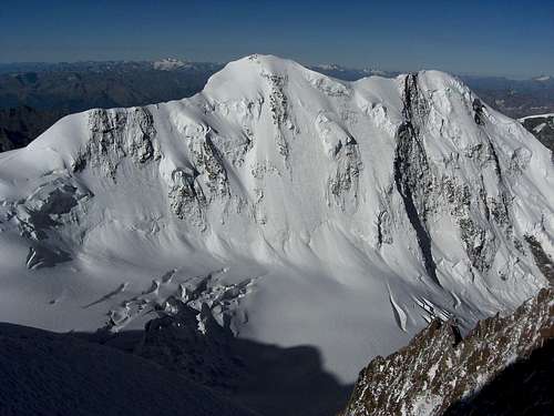 Liskamm west (right) and east summit (left) as seen from Dufourspitze ascent Liskamm west (right) and east summit (left) as seen from Dufourspitze ascent |
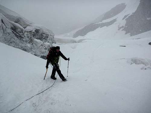
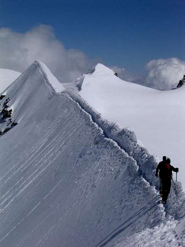 (from member iluka) walking on Liskamm (from member iluka) walking on Liskamm |
I was lucky. We had a cloudless day, good conditions with views down to the Appennin range across the Pianura Padana and arrived at Capanna Gnifetti at 2.00 p.m. for a long nap in the sun after a great day in the high ranges of the Alps.
Starting and end points
The main starting and end points for the traverse are mainly the italian alpine huts on the south side of Monte Rosa. The only normal route from the swiss side of the mountain range uses Grenzgletscher up to Colle del Lys; normally this route is used for descending to Neue Monte Rosa Hütte.
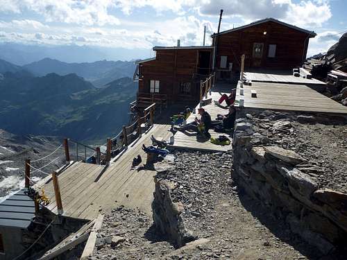
Rifugio Quintino Sella al Felik
Rifugio Quintino Sella al Felik
3585 m
located south of Castor on the lower rim of the Ghiacciaio di Felik
Club Alpino Italiano, sezione di Biella
142 beds, winter shelter with 25 beds
online reservation possible
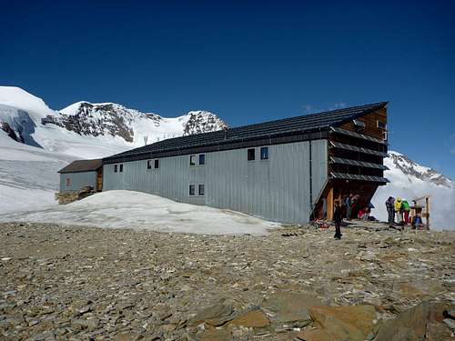
Capanna Giovanni Gnifetti
Capanna Giovanni Gnifetti
3647 m
located on a rock ridge between the Ghiacciaio Garstelet and Ghiacciaio del Lys
Club Alpino Italiano, sezione Varallo Sesia
176 beds, winter shelter with 4 beds
online reservation possible
Rifugio Città di Mantova
3498 m
located below Ghiacciaio del Garstelet and Capanna Gnifetti
private hut (Guide Alpine di Gressoney)
80 beds
Neue Monte Rosa Hütte
Neue Monte Rosa Hütte
possible end point of a traverse
2883 m
located at “Plattje” above the Grenzgletscher
Schweizer Alpen Club, Sektion Monte Rosa
120 beds
online reservation possible
Route Description
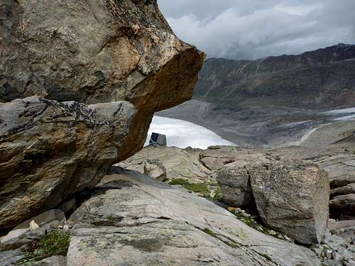
The ridge extends between Felikjoch / Colle Felik to the west and La Sella / Roccia della Scoperta (on the swiss topo maps called Lisjoch), west below Colle del Lys (as named on the italian maps).
You reach Felikjoch from Rifugio Quintino Sella over the Ghiacciaio di Felik (Felik glacier), which is located just behind the hut. Ascend the southern orientated glacier (easy, some crevasses) first straight north and in the upper part northeast to reach a steep snow ridge east of the glacier, which leads up to Punta Felik and broad Felikjoch.
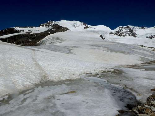 Ghiacciaio di Felik with Liskamm (right) Ghiacciaio di Felik with Liskamm (right) |
 Felikjoch and Castor Felikjoch and Castor |
You reach La Sella / Roccia della Scoperta (or Lisjoch as marked on the swiss topo maps):
 Liskamm as seen from Grenzgletscher Liskamm as seen from Grenzgletscher |
 Better avoid bad weather on Grenzgletscher Better avoid bad weather on Grenzgletscher |
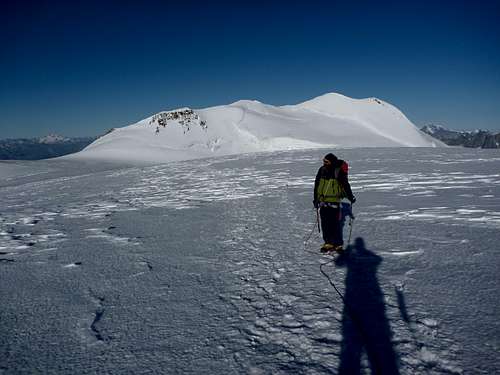
Traverse from Felikjoch to La Sella / Roccia della Scoperta
Arriving at broad Felikjoch turn in northeastern direction and walk near level to the southwest ridge of Liskamm west summit.
 Felikjoch and the ascent ridges and slopes to the West summit as seen from Castor Felikjoch and the ascent ridges and slopes to the West summit as seen from Castor |
 The lower southwestern snow ridge The lower southwestern snow ridge |
Follow the lower snow ridge, which can be sharp and narrow in some parts, to the lower end of the steep west slope. Climb the west slope directly or traverse to your left to the northwest ridge, depending on the snow and ice conditions. It is possible, too, to traverse right to the rocks of the southwest ridge and climb up to the upper end of the west slope.
The west slope has a grade of about 45 degrees. There may be good snow or ice. If you feel unsafe, secure with ice screws.
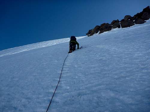 Ascending directly the west slope Ascending directly the west slope |
 Upper west ridge with west summit of Liskamm Upper west ridge with west summit of Liskamm |
Follow the upper west ridge to the west summit.
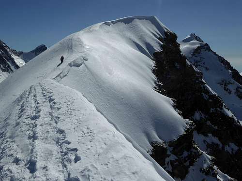
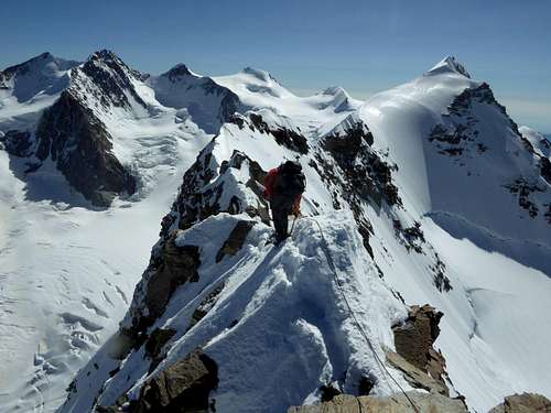
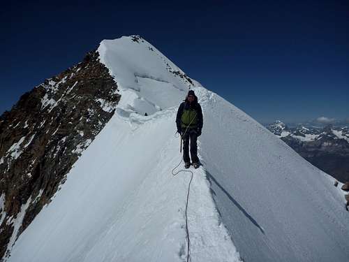
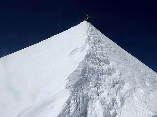
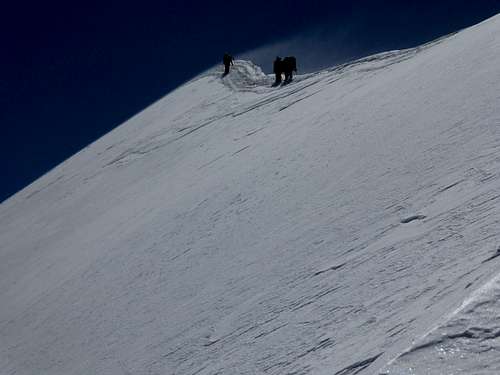
Shortly after the west summit the broad ridge gets sharp, narrow, very airy. You have to overcome mixed rock and snow terrain with some ups and downs. Depending on the snow or cornice situation best stay on the ridge crest.
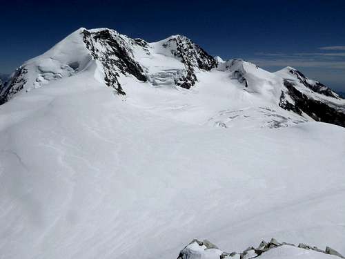
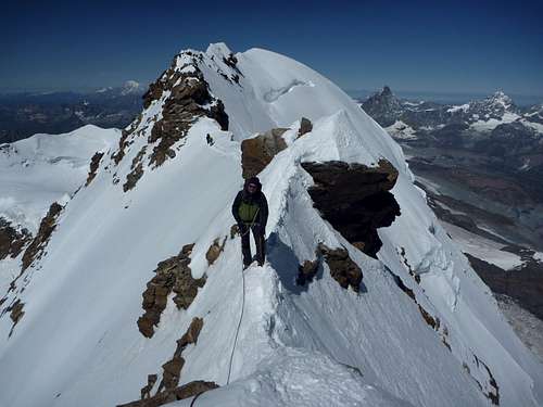
 Ridge overview from west to east summit Ridge overview from west to east summit |
 Ridge gets narrow and airy Ridge gets narrow and airy |
You will arrive at a rock step (about 20 m high) after a while. Descend first steep slabs and then a perpendicular drop (some slings) slighlty south of the ridge crest. This is the rock crux (grade II / II+) of the traverse.
 Ridge gets narrow and airy Ridge gets narrow and airy |
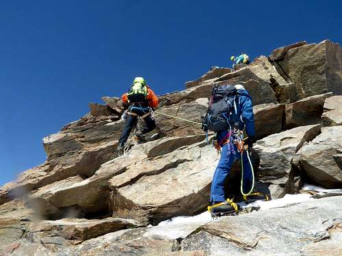 The rock crux The rock crux |
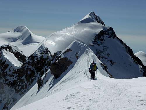
Go back to the still narrow ridge and follow again mixed rock and snow terrain, mainly on the ridge crest, navigating round a rocky knob on its south side.
The track moves then on the north side to avoid a part with cornices bearing to the south, descends and arrives at La Sella, the lowest point between the two summits.
 Ridge after the rock crux Ridge after the rock crux |
 Ridge between rock crux and La Sella Ridge between rock crux and La Sella |
 La Sella and the ridge to the west summit La Sella and the ridge to the west summit |
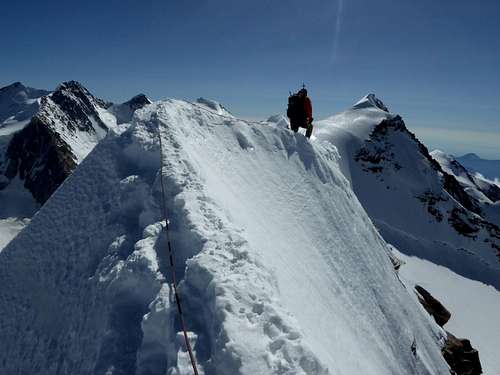
Ascend the broad west ridge of the east summit to the highest point of the traverse.
 Walking the ridge near La Sella between the two summits Walking the ridge near La Sella between the two summits |
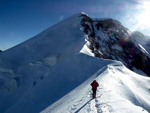
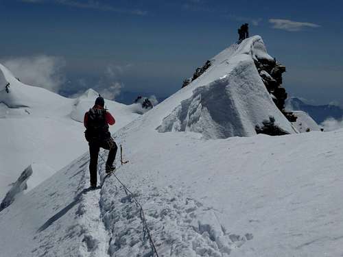 West summit, highest point of the traverse (4527 m) West summit, highest point of the traverse (4527 m) |
At the east side of the east summit the ridge gets narrow again and steeply drops dorm to a long level part. This descent requires a good beaten snow track to facilitate things.
The following level part of the rigde may have cornices to both sides; the ridge stays narrow, exposed and traverses below the crest / cornices have do be done carefully.
 The upper drop of the east descent as seen from the level part of the ridge The upper drop of the east descent as seen from the level part of the ridge |
 The lower drop of the east descent above La Sella / Roccia della Scoperta The lower drop of the east descent above La Sella / Roccia della Scoperta |
A second lower steep drop of the ridge ends at La Sella / Roccia della Scoperta, from where you may descend to Capanna Gnifetti, Rifugo Città di Mantoca or Neue Monte Rosa Hütte.
Gear & Route Condition
Gear:
Rope, hareness, two ice screws per person, crampons, ice axe, quickdraws, slings, several carabiners.
 View from the west summit to Matterhorn and Dent Blanche View from the west summit to Matterhorn and Dent Blanche |
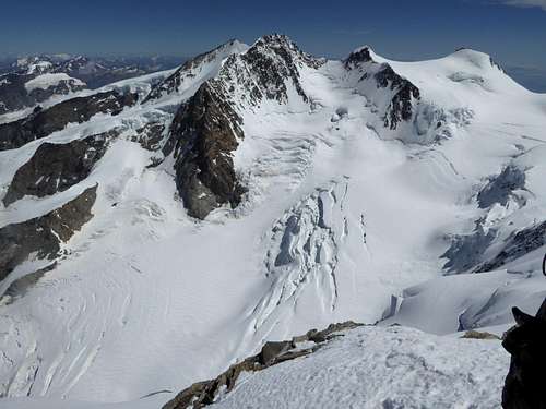 View from the east summit to Monte Rosa main summits View from the east summit to Monte Rosa main summits |
Route Condition:
The traverse is mostly done in summer during the summer season of the adjacent huts. However winter or springtime undertakings are possible for the very experienced mountaineer.
The traverse is rated AD (fairly difficult).
It has some very steep and mostly iced slopes (up to 45 degrees) and one short rock part rated with grade II.
Depending on the snow conditions you may encounter more rocks than snow or huge cornices, which may bear out to the north and/or the south.
Don´t go if the weather is not good for a whole day!
Be very careful with fresh snow on the ridge!
Be accustomed to long sharp and very exposed ridges!
Current Weather:
Zermatt valley
Zermatt mountain (Gornergrat)
Gressoney
Maps
Near Liskamm east summit
Landeskarte der Schweiz, scale 1 : 25000; Zermatt, Gornergrat, Zusammensetzung, number 2515; Bundesamt für Landestopographie, Wabern
Carta dei Sentieri e dei Rifugi, scale 1 : 25.000, Monte Rosa, Alagna, Valesia, Macugnaga, Gressoney; number 109; Istituto Geografico Centrale, Torino