
-
 10236 Hits
-
 89.01% Score
-
 28 Votes
|
|
Route |
|---|---|
|
|
45.92833°N / 7.82107°E |
|
|
Mountaineering, Ice Climbing |
|
|
Summer |
|
|
Most of a day |
|
|
Alpine PD, UIAA II, 40° |
|
|
Overview
Western Lyskamm South-West Ridge
The Normal route to climb the Western summit of Lyskamm
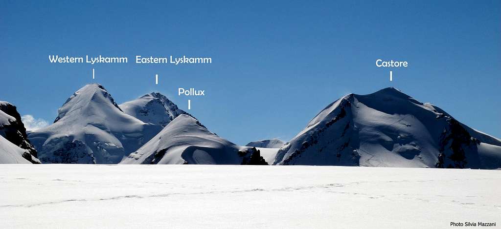
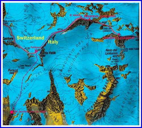
Lyskamm belongs to Monte Rosa Group, Breithorn – Lyskamm chain, and it is one of the finest peaks of the whole Western Alps; to reach its summit, only a few meters lower than the Cervino – Matterhorn, is quite a great satisfaction. This wonderful peaks has two summits: the Eastern one, dominating the Lys Col, is the highest, the Western one, dominating the Felik Col, is about 40 meters lower. Lyskamm Eastern and Western summits are considered by the UIAA as two distinct summits. Western Lyskamm can be climbed following the South-West ridge of the peak , running on the boundary ridge between Switzerland and Italy. This fine route starts from Colle di Felik (Felikjoch) m. 4061, being this latter a wide snow - saddle located between Western Lyskamm and Castore, an important col allowing the crossing from the Quintino Sella Hut on the Italian side to the Monte Rosahütte on the Swiss side.
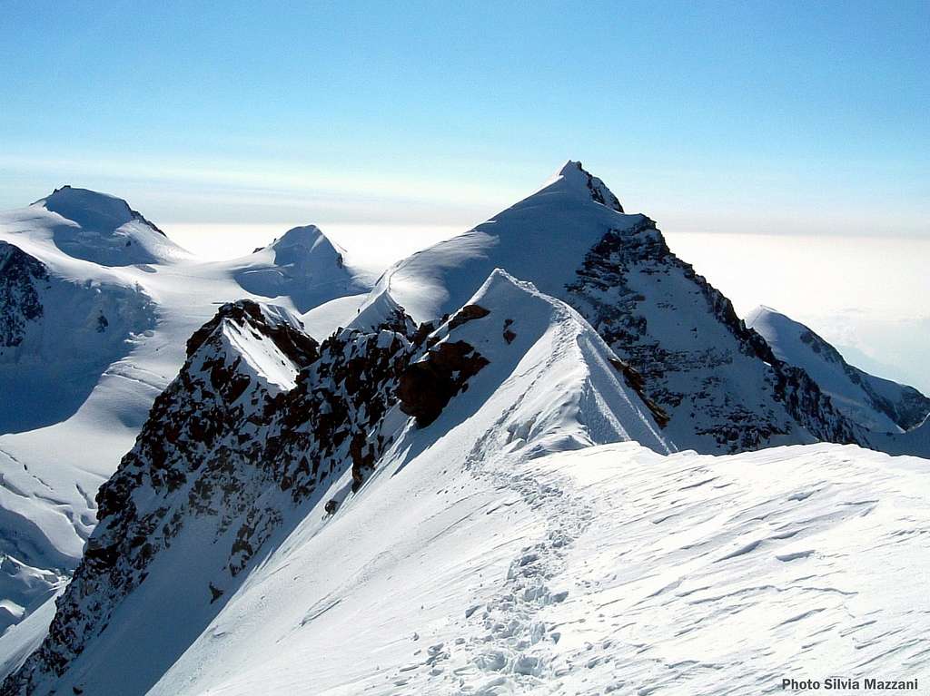
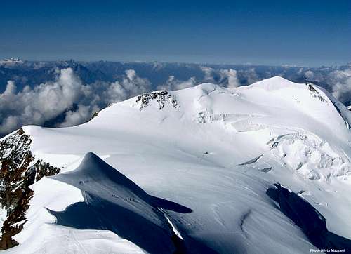
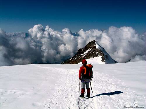
Western Lyskamm summit view towards Eastern Lyskamm - Punta Gnifetti and Punta Parrot on the left
The SW ridge is a safe route, the easiest way to reach the summit, and it’s frequently climbed in reason of its beauty and its moderate difficulty; it’s an ascent entirely following ice-slopes and exposed snowy ridges. This route is less difficult and airy than the Eastern ridge to Lyskamm Eastern summit, but it’s quite a wonderful ascent. Unforgettable summit views to the 4000s surrounding Western Lyskamm, as Eastern Lyskamm, Castore, Cervino, Punta Gnifetti, Punta Dufour and Punta Parrot.
Getting There
Road Approach
The starting point to climb the route is the village of Stafal m. 1825, located in the upper Valle di Gressoney, a valley starting from Pont St Martin m. 345, in the main Aosta Valley.
- From Torino (International Caselle Airport) - Take the A5 Motorway, exit Pont St Martin and follow the road entering the Gressoney Valley to Gressoney St Jean, Gressoney-la-Trinitè m. 1624 and Stafal m. 1825, (37 km. from Pont St Martin), where the road ends.
- From Milano (International Linate Airport) – Take the A4 Motorway, then the junction to A5 Motorway, exit Pont St Martin.
- From Aosta – Take the A5 Motorway towards South, exit Pont St Martin
- From Chamonix (France) – Take the Mont Blanc Tunnel, then the A5 Motorway, exit Pont St Martin
- From Martigny (Switwerland) - Take the E27 then the Gran San Bernardo Tunnel to Aosta, then the A5 Motorway, exit Pont St Martin
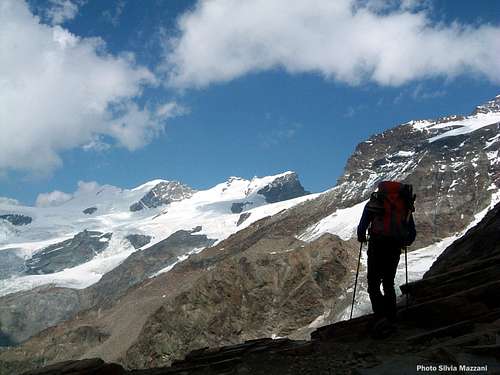
On Quintino Sella approach path |
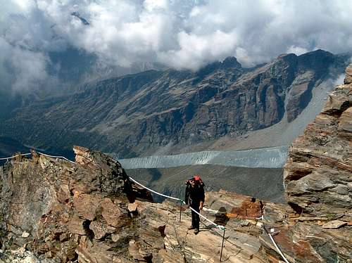
Fixed ropes along the approach |
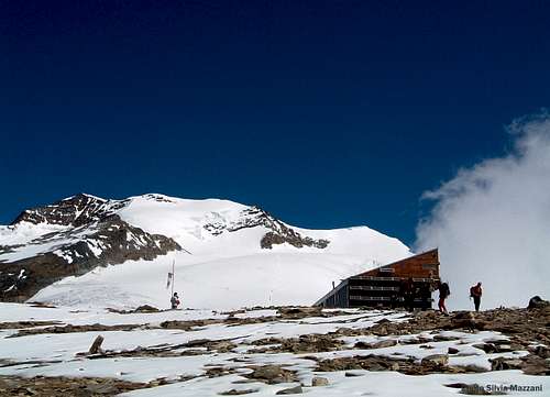
Clouds rising over Twin Lyskamm |
Walking approach from Stafal m. 1825 to Rifugio Quintino Sella m. 3585 A - In Stafal follow the gravel road to Colle di Bettaforca m. 2672 (2 hours from Stafal). Here take the path starting nearby the upper station of the Stafal-Bettaforca chair lift and heading North, reaching the Passo di Bettolina m. 2905 and the upper Passo di Bettolina m. 3100. After a little wooden cabin, follow the rocky ridge, sometimes exposed (some fixed ropes), leading to the hut m. 3585 (5,30 hours from Stafal) B – A shorter and quicker approach is possible by the chair lift starting in Stafal and rising above the Colle di Bettaforca , reaching the altitude of 2730 m. Another way is taking a minibus service starting from Stafal to Colle di Bettaforca. From here same approach as at the previous point (3 hours)
Route Description
Western Lyskamm South – West ridge report
Summit altitude: m. 4481
Difficulty: Alpine PD, II UIAA, 40°
Difference in level: 900 m. from Rif. Quintino Sella
Exposure: SW
First ascent: unknown
Hut: Rifugio Quintino Sella m. 3585
Starting point: Stafal in Gressoney Valley m. 1825
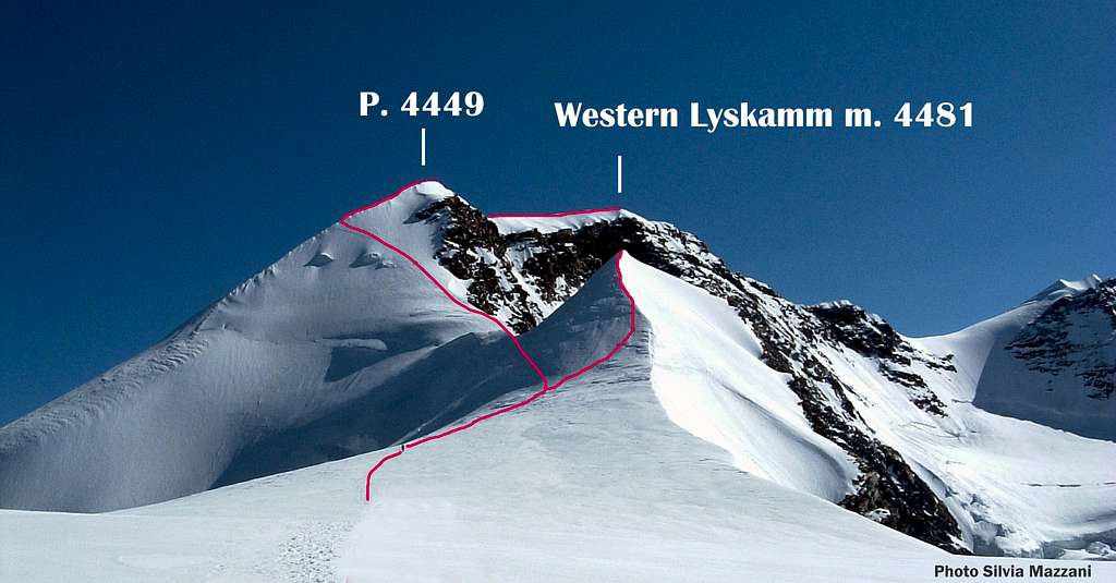
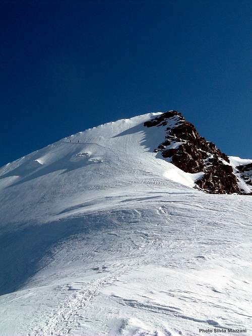
Western Lyskamm Normal Route (SW Ridge) topo
Western Lyskamm South – West ridge is the normal way to get the summit of this mountain. A wonderful ascent and a popular “course”, alternating snowy ridges and easy ice slopes. Notwithstanding it’s not a difficult climb, the route must not be taken lightly, in order of the altitude, the frequent presence of ice and the possible weather adversities. Good acclimatization and good meteo-forecasts are required for a safe climb.
Route report
Part I – From Rifugio Quintino Sella m. 3585 to Colle di Felik (Felikjoch) m. 4061
Colle di Felik (Felikjoch) m. 4061 is a wide snow - saddle lying between Castore on the left and Western Lyskamm on the right. From the hut reach soon the Felik Glacier and follow it towards North, heading to Punta Perazzi and skirting this peak. Head towards North-East (some crevasses) and leave on the left hand side Colle Perazzi m. 3880, gaining the base of the steep ice-slopes facing South-East, lying below the col.. Pass the bergschrund on its right side, then climb the ice slope, exiting on a snow-ridge and reaching the base of Punta Felik, then the wide ice plateau of Colle Felik (1,45 hours from the hut).
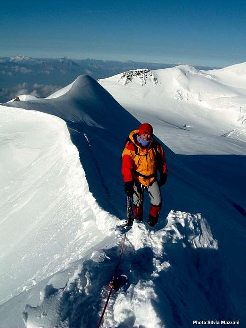
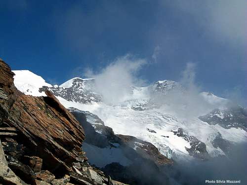
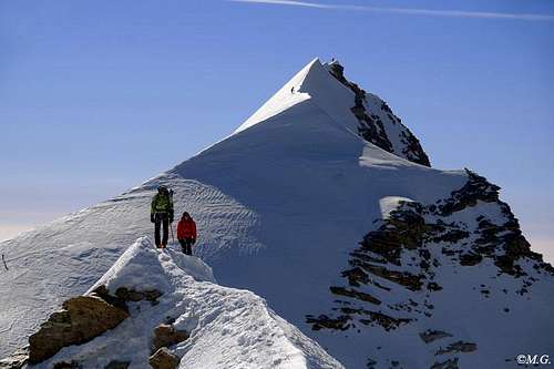
First airy snow ridge |
The middle ice slope |
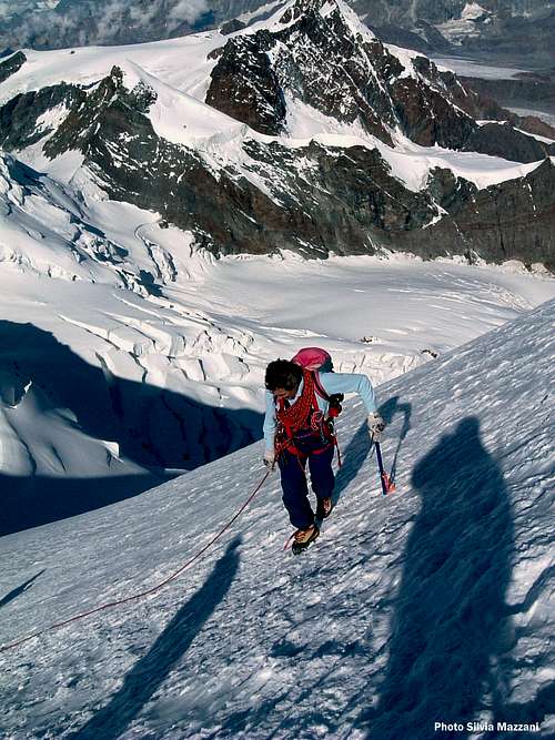
Near the summit |
Part II – From Colle di Felik (Felikjoch) m. 4061 to the summit of Western Lyskamm m. 4481
From Colle di Felik (Felikjoch) m. 4061 skirt Punta Felik on the left and leave the easier track to the Castore on the left, heading towards a sharp snowy ridge. Follow the ridge (some cornices) and pass the quote m. 4207, climbing the snowy ridge, large at first, then sharp. The ridge gains the bottom of the Western ice-slopes of the peak (crux). Climb the steep ice-slopes (40°-45°), reaching another snow-ridge. Another possibility is to climb the rocks on the right (II UIAA). Pass the Western foretop m. 4447 and follow the last easier ridge (cornices), joining the Western foretop to the Western Lyskamm summit (2 hours from Colle Felik). Descent: following the same route
Essential Gear
Rope, helmet, ice-axe, crampons, some ribbons, glacier-gear, some quickdraws.
Red Tape
No particular restrictions in climbing and hiking.
Hut
Rifugio Quintino Sella m. 3585 – C.A.I. Club Alpino Italiano Sez. Biella
Situation: on the boundary ridge between Valle Ayas and Valle Gressoney - Shore of Felik Glacier
Open: from June, 20th to September, 20th
Size: 142 persons (25 in the winter-shelter)
Guardian: Ezio Cassina
Phone +39 0125 366113 Cell +39 348 8107793
E-mail: info@rifugioquintinosella.com
Meteo
When to climb
Best period goes from July to September
Guidebooks and Maps
- Guidebooks
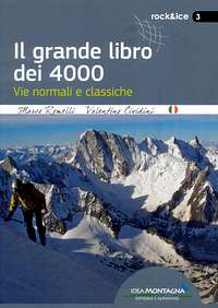
"Il grande libro dei 4000 - Vie normali e classiche" by Marco Romelli, Valentino Cividini - Idea Montagna Editore, 2015
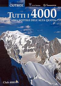
“Tutti i 4000 – L’aria sottile dell’alta quota” – Club 4000, CAI Torino – Vivalda Editori
“4000 delle Alpi” by Richard Goedeke - Ed. Libris
“Monte Rosa” by Gino Buscaini – Collana Guide dei Monti d'Italia C.A.I.-T.C.I.
- Maps
"Breuil/Cervinia-Zermatt" Kompass map 1:50.000.
"Cervino-Matterhorn e Monte Rosa" n. 5 - Istituto Geografico Centrale map 1:50.000
 |
 |
 |
 |
 |