
|
|
Mountain/Rock |
|---|---|
|
|
35.43863°N / 111.7318°W |
|
|
Coconino |
|
|
8880 ft / 2707 m |
|
|
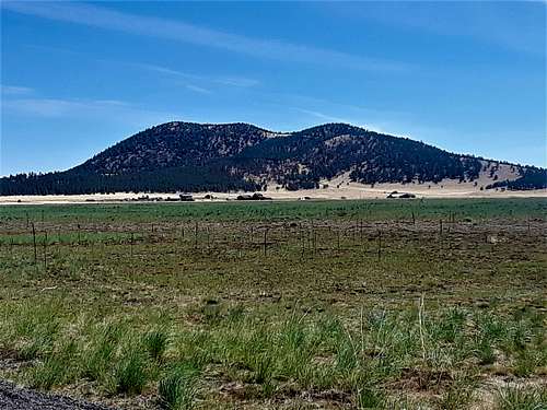 Saddle Mountain 8,880' from the south
Overview
Saddle Mountain is a relatively indistinct summit in the San Francisco Volcanic Field. It is located approximately 7 miles E/NE of Kendrick Peak 10,423’. It is easily accessed from right off of the 180 Highway about 20 miles north of downtown Flagstaff. It sits just north of the Kendrick Cabin, which is a recreational site for visitors to rent out in the Flagstaff area.
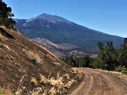 View of Humphreys Peak 12,633' from the descent
There is no organized trailhead and the summit isn’t well known. However, there are three clear routes to the summit. It is easy to combine with nearby Slate Mountain 8,215' not far up the highway.
Saddle Mountain does have a prominence of over 1,000’, so there are excellent views all around. The best time to hike is in springtime or fall. It can get pretty hot during the summer.
Getting There
Take the 180 for 20 miles past Flagstaff. Once you pass the forest and enter a meadow, there are some buildings on the right. Saddle Mountain is just to the north of them.
The road off 180 is called West Kendrick Pk Road. From here you have two options.
The first, and primary option for Saddle Mountain is to drive about a mile to the sign towards the Kendrick Cabin. Signs prohibit anyone who isn’t staying in the cabin from driving further. So, you can park on the main road and walk up to the cabin.
The second option is to continue past the Kendrick Cabin turnoff. After a mile and a half, take a left turn on the 550 road. Drive another almost 2 miles and there is another left turn. This is the road to the summit. There are a number of options from off of these roads. If starting from the base of the 550 road, you can do a longer hike up to the peak.
If wanting to park just off the 180, drive another three-quarter miles north of the 514 turn off. There are small dirt roads on each side the highway. Park at the base of the road to the right. Remove all valuables. The 180 is a pretty popular road, since it is a gateway to Grand Canyon National Park. However, your car should be safe.
Route
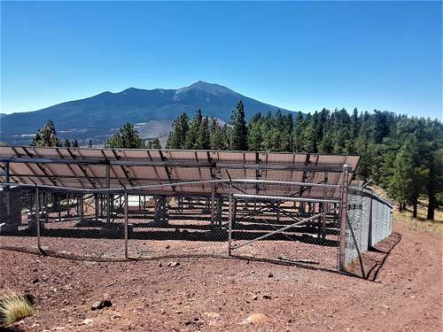
For the primary route, hike towards the Kendrick Cabin. Once past the cabin, hike another quarter mile. There is a jeep track on the right. It heads steeply up to a ridge, gaining over 500 feet in less than half a mile. Once at the ridge, continue on this road as it heads east (to the right) and you will reach the main summit road. The road leads up to some electrical equipment powered by solar panels. The summit is behind the solar panels next to a small building. It is about 1,060’ to the summit via this route in about 2 ¾ miles.
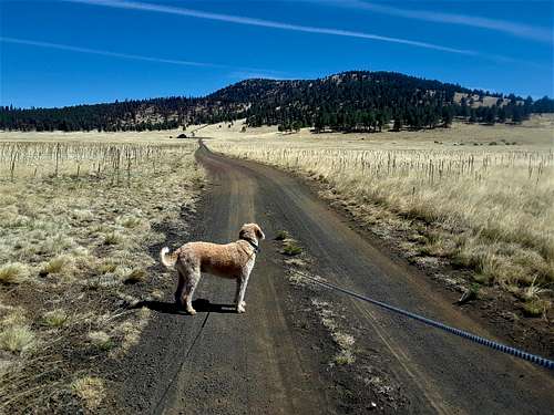 Heading towards Kendrick Cabin
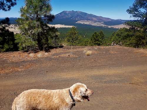 Heading up the summit road with Kendrick Peak in view
From the 550 road there are a couple options if starting from the start of the road. The first option is to hike 3/4 miles up the 550 road and turn left on a road heading towards Saddle Mountain. Follow the road for about 3/4 miles until it takes a left turn. From here, there is no road, but you can wind up through the forest gaining about 300 feet to reach the summit road. It is about 3 3/4 miles to the summit via this route gaining about 1,100'. Alternatively, if wanting to be 100% on road, instead stay on 550 for two miles from the start of the road. Turn left and follow the road leading all the way to the summit. This is about 5 miles to the summit, also gaining about 1,100'.
From the road off of 180 (which is a tiny ATV road), take the road for over a mile and then bushwhack up to the ridge on your right. That will take you to the ridgeline road mentioned above, and on to the summit road. It is about 3 ¼ miles to the summit, gaining 1,100’.
 View from the summit looking south to Humphreys Peak
Red Tape
There is no red tape in particular besides the fact you cannot take a car on the road to the Kendrick Cabin. As for other roads, just look for any signs that may arise advising fire danger. Sometimes this leads to Forest Service Roads being closed. You can go here for more information.
External Links