
|
|
Mountain/Rock |
|---|---|
|
|
35.22989°N / 111.51236°W |
|
|
Coconino |
|
|
Hiking |
|
|
Spring, Summer, Fall, Winter |
|
|
7430 ft / 2265 m |
|
|
Overview
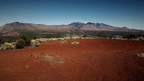
Mount Elden and Humphreys Peak from the Turkey Hills High Point
The Turkey Hills consist of two small rounded volcanic summits just north of I-40 about 5 miles east of the commercial part of Flagstaff.
There are two prominent summits. The highest summit, which is 7,430', is labeled “Cinder Pit” on Topo maps. It has a road winding around all the way to the summit. The lower summit, at 7,290', doesn’t have a road and requires bushwhacking up the sandy slope to the summit.
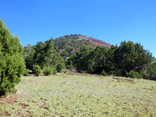
Turkey Hills High Point
Both summits can easily be accessed within a couple hours of hiking. From the summits, there are very nice views to the San Francisco Peaks and to the eastern part of the San Francisco Volcanic field. The higher, southern summit offers excellent views south to vast forest land.
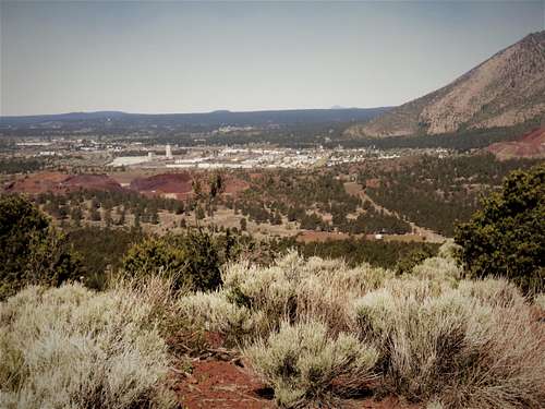
Flagstaff from the Turkey Hills High Point
The Turkey Hills are best hiked in spring and fall. They are good options when it is too snowy in the high country.
Getting There
There are two primary starting points. 2WD cars can easily drive to the base of the south summit. There is also a nice loop hike from the northeast easily accessed by 2WD.
From the northeast, the best access is Foster Road. Take 89 North to the Townsend-Winona Road (Route 394) for 3 ½ miles to Foster Road. Foster Road is well graded dirt. Take it for about 0.6 miles to the signed 510B road on the right. This is a great place for the loop.
From the south, take the Historic 66 as it splits once meeting the junction for 89 North. Continue on the road as it travels for just under three miles to the 791 road. At this point, the Turkey Hills high point rises just over a mile to the north. Take this road as far as desired. You can park at the turn off, which is the point where the road up the mountain begins, about three quarters of a mile from the main paved road.
Route Information
Northeast side loop
For the loop from the northeast, hike south on the 510B road for about 300 yards until you run into large transmission lines. Take a right and follow the transmission lines west. If wanting to hike the north summit, you can simply head for the east side and bushwhack steeply up the sandy slope. To do that, just take the road on the right when the t-line road splits after a quarter mile. However, if wanting to avoid the super-steep side, instead continue on the main t-line road for 0.85 miles (from the intersection with 510B) and then head up. This is longer, but a little easier.
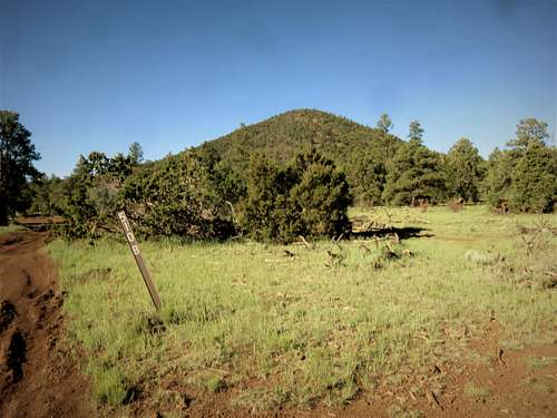
Peak 7290 from the 510B turn off
To get to the south summit, there is a shortcut road as the bottom of a hill on the left. That road is actually 1 mile from the intersection with 510B and the t-line road. Take the shortcut road for about 0.4 miles where the road splits and continue on the road heading straight up the mountainside. Eventually this road terminates. But you can bushwhack for 200 yards up to the main summit road.
To descend, take the summit road down, but then a quarter mile from the summit, there is a road that heads steeply down. I followed it for about a half a mile, and then I cut through pretty open woods down to the main 510B road just to the south, and took that back to the starting point.
Depending on how you approach the north summit, and how you descend the south side, this loop can be between anywhere between 5 ¾ miles and 7 miles.
South side
The south approach is ideal if just wanting a short hike up the south summit. It is only 1 ¼ miles to the summit from the base of the mountain with an elevation gain of about 530’. You can add Turkey Hills’ north summit by trekking down the back side of the south summit. You will need to bushwhack for at least 200 yards down to the road coming off the west side of the south summit. That leads down to the shortcut road described above and over to the south side of the north summit. When returning, take the shortcut road for about 0.4 miles and then turn right on a road heading south. That eventually merges with the main road up Turkey Hills’ south summit, and can be taken south back to the starting point. By going this way, you can do both summits via the southern route in 4 ½ miles.