
-
 26910 Hits
-
 85.36% Score
-
 20 Votes
|
|
Area/Range |
|---|---|
|
|
31.69610°N / 110.8483°W |
|
|
Overview
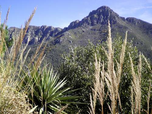
Mount Wrightson from Jack Mountain summit
Anchored by the range highpoint Mount Wrightson, the fourty-ninth highest summit in the state of Arizona and the highest peak in the Tucson, Arizona area, the Santa Rita Mountains are a special and beautiful Sky Island range in far southern Arizona.
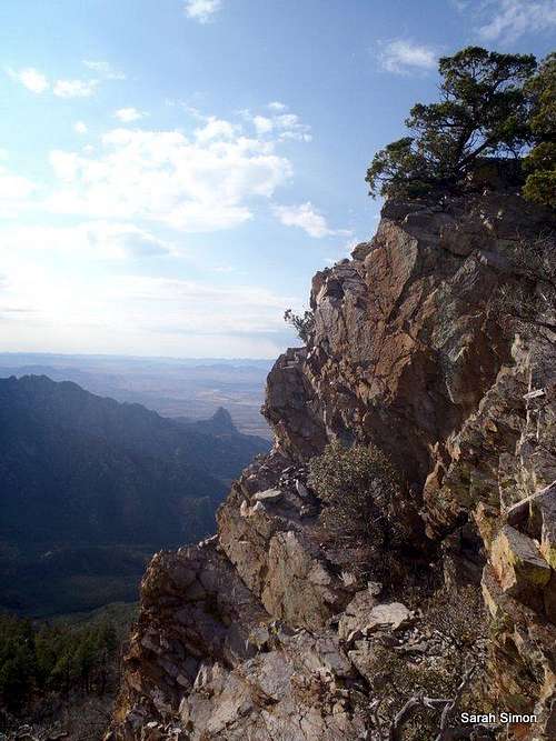
The range is characterized by two very different zones, if you will: The higher, greener and cooler "sky island" peaks and the lower desert peaks dotted in cholla, prickly pear and ocotillo. This means you can have two very different experiences within the same mountain range. In fact, you can travel through several "life zones" on a longer trip up one of the higher peaks from a low trailhead.
Magma intrusions left behind deposits of copper, zinc, gold and silver, and subsequent activities to extract these precious metals from the earth have let some mining scars on these mountains. Some of the older, historic mining operations are not terribly noticeable, but there are a few active mining operations (including the marble mine at the northern end of the range) as well as a proposed large, open-pit copper mine.
Recommended Maps
Green Trails Maps: Santa Rita Mountains
US Forest Service: Coronado National Forest | Nogales and Sierra Vista Ranger Districts Map
Profile image by Andinistaloco
Getting There: Major Access Points
Views from the McCleary Peak ridgeline

Elephant Head and "Little Elephant Head"

summit pachyderms, Elephant Head
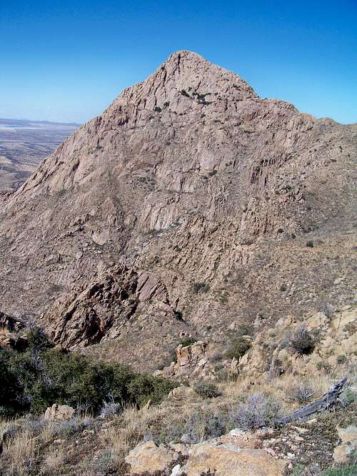
Elephant Head Looms

Cool water in desert
Mt. Wrightson wildflowre | rsw241
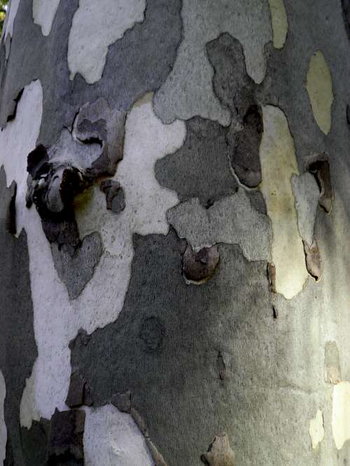
Sycamore Bark close-up

Elephant Head Saddle
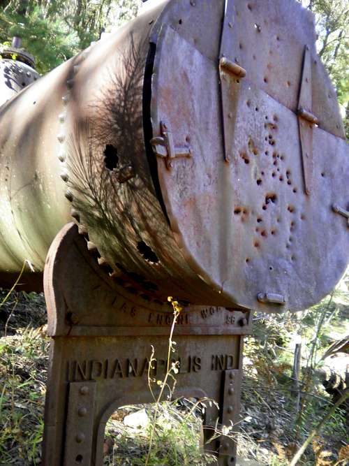
Mining Boiler
These mountains are roughly 40 miles south of Tucson, Arizona, halfway between Tucson and the international border between the USA and Mexico. While they can be accessed from the more remote east side, most visitors to and residents of Tucson will access this range from the more developed west side.
WEST SIDE
West Side via Madera Canyon
A few primary access points for this peak are available via the Madera Canyon area, accessible from I-19 on the west side of the Santa Rita Mountains, exiting at Continental and traveling toward Madera Canyon.
• Follow I-19 to Green Valley, Arizona
• Exit #63 Continental Road.
o From the exit, it is a good 12 miles to the trailhead
o Follow signs to Madera Canyon Recreation Area, they are plentiful
• Take the road to the east (if coming from northbound I-19, you will pass under the interstate)
• Keep an eye out for the plentiful signs to Madera Canyon! Don’t miss the right turn onto Whitehouse Canyon Road. You will leave the desert floor and enter the wooded canyon, heading toward the Santa Rita peaks.
"Round Up" Lot (Mount Wrightson Picnic Area):
Super Trail, Carrie Nation Trail, Vault Mine Trail, Old Baldy Trail
Follow the road to its very end, high up in Madera Canyon, where there are two lots, and upper and lower lot for parking. Paved road access.
Ampitheater & Madera Trailhead/Picnic Area:
1. Madera Trailhead Picnic Area: On the left after the Bog Spring Campground. Paved road access.
2. Amphitheater parking area and trailhead: On the right side of the road after Bog Spring Campground (heading up-canyon), and just past the Santa Rita Lodge. Cross the road to reach the start of the trail. Paved road access.
Whitehouse Parking:
Proctor Parking:
Just past the Visitor Information Station.
West Side: Other
Less than one hour south of Tucson, Arizona via I-19 and about 20 minutes from Green Valley, Arizona, there are a few options to accessing the Santa Rita Mountains (especially the lower, dryer peaks like Elephant Head and Little Elephant Head) from I-19. Here are two primary trailheads:
Southern Approach: Aqua Caliente Canyon
Though high-clearance is recommended for this route, it is passable in dry conditions for 2-wheel drive vehicles.
• I-19 to Exit 56 (Canoa Road)
• Under highway toward east (roundabout?)
• Right (south) on Frontage Road for 3 miles to Elephant Head Road. Turn left.
• Cross the Santa Cruz River (usually dry)
• Right on Mount Hopkins Road (paved) for 5.5 miles to sign: Aqua Caliente Canyon KMSB.”
• Turn left on a dirt Forest Service road FS 183.
• Follow FS 183 for 2.5 miles. Park in pullout on right before road makes sharp left turn across wash with “Dead End” sign.
Northern Approach: Chino Canyon
High clearance 4x4s recommended.
• I-19 to Exit 56 (Canoa Road)
• Under highway toward east (roundabout?)
• Right (south) on Frontage Road for 3 miles to Elephant Head Road. Turn left.
• Follow Elephant Head Road to Hawk Road and turn right.
• Follow Hawk road to its end
• Go through the gate, where the road becomes increasingly rough, requiring a high clearance 4x4 drive.
• Continue on the dirt road to the junction with FS 4073. Follow FS 4073 down through a wash and through another gate.
• Look for a sign to Madera Canyon and Chino Canyon, and follow the road to Chino Canyon.
NORTH SIDE
Florida (locally pronounced Flo ree’ da) Canyon Trail: Directions courtesy of the US Forest Service. Leave Interstate 19 at the Continental Exit (#63)/Madera Canyon Road. Turn east and follow the Madera Canyon road about 7.3 miles to the FR 62 cutoff then bear right onto FR 62A and continue about 3.6 miles to the Florida Canyon trailhead on the left, just outside the entrance to the Florida Work Center. Graded gravel.
SOUTH SIDE (Western Approach from Patagonia)
Per the National Forest Service, driving directions to Josephine Canyon Trail:
From 4th Avenue and AZ Hwy 82 in Patagonia drive north 2 blocks and turn left on Pennsylvania Avenue. Cross Sonoita Creek and continue west through the Nature Conservancy area to the National Forest boundary where the road you’re traveling becomes FR 143. Bear left on FR 143 at the Squaw Gulch intersection. Continue to Alto Townsite then beyond 2 more miles to a point where FR 143 turns left onto Bull Springs Road. Continue straight on FR 4082 about 2 miles to the trailhead. If you don’t have a 4-wheel drive vehicle, it may be best to walk these last two miles.
EAST SIDE
Gardner Canyon Trail (or Gardner Trailhead)
Per the National Forest Service:
At an intersection 21 miles south of Interstate 10 and 4 miles north of Sonoita on AZ 83, turn west onto Gardner Canyon Road (FR 92). Keep to the left at three quarters of a mile and take the right fork at about 4 miles around a piece of private property. Continue 2.5 miles to a junction where FR 785 branches south. Turn left here and drive about 5 miles to the trailhead at the end of the road.
Cave Creek Canyon Trail (or Cave Canyon Trailhead)
Per the National Forest Service:
At an intersection 21 miles south of Interstate 10 and 4 miles north of Sonoita on AZ 83, turn west onto Gardner Canyon Road (FR 92). Keep to the left at three-quarters of a mile and take the right fork at 4 miles around a piece of private property. Continue a total of 10.3 miles to the trailhead at the end of the road.
Sawmill Canyon Trail (or East Sawmill Canyon Trailhead)
Per the National Forest Service:
East Sawmill Canyon Trail: 21 miles south of Interstate 10 and 4 miles north of Sonoita on AZ 83, turn west onto Gardner Canyon Road (FR 92). Keep to the left at three-quarters of a mile and take the right fork (FR 4084) at about 4 miles around a piece of private property then continue about 7.5 miles to the trailhead. The last 5 miles or so of this road requires a high clearance 4-wheel drive vehicle.
Red Tape & Land Ownership

"Mt. Ian" and Mt. Wrightson
• Much of the Santa Rita Mountains resides within the Nogales Ranger District of the Coronado National Forest. There are, however, private land holdings in the area, including ranches and mining operations.
• There is a $5 per vehicle fee to access the Coronado National Forest Recreation Area (known locally as "Madera Canyon."
• Part of the Santa Rita Mountains are contained within the Mount Wrightson Wilderness. Standard wilderness restrictions apply regarding motorized vehicles (no mountain bikes), hiking party size and pet leashes.
A note on geology and rock climbing
The rock quality in the Santa Ritas is notably crappy and crumbly and the area is not generally esteemed for its rock climbing. That being said, a few 5th class routes exist on Elephant Head including West Gully (YDS 5.6), Just What the Medicine Man Ordered (YDS 5.9), and Rocktology (YDS 5.10a).
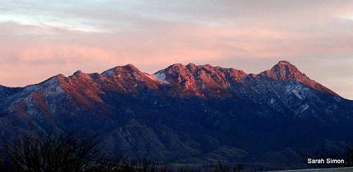 Santa Ritas in winter alpineglow
Madera Canyon
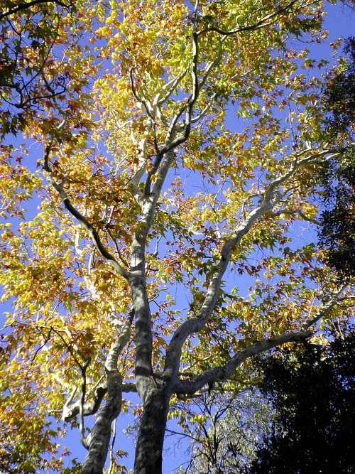
October Sycamore
Known as a world-renowned birder's paradise, Madera Canyon is an incredibly scenic gem that offers a cool(er) respite from the desert heat. As one gains elevation out of the lovely but stark Sonoran Desert, the canyon envelops the visitor in a dark, shady embrace. Wildflowers, cactus, yucca, pine trees, alligator juniper, several types of oaks, sycamore, lizards, snakes, birds, bears, mountain lion...they all call this amazing canyon home. A sliver of heaven delightfully sliced into this Sky Island in the middle of the desert, Madera Canyon is a sight to behold. Come experience it for yourself!
The canyon has a paved road running its course, and features picnic areas, several trail heads, a bed & breakfast or two, and an awful lot of peace, quiet and beauty.
Mount Wrighton Wildflowers | rsw241
Whipple Observatory

Mount Hopkins | Surgent

Mount Hopkins from Jack Mountain
At the summit of Mount Hopkins sits the Fred Lawrence Whipple Observatory, a joint initiative between the Smithsonian Institute and the University of Arizona.
While several smaller observatory structures dot the ridgelines of Mount Hopkins, the Whipple Observatory - big blocky beast - crowns the summit of this mountain. Tours of the facility are available (arrange in advance to purchase admission, currently $7.00 US for adults, for the tour bus drive to the top), though you can roadbike along the road or hike a mish-mash of trails and footpaths to the summit. Call +1 (520) 670-5707 for more information about tours.
 |
 |
 |
Flora & Fauna

Wildflowers on Mount Wrightson | rsw241

Lizard on Jack Mountain

Sonoran mountain king snake

Wild turkeys
The diversity of wildlife in the Santa Rita Mountains is amazing and includes: Black bear, mountain lion, wild turkey, skunk, a variety of bats, several types of mice, many snakes including coral snake, plenty of different lizards including the banded gecko, pocket gopher, numerous types of frogs and toads, sufficient variety of birds to make this area an international birding destination, the infamous javalina, and even badgers.
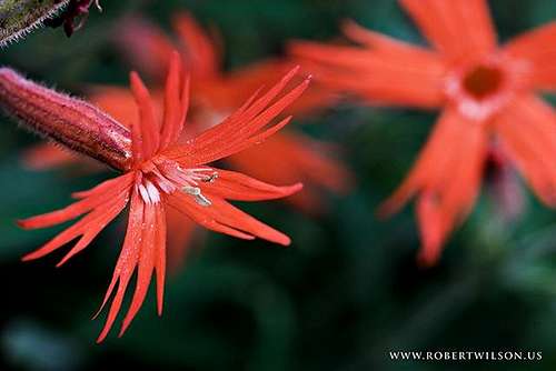
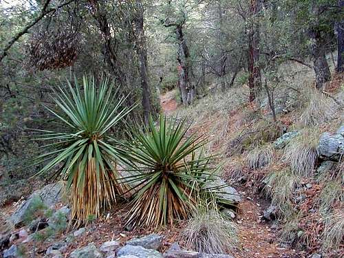
Flora varies drastically with elevation, from the hot dusty desert floor and lower mountain slopes to the wooded Sky Island canyon depths to the tops of the higher summits. Plans encountered include prickly pear, several ground cacti including pineapple cactus, seven species of oak, a few pines including Ponderosa Pine, Douglas Fir, ash, a few native ferns, sycamore, Quaking Aspen, yucca, madrone, a broad selection of wildflowers including Monks Hood, mountain mahogany, wild rose, jojoba and autumn-colorful maples.
 Purple prickly pear Purple prickly pear |
 Cactus 8357 ft / 2547 m Cactus 8357 ft / 2547 m |
 Cactus 8357 ft / 2547 m Cactus 8357 ft / 2547 m |
Camping & Lodging
Forest Service Campgrounds
The Bogs Spring Campground, operated by Coronado National Forest, is the only designated Forest Service campground I am aware of on the west (I-19) side of the range.
• 13 campsites with tables and fire grills
• Drinking water available
• Toilets
• Paved access road
• Elevation: 5,200 feet
• Season: Year-round
Kentucky Camp dispersed camping area can be found on the east side of the range.
Backcountry Camping
I am unaware of any special regulations on backcountry camping in the Santa Rita Mountains, but do ensure you camp away from areas that might see high smuggling traffic.
Hotels
The nearby community of Green Valley has a few simple hotel options.
Border Security

Warning sign | Outdooraholic
Unfortunately for recreational visitors to the Santa Rita Mountains, this range is inhabited by coyotes and mules. I don't mean the animals necessarily. I mean smugglers of people and drugs. Sadly, I cannot recommend staying over night in these mountains. Even more, it's not the best idea to get an "alpine start" or to hike into the evening in this range. I recommend a visit to the Santa Rita Mountains only during daylight hours. Even then, be vigilant and aware as you travel through the area. Chances are no one wants to harm you...you just don't want to find yourself in the wrong place at the wrong time.
Weather & Seasons
Typical Santa Rita Flora, Madera Canyon Vicinity | Larry V
 |
This is a great mountain range to visit in the fall, when the weather is cooler and the leaves are changing. In the summer, all of the area will be hot, but the lower reaches of the range will be brutally hot in the scorching southern Arizona sun. These mountains see cold mountain weather and snowstorms in winter and early spring, and heavy snow could mean impassible trails or even a locked road gate. |  |
Additional Resources
US Forest Service | Coronado National Forest
Amazing photo album of Santa Rita wildflowers by SPer rsw241
A fantastic assessment (including comparison photos) of turn-of-the-last-century mines with today's scenery: Mines of the Santa Rita Mountains