Prologue
August 30, 6.00 am
The sound of my alarm-clock abruptly transfers me from dream to reality. From a bad dream, something about work. To bad reality. Another working day ahead. Hey, wait a moment... I’m lying in my sleeping bag on the reclining seat of the rented Opel Corsa. Yeah, I’m in Bulgaria.
* * * * *
Yesterday I flew from Amsterdam via Budapest to Sofia, three days before the conference. Three days of freedom. I took a bus to the city, rented the car that I had ordered by phone a few days before and drove south to Borovec in the
Rila mountains. I had a good dinner at a local little restaurant. Slavko, the owner, has an impressive collection of scarves of football clubs from all around Europe. Shame I did not have my scarf of Widzew Łódź to give him...
The season is almost over and there aren’t many people around. I parked in a secluded corner next to a deserted hotel and crashed out in the car.
* * * * *
The radio’s not playing. Have I switched it off before going to sleep? I should have remembered. Must have dropped off. So why isn’t it playing? Bloody hell, the battery’s dead. Why has some brilliant constructor decided that you can’t switch it on with the ignition off? I had to turn the key on to make it play and it stayed like that for the night. Looks like I need a helping hand. But will there be enough time for
Musala? And can I make it to
Pirin tomorrow?
The Devil of Musala
August 30
I go out on the road. The day is just dawning. Two or three cars pass by but none of them stops for me. A bloke who is just opening his eatery nearby tells me he can’t leave his business to go with me.
I finally find a helping hand an hour later. Some local guy driving out of the side road. In my bad Bulgarian mixed with Serbian I tell him about my problem. He shakes his head, confirming (the Bulgarian way) that he understands. Together we push the Corsa up the hill out of the parking lot. The main road is downhill so the car starts easily on the second gear.
I drive on high revs over 20 km on the roads nearby. That’s got to be enough to recharge the battery. I return to my parking lot, have a quick breakfast, pack up and just before 8am local time start walking up the road. Only 1.5 hours later than I planned. Could be worse.
![]()
First glimpse of Ireček
and Musala |
| The marked trail to Musala soon turns left into the forest, going up a gravel-dirt road that is sometimes very rough and steep. In one place the trail cuts a few bends across the forest, soon returning to the road.
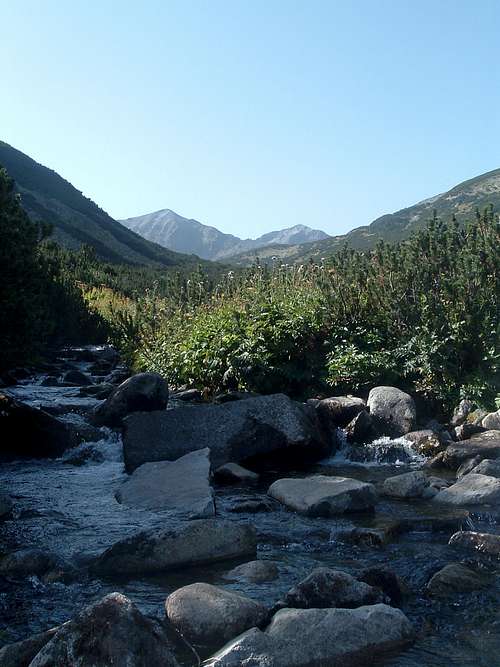
After more than an hour of fast walking I am above the treeline, reaching a bridge over the stream. If you have a 4x4 or a lorry, in theory you could drive up to this place. By the bridge there is a ‘no entry’ sign and above there is a closed barrier. Perhaps only the vehicles taking the workers and supply to and from the mountain huts can go further.
The sun is getting higher and it’s getting very hot. Helped by lots of water with fizzy tablets I keep a good tempo. According to my old guidebook it takes 5 hours from Borovec to Musala Hut. Slavko told me it is more like 4 hours. Looks like I’m gonna get down to 3.
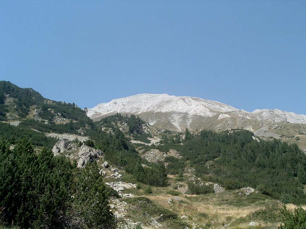
At the next crossing of the stream the road turns right to Jastrebec Hut, the top station of the cable car from Borovec. Maybe I can take it on my way down if I’m quick enough? I take the path to my left, into the dwarf pines. From that fork in the road I can see Musala for the first time, with buildings on its top. To its left, Ireček (2852 m) stands proud, pretending to be higher than Musala.
The last bit is almost flat but my speed drops like hell. I had no chance to build up the stamina before. This is my first ‘holiday’ of the summer, and except the ocassional Sunday footy I took no exercise at all, only working my arse off. But although my last steps before the hut are very slow indeed, I still clock an impressive time of 3 hours and 15 minutes. And it’s more than 1000 m above Borovec, already two-third of the planned elevation gain for the day. Already from a distance I notice that a new, big and quite ugly hut is being built next to the old one, by the lake. |
Several people sit in front of the old hut. Most of them came here by the cable car to Jastrebec. Some get ready to go to Musala, probably via the normal way. I go to take some water from the tap just outside the door. I manage to drip about half a litre and the tap goes dry for good. Niama vode? (No water?) – I ask the landlord. Niama – he shrugs indifferently. All I can do is to buy mineral water. After half an hour I set off.
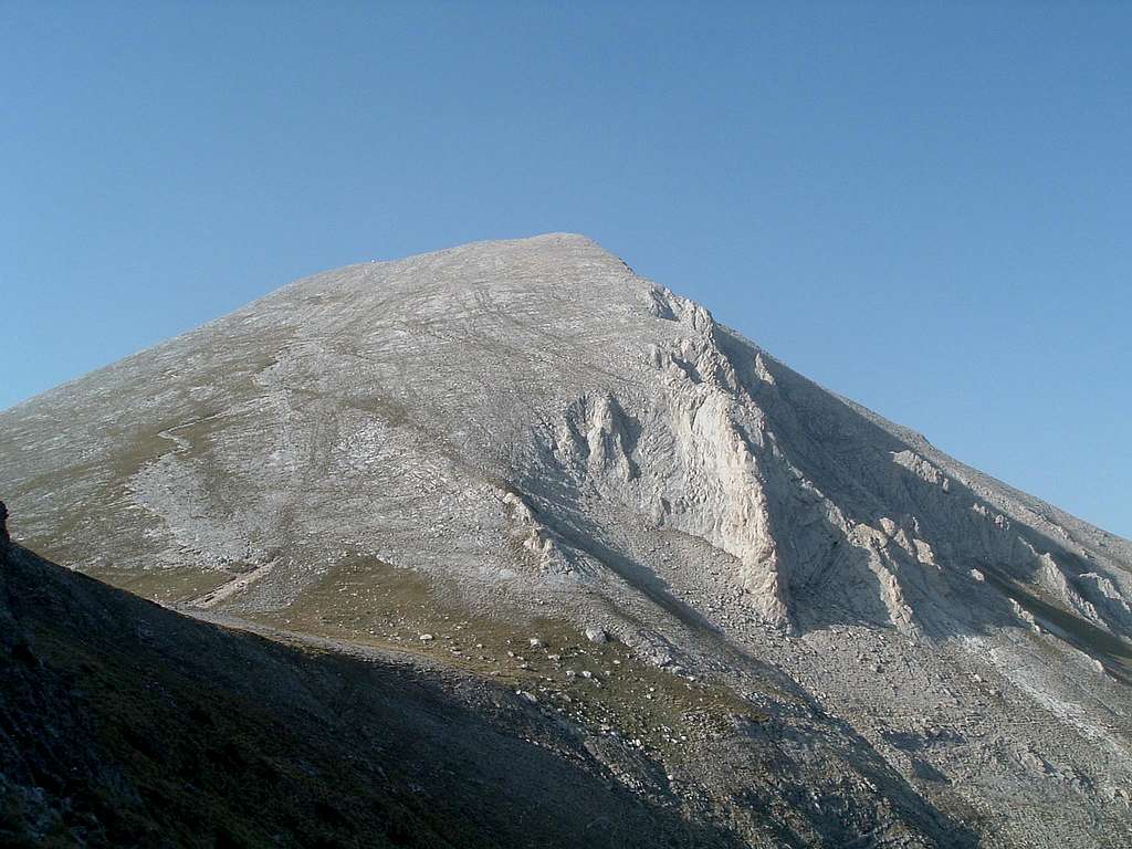
I plan to go up to the col between Deno (2790 m) and Ireček, where there is a characteristic group of rocks called Sfinksa (Sphinx). Then along the ridge of Musala Cauldron, via Ireček and Malka Musala (2902 m) to the top of Musala. That is the most interesting part, so I know I won’t be arsed to follow the ridge to Aleko (2713 m) and will go down to the hut via the normal way. Especially that it will be probably too late to catch the cable car from Jastrebec and I will have to return all the way to Borovec on foot. | ![]()
Ireček and Musala |
|
![]()
Sfinksa |
| I take a shortcut to the col, without any path, sometimes bushwhacking through dwarf pines, sometimes boulder hopping. Those who have ever done it know that dwarf pine-whacking is actually a more advanced and sophisticated form of bushwhacking. Only just below the col I see a path going from the hut. I join it and scramble on top of Sfinksa. Two hikers pass by – the first ones I meet since leaving the hut. I won’t meet any more until the top of Musala.
I take my time, there’s no point pushing myself too much. The slope of Ireček is not steep at all. On its first summit I stop for a drink, food and photos. From here I can already see the rest of Musala Lakes. | ![]()
Deno from Ireček |
|
![]()
View from Ireček to the north |
![]()
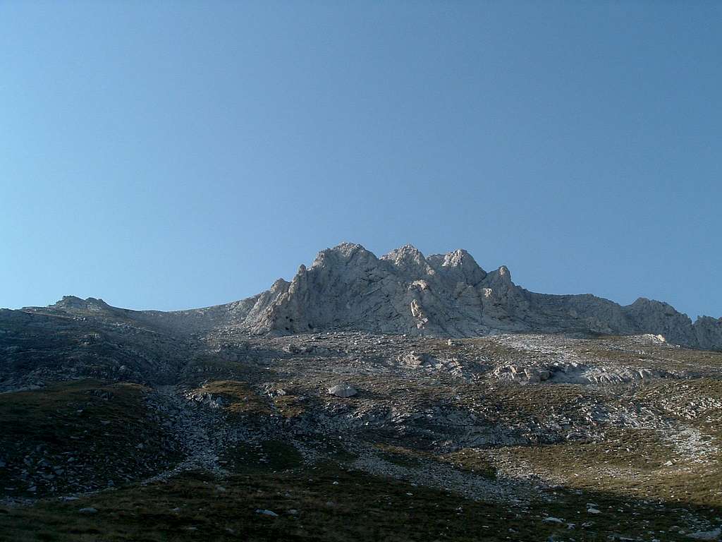
Malka Musala and Musala |
| Having passed the other culminations of Ireček, I descend steeply down the ridge. Wherever possible I’m following the ridge proper, although most of the difficult places can be easily bypassed. From the col I scramble the steep rocks and here I am on the top of Malka Musala (Little Musala). In my old guidebook it is still called Georgi Dimitrov after one of the Communist leaders. On the summit there is the whole city of cairns. I take a long break just lying in the sun. Freedom!!!
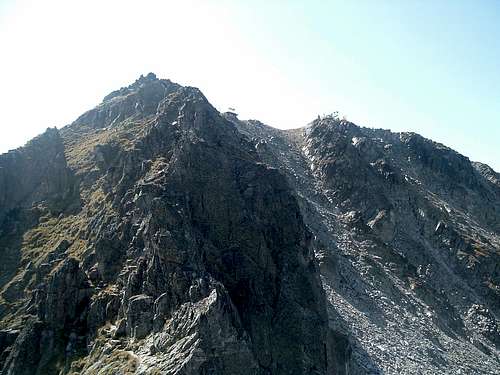
From here to Musala it’s supposed to be the hardest section. The guidebook even recommends doing it in the opposite direction. There is a scary description of a couple metres high chimney that I will have to downclimb. The SP route page, on the contrary, describes it from Malka Musala towards Musala, giving the difficulty of II UIAA. It’s time to confront the descriptions with reality. | ![]()
The ridge |
|
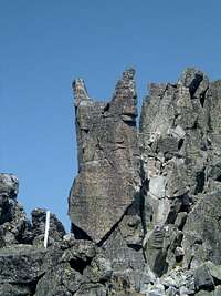
Again I start straight down the ridge, not caring about the path that’s bypassing the difficulties from the southern side. The way I’m going it can be grade II indeed. I’m forced to bypass some hardest bits only in a few places. Just before the lowest point of the ridge I meet the Devil of Musala. Does he want to scare the hell out of me before that supposedly most difficult place?
![]()
The Devil of Musala :) |
| ![]()
On the ridge |
| ![]()
The ‘chimney’... |
| ![]()
...or rather an easy staircase |
|
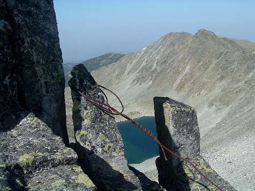
From here there is no other way but to use the path bypassing a high vertical rock barrier. The path actually crosses the barrier it in its lowest place, going down the mentioned chimney. But it turns out to be more of an easy staircase, maybe a bit slippy because of gravel. A rusty, shattered steel cable sadly hangs down. Good protection indeed. If you use the path all the way, maybe that really is the most difficult place?
![]()
Cables that ‘secure’ the route |
| I keep on following the ridge till the end, climbing some boulders maybe even of III UIAA just for fun. I find them perfectly safe. I come across some more of knackered steel cables that used to secure the route in the days gone by.
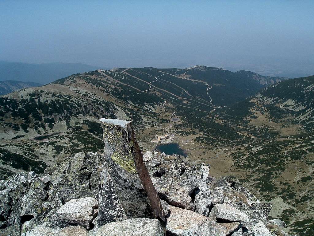
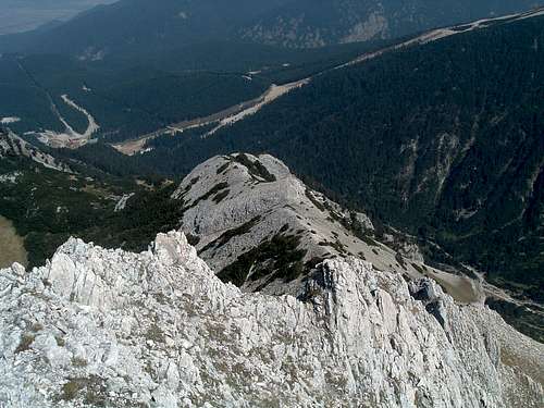
At 4pm I stand at the highest peak of the Balkans. It’s also my personal highest point so far. The buildings and objects on the summit are crammed here beyond belief – the cosmic radiation lab, meteorological observatory, some more stuff... Workers are improving the path, loudly banging their pickaxes against the rocks. There are a few hikers too. They must have come here via the ‘normal’ routes from the north or the south. I talk to them for a while, have some grub and drink the rest of my water. After all, by the highest of Musala Lakes there is a shelter where I can fill up my bottle. I text my friend in Poland. Get the answer right back – you were supposed to go on holiday only in October. This ain’t no holiday, it’s a conference – I reply. | ![]()
Looking down
the final climb |
|
![]()
Musala summit |
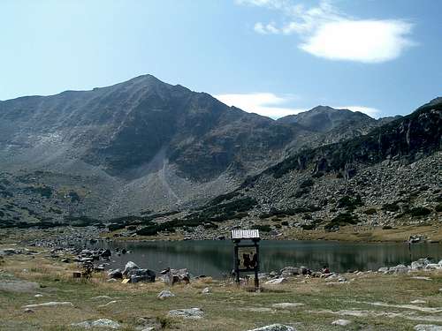
| ![]()
Ledenoto Ezero |
| I start running down the path towards the shelter by Ledenoto Ezero, the highest lake. In fact it’s more like a small mountain hut, with a hall and a little bar inside. Again there’s no tap water, only bottled mineral water. Only a couple minutes down the path there is a spring.
I descend quickly, sometimes stopping to take photos. By the lowest lake, near Musala Hut, I take a longer rest. Finally I force my knackered legs to go down the path and then the dirt road to Borovec. | ![]()
At the summit |
|
![]()
Ireček |
Below the treeline it becomes dark, both because of the trees and the late time of the day. The last couple of kilometres I walk in complete darkness. I can still see the road so I don’t turn my headlamp on, enjoying the eerie feeling of the black forest around me.
About 10pm, after 14 hours of hiking, I’m finally back at Borovec. Unfortunately Slavko’s restaurant is already closed. I leave my backpack in the car and go to another place. I have some
kavarma and
šopska salata and wash them down with Zagorka beer and a shot of
rakija.
While I was still walking, I was feeling alright. Now, standing up from the table, I feel the pain in every muscle of my legs. Walking Robocop-style, I go back to my hotel on four wheels. I don’t turn on the radio this time.
Wind on Vihren
August 31
I wake up at 6, like yesterday. It’s still dark, the moon lurks through the sunroof. Forcing my sore legs to move, I pack up my stuff. I turn on the key... the engine starts at the first try.
I drive down the valley, through sleepy villages and towns, straight into the rising sun. I already got used to driving this car, it’s small but nifty with its 1.4 engine.
Behind Kostenec I turn right to the road that leads to the artificial lake Belmeken and then to the southern side of Rila. Having driven through the town of Sestrimo I have a choice between two roads. I choose the one that looks ‘more important’ on my map. Soon it becomes very narrow. The asphalt has lots of potholes or sometimes there is no asphalt at all. The road quickly zigzags up the forest up to about 2000 m a.s.l., reaching the lake.
Behind the dam the road connects again with the other one. Driven by curiosity I drive a bit that way. That ‘less important’ road turns out to be in a much better condition...
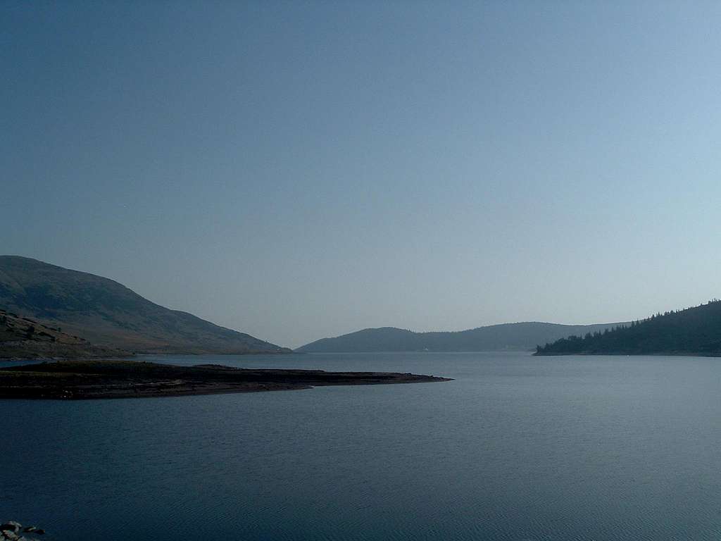
![]()
Belmeken |
I go down the other side of Rila to Jundola and join the main road to Jakoruda and Belica. Then a long, straight road leads me across the great plain to Bansko and towards the huge white mountains of Pirin in the distance. I heard it might be possible to drive from Bansko to Vihren Hut at 1950 m, which would spare me a couple hours of walking. Only then my plan of climbing the two highest Bulgarian peaks in two days is going to work.
Having driven through Bansko I find the road to Vihren Hut. The road is open for cars but is in a rather poor state. It’s asphalted all the way but some potholes have the size and depth of small fishponds. Further up the road crosses some expanding skiing areas – the forest has been cut down and the ground completely ripped. Left like that for a longer time, the ground will soon give way to erosion. I have no clue how downhill skiing routes should be built but this sight is quite depressing.
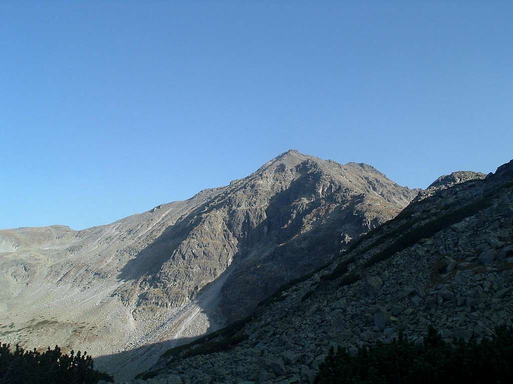
In the last part the road narrows and further deteriorates. It‘s almost noon when I see the large building of Vihren Hut. After negotiating the enormous potholes I park at one of the last free places in front of it. The huge white pyramid of
Vihren stands high above everything else.
![]()
Vihren |
Soon I meet the landlord. I buy some chocolate bars and mention that I‘m going to climb the
Djamdjiev Ridge. Hearing where I come from, he says he’s climbed the famous
Kazalnica wall in the Polish
High Tatras in winter. He also mentions his climbs in Caucasus and Tien Shan.
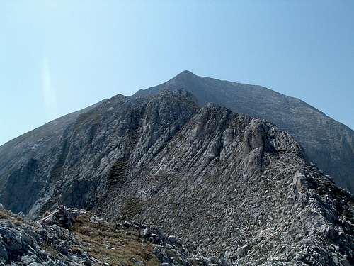
I prepare and pack my stuff and at 1pm I set off up the red-marked path. At the fork I turn right, following the arrow sign showing the way to Kazanite valley. Forgetting my sore legs I quickly gain elevation. The hut gets smaller and smaller and the Djamdjiev Ridge becomes better visible. Meeting only one party of hikers on the way, I soon reach the highest point of the path. From there the white rocky ridge goes to my left. There’s no marking but the orientation is dead easy – I just have to follow the ridge. According to the SP route page it is II UIAA but the difficulties are only at the beginning. I eat some chocolate and gulp down a lot of water with fizzy tablets. To the right of Vihren I can see its slightly lower neighbour
Kutelo (2908 m). Bansko hides far below in the mist.
![]()
Hiža Vihren |
| ![]()
Djamdjiev ridge... |
| ![]()
... to Vihren |
| ![]()
Kutelo |
|
![]()
In memory... |
| After a while the scrambling begins. Just below the ridge I find a stone plaque with pictures of some people who must have died here. The writing has faded and is impossible to read. Next to it sits a not completely empty bottle of rakija wrapped in a piece of old climbing rope. Further up the ridge I will find two more similar plaques to remember the deceased mountaineers.
Just like yesterday, I try to follow the ridge proper, just once or twice making small bypasses. Anyway, making larger bypasses would involve going a long way down the northern slope and staying there on steep scree for a longer time. The difficulties are also like yesterday, just the exposure is sometimes even greater. I find a peg in the crack. So some parties belay here.
Once I cop out and bypass an exceptionally exposed, a few metres long knife edge. But when I see it from the other side I decide to return and give it a bash. So I scramble back to the ridge. Hands on the edge, I take a step of faith with air below my feet and fear in my pants. Made it. Not even the hardest place technically, maybe just psychologically. For a while I feel like on Qatat e Verlla a year ago. | ![]()
Step of faith |
|
It’s so quiet, there’s no wind at all. Am I climbing the right mountain? I don’t know the origin of its name but in my language
wicher means strong wind. And Polish is from the same family as Bulgarian.
![]()
Look down the ridge... |
| ![]()
...and up towards Vihren |
| ![]()
Graniten and Vlahinsko Ezero |
|
For some more time I go in turns on two and four legs, then the sharp ridge is over. The further part, although easier, seems to go forever. Especially that I'm getting more and more knackered, not having properly recovered after yesterday’s long day. I take breaks more often now. The last metres are steep again but don’t involve any scrambling. At 4.15pm I reach the summit. Instantly the wind starts blowing. So the mountain lives up to its name after all.

Summit of Vihren... |
| I take a few pics and sit down on a stone. For a long time I can’t be bothered to make any move. I drink another litre of water and eat more chocolate. The wind is strong enough to make me put my fleece on. Earlier on I thought I might go to Kutelo and back, just to bag all four Bulgarian peaks above 2900 m under my belt. Then I could give this report a fancy title, like Four Aces in Bulgaria. But the perspective of going down and up more than 200 m and then doing it again doesn’t sound appealing. I remain sitting on my arse on Vihren, satisfied with three of a kind. I will have to coin a nice title with the number three in it.
From the direction of Kutelo I first hear and then see four Bulgarian hikers approaching. Dober dan! We start talking, they produce a bottle of rakija, we all take a sip. They all live in Bansko. They left their car at Banderica Hut, a bit below Vihren Hut, and climbed via Kazanite valley and the col between Kutelo and Vihren. One of them asks me if I’m Croatian. Two days ago a bloke at a petrol station mistook me for a Serb, and then Slavko from the restaurant at Borovec thought I was Russian. Perhaps one can take a wild guess, listening to the mix of Slavic languages I use. | ![]()
...with local hikers |
|
We all take the shortest route to descend together to Vihren Hut. The path goes down the steep southern slope to a col where we sit down to rest. The bottle makes its way out of the backpack once more. On a meadow in the valley below we can see some words made of stones in such a way that they are visible from above. Only one of them can be read –
magarija (donkey). A greeting for those returning from Vihren?
Tomorrow in Sofia my Bulgarian friend Petar will tell me what they say when someone whinges that he looks stupid on a photo:
snimaš magara – vidiš magara (you photograph a donkey – you see a donkey).
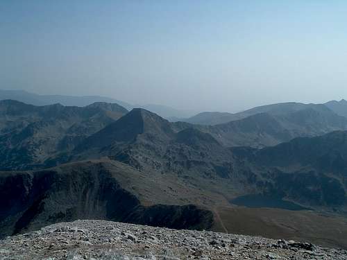
![]()
Southern side of Vihren |
Petar will also tell me that Pirin, because of both its name and the rocky roughness, is considered the only ‘masculine’ mountain range in Bulgaria. All the others – Rila, Rodopi and
Stara Planina – are women.
We slowly descend further down the valley. One of the Bulgarians notices a few mountain goats through his binoculars on the slopes of
Todorka at the opposite side of the valley. They tell me the mountain goat population is shrinking due to mass poaching, although they are officially protected.
![]()
Doviždane, Vihren! |
We are back at the hut at 7pm. The daughter of one of my new friends already waits for them in a car. We have a farewell round. I decide to stay the night here so I pay 10 leva to the landlord and go for dinner. At the table I meet a couple from Poland whose car with Warsaw number plates I saw in front of the hut. They came here yesterday and also climbed Vihren earlier today. The bloke had a nasty fall on the descent, he bruised his ribs and is feeling very sore. Before ending their trip somewhere on Greek beaches they have been planning to hike some more in Pirin. But because of that injury they now think of going straight to the last point of their plan.
I hit the sack, setting my alarm clock for 5.30am. Tomorrow I'm leaving the car in Sofia, registering for the conference at the hotel and meeting Petar and my Italian crew from Holland, Elena and Davide...
Epilogue
September 1, 2.00 pm
Having left the Corsa at the car rental company, I have a half an hour’s walk with my heavy backpack to the hotel. On the way I stop for a
banica, a local kind of pancake with cheese. Entering the swish hotel I realise that my straight-out-of-wilderness look contrasts a bit with the surroundings. A girl at the reception looks at me suspiciously when I give her my passport. She greets me in English, I answer in Bulgarian. She gives me a big smile.
* * * * *
September 6, 4.30 am
The conference car takes me, my Dutch colleague and some third bloke from the hotel to the airport. The radio plays a song. I can understand all the lyrics. My Bulgarian must have improved a lot over those couple days. It takes my half-asleep brain a few more minutes to realise the song is in Serbian.


Comments
Post a Comment