Taking it on the Chinle - Feb 23rd, 2013
I needed some warmth. The winter, back pain, an awful loss by the Pats among other things and as well as the usual cabin fever in general left me needing a break from the long SLC winter (if you ski/board it’s great…otherwise it drags). I decided that having yet to check out the redrock country or the national parks since moving to Utah, I was long overdue. And here in mid-February, the only one that was somewhat melted out was Zion and specifically, the lower southwest desert portion of it.
But that was fine. I had my eye on the Chinle Trail, a 15 miler that would be a good warmup for the legs and the lungs after a relatively inactive winter. I could use it to gauge where my back and hips were in their recovery (from earlier strains/pulls in the winter at the gym). An added bonus was that the weather looked relatively warm down in Southern Utah, compared to SLC at least. It wasn’t completely settled, with some chance of precipitation and light snow as I drove down Saturday morning, but I decided that a mild dusting was certainly unmanageable on what I suppose is a well traveled national park trail.
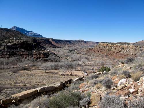
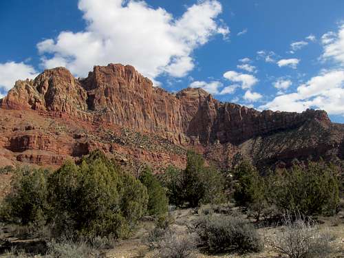
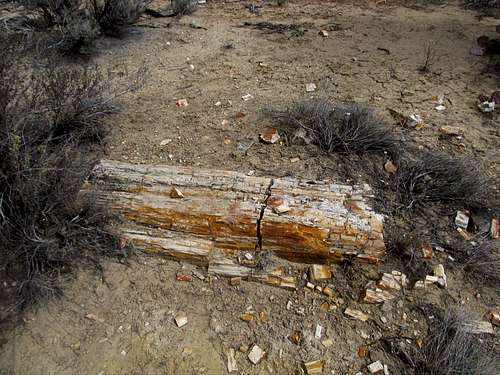
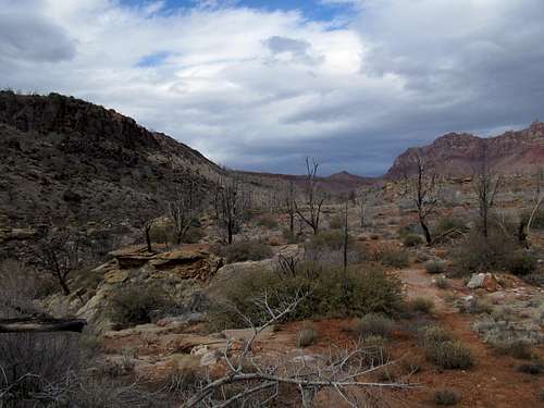
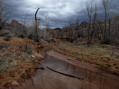
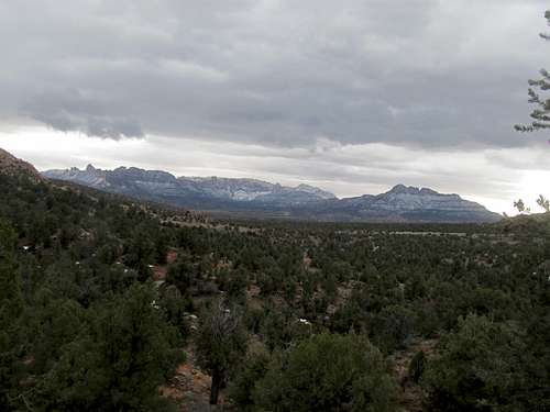
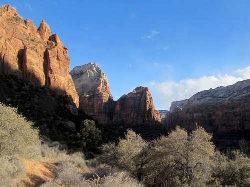
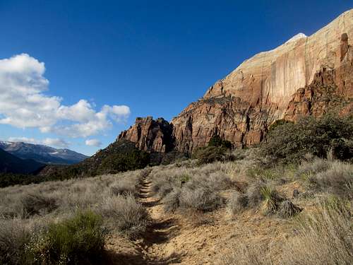
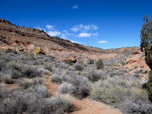
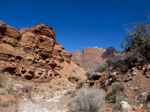
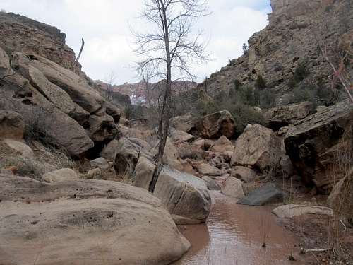
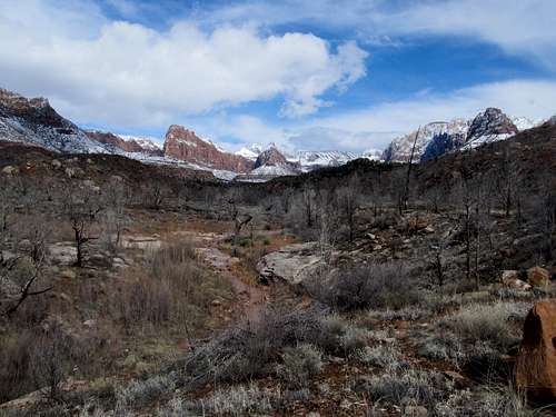
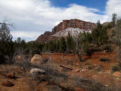
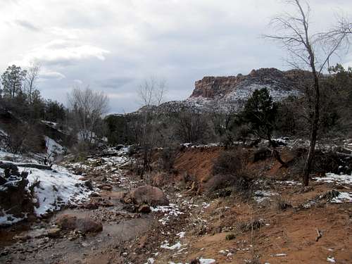
With something of a late start, and adding a little bit of back and forth trying to find the trailhead among the new development areas, I didn’t really get going until 11-12 ish (the turnoff from the road ascending into the housing development was pretty rough and I was hesitant at first on whether or not it led to the right TH…it did). Which was fine, since I could then take advantage of the warmest part of the day. And that warmth was glorious, the sun bathing down on me and I revelled in the fifty degree plus weather as I ascended the small plateau overlooking the Virgin River and wandered through the trail as it wound through a small development. Then the trail got a little boring until it finally picked up the pace as it approached the badlandish foothills of Mt. Kinesava. As promised though, the trail did get interesting as it approached and crossed Huber Wash, a moderately impressive canyon; the trees picked up, and soon I was walking through the very interesting petrified forest.
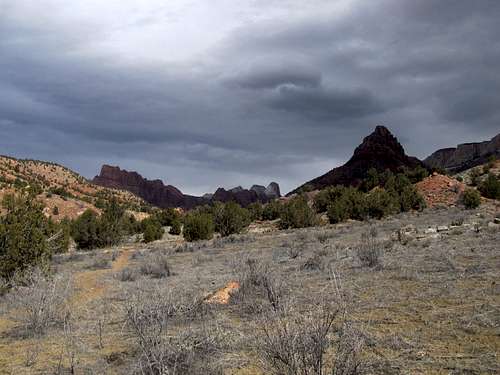
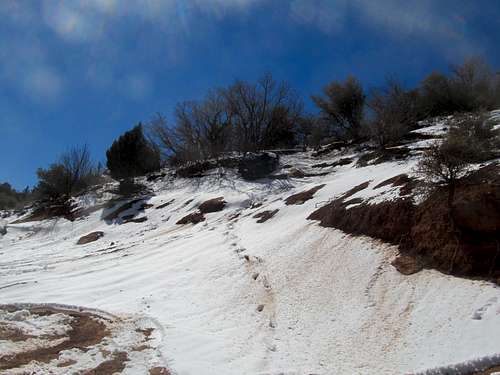
The weather was starting to get interesting too. I kept seeing storm clouds off and on to the south, west, and southwest, but so far it had been sunny. As if on cue, the clouds began darkening the landscape as the trees got denser, and as I descended the north facing slope down towards Scroggins Wash, the shaded landscape aided by some trace amounts of snow on the ground and the trail all worked to make the atmosphere chilly and bleak.
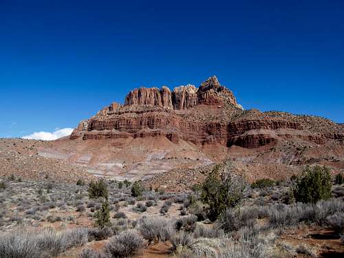
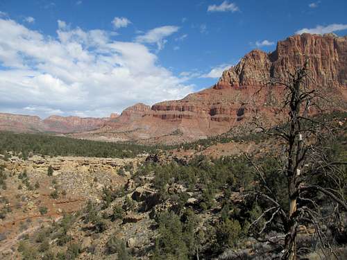
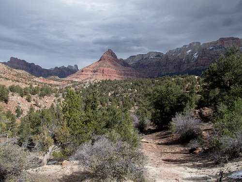
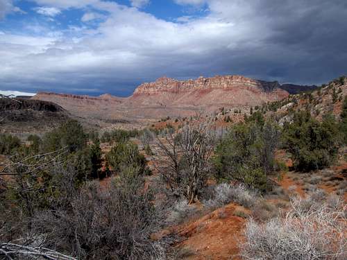
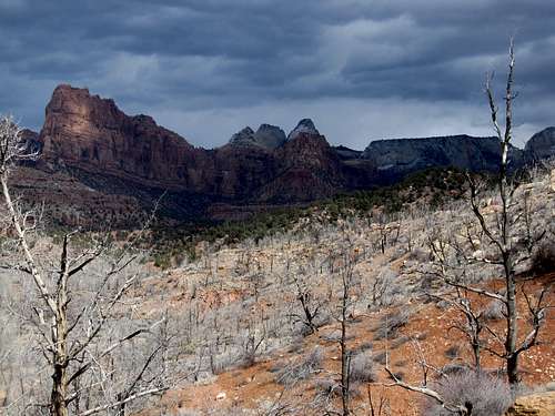
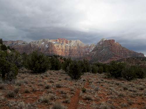
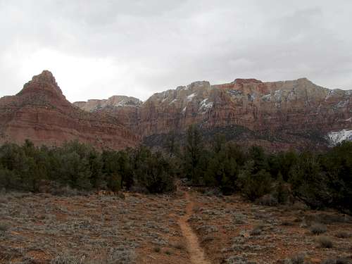
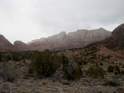
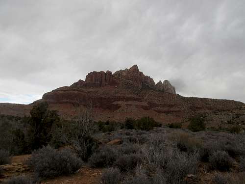
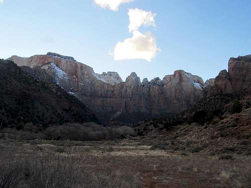
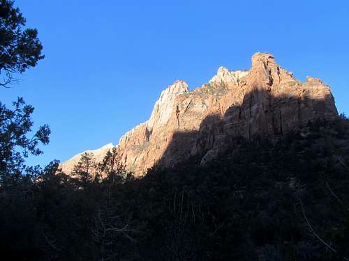
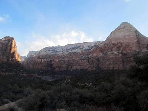
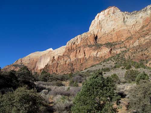
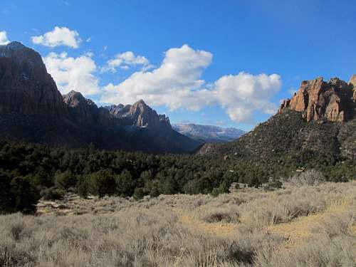
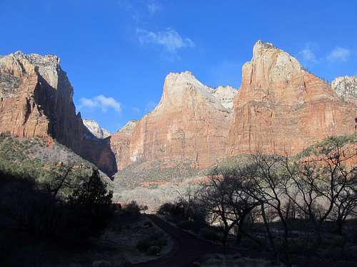
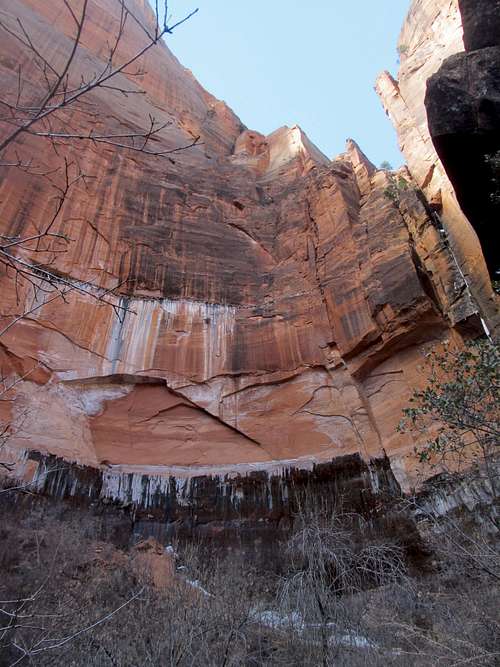
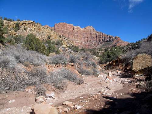
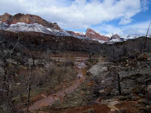
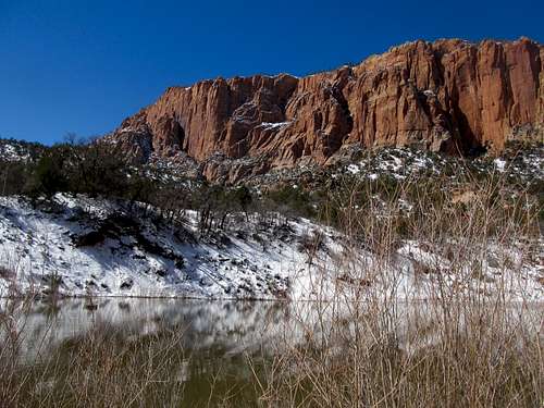
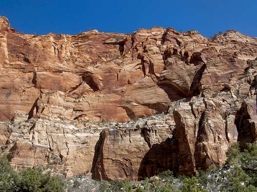
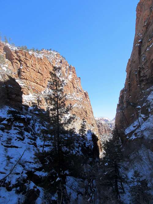
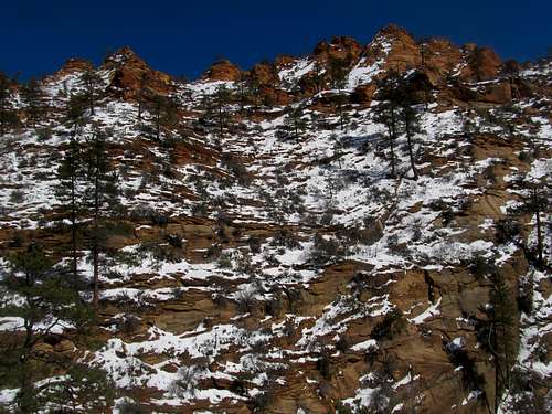
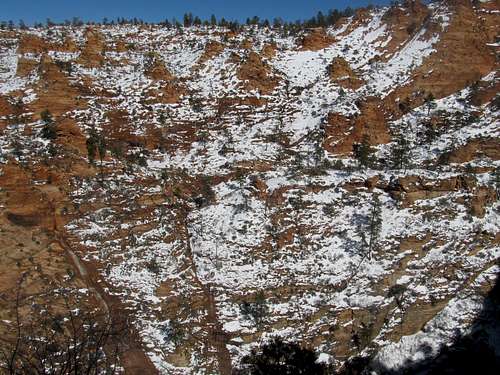
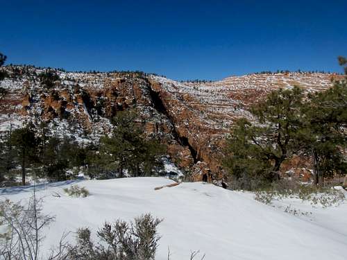
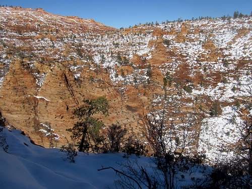
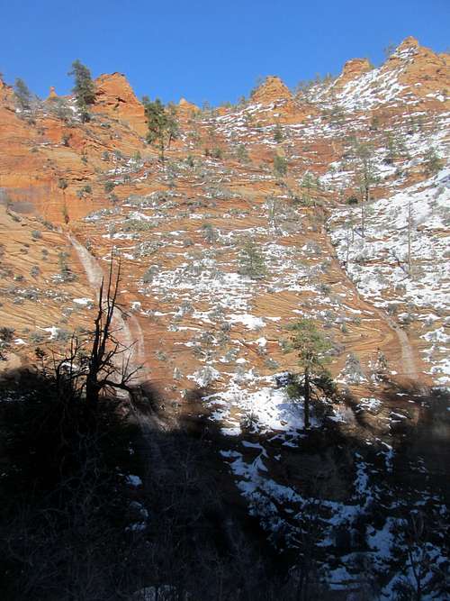
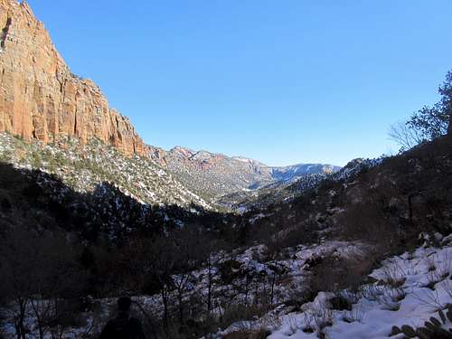
But not the scenery though; here, the views really opened up into West Temple and the many other lining the western aspect of Zion Canyon. What you see from the Chinle Trail are the lesser known west faces of the world famous canyon, the visitor center and park roads close from a bird’s eye standpoint but worlds apart on the opposite side of the monoliths facing you. The tops of the cliffs were still lined with a light layer of snow that seemed to blow precariously off, accompanying any wind strong enough to carry it off the ledge and far into parts unknown.
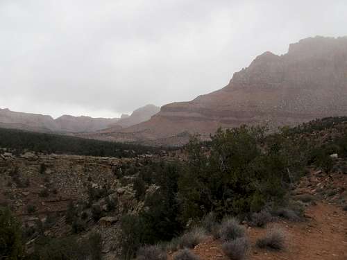
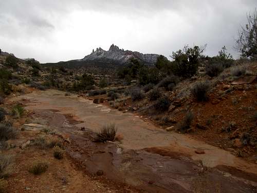
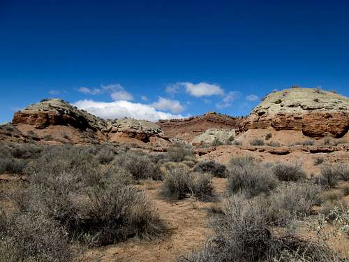
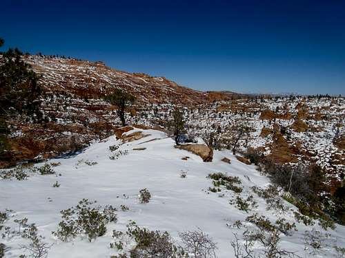
The trail turned west after bottoming out at Scroggins wash and started up some small canyon and hilly areas. The scenery got more and more monotone as it rounded a few hills, turned north, and followed a long and barren ridge as nearby Crater Hill came into view and it followed a long plateau lining the eastern edge of Coalpits Wash below. That’s not to say it wasn’t pretty…far from it. The land had a bleak, barren look to it at times that was striking, especially after the excitement of the West Temple area cliffs. The last mile or so of the trail seemed to drag though; the route ends as it descends down into Coalpits Wash and junctions with that route, but despite that wash being in sight just below you, the trail continues onwards before finally dropping into the wash.
Here I admired the view back towards the Zion landmarks cast against the dark afternoon clouds. To the south I could see a storm raging somewhere in the distance, the puffiness of the clouds seeming to indicate precipitation. So far the storms had eluded me, and that made sense, seeing as this WAS the driest, lowest, part of the park, pure desert where a lot of the other places are actually fairly high elevation plateaus.
I headed back up and started my clamber back.
As I had trekked over 8 miles now I realized a small miscue was now chafing me, literally. First, a little background. I wear the hell out of anything that touches the heel of my right foot, whether it be socks or shoes. In fact, every pair of shoes or boots I’ve ever owned I’ve had to discard because the right heel wears out after awhile. So in order to avoid damage on my hiking socks while driving, an activity that seems to bring out the worst from my heel, I usually wear shitty white gym socks, then switch after I get to the trailhead. The problem is, I had forgotten the switch, and as I approached mile 10 and beyond my boots were really starting to rub raw into my feet, giving me blisters really for the first time since I bought them over three years prior.
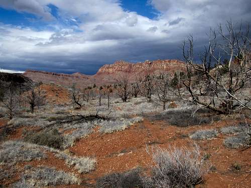
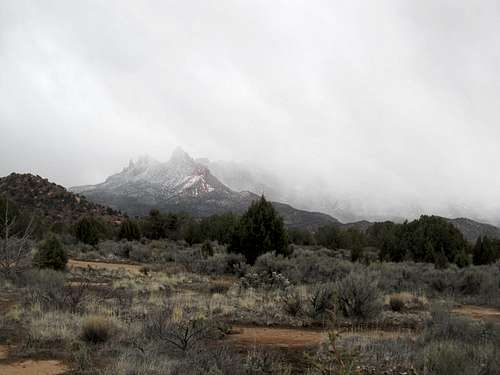
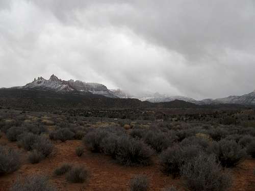
The sun came out as the trail turned east back towards Scroggins Wash, but the storm clouds finally hit as I once more admired the views of West Temple, bearing down on said rock formations.
The storm made for a dramatic scene and thankfully the bulk of the precip stayed up higher and left me alone down in the desert. More pressing was the pain from the blisters as I swore at myself for the umpteenth time for forgetting to change into hiking socks.
This made for a nightmarish and long last few miles back to the trailhead, and add to that an aching hip I was very thankful to be back at my car.
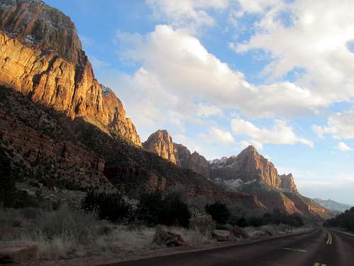
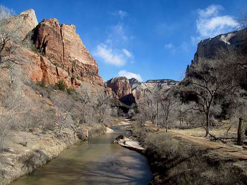
Having not been to Zion Canyon since visiting it as a kid, I made the quick round trip drive into the park and back, with a small detour up the Weeping Rock trail. It was late evening, and the park was far from crowded as the sun began its decline over the other side of the canyon.
I pulled back into Springdale, which struck me as a pleasant surprise, a nice, if smaller but cozier version of Moab at the mouth of the canyon.
Benches Pools and Huber Hubris - Feb 24th, 2013
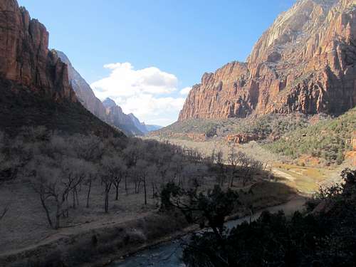
February proved to be a nice time to visit Zion Canyon, especially some of the more popular areas. It’s the offseason, and while some of the higher elevation rim trails may still be socked in snow, the lower canyon is pleasant and crowd free compared to the rest of the year, and being able to drive into the park and the canyon (as opposed to taking the mandatory peak season shuttle) was an added bonus. Among the many guilty pleasures in my arsenal is the urge to every once in awhile indulge myself as a casual tourist, and that I decided to indulge in indeed this Sunday, doing a few hikes along the Canyon’s easiest and most popular trails. First off in the morning was the Sand Bench Trail which lived up to its sandy namesake. Finding the trail amidst some of the maintenance roads in the area was a bit of a challenge but once I was on route I was afforded some spectacular views into either direction of Zion Canyon depending on where I was on the loop.
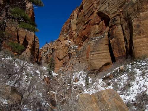
Next was the Emerald Loop Trails, one of the most popular hikes in the park, and one that I vaguely remembered doing with my parents as a kid (though I think we only went to the Lower Pool). It was a quick hop and a skip this time around to the Lower Pool, which was actually closed off due to supposedly hazardous conditions from falling ice. And more problematic, the connecting trails to the Middle and Upper Pools were closed off too.
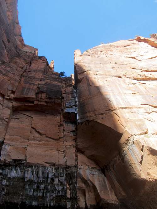
Fortunately there was a way around this problem. Looking at the park maps near the trailhead I noticed that there was another trail to the north that backtracked and connected directly to the Middle and Upper Pools. I drove a mile or so up to the Grotto parking lot then backtracked south along the trail back to the same side canyon to the Middle Pool, then a surprisingly steep trail to the Upper Pool. The latter, still half frozen over and sitting immediately in the shadows of the cliffs, was the most impressive of the three, and despite the bluebird clear skies I felt drops of icy coldness fall upon my skin and realized that it must’ve been windblown bits of snow and ice falling from atop the cliffs hundreds of feet above. All in all it was nice to check out these popular attractions in the canyon while having the trail, views, and pools to myself for the most part.
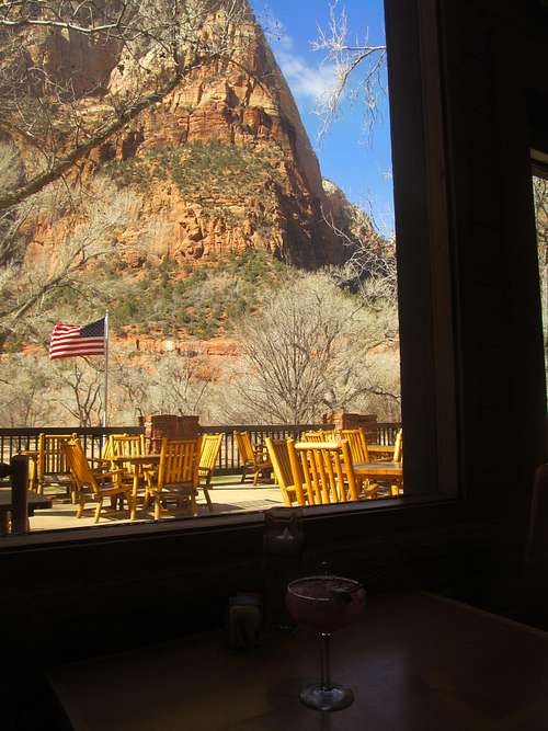
It was about time for lunch, so I figured it was worth visiting the Historic Zion Lodge for a meal. I mean if it’s good enough for luminaries such as Warren G(-unit) Harding, it was good enough for me right? The place was mostly deserted but that didn’t prevent me from enjoying a decent if slightly pricey burger but more importantly, an absolutely delicious Prickly Pear Margarita (and trust me, the taste is far more pear than prickly).
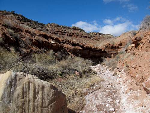
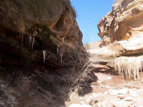
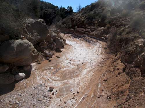
I hit the Huber Wash trail on my way back to SLC. It was the last hike of the day, and I was iffy about doing it seeing how painful my feet were. Surprisingly the wash actually felt great on my feet, as the soft dirt and rocks of the route were much more soothing compared to the sandy and gravel trails in the park.
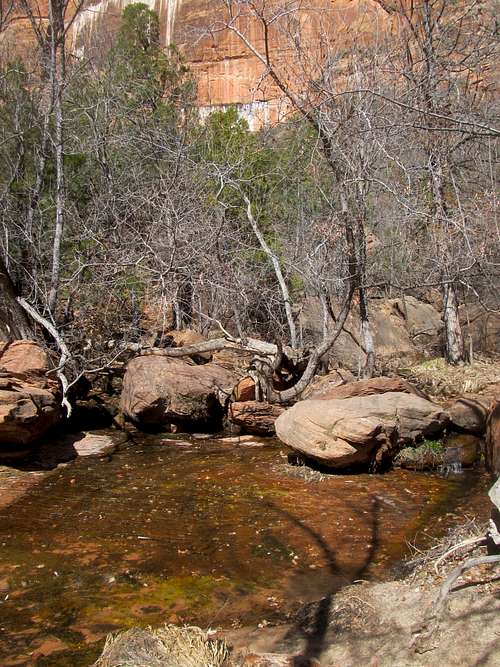
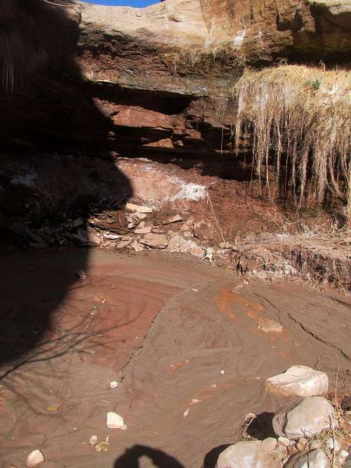
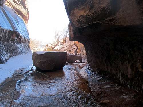
The scenery was far from spectacular but the wash was neat enough, with lots of interesting rock features, and the small dry wash at the end of the route was pretty cool too, with its overhanging walls strewn with small icicles.
The nice warm weather added the overall pleasantness of the weekend, and capped off a nice respite from the snow and cold of northern Utah.
In the Coalpits - March 9th, 2013
Two weeks later I was back for another weekend. The weather was unsettled throughout the entire state, actually, and Southern Utah was no exception. However, I hoped that once again the low desert would nevertheless offer some better hiking opportunities than the higher peaks in the state. Additionally, Greg and Kadee were headed down to St. George too, and accompanying them were Greg’s parents, visiting from Vermont. I grabbed dinner with them Friday night in SLC after work; the next day all of us would head down I-15, though with the unsettled weather no plans were set in stone. Greg’s goal Saturday was to do a 40 mile run while Kadee and his parents checked out nearby Snow Canyon, while I had my sights set on Coalpits Wash, once again in the low desert of Zion. Plans for Sunday were unsure as well; I tentatively leaned towards a peak, maybe Virgin, maybe West or Scrub, but that would depend on how much snow the area got during the impending storm. But regardless, we all figured that we could at least meet Saturday night in St. George and grab some food.
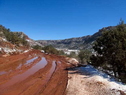
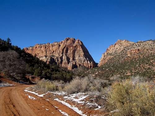
The drive down was the crux of Saturday, with snow blanketing the highway for the 100 or so mile stretch from Scipio to Beaver. Conditions were horrid, or rather, only the road conditions were putrid. What pissed me off was the fact that the snow wasn’t even that bad, nothing more than a few light flurries, yet the assholes running the state had decided that the MAIN f’ing highway running through the state didn’t really have to be ploughed. I’ve driven through bad storms before, and treacherous conditions are perfectly understandable during a major storm or blizzard. But guess what, after it stops snowing, you plow the damn road, especially when it’s the main corridor through your state. But nope, here I was, with barely a few inches of snow in the sagebrush desert around me, yet trucking my poor Camry around trucks, vans, and other stalled cars through a hundred miles of chaos and an interstate highway covered by shit ice and slush that still remained unplowed by midday. Mind bottling. After cursing the Utah highway bureaus (or whatever the hell passes for that) to fire and brimstone a few thousand times over (third world country shit, seriously) the roads finally cleared and I sped my way down to Zion, where I found the informal trailhead where the wash crossed highway 9 and started up the route.
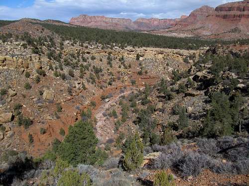
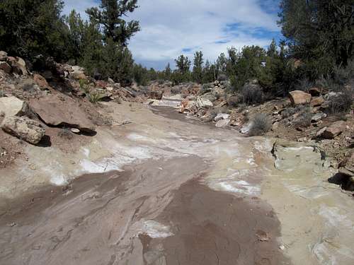
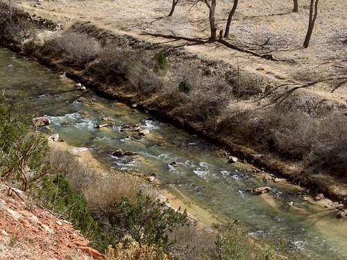
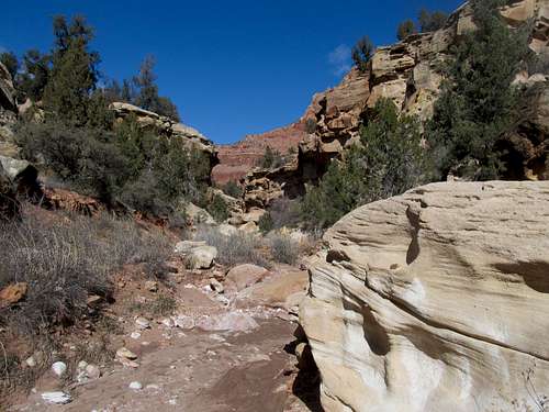
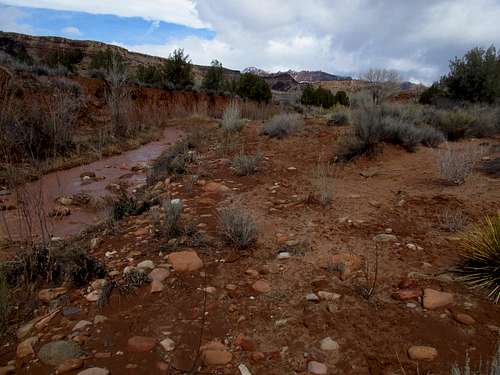
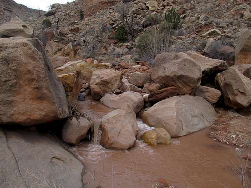
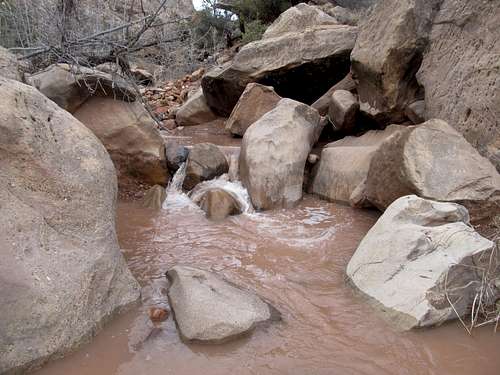
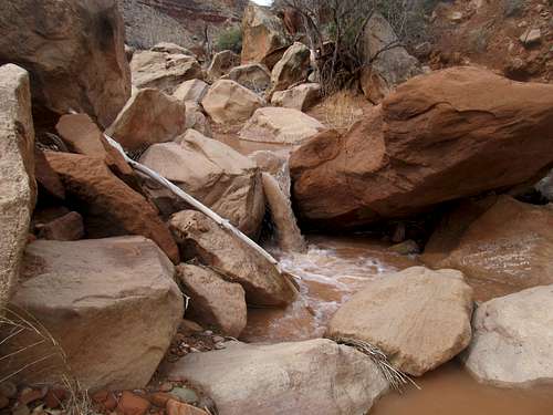
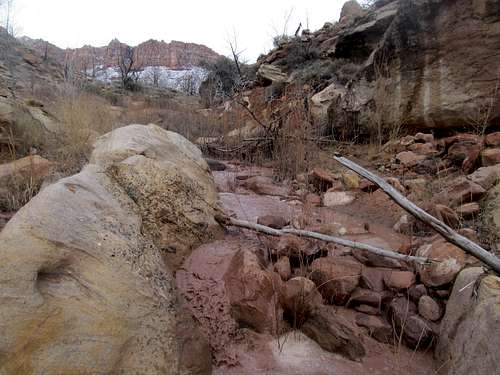
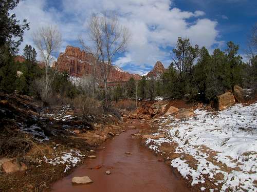
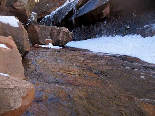
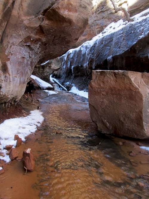
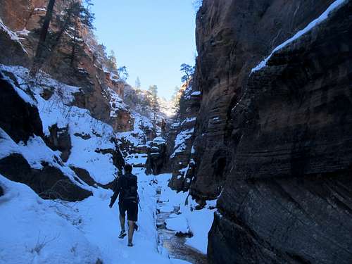
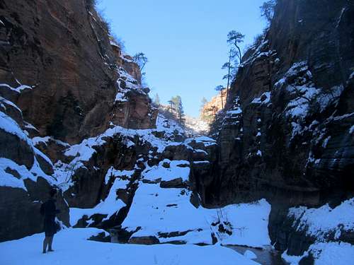
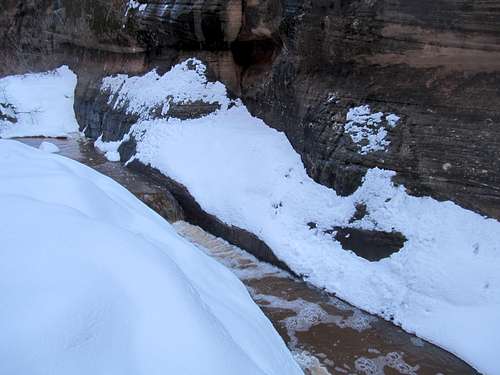
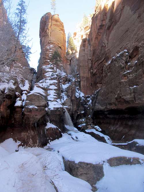
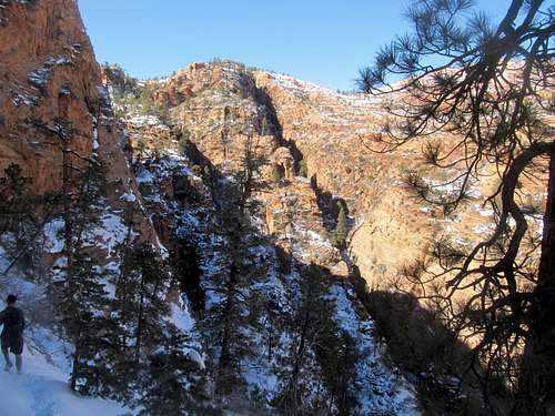
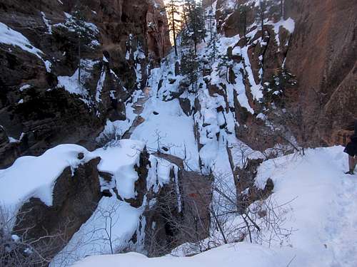
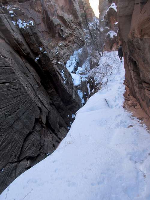
Once more it was sunny down here, and I followed up the left side of the wash where the trail seemed to disappear in brush and mud and was overall not well defined. It turns out the proper trail was on a small bench on the other side of the wash, something that I would find out on the way back. Eventually the wash narrowed and I found myself following the trail as it wound along and around the fast flowing and muddy creek, often winding through boulders and such. Sometimes the trail was ill defined, and sometimes it was hard to tell which side of the wash the trail proper was located on, but it was tough to get lost and the route was pretty cool as it passed besides a dozen or so muddy cascades and small brook rapids.
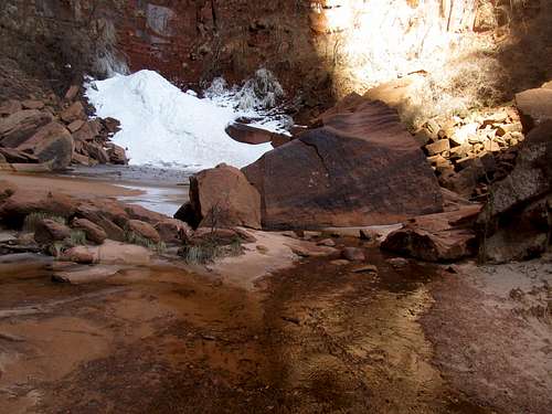
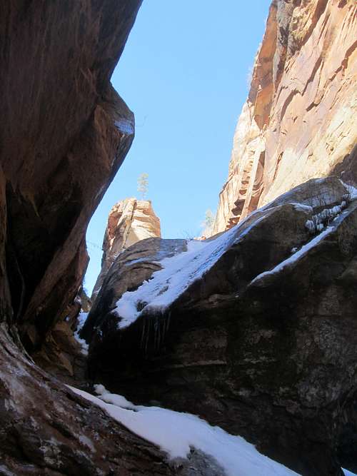
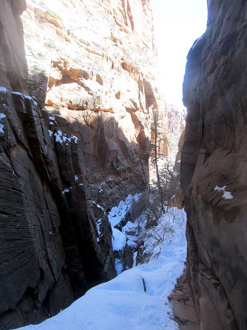
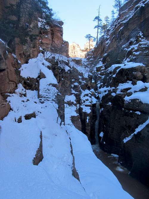
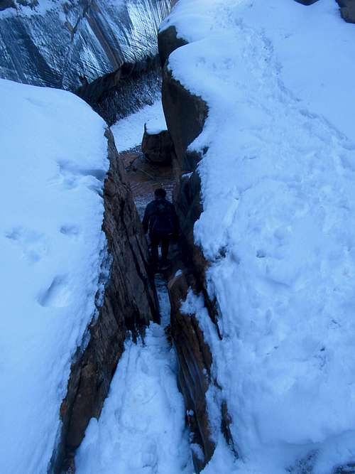
Then the wash narrowed for the tougher part of the route, the narrows. I was a little apprehensive about this, especially since apparently this was high water season, but despite some muddy mucking around the willows it wasn’t too bad, and after a section I clambered up the rocky ledges on the right side of the wash to exit the mud wallowing.
Soon I found myself at the same trail junction that signaled the terminus of my Chinle hike two weeks prior. This time, I dried my socks in the lukewarm weather then moved on.
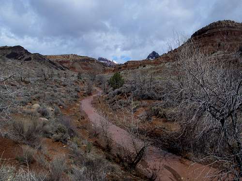
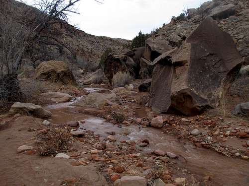
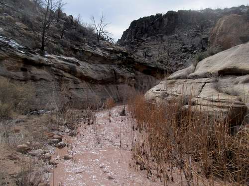
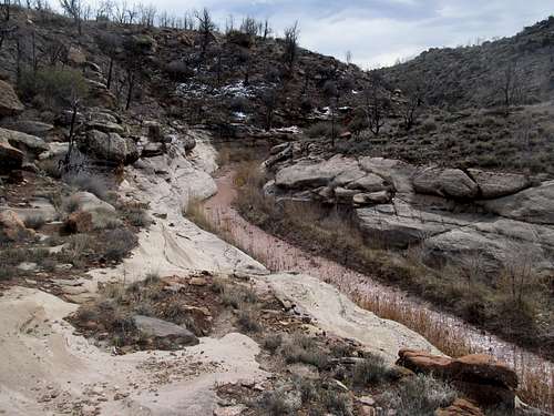
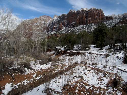
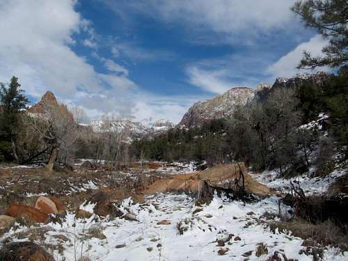
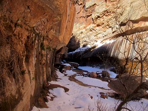
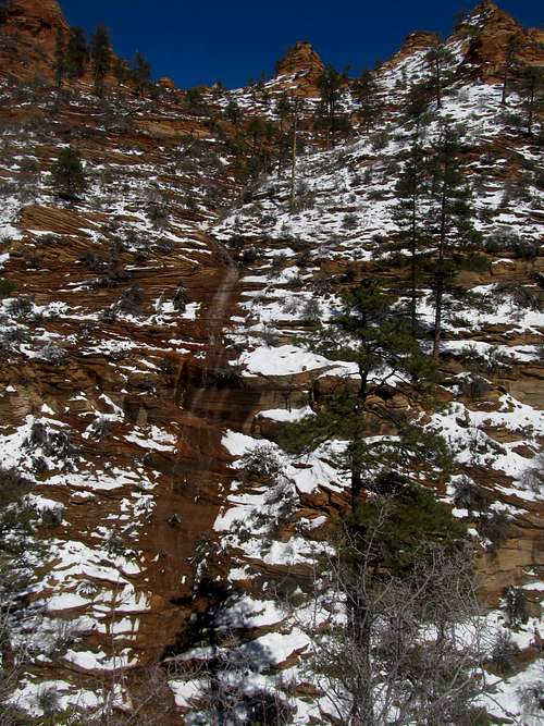
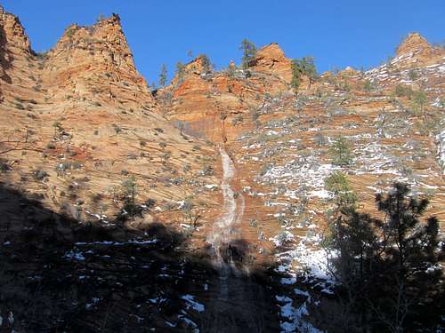
The wash got narrower past the junction and the snow cover a little heavier, making for a fascinating scene of snow cover over the red dirt. The trail was pretty easy to follow, but with temperatures dropping and my hip and leg pain flaring up again, I was getting anxious to get the hell out of dodge.
My goal was to reach the official terminus of the trail, some oil wells on the right bank, but I never saw them. After a few miles I decided enough was enough, and turned back. I didn’t notice them on the way back either, so I figure I either stopped a little short of them, or just never saw them (perhaps they were camouflaged by the snow cover).
Tired and eager to return to civilization, I backtracked my way through the wash without too much difficulty and as mentioned before, found the right trail leading back to the trailhead. I pulled into St. George and found a nice cheapo motel. Greg had finished his run, and after they rested up and got ready we grabbed dinner in town. Greg planned to show his parents Water Canyon near Hilsdale (of polygamy fame) at the base of Canaan Mountain the next day. I still was undecided; I really wanted to get a peak, and Virgin would have worked nicely, but with my lingering leg and hip pain, surprisingly bad after what seemed like an easy and undemanding hike, along with the precipitation that the entire area had gotten and would continue to get through the night, all helped me shirk away from a more strenuous peak climb half out of laziness and half out of apprehension.
Water on Fire and Ice - March 10th, 2013
I dilly-dallied around the next morning, sleeping in, checking snow coverage, and just being a wuss in general. The surrounding peaks were indeed snow covered, from Bangs in Arizona to West Mountain southwest of town, and I decided that my muscles hadn’t recovered enough subject myself to a long day of elevation gain. I eventually decided to join the others on a trip to Water Canyon. Summitting Canaan was out of the question; the plan was a simple hike up the canyon for Greg’s parents and Kadee. After that, we figured if time and allowance for laziness allowed, Greg and I could ascend the rest Water Canyon, perhaps check out the White Knobs, then loop back around for an easy descent down neighboring Squirrel Canyon. Just an easy canyon hike up a popular trail…what could go wrong?
We didn’t leave St. George until late morning, and as we approached Hilsdale we noticed significant snow atop Canaan. It had really stormed out here Saturday, the consequences of which we were immediately faced with when we realized that all the roads leading to the trailhead were so muddy they were for all intents and porpoises undriveable, even if you had 4WD, but especially so for my Camry and Greg’s parents’ rental sedan. Just getting to the trailhead was pure torcher as we slopped through the slippery, soft, and often ankle deep clay like mud one tortuous step at a time, trying our best not to sink and be lost to the world forever (and not to mention we had to worry about avoiding the polygamous crazies from the nearby towns…none of us wanted to be part of some hillbilly’s harem). I felt especially bad for Greg’s parents, but apparently they were used to being subject to such “adventures” on their trips down to Utah.
We finally reached the reservoir and the trailhead (and were greeted to the odd sight of a jeep parked VERY steeply 30 feet or so up a hillside and surrounded by the snow), and proceeded up the trail. Once on it the going got easier, with only the occasionally slippery spot as the trail climbed through some light snow cover past Water Canyon Arch atop the surrounding canyon wall and into a beautiful little alcove with a small waterfall and a crystal clear and cold shallow pool. We all stopped, admired the scenery, took pictures, and were happy with our destination at the end of what was already a slog of a day (literally).
Except Greg was still feeling adventurous. He wanted to keep going up the canyon and possibly try our planned circuit around to Squirrel Canyon, which he hadn’t yet explored before(he and Kadee had already ascended Canaan’s summit years ago). I talked myself in and out and back in of whether or not to tag along. First off though, an ice covered boulder at the end of the alcove hindered progress through the only feasible squeeze up into the Canyon but as we deliberated, myself, Greg, and Greg’s dad all haphazardly chipped away at the layers of ice until it was barely climbable. For Greg at least; I needed his help to drag me up the damn thing. But did I really want to do this? Ultimately FOMO won out, and I found myself begrudgingly following Greg as we made our way up through the narrows and up the canyon.
I can barely describe the rest of the trip, as it was a mixture of sheer terror and sheer amazement. In the summer the trail up Water Canyon is pretty basic, if a little exposed. In winter, for me at least, after a recent dusting had dumped half a foot or more of snow onto the plateau, it was downright terrifying. The entire trail to the plateau rim follows (or in the winter, seemingly and inconceivably forces its way up) small, narrow and exposed ledges lining the left side of the canyon. With snow and ice cover, I just prayed not to slip fall and die.
Plus it was impossible for mere mortals to know where the trail was under all the snow cover, but Greg vaguely remembered the route from his last time up and, along with his mountain spidey senses (such as seeing cut branches indicating a trailside tree), managed to lead the way up.
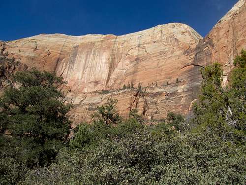
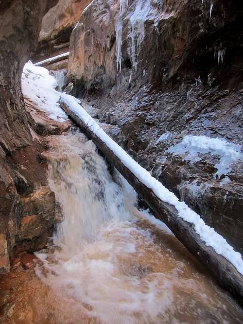
The views that the canyon opened up to were indescribable, fiery shades of orange and yellow hues, slickrock knobs, covered in snow and several impromptu torrential waterfalls plunging down the sheer slickrock cliffs.
It was as surreal and spectacular a scene I had ever seen, and fleeting too, as these waterfalls lasted only until all the snows melted.
I stood in awe as we reached our turnaround point a little ways past where we reached the plateau rim.
Our progress through the snowed in ledges had been pretty slow, both the White Knobs and Squirrel Canyon looked to be very far away, it was already getting very late in the day, and the snow covered slickrock seemed a little too dangerous even to Greg. So we had to backtrack.
Back down those awful ledges with their steep drop-offs and often dangerous and exposed downclimbs over slippery and icy rock.
I was a little more than half convinced that I wasn’t going to make it out alive. And boy did I want to make it out alive. I was flying to New York City the next weekend! Friends! Drinking! Food! Shopping! St. Patty’s Day! Tickets to watch ‘Cuse and Georgetown face off at Madison Square Garden in the last ever legendary Big East Tournament Semifinals (oh, and since one ticket gets you in for both games we'd be watching the matchup between Notre Dame and the eventually national champion Louisville immediately after the ‘Cuse game too!). And sadly, I was gonna have none of that because I was doomed to fall to a painful and icy death down a canyon in polygamy country. Instead of 5th Avenue, the Upper East Side, and the NYC nightlife I’d be lucky if my skull was eventually recovered and ended up as a lucky charm for some dude’s 10th wife.
Fortunately, my imagination proved worse than reality, and we managed to carefully make our way safely ledge by ledge down the canyon, back to the alcove, and back down the muddy road (which had dried out a little) and back to our cars, where Kadee and Greg’s parents were still working hard to wipe that nefarious mud off their socks, boots, and clothes.
We bid adieu to Southern Utah, grabbed one final meal at a Chili’s in Cedar City, and drove through the dark back to SLC. Greg’s parents made it back to Vermont intact (and likely took some of that Utah mud with them), I made it to Manhattan with my nightmares of being stalked by toothless polygamists a distant memory, and had a great long weekend. And in hindsight, glad that I had made the journey up Water Canyon, and lucky to have had the once-in-a-lifetime fiery rawness of the desert fight its short but intense and timeless battles against the icy and corrosive forces of a winter storm.
Goodbye winter, and farewell forever ye fond Big East Tournament.


Comments
Post a Comment