
-
 66296 Hits
-
 99.61% Score
-
 122 Votes
|
|
Area/Range |
|---|---|
|
|
37.21090°N / 113.019°W |
|
|
Hiking, Trad Climbing, Bouldering, Aid Climbing, Big Wall, Scrambling, Canyoneering |
|
|
Spring, Summer, Fall, Winter |
|
|
Overview
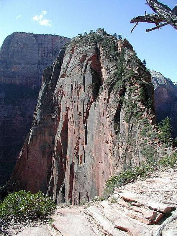
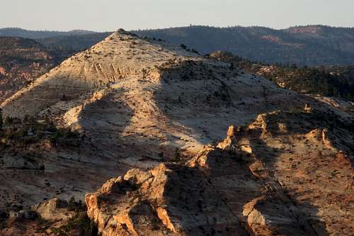
East Temple
Yellowstone. Yosemite. Grand Canyon. Glacier. Grand Teton.
When people talk about the crown jewels of the national parks system in the United States, those names invariably end up on most lists.
And Zion is another of them. Its canyons, walls, pinnacles, and amazing sandstone shapes and patterns all come together to forge one unforgettable and inspiring landscape.
Italicized text is by the original page owner, cp0915--
Undeniably one of the most beautiful national parks in the United States, southwestern Utah’s Zion National Park is most known among adventurers for two things-- world-class canyoneering and awesome big wall climbing.
Other than the Zion classic Angels Landing, peakbagging in Zion has never really taken off. Maybe it’s the understandable distraction of all the unbelievable scenery in the park that pulls people away from the presumably unclimbable peaks above them; perhaps it’s those peaks’ typically chossy rock that steers people away; perhaps it’s what was once an unfortunate lack of route beta to be found out there; or perhaps it’s the atrocious nature of many of the approaches…long and bushwhacky; or the technical nature of some of the approaches…sketchy climbing on bad rock, multiple rappels from natural anchors of questionable fortitude, and whatnot. Who knows?
For these, and perhaps other, reasons, a number of peaks in Zion National Park have no documented ascents. This peak didn’t see its first ascent until 2001.
Not exactly a park full of peak-gimmes, most of Zion's peaks require considerable effort, a lot of nerve, and/or some extraordinary route-finding.
The next several sections focus on the peaks, climbing, and canyoneering in the park. Listed with the peaks are routes that are the easiest or are otherwise recommended (or both). If you are looking to read about the natural and human history of Zion, this is not the page for it; the focus is on the climbing!
![Pine Valley Peak and Cave Knoll]() Cave KnollWest Ridge-- Class 3
Cave KnollWest Ridge-- Class 3
![West Face]() East Northgate PeakNorth Slopes-- Class 2
East Northgate PeakNorth Slopes-- Class 2
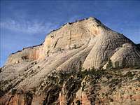
![Snow covered slabs leading to...]() North Guardian Angel-- East Ridge-- Class 4
North Guardian Angel-- East Ridge-- Class 4
![Pine Valley Peak, 5.5]() Pine Valley Peak-- East-North Face-- 5.5
Pine Valley Peak-- East-North Face-- 5.5
![South Guardian Angel and the NE Ridge]() South Guardian Angel-- Northeast Ridge-- Class 3
South Guardian Angel-- Northeast Ridge-- Class 3
![Tabernacle Dome]() Tabernacle Dome-- Northwest Ridge-- 5.2-5.4
Tabernacle Dome-- Northwest Ridge-- 5.2-5.4
![Pine Valley Peak and West Northgate Peak]() West Northgate Peak-- East Face-- Class 3
West Northgate Peak-- East Face-- Class 3
![Angels Landing from Scout...]() Angels Landing-- NPS Trail (Class 3), Prodigal Son (IV, 5.8), Ball and Chain (VI, 5.10a, A2+)
Angels Landing-- NPS Trail (Class 3), Prodigal Son (IV, 5.8), Ball and Chain (VI, 5.10a, A2+)
![Bridge Mountain]() Bridge Mountain-- Exposed, complicated Class 4 route from the east via Gifford Canyon
Bridge Mountain-- Exposed, complicated Class 4 route from the east via Gifford Canyon
![Cable Mountain]() Cable Mountain-- Many Pools (Class 3+), Echo Canyon (Class 1), East Entrance (Class 1)
Cable Mountain-- Many Pools (Class 3+), Echo Canyon (Class 1), East Entrance (Class 1)
![Coke Explosion, 5.10]() Cathedral Mountain-- Voodoo Rooves (5.10+), Coke Explosion (5.10)
Cathedral Mountain-- Voodoo Rooves (5.10+), Coke Explosion (5.10)
![Point 6921 ft, East Face]() Deertrap Mountain-- East Entrance, Class 1
Deertrap Mountain-- East Entrance, Class 1
![The Great White Throne]() The Great White Throne-- South Face Diagonal (III, 5.8, A0)
The Great White Throne-- South Face Diagonal (III, 5.8, A0)
![South Face of Mt. Kinesava]() Mount Kinesava-- East Face (Class 4), Cowboy Ridge (III, 5.7)
Mount Kinesava-- East Face (Class 4), Cowboy Ridge (III, 5.7)
![Lady Mtn. (the high,...]() Lady Mountain-- South Cliffs (5.7), Chimney Sweep (5.10)
Lady Mountain-- South Cliffs (5.7), Chimney Sweep (5.10)
![Observation Point and it s...]() Observation BM-- Weeping Rock or East Mesa Trailhead-- Class 1+
Observation BM-- Weeping Rock or East Mesa Trailhead-- Class 1+
![The Organ]() The Organ-- SE Chimney, 5.6
The Organ-- SE Chimney, 5.6
![Iron Messiah, III, 5.10c]() The Spearhead-- Iron Messiah (III, 5.10c)
The Spearhead-- Iron Messiah (III, 5.10c)
![Mount Spry]() Mount Spry-- Holy Roller (5.11), Shark Tooth Freighter (5.10)
Mount Spry-- Holy Roller (5.11), Shark Tooth Freighter (5.10)
![The Three Marys]() Three Marys-- Scramble to Middle and Right Marys (5.2-5.4)
Three Marys-- Scramble to Middle and Right Marys (5.2-5.4)
![The Watchman]() The Watchman-- West Face-- Class 4 (with major route-finding issues, fantastic scenery)
The Watchman-- West Face-- Class 4 (with major route-finding issues, fantastic scenery)
![West Temple, III, 5.8]() West Temple-- Southwest Ridge, 5.8
West Temple-- Southwest Ridge, 5.8
![Aires Butte]() "Aires Butte"-- SE Face-- 5.6
"Aires Butte"-- SE Face-- 5.6
![Ant Hill-- South Buttress]() Ant Hill-- South Buttress-- Class 4
Ant Hill-- South Buttress-- Class 4
![Checkerboard Mesa]() Checkerboard Mesa-- East Side-- Class 3
Checkerboard Mesa-- East Side-- Class 3
![Destination Peak]() "Destination Peak"-- Via Gifford Canyon-- Class 4
"Destination Peak"-- Via Gifford Canyon-- Class 4
![Jenny Peak]() Jenny Peak-- North Ridge and Slopes-- Class 4
Jenny Peak-- North Ridge and Slopes-- Class 4
![6460 'Lost Peak' - Zion NP]() "Lost Peak"-- Clear Creek-- Class 3
"Lost Peak"-- Clear Creek-- Class 3
![Nippletop]() Nippletop-- North Ridge-- Class 3
Nippletop-- North Ridge-- Class 3
![Summit of Progeny Peak]() Progeny Peak-- Southwest Slopes-- Class 3
Progeny Peak-- Southwest Slopes-- Class 3
![Red Jenny and North Jenny]() Red Jenny-- NW Ridge (5.8), NE Ridge (5.4), East Slopes (Class 4)
Red Jenny-- NW Ridge (5.8), NE Ridge (5.4), East Slopes (Class 4)
![South Ariel Peak and Aires Butte, Dawn]() "South Ariel Peak"-- South Face-- Class 2-3; Southeast Face-- Class 4
"South Ariel Peak"-- South Face-- Class 2-3; Southeast Face-- Class 4
![The Triplets]() The Triplets-- Traverse-- Class 4
The Triplets-- Traverse-- Class 4
![Canaan Mountain]() Canaan Mountain-- Water Canyon-- Class 2
Canaan Mountain-- Water Canyon-- Class 2
![Cliff Bands Above]() Clear Creek Mountain-- Birch Hollow Drainage-- Class 2
Clear Creek Mountain-- Birch Hollow Drainage-- Class 2
![Lambs Knoll]() Lambs Knoll-- Northeast Face-- Class 3
Lambs Knoll-- Northeast Face-- Class 3
A mere sampling of some of the fine canyoneering adventures available in the park follows. Permits are required for all those listed except for the Hidden Canyon route linked below. Canyon ratings are in parentheses.
-Separation Canyon (1AII)
-Zion Narrows (1BIV)
-Hidden Canyon (2A R II)
-Behunin Canyon (3AIII) - trip report
-Spry Canyon (3AIII) (photo)
-Keyhole Canyon (3BII) (photo)
-Middle Echo (3BII)
-Pine Creek (3BII) (photo)
-Mystery Canyon (3BIII) (photo)
-The Subway (3BIII) (photo)
-Orderville Canyon (3BIV)
-Englestead Canyon (4AIV) (photo)
-Das Boot (4BII) - (photo)
-Imlay Canyon (4B R IV)
-Heaps Canyon (4B R V) (photo)
Canyoneering ratings in a nutshell:
-The first character in the rating, such as the "3" in 3BIII, refers to the technicality of the canyon.
A "1" refers to a non-technical canyon hike. No rope or other technical gear is needed.
A "2" is a basic canyon, wherein one might need to do some scrambling to work through the occasional obstacle. A rope might be useful for assistance with packs, belays, etc. Up-canyon escape options (without fixed ropes) are available.
A "3" is an intermediate-level canyon. There may be actual climbing (and/or downclimbing) and/or rappels involved. A rope will be needed and a retreat upcanyon would necessitate fixed ropes.
A "4" refers to an advanced canyon. Multi-pitch rappels, difficult climbing and/or complex rope work can be expected. Natural anchors may be challenging to establish, and unique canyoneering obstacles, such as keeper potholes and Mae West obstacles, may be present.
-The second character in the rating, such as the "B" in 3BIII, refers to the water volume and current in the canyon.
An "A" means that the canyon is typically dry or contains very little water. Some wading might be needed.
A "B" means that there is water in the canyon. The water should have little or no current. Some swimming can be expected.
A "C" means that there is water in the canyon and it moves swiftly. Expect waterfalls...and expect that wet canyon rope techniques will be needed.
-The third character in the rating, such as the "III" in 3BIII, refers to the grade of the canyon.
A "I" means that the canyon will only take a couple of hours to do.
A "II" means that the canyon should take about half a day to complete.
A "III" means that the canyon can be expected to take most of a day to complete.
A "IV" means that one should expect a long day. A bivy may be required.
A "V" means that the canyon will take about two days to complete.
A "VI" means that the canyon will take two full days (or more) to complete.
Occasionally, a rating will have an "R" or an "X" as well. The "R" means that the canyon is particularly risky. Beginners, even in the presence of solid partners, are not appropriate. An "X" means that the canyon is appropriate for experts only.
Canyoneering, like climbing, is a potentially dangerous activity. Conditions change regularly. Don't bite off more than you can swallow. 'Nuff said.
Refer to Tom Jones' excellent Utah canyoneering site for more info. He's got a Zion canyoneering guidebook out too. Check it out.
![The Streaked Wall, Dawn]() The Streaked Wall
The Streaked Wall
The main entrance is located on Highway 9 at the east end of Springdale, Utah.
The park’s east entrance can be found about 10 miles west of Mt. Carmel Junction, Utah, also off Highway 9.
And the park’s third entrance, lending access to the Kolob Canyons section of the park, is found off Interstate 15 north of St. George, Utah.
Additionally, the Kolob Terrace [Reservoir] Road, found off Highway 9 in the small town of Virgin, gives access to the Kolob Terrace section of the park. You can also reach Kolob Terrace Road from the north from Highway 14 near Cedar City.
Consult the park’s SP mountain pages for specific directions to a peak (or climbing spot) of interest. Or click on one of the park contact links found on most of the mountain pages for more information.
The Peaks + Routes Overview-- Kolob Terrace
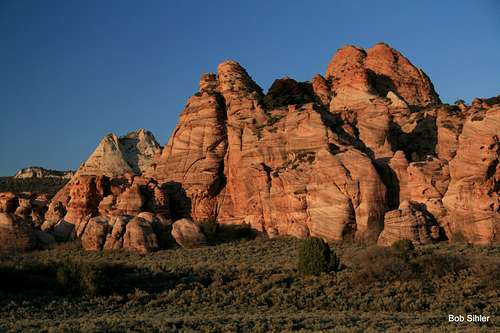
Located some miles west of Zion Canyon and north of Virgin and south of Kolob Reservoir, the Kolob Terrace area holds fantastic scenery; some of the park's best scrambling peaks, including the classic North Guardian Angel and the elusive ultra-classic South Guardian Angel; the world famous semi-technical slot canyon known as the Subway; and, in comparison to Zion Canyon, a feel of being almost deserted. A good deal of private property abuts this section of the park, but there is still a wild, wide-open feel to much of it. Be aware that there are no NPS campgrounds out here except for the one at Lava Point, which is several miles north of the best peaks and trails of the Kolob Terrace area. However, there is some BLM land adjacent to the park out here, and one can camp there for free and with few restrictions.Spring and fall travelers-- be aware that the Kolob Terrace area is significantly higher than the Zion Canyon area. Be prepared for temperatures to be at least 10 degrees (F) cooler.
 Cave KnollWest Ridge-- Class 3
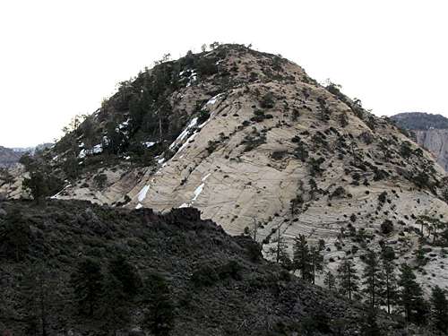 East Northgate PeakNorth Slopes-- Class 2
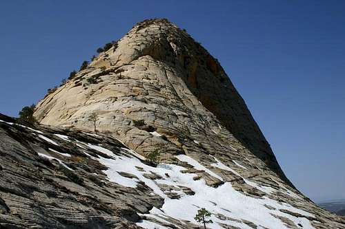 North Guardian Angel-- East Ridge-- Class 4
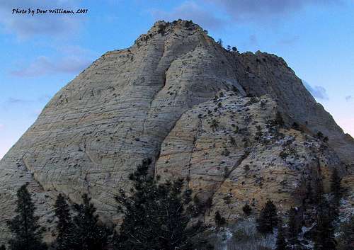 Pine Valley Peak-- East-North Face-- 5.5
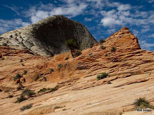 South Guardian Angel-- Northeast Ridge-- Class 3
 Tabernacle Dome-- Northwest Ridge-- 5.2-5.4
 West Northgate Peak-- East Face-- Class 3
In and Near Zion Canyon
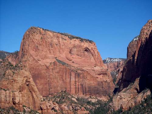
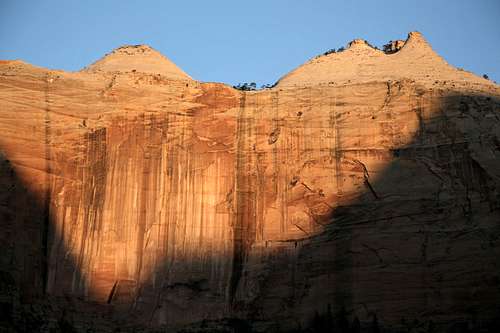
Zion Canyon-- even if you're a world-class climber who's seen it all or someone who's been into the canyon a hundred times or a first-time visitor, it is impossible not to be awed by this spectacle.
Sheer cliffs and spires rise, in some cases, more than 3000' above the canyon floor, rivaling the great walls of Yosemite Valley. In the spring and after heavy rains, ephemeral falls pour from the heights, sometimes transforming into misty wisps short of pounding onto the ground below. The Virgin River, emerging from one of the most famous stretches of narrows in the world, winds its way through cottonwood groves that create a nigh-unbelievable contrast against the red cliffs all around. In autumn, those cottonwoods turn a burning gold that defies belief. This is the desert?
Although it can seem incredibly crowded, don't let Zion Canyon even in the busiest times turn you away. As is always the case, a sense of adventure or some good route beta will remove you from the hordes and transport you to what the canyon's namers saw in it-- Heaven, or Zion.
 Angels Landing-- NPS Trail (Class 3), Prodigal Son (IV, 5.8), Ball and Chain (VI, 5.10a, A2+)
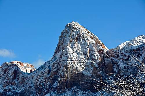 Bridge Mountain-- Exposed, complicated Class 4 route from the east via Gifford Canyon
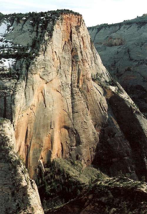 Cable Mountain-- Many Pools (Class 3+), Echo Canyon (Class 1), East Entrance (Class 1)
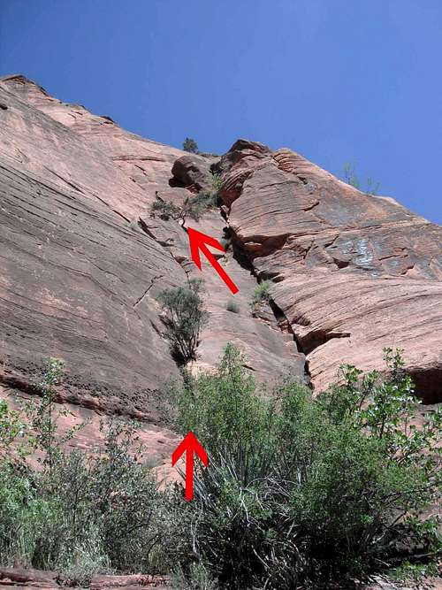 Cathedral Mountain-- Voodoo Rooves (5.10+), Coke Explosion (5.10)
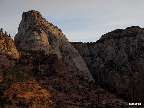 Deertrap Mountain-- East Entrance, Class 1
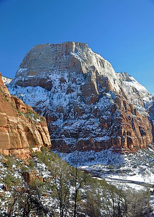 The Great White Throne-- South Face Diagonal (III, 5.8, A0)
 Mount Kinesava-- East Face (Class 4), Cowboy Ridge (III, 5.7)
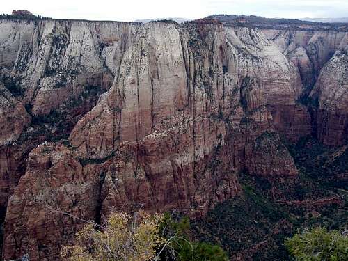 Lady Mountain-- South Cliffs (5.7), Chimney Sweep (5.10)
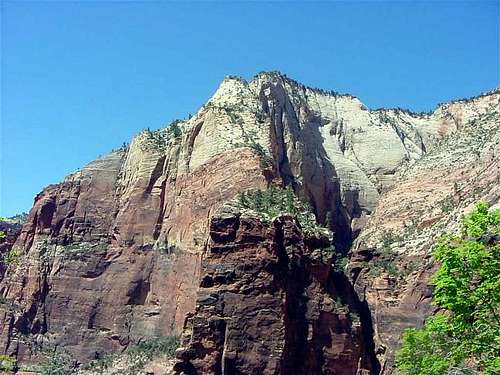 Observation BM-- Weeping Rock or East Mesa Trailhead-- Class 1+
 The Organ-- SE Chimney, 5.6
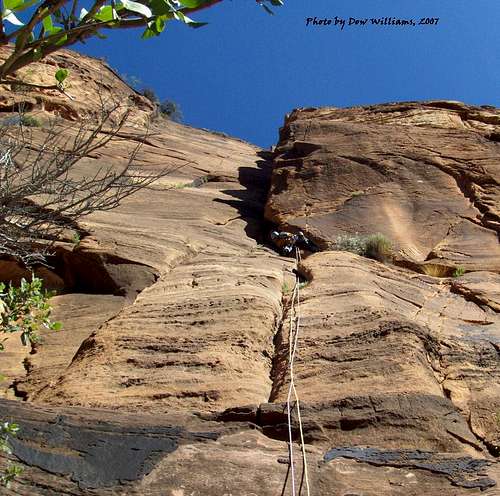 The Spearhead-- Iron Messiah (III, 5.10c)
 Mount Spry-- Holy Roller (5.11), Shark Tooth Freighter (5.10)
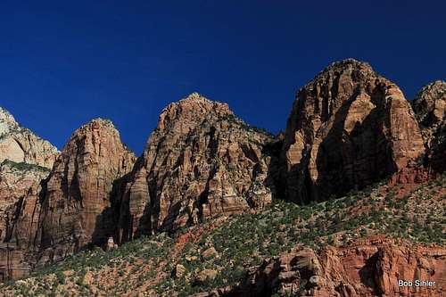 Three Marys-- Scramble to Middle and Right Marys (5.2-5.4)
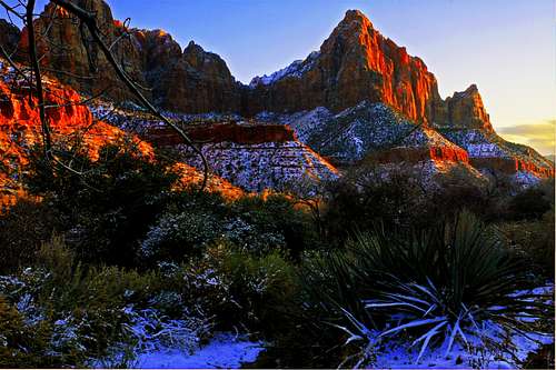 The Watchman-- West Face-- Class 4 (with major route-finding issues, fantastic scenery)
 West Temple-- Southwest Ridge, 5.8
East Side
Because only one peak east of the Zion-Mt. Carmel tunnel and not considered part of the Zion Canyon group-- Checkerboard Mesa-- has a name on USGS maps, and because there are only two officially maintained trails originating out there-- Tunnel Overlook and East Rim-- the east side is Zion's flyover country, so to speak; the majority of visitors are people on their way to or from Zion Canyon, and they do little more but stop and wander a few yards from the roadside to take some pictures. Thus, the east side, with its many unnamed peaks and its numerous washes and canyons, is a haven for scramblers and explorers who delight in isolation and secret wonders. In addition to all the peaks, there are several small slot canyons of varying difficulty levels, including Keyhole Canyon, a dark, very narrow technical slot. The Pine Creek slot also begins on the east side although it ends west of the tunnel.
 "Aires Butte"-- SE Face-- 5.6
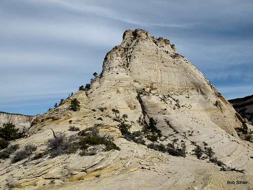 Ant Hill-- South Buttress-- Class 4
 Checkerboard Mesa-- East Side-- Class 3
 "Destination Peak"-- Via Gifford Canyon-- Class 4
 Jenny Peak-- North Ridge and Slopes-- Class 4
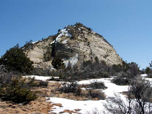 "Lost Peak"-- Clear Creek-- Class 3
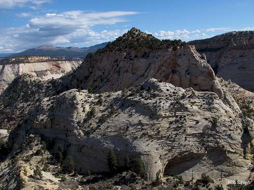 Nippletop-- North Ridge-- Class 3
 Progeny Peak-- Southwest Slopes-- Class 3
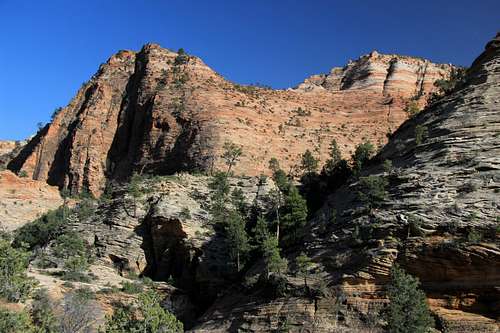 Red Jenny-- NW Ridge (5.8), NE Ridge (5.4), East Slopes (Class 4)
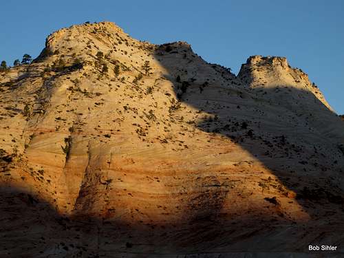 "South Ariel Peak"-- South Face-- Class 2-3; Southeast Face-- Class 4
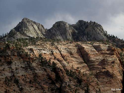 The Triplets-- Traverse-- Class 4
Kolob Canyons
The Kolob Canyons area, accessed from I-15 north of where people exit to get to Springdale and Zion Canyon, is a relatively little-known area that has some very nice hikes but does not see a lot of climbing activity despite the fact that Zion's highest peak, Horse Pasture Mountain, is located there. Horse Pasture Mountain is a 12-mile undertaking with Class 3 scrambling and very tedious brush near the summit.
Just Outside the Park
Around the borders of Zion are numerous peaks ranging from walk-ups to multi-pitch climbs. Many of these peaks are very "Zionesque" in character, and most do not attract much activity even though some of them are just as spectacular as most Zion peaks are. Almost all of these peaks are on BLM land or are in federally designated wilderness areas. Several are easy to access from the Kolob Terrace Road.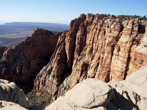 Canaan Mountain-- Water Canyon-- Class 2
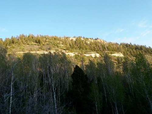 Clear Creek Mountain-- Birch Hollow Drainage-- Class 2
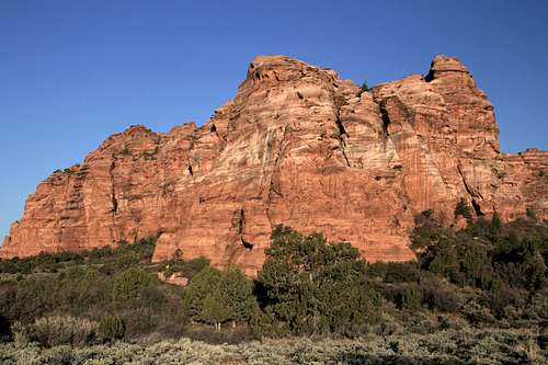 Lambs Knoll-- Northeast Face-- Class 3
Canyons
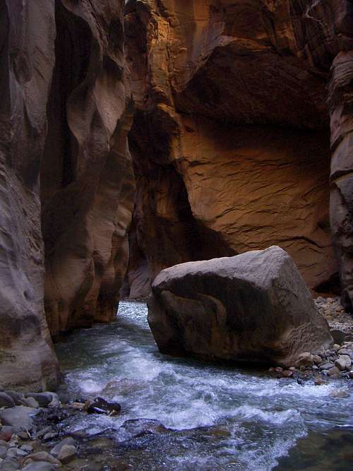
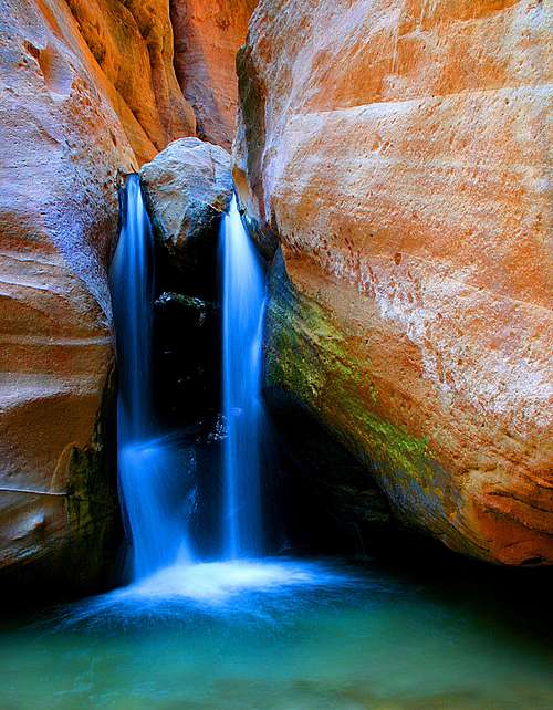
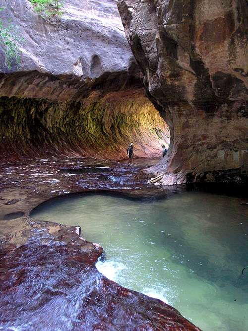
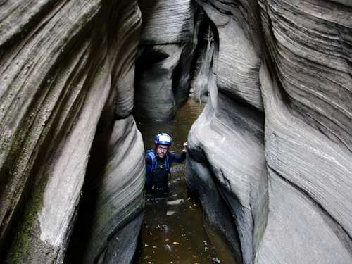
From “walk-thru” canyoneering classics like the world-famous Virgin River Narrows (aka – Zion Narrows or “The Narrows”), to semi-technical classics like The Subway (Left Fork of North Creek), and yet still to technical canyoneering epic-builders like Heaps Canyon, Zion canyoneering (click on the link for further, and highly informative, reading) has certainly found its way onto the adventurer's map.A mere sampling of some of the fine canyoneering adventures available in the park follows. Permits are required for all those listed except for the Hidden Canyon route linked below. Canyon ratings are in parentheses.
-Separation Canyon (1AII)
-Zion Narrows (1BIV)
-Hidden Canyon (2A R II)
-Behunin Canyon (3AIII) - trip report
-Spry Canyon (3AIII) (photo)
-Keyhole Canyon (3BII) (photo)
-Middle Echo (3BII)
-Pine Creek (3BII) (photo)
-Mystery Canyon (3BIII) (photo)
-The Subway (3BIII) (photo)
-Orderville Canyon (3BIV)
-Englestead Canyon (4AIV) (photo)
-Das Boot (4BII) - (photo)
-Imlay Canyon (4B R IV)
-Heaps Canyon (4B R V) (photo)
Canyoneering ratings in a nutshell:
-The first character in the rating, such as the "3" in 3BIII, refers to the technicality of the canyon.
A "1" refers to a non-technical canyon hike. No rope or other technical gear is needed.
A "2" is a basic canyon, wherein one might need to do some scrambling to work through the occasional obstacle. A rope might be useful for assistance with packs, belays, etc. Up-canyon escape options (without fixed ropes) are available.
A "3" is an intermediate-level canyon. There may be actual climbing (and/or downclimbing) and/or rappels involved. A rope will be needed and a retreat upcanyon would necessitate fixed ropes.
A "4" refers to an advanced canyon. Multi-pitch rappels, difficult climbing and/or complex rope work can be expected. Natural anchors may be challenging to establish, and unique canyoneering obstacles, such as keeper potholes and Mae West obstacles, may be present.
-The second character in the rating, such as the "B" in 3BIII, refers to the water volume and current in the canyon.
An "A" means that the canyon is typically dry or contains very little water. Some wading might be needed.
A "B" means that there is water in the canyon. The water should have little or no current. Some swimming can be expected.
A "C" means that there is water in the canyon and it moves swiftly. Expect waterfalls...and expect that wet canyon rope techniques will be needed.
-The third character in the rating, such as the "III" in 3BIII, refers to the grade of the canyon.
A "I" means that the canyon will only take a couple of hours to do.
A "II" means that the canyon should take about half a day to complete.
A "III" means that the canyon can be expected to take most of a day to complete.
A "IV" means that one should expect a long day. A bivy may be required.
A "V" means that the canyon will take about two days to complete.
A "VI" means that the canyon will take two full days (or more) to complete.
Occasionally, a rating will have an "R" or an "X" as well. The "R" means that the canyon is particularly risky. Beginners, even in the presence of solid partners, are not appropriate. An "X" means that the canyon is appropriate for experts only.
Canyoneering, like climbing, is a potentially dangerous activity. Conditions change regularly. Don't bite off more than you can swallow. 'Nuff said.
Refer to Tom Jones' excellent Utah canyoneering site for more info. He's got a Zion canyoneering guidebook out too. Check it out.
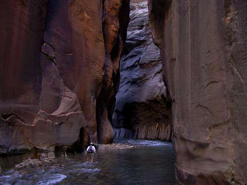 Virgin River Narrows Virgin River Narrows |
 Virgin River Narrows Virgin River Narrows |
 Orderville Canyon Orderville Canyon |
 The Subway The Subway |
 Imlay Canyon Imlay Canyon |
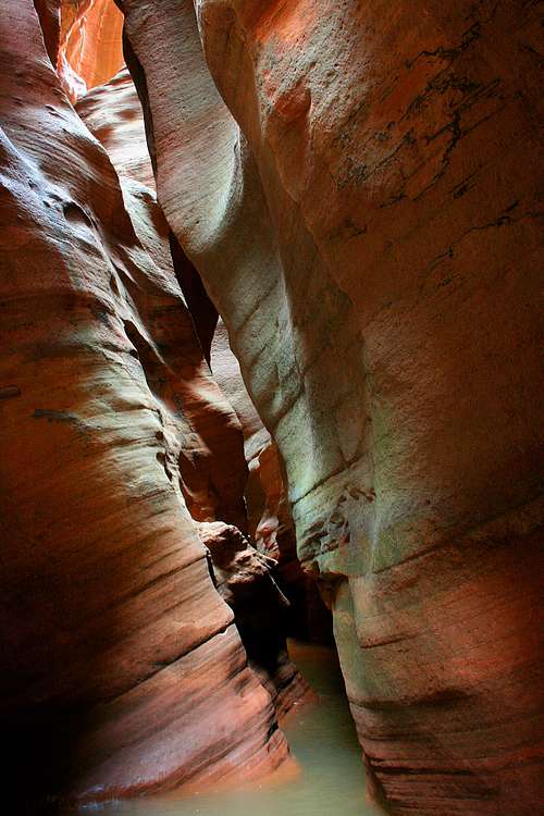 Pine Creek Slot Pine Creek Slot |
Big Walls and Climbing Spots (Short Routes)
In the American West, only Yosemite is more prized as a destination for big-wall climbers. In 1967, Fred Beckey and company completed the park’s first big wall ascent. They climbed the northwest face of The Great White Throne. Since then, big wall climbing in Zion has only grown more popular. On fall days, it’s quite common to see the tiny dots of wall climbers making their slow way up any number of the park’s monstrous sandstone faces.
Additionally, Zion has an abundance of other climbing spots, many of them roadside locations.
Extensive information is available on sites like MountainProject and SuperTopo, but quite a bit of beta is right here on SP through this page on Zion free routes.
 The Streaked Wall
Getting There
Zion National Park has three entrance stations:The main entrance is located on Highway 9 at the east end of Springdale, Utah.
The park’s east entrance can be found about 10 miles west of Mt. Carmel Junction, Utah, also off Highway 9.
And the park’s third entrance, lending access to the Kolob Canyons section of the park, is found off Interstate 15 north of St. George, Utah.
Additionally, the Kolob Terrace [Reservoir] Road, found off Highway 9 in the small town of Virgin, gives access to the Kolob Terrace section of the park. You can also reach Kolob Terrace Road from the north from Highway 14 near Cedar City.
Consult the park’s SP mountain pages for specific directions to a peak (or climbing spot) of interest. Or click on one of the park contact links found on most of the mountain pages for more information.
Red Tape
As of 2021, the fee per vehicle, good for a week, was $35. Annual and interagency passes are available as well.
For much of the year, access to Zion Canyon is by foot or shuttle bus only except for Zion Lodge guests (who are only permitted to drive to and from the lodge, with no stops).
For details about park regulations, see the NPS page for the park.
Camping and Lodging
The park has two campgrounds in Zion Canyon. One of them has reserveable sites.
The Zion Lodge is inside Zion Canyon.
Seasons
Zion is great all year long, but spring and fall are the best. Summer can be very hot, so climbing is better when done on shorter routes early in the morning. It is the best time of year for exploring slot canyons, but one has to be wary of flash floods resulting from thunderstorms.