
-
 9569 Hits
-
 93.81% Score
-
 44 Votes
|
|
Mountain/Rock |
|---|---|
|
|
44.15860°N / 114.6755°W |
|
|
Custer |
|
|
Hiking, Scrambling |
|
|
Summer, Fall |
|
|
10271 ft / 3131 m |
|
|
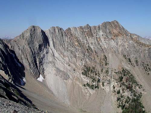 Northeast Face
Overview
In the northern part of central Idaho’s White Cloud Mountains, there are a group of ten peaks that do not have official names. Only number designators identify these particular “White Cloud Peaks”. White Cloud Peak #2 (WCP-2) is the northwestern-most peak in this grouping. Most of the peaks are not often visited, and a couple (this one included) have probably only seen a handful of ascents. The area has very few trails, and the fact that WCP-2 is located further from a trail than any other WCP’s is the main reason for the lack of summit visitors. The peak has a couple of non-technical route options, but it takes some creativity to reach them.With an elevation of 10271’, WPC-2 is the shortest of the four corner-post peaks that surround the remote and trailess Swimm Lake. The peak is the highpoint of the narrow ridge that extends west from White Cloud Peak #3 and then fades into the Warm Springs Creek drainage, which empties into the Salmon River at Robinson Bar. Having a clean prominence of only 471’ from WCP-3, WCP-2 lacks the classic pyramidal “peak-like” shape when viewed from most angles. Nonetheless, it is still very attractive mountain, mainly due the variety of rock color found on its slopes. The most striking feature of the mountain is the distinctive vertical ribbons of color on the peak’s south face. Many colors are represented on the slopes including white, dark gray, caramel, and dark brown.
  |
Getting There
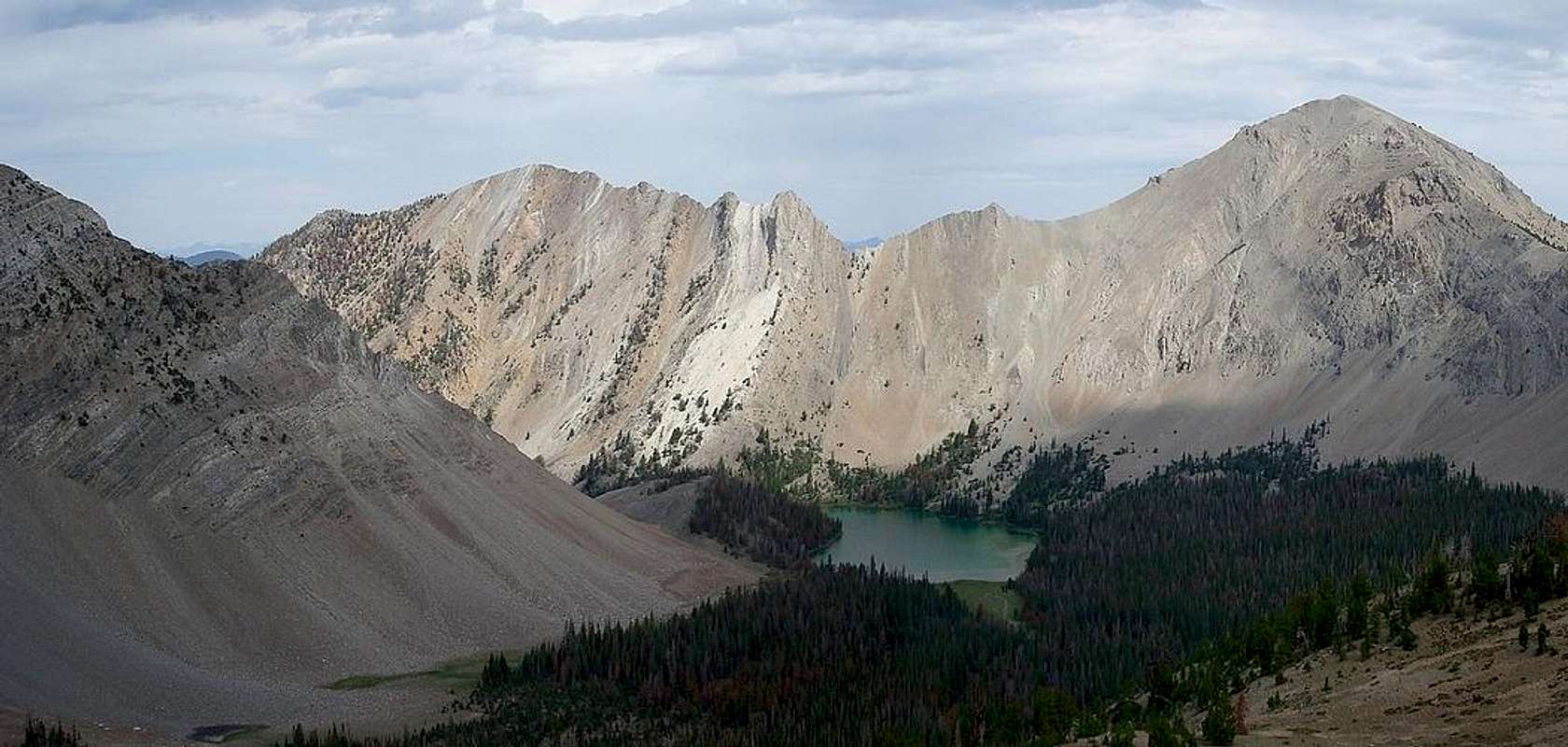
 Looking back on Swimm Lake
The routes most likely to be used to reach WCP-2 begin at the Slate Creek trailhead in the Northern White Clouds. To get there, find your way to the beautiful mountain town of Stanley, and then go northeast on Highway 75 for about 24 miles (or 34 miles southwest from Challis). Just after the highway crosses the Salmon River, look for a turnoff to the right (south) for Slate Creek. Follow the dirt road for 0.8 miles until you reach a fork. Take the left branch and follow the Slate Creek Road (FS666) until it ends at around 7 miles from where it leaves the highway.
At the trailhead you’ll find the Slate Creek Hot Springs to soak your feet, but be prepared for the strong rotten egg aroma from all the sulfur in the water. There are also some old mine buildings nearby that you should stay away from, as well as big mounds of silty mine tailings.
The only route that can get you to WCP-2 and back in a single day involves following the trail past the hot-springs to Hoodoo Lake, then heading cross country up and over WCP-3, before reaching WCP-2 via the “east ridge indirect” route. The total round trip is about 10 miles and 5200’of elevation gain. An alternate option would be to climb the south face of the peak from Swimm Lake, but that would likely involve an overnight stay and some resourcefulness.
Camping
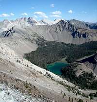
 South face from Swimm Lake.
Setting up camp at the Slate Creek trailhead is a possibility, but there aren't many spots to pitch a tent, and the sulfur smell and mine building might diminish the experience a bit. There are a few dispersed camping areas along Slate Creek Road that are probably better options. The nearest improved camping is at the Holman Creek Campground down on the Salmon River, just off Highway 75. Lodging is also available in Stanley, which is about a 45 minute drive from the trailhead.
If you prefer to backpack in closer to WCP-2, great campsites can be made along the “east ridge indirect” approach. Options include Hoodoo Lake or in the 8900' basin just above Hoodoo Lake. Swimm Lake offers excellent views and solitude, but it is very remote so getting there is quite the undertaking.
Red Tape
 Nearing the summit
No permits, parking passes, or any other kind or red tape to worry about. Just tread lightly and respect the fragile nature of the local ecosystem. Also steer clear of the mine buildings at the trailhead, they may not be structurally sound and they are private property.
When to Climb
The summer climbing season in the White Clouds is typically from July until the snow flies in October. A visit earlier in the year may be feasible, but would require crossing a couple streams swollen by snow run off, and the approach could be longer depending on spring road conditions to the Slate Creek trailhead. As for the winter, not sure why anyone would target this particular peak, but it would be very challenging due to the long approach, and dangerous due to avalanche potential on WCP-2’s steep slopesMountain Conditions
- Sawtooth National Forest - NF Current Conditions.
- NOAA Pinpoint Forecast – Weather.
- Idaho Outdoors Forum – Message board monitored by many local climbers.
Guidebooks
The northern White Clouds are seldom visited, so beta is somewhat limited, but there are actually at least two guidebooks with details on this section of the range
 | Idaho: A Climbing Guide by Tom Lopez – This is far and away the premier mountaineering text for the state, with an entire section devoted to the White Clouds. (But beware of the WCP-2 info.) |
 | Trails of the Sawtooth and White Cloud Mountains by Margaret Fuller – Detailed descriptions of hikes in the White Clouds and neighboring Sawtooths. Includes approach information on how to get to Hoodoo Lake. |