
Comments
No comments posted yet.
|
|
Trip Report |
|---|---|
|
|
Jan 6, 2011 |
This is just a simple log to keep track of our 2011 trips.
See the 2010 Trip Log for 2010.
See the 2009 Trip Log for 2009.
See also the 2008 Trip Log for 2008.
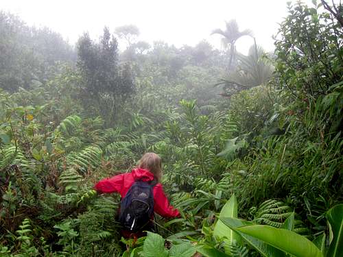
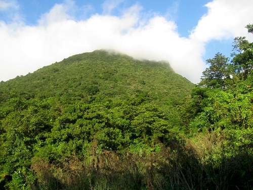
December 31: Morne Trois Piton (Dominica)
Shaylee and I made a climb of Morne Trois Piton today. Trois Piton turned out to be the most difficult mountain we have climbed on our Dominica/Puerto Rico Trip.
From Roseau we were able to find a bus that would drop us off at Pont Casse. From there we walked the highway to the trail and started up the mountain. A family that lives near the trailhead asked us if we were going to the top and gave us some strange looks when we said yes.
The trail going up is very steep, but there are log steps along the way. Unfortunately some of the logs are quite rotten and the trail is somewhat overgrown, so my legs got really scratched and beat up (I was wearing shorts, but Shaylee was wearing long pants).
We kept waiting for the climb to get easier, but it actually got more difficult the higher we climbed. There were many logs to climb over and some rock scrambles as well. Eventually we found ourselves at the summit, but it was a hard won summit to say the least. It was misty and rainy and we didn’t get any views.
The climb down was more difficult than the climb up. The logs were all incredibly slippery and we both had several falls each. We were also plagued by torrential rainfall. When we (finally) got down the mountain, I was guessing that the torrential rainfall would help us get a sympathy ride back to Roseau, but this was not to be. The driver of one car that stopped said “I would give you a ride, but you guys are all wet”. We started walking down the highway and eventually we got a ride back to Roseau in the back of a pickup.
December 30: Morne Bruce (Dominica)
After 10 days of steady hikes and climbs, it was time for an easier day. Today Shaylee and I walked through the botanical gardens at Roseau before climbing Morne Bruce (which is more a hill than a mountain). We walked the trail known as Jack’s walk to the summit. It was some a nice hike and we saw several huge millipedes along the way.
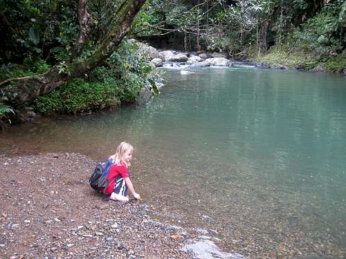
December 29: Titou Gorge/Middleham Falls (Dominica)
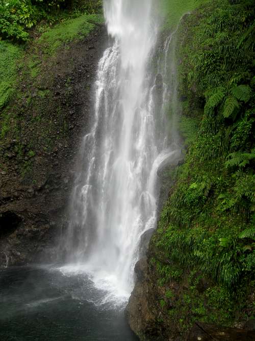
In the morning, Shaylee and I walked to the Rainforest Arial Tram from Roxy’s in Laudat. We wanted to see if Shaylee could do the zipline across the Breakfast Gorge, but they said that she was too young. We then walked to the Titou Gorge to poke around before walking the road all the way to the Middleham Falls Trailhead. We did the hike to the falls and then all the way back to Roxy’s.
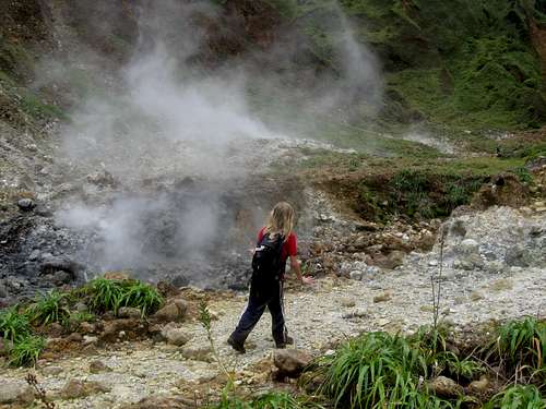
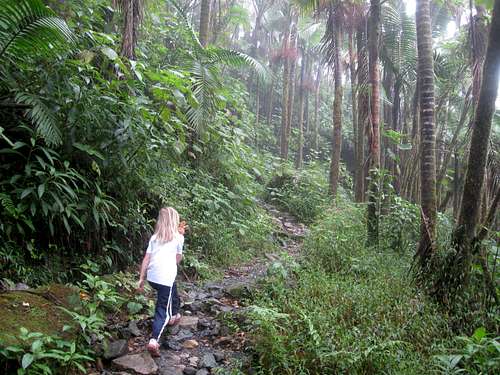
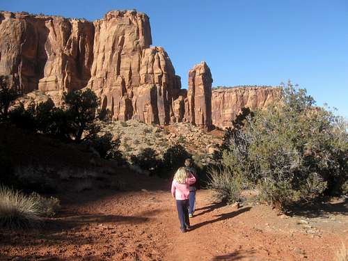
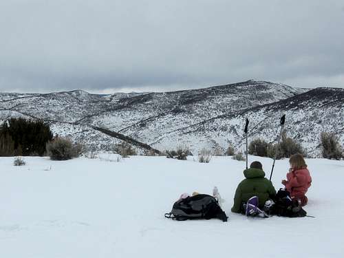
December 28: Morne Nicholls/Valley of Desolation/Boiling Lake (Dominica)
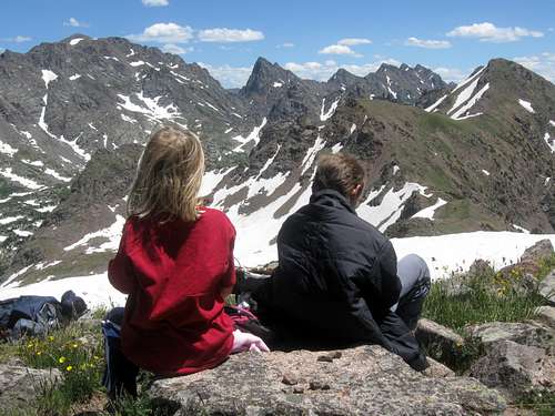
Shaylee and I went for a hike over the top of Morne Nicholls to the Valley of Desolation and Boiling Lake. We started out with two other people who invited us along and who were using a guide, but it was quickly obvious that they were moving rather slowly, so we gave them some money and just went on by ourselves. We passed three other guided groups along the way to Mount Nicholls. We enjoyed the spectacular views from the summit and the weather was great.
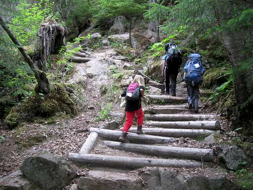
The route to Morne Nicholls and to Boiling Lake is actually well marked and the horror stories about the difficulty of the hike are much exaggerated. The hike is steep in places with some minor scrambling and many stairs, but it only took us 2 hours 31 minutes to reach Boiling Lake (Shaylee is seven years old). The walk through the Valley of Desolation was spectacular. Below the Valley of Desolation were many turquoise colored pools and waterfalls.
At last we found ourselves at the final scramble and we hiked up to Boiling Lake just in time to eat a nice lunch and to watch the lake boil. It was quite a sight to behold.
After hanging out at the Boiling Lake for an hour, we headed back down, meeting the group we started with at the bottom of the last scramble. They had given up and were headed back down. We passed them and rather quickly made our way back up to the top of Morne Nicholls. After passing two more groups we made our way down to the trailhead and then took the long way to Roxy’s so we could stop and buy ice cream at the small store in Laudat. The hike to Morne Nicholls, Valley of Desolation and Boiling Lake was one of the highlights of our trip.
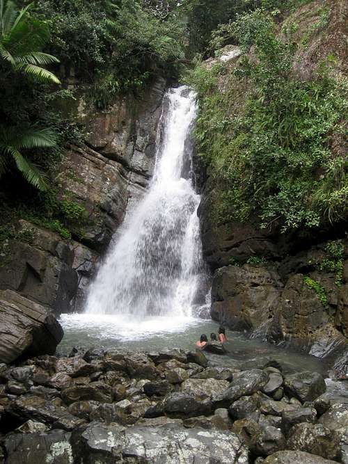
December 27: Lower Titou Gorge to Trafalgar Falls (Dominica)
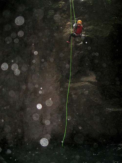
Today Shaylee and I went canyoneering. We walked part way down to Trafalgar before getting a ride to the Trafalgar turnoff where we walked to the canyoning office near Cocoa Cottages. After some practice rappels our group headed off to the gorge near Laudat that is below the more well known Titou Gorge. We rappelled down several waterfalls and swam many crystal clear pools while heading deeper into the gorge. It sure was a spectacular slot canyon. Shaylee had a great time and she got to rappel several times without being lowered.
We exited the canyon just above Trafalgar Falls (which takes very long ropes to negotiate). It was a great canyon and a great day.
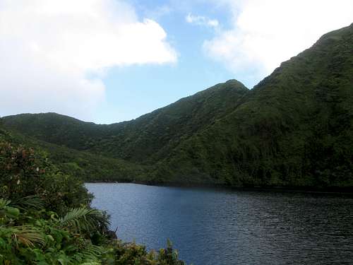
December 26: Boeri Lake/Freshwater Lake/Trafalgar Falls (Dominica)
Shaylee and I had a long, but spectacular day. First we hiked all the way from Laudat to the Boeri Lake Trailhead. After that we made the nice hike up to the scenic Boeri Lake. After resting at the lake and admiring the views and watching the clouds and mist swirl around the nearby peaks, we headed back down to Freshwater Lake. We hiked around the lake and climbed a peak to the SE of the lake. After enjoying the lake we hiked back down the road a short distance where we got a ride to near the Trafalgar turnoff.
After chatting with one of the guides at Extreme Dominica (whom we were to go canyoning with the next day) we got a ride to near the Trafalgar Falls Trailhead. We hiked to the spectacular waterfalls and climbed up to them. After enjoying the two falls we headed back to Trafalgar and started walking to the main highway. We tried in vain to get a ride back up to Laudat so we walked most of the way back to Laudat before finally getting a ride. It was a very spectacular, but long day!
December 25: Lower Micotrin (Dominica)
Today I took a late evening hike up the concrete road towards Freshwater Lake to the lower slopes of Micotrin to orientate myself to the area and to look for the routes up Micotrin (I was just looking for the beginning of the route, not looking to climb the peak yet). It was getting dark and I didn’t find the main route before I had to head back down. After it got dark, there were many jumping glowing bugs all over the ground.
December 24: El Toro/La Coca Trail (Puerto Rico)
Shaylee and I left for a climb of El Toro in Caribbean National Forest near El Yunque. It had rained hard the night before and the trail was extremely muddy. The trail isn’t used that much and there were some big washouts that we had to bushwhack around. Because of all of the deep mud, Shaylee said that she wanted to try another trail. We hiked back to the trailhead and drove to the La Coca Trail, which was the last trail we hadn’t hiked in the El Yunque area.
We found the La Coca Trail to be just as muddy as the trail to El Toro, but we persevered anyway. We hiked down across the river and continued along the muddy trail to a nice waterfall. After enjoying the waterfall we hiked back up the muddy road to the trailhead. After reaching the trailhead we found that the trail was barricaded and closed for “dangerous conditions” (it wasn’t closed when we started the hike). It wasn’t dangerous, but it was extremely muddy.
December 23: Los Picachos/Pico El Yunque/Roca El Yunque/Monte Britton (Puerto Rico)
Shaylee and I climbed all the points in the El Yunque area today. We started out at the Baño de Oro Trailhead and hiked up the mountain up to the turnoff for Los Picachos. We climbed the side track to Los Picachos where enjoyed the views before heading back to the main trail and climbing up to the summit of Pico El Yunque.
We decided to also climb the Roca El Yunque so we headed west and found the track to the scrambling route up to the summit. We found the Roca El Yunque to have the nicest views of the bunch and the scramble to the summit was fun.
After climbing the Roca we headed towards Monte Britton so we could climb that too. We climbed up the tower on top of the peak and then headed down to the Monte Britton Trail and back to the trailhead. It was a really great hike and with the paved trails, mountains don’t get that much easier in the tropical rainforest. There was some rain, but it wasn’t bad.
December 22: Big Tree Trail (Puerto Rico)
In the morning Shaylee and I attended the iguana feeding at the hotel and after that we went horseback riding so we only had time for a short hike by the afternoon. We chose to hike the Big Tree Trail in the El Yunque area. We hiked the trail to the Cascada La Mina, a beautiful waterfall.
After enjoying the waterfall we hiked back to the trailhead and on the way back we stopped to check out the Cascada La Coca.
December 21: El Portal Trail/Angelito Trail (Puerto Rico)
After arriving at the San Juan Airport at 3 am we caught some sleep before picking up a rental car and heading to the Caribbean National Forest and the El Yunque area. We were tired and only had some time for some short hikes.
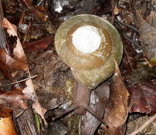
The first hike we did was the El Portal Trail. We completed the loop trail and saw some really big snails and lizards along the way. Shaylee also liked to play with the huge dead leaves on the trail.
After the El Portal Trail, we drove to the Angelito Trail so we could hike it. We hiked down the trail to the beautiful pool at the river and watched the fish swim in the crystal clear pool before heading back up to the trailhead. It was a great day, but we were tired from the previous flight.
See the trip report for more details:
The Wild Caribbean
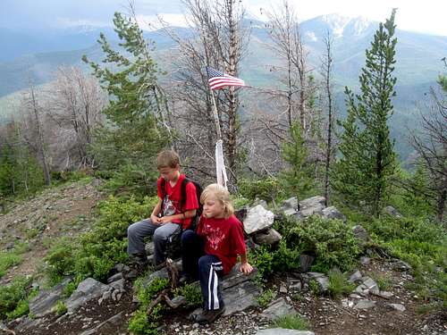
December 17: Sleeping Giant [Elk Mountain] (Colorado)
Today I climbed Sleeping Giant near Steamboat Springs/Milner. The mountain looks nice from afar, but wasn’t a very fun climb, at least by the route I took up (west ridge). It was a battle between posholing through snow (much of the ground was bare, so I couldn’t wear snowshoes), loose scree, and frozen slippery steep slopes.
Since the climb appeared short while looking at the map, I left pretty late. I struggled to the west ridge and followed it to the summit. Along the way were several elk on the summit ridge.
Since the climb took longer than I thought it would, it was dark by the time I reached the car.
December 10: Devils Canyon (Colorado)
Kim said that she was really tired and needed a rest. I asked her if she'd enjoy me taking the kids for the weekend to give her a break and she said yes.
Kessler, Shaylee and I threw some sleeping bags in the car and drove down to the Colorado River State Park (Fruita) to camp.
Since we were headed for the desert, I didn’t bring wool socks and my toes got cold. I woke up at night to build a fire and I watched the lunar eclipse (I didn't wake the kids for it-it was 9F anyway).
After a visit to the Dinosaur Museum, we hiked Devils Canyon. We completed the seven mile loop in 2 hours and 25 minutes. The kids had to wait for me-twice.
December 2-3: Mount Columbia (Colorado)
December 2
We had a big group (10+ people) planned for the attempt on mount Columbia, but in the end, only two of us ended up going. The weather forecast kept going back and forth between a light and a big snowstorm. By morning, the snow predicted wasn’t very much, so Brian and I met in Buena Vista for an attempt. We waited for about an hour before it was clear that no one else was coming.
After driving to the trailhead, it was obvious that while places like Silverthorne and Breckenridge were really dry, the area around Columbia got pounded during the last few storms.
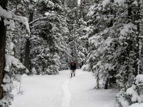
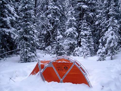
The road to the trailhead was closed at the Harvard Lakes Trailhead and we had to walk from there. The snow was deeper than expected and soft and we made it to the bridge crossing before setting up camp.
December 3
It snowed throughout the night and by morning it was 7F and still snowing. We climbed up towards Horn Fork Basin and we found that there was over 4' of soft powder (new) at about 10,500 feet and even more higher.
With the slow progress, and with brutal trail-breaking, it was quite obvious that we wouldn’t make the summit by nightfall. We were also worried about the vehicle getting snowed in at the trailhead and since failure was inevitable, we didn’t try that hard as far as making a serious attempt on the summit. We knew that avalanche danger might be high in spots and with poor visibility we wouldn’t be able to see what’s above us.
By mid-morning we headed back down the mountain without getting close to the summit.
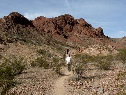
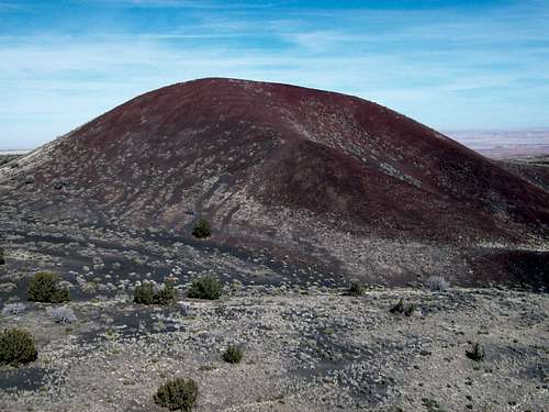
November 28: Red Mountain; Black Mountain (Nevada)
Kimberly wanted to take a tour of the Hoover Dam in the evening, so we decided to do a hike nearby to that location. Climbing Red and Black Mountains in the River Mountains near Boulder City looked interesting, so Kessler, Shaylee, Kimberly and I decided to climb those. We opted for the longer of the two standard routes since it would provide a good workout.
It was a beautiful day and we made our way through the maze of trails until we were in the canyon leading up to the saddle between Red Mountain and Black Mountain. It was a pretty trail and after reaching the saddle, we opted to climb Red Mountain first. There was some new development at the top (zip line) so we went over to climb the more pristine Black Mountain.
After enjoying the great views of Las Vegas and Lake Mead from the summit of Black Mountain, we hiked back down to the trailhead.
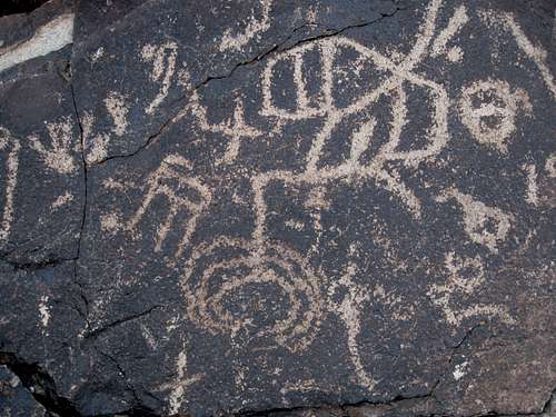
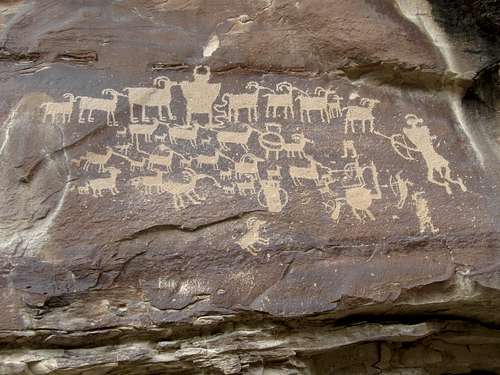
November 27: Sloan Canyon (Nevada)
After church (in Henderson), Shaylee, Kessler, Kimberly and I went for a hike up Sloan Canyon near Henderson. The road to the trailhead was rough so it took much longer than expected. Because of this we didn’t have as much daylight left over as we had hoped.
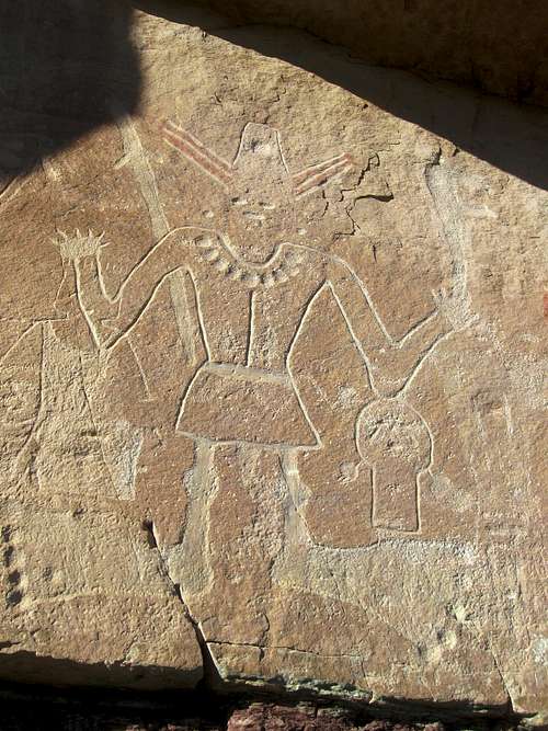
We started hiking up Sloan Canyon, passing several minor obstacles along the way. We found many petroglyph panels and took some time to admire and photograph them before heading back to the trailhead. It was dark by the time we reached the trailhead, but we were told of a shortcut driving route back to Henderson. We took a few wrong turns, but the road back was both shorter and less rough.
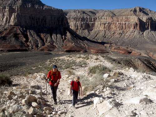
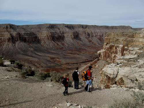
November 24-26: Havasu Canyon (Arizona)
November 24
After waiting around and taking a cave tour at the Grand Canyon Caverns, Shaylee, Kessler, Kimberly and I drove to Hualapai Hilltop to start our hike to Supai. We started our hike at 1 pm and with short daylight hours, we knew we had to hike fast.
We hadn’t need worry though since Shaylee was mad at her brother and would run off ahead. We did the entire 8 miles in three hours.
The weather was perfect and the hike down to Supai was prettier and more interesting than I thought it would be.
November 25
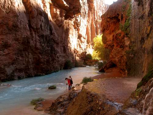
Today was the big one and the day we had all been waiting for. We would hike down to Beaver Falls, visiting all the other waterfalls along the way. Navajo was the first falls and we also quickly hiked to Havasu Falls. Mooney Falls was next and there was where the most challenging obstacle of the hike was. You have to climb through a few tunnels, a ladder and some rock steps to get down a cliff.
On the way down someone coming up warned us not to do it, but it wasn’t bad and the kids had no problem. Below Mooney Falls were four creek crossings up to waist deep and then it was a long streamside hike down to the Beaver Falls area.
After admiring the area, we returned back up canyon and back to Supai, but we stopped to explore several caves along the way.
It was a beautiful day and the scenery was some of the best in the world. We completed 10 miles, but it seemed a little longer with all the creek crossings and obstacles.
November 26
Today we hiked from Supai and back to the rim. The climb out was faster than expected and we completed the 8 miles in four hours. After that we drove to Las Vegas.
November 23: Lomaki Pueblo; Citadel Pueblo; Doney Craters; Wupatki Pueblo; Lava Fields Trail; Lenox Crater (Arizona)
On our way to Havasu and the Grand Canyon Caverns, Kessler, Shaylee, Kimberly and I spent a day doing several hikes in Wupatki and Sunset Crater National Monument. We did the hikes to Lomaki Pueblo and Citadel Pueblo before climbing both Doney Craters. After climbing the craters we quickly hiked the loop hike around Wupatki Pueblo before heading to Sunset Crater National Monument.
In Sunset National Monument we hiked the “Long Loop” on the Lava Fields Trail and then climbed Lenox Crater in fading daylight. We reached the summit and watched the sunset before heading back down the mountain.
All of our hikes were fairly short, but we packed a lot of them in a single day!
November 18: Model A Peak (CO)
Shaylee and I climbed Model A Peak after school and in great weather.
November 17: Sand BM (CO)
I did a night climb of Sand BM on a windy late evening.
November 16: Yampa River Trail (CO)
I hiked a section of the Yampa River trail on a cold day.
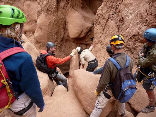
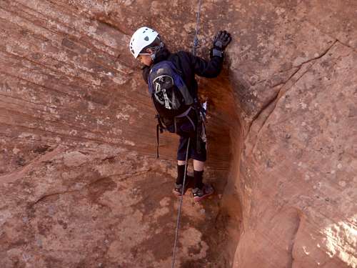
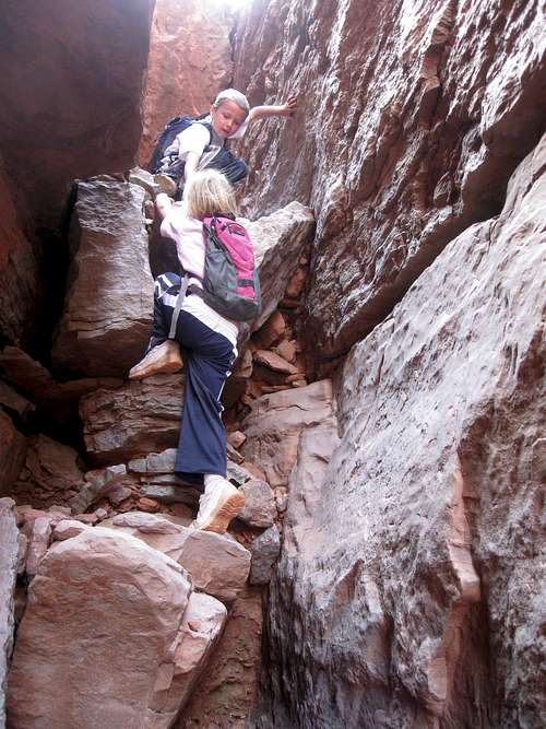
November 13: Chamber of the Basilisk (UT)
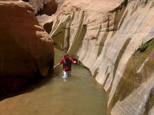
The weather was looking very cloudy, but the route through the Chamber of the Basilisk doesn’t have high flash flood danger, so we chose to do the route anyway. Only a little precipitation fell on the drive to the trailhead; the route itself was dry.
This is the kid’s favorite canyon and they were eager to show everyone else the canyon. Twelve other people joined us, which was a good crowd, but since the route is all hard packed dirt and sand, it is well suited for a group.
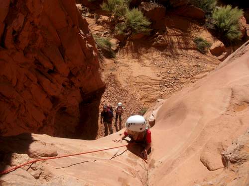
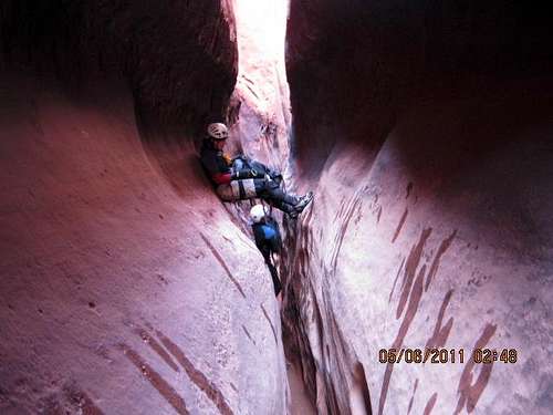
Since we had done this canyon previously, we knew the route well and we were able to go directly to the starting point. We climbed into the canyon to where it slotted up. The thing that makes the Chamber of the Basilisk so unique is that the slot canyon disappears into a hole in the ground!
We assured the rest of the group that the route goes and rappelled the 90 feet into the hole. Once in the underground “hole”, it opens up into a huge underground chamber with big holes in the ceiling. We relaxed an took photos of the amazing place before exiting the chamber and climbing down the boulders to the desert flats.
From there, it was a cross-country hike across the flats and to another slot canyon which we followed back to the trailhead. It was a great route and since it is fairly short, left plenty of time for the drive home.
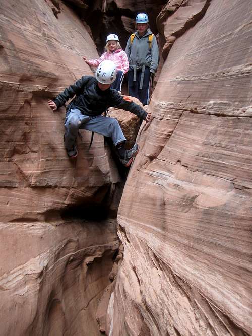
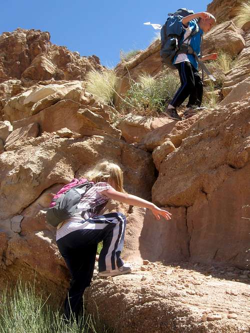
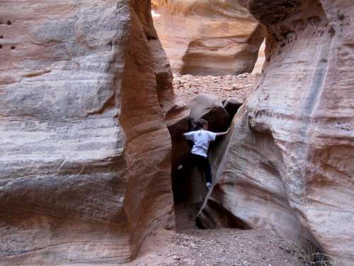
November 12: Arscenic Canyon (UT)
Shaylee, Kessler, Kimberly, Justin Kuhn, Shane Burrows, Sienna (Shane’s daughter), Tim and I made a descent of Arscenic Canyon. Upon arriving at the first drop, we found that a group of college students from Durango were making a descent of the canyon.
We let them play through and waited an hour and a half for them to all get down the canyon. After waiting we did the three stage 200 foot rappel. The kids liked doing the rappel since it was their highest to date.
There were several good down climbs, stemming and some cold pools to wade, but we made quick progress and caught up with the college students.
After stemming and climbing through some more narrows and wading a long pool we climbed out of the canyon and to Arscenic Arch. From there it was a cross country hike back to the trailhead.
November 11: Blarney Canyon (UT)
Shaylee, Kessler, Kimberly, Justin Kuhn and I decided to do Blarney Canyon today, because we heard that it was pretty dry.
Along the approach we climbed a high butte for the views and enjoyed looking into the canyon. Once dropping into the head of the canyon there were many fun downclimbs and a couple rappels. We were able to stem the water, but Kessler fell in at the end.
Later that afternoon, we went to go check out the Indian maiden pictographs.
October 29: Cedar Mountain (CO)
I was sick the day before and still recovering somewhat, so I needed an easy climb. In addition the mountains are crawling with hunters, so Cedar Mountain seemed like the logical choice.
Kessler, Shaylee and I completed the short loop on a breezy, cloudy and cool day.
October 23: Sand BM (CO)
Kessler and I went for an evening climb of Sand BM.
October 22: Tabeguache Peak (CO)
With a group of 14ers.com members, Kessler and I climbed Tabeguache Peak. We camped along the road above the Angel of Shavano Campground.
After a mild, but windy night we drove to the trailhead and set off up the mountain. There wasn’t as much snow as expected, so we left the snowshoes, behind (which turned out to be a good move).
We made our way rather quickly up the mountain and up to the west ridge of Tabeguache. The going was pretty tedious with all the scree fields from there on. There wasn’t much snow on the route and I had carried a bunch of gear for nothing, including face masks, microspikes, extra coats, etc.
Strangely, the ridge was much more windy than the summit. After enjoying the fine October views, we headed back down the mountain and back home.
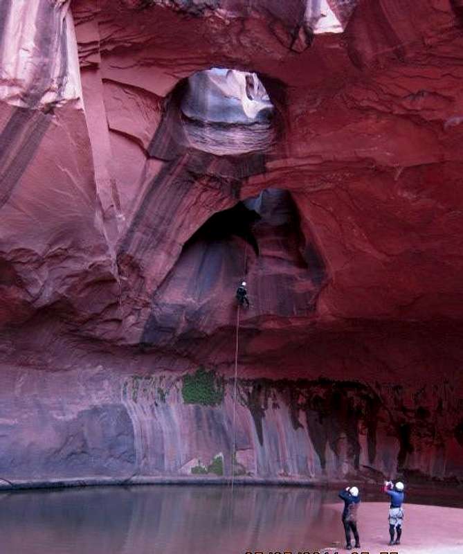
October 16: Chamber of the Basilisk (UT)
In the morning, Scott (a different one), Brad, Kessler and I checked out a “new route” at White Roost Canyon. After seeing that we didn’t have enough time to reverse the “new route” and complete the standard route, we headed off to Goblin Valley to check out a slot canyon I had found there earlier in the year.
Kessler, Shaylee, Kimberly, Brad, Scott and I climbed up to some bluffs, climbed an un-named butte for a good look around and made our way over to the slot canyon. After following the slot canyon a ways, we got a big surprise.
The reason the route was so good is that the slot canyon just disappears into a hole in the ground (we didn't expect anything like this). It didn't drop into a crack or a narrow slot, but just a hole. It was kind of intimidating to just look into a deep and dark black hole in the ground since we couldn't see what was down there or if you can get out of it. We lowered a pack down to see if it would hit the bottom with our ropes.
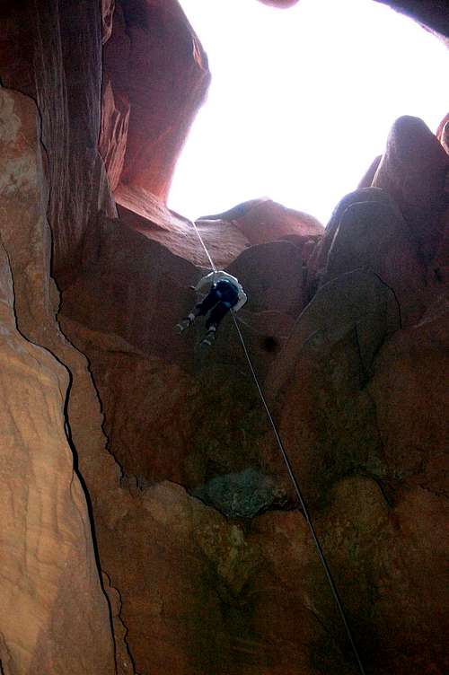
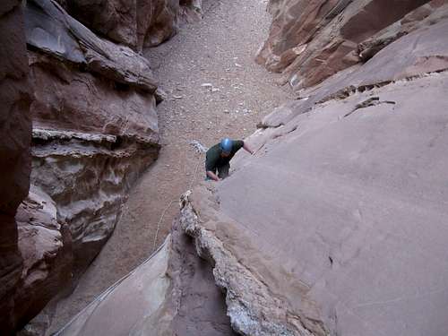
After rappelling 90 feet into the black hole in the ground it opens up into a giant underground chamber. It's maybe 300 feet long and 100 feet wide and high. You don't need a headlamp since there are huge holes in the ceiling (with beams of light spilling in). It's one of the coolest features I've ever seen in a canyon (I hope this isn't spoiling the surprise and giving too much away).
Brad rapped down first (taking ascenders in case the route didn't continue and above we had made sure we could reverse the route if needs be) and shouted up that he would check out "down canyon" and see what there was. After a little while he shouted up for us (anyone who wanted to) to go ahead come down. We were going to send the kids back (with their mom and with me assisting them on the upclimbs), but they really wanted to go down, so we let them (especially since Brad said that after the chamber we could continue down canyon to get out). We completed the entire route in four hours.
October 15: Sams Mesa Box Canyon (UT)
There was a canyoneer’s gathering in the Robbers Roost area of Utah, so Kessler, Shaylee, Kimberly and I decided to join the group.
Brad and Scott decided to join us for a trip through Sams Mesa Box Canyon. After finding the trailhead, we made our way cross country to the head of the canyon. We checked out, but skipped the highly technical and difficult upper slot and made our way into the canyon via a very steep chute.
After heading down canyon we made our way through the lower slot. There were some excellent and fun down climbs required to descend the slot, but it was also very muddy and slippery as well. We had to wade through the water at one place before coming to the rappel at the end of the slot. After rigging the rappel, the kids had fun descending it.
After the rappel, it was a long hike down canyon with several downclimbs before reaching the exit route. We climbed out of the canyon at the exit route and climbed (challenging) to the top of a high slickrock dome to have a look around. After having a good look around, we made our way to and over the final cliff bands.
After that it was a long hike out along the rim of Sams Mesa Box and back to the vehicles.
October 8: Cross Mountain (CO)
Because of the weather forecast, I was hoping that everyone would want to hike to Strawberry Hot Springs, but the kids didn’t want to go. Kimberly and I hiked to the top of South Cross Mountain and explored around a bit before heading back down. It was rather cool and it snowed a little, but the views were nice, as always.
October 7: Cedar Mountain (CO)
It was a cold and windy day with some snow in the morning, but since I got off work fairly early, Kessler, Shaylee, Kimberly and I decided to climb Cedar Mountain. It was a bit breeze and cool, but we made the short loop quickly and were done just before sunset.
October 2: Ninemile Canyon (UT)
Kessler, Shaylee, Kimberly and I went to Ninemile Canyon on our way back from the Patmos Head climb. Since we could hear our church conference on the radio in Ninemile Canyon, we took breaks to view the rock art and make short hikes between the sessions. We visited/walked to the many petroglyphs and pictograph panels in Ninemile and Cottonwood Canyons as well as saw several signatures from the 1880’s.
October 1-2: Patmos Head (UT)
October 1
Patmos Head is a mountain which I have had a strange attraction to over the years. When I was 11 or 12 or so, I wanted to climb the peak as a birthday hike and since then I have driven by the mountain many, many times. My wife and I went to climb the peak not long after we got married, but she changed her mind and we went somewhere else. There are more spectacular mountains out there in the world, but I admit that I did have a weird attraction for climbing Patmos Head!
Now in 2011, it was time to finally make the climb. We also wanted to hear a church conference on the radio up there and it sounded like a good place to do so.
After driving to the trailhead Kessler, Shaylee, Kimberly and I hiked up the North Fork of Horse Canyon and found it to be a nice slot canyon. Our packs were very heavy since we were carrying all our water in order to make a dry camp. After scrambling through the slot canyon we headed up the canyon to the base of the Southwest Ridge of Patmos Head.
Getting to the Southwest Ridge of Patmos Head was the where the real work began. It was an incredibly steep climb in order to get to the top of the ridge where we thought that the going might get easier. The ridge was much harder to climb than was expected and we had to pass several difficult cliff bands. There was some bushwhacking as well, though it wasn’t too terrible.
After a long struggle Kim and the kids decided to call it quits at 9400 feet. I climbed as quickly as possible to the summit (while routefinding around two final cliff bands) and spent a few minutes on top before heading down. It sure was a harder climb than we expected.
After meeting back up with Kim and the kids, we headed back down the ridge a ways before deciding to make an attempt at descending down to the canyon to the north which we hoped would be an easier route. It wasn’t and the going was really steep and tedious.
When we reached camp it was dark and we had a nice dinner before heading off to bed.
October 2
After waking up we packed up and headed back down the North Fork Horse Canyon to our car parked near the Geneva Mine. We had to do some scrambling in the slot canyon section, but it was a much easier hike than the day before. After reaching the car we headed off towards Ninemile Canyon.
September 25: Calf Canyon (UT)
Kessler and I went for a morning hike of Calf Canyon in the San Rafael Swell. I had been there years ago, but we had heard that there were allosaurus tracks in the canyon and we thought we’d take a long shot and try and look for them. ATV tracks have been pushed up the canyon much farther than the old 4wd road used to go and with the heat; it was a rather discouraging hike. We made it past the ATV track, but by then it was time to go back since we had somewhere to be.
September 24: Music Canyon (UT)
Kessler and I joined Tom Jones and others during the SUWA Roundup for a descent of Music Canyon in the San Rafael Swell.
The canyon was filled with water and mud and thus was much more challenging than it usually is. There were several nice downclimbs and a few rappels. It took much longer to get through the canyon then it usually does and when we reached Muddy Creek, it was flowing higher than normal as well.
We hiked through the Chute of Muddy Creek and arrived back at camp right when it got dark. It was a long day, but a good one.
September 17: Cedar Mountain (CO)
Kim was out for a girl's day activity, so Kessler, Shaylee and I were going to climb Slater Peak. However, it rained and rained until afternoon. Finally at 2:30 PM, the rain started to taper off and we decided to climb Cedar Mountain. We did the long loop.
September 10: Slide Mountain (CO)
We were busy this Saturday so we needed a short and easy mountain to climb. On the map, Slide Mountain in the Elkheads seemed to be just the ticket.
Maps can be deceiving however, and it was quickly apparent that the joke was on us and that the mountain was a wolf in sheep’s clothing. It was a struggle against bushes, slippery slopes and thistles and it took twice as long to climb than we thought it would. There were literally hundreds of ravens circling overhead as well. Weird.
September 9: Cedar Mountain (CO)
After school and work, Kessler, Shaylee and I went for a climb of Cedar Mountain. We completed the long loop rather quickly and without any rest stops.
September 3-5: Cloud Peak (Wyoming)
Since I hadn’t climbed anything in the Bighorn Mountains yet, Cloud Peak seemed like a logical choice for Labor Day Weekend 2011. Kessler, Shaylee and Kimberly would join me for the trip.
We had a rough start to the trip. We stayed in a hotel in Thermopolis and they were supposed to leave a key for us, but when we got to the hotel there was no key. After waiting an hour and after several phone calls we were finally let in, but the hotel was noisy and we didn’t get to sleep until 4 am.
September 3
After a noon start (we visited the Dinosaur Museum in Thermopolis before heading for the mountains), we headed for Mistymoon Lake. The guidebook made it sound like the trail to the lake was really rugged, but it wasn’t so bad and we made the six miles to the lake in a relatively quick four hours. We spent the evening reading some books and some church articles before going to bed. The scenery was quite nice along the way, but it was a cool and breezy day.
September 4
After a cold morning with frozen water bottles (a nearby party said they recorded 10F [-12C]), Kessler and I set off for the summit of Cloud Peak. Because of the rough night before this one, at 7:45 AM, we got a later start than we wanted to. The weather and weather forecast was great through, so we pushed on over the ridge and down to Paint Rock Creek where the work began.
We steadily made it up the slopes of the mountain and about half way up we passed another group who had camped nearby to us the previous night. When we learned that they had started over an hour before us, we felt good about our speed, but were wondering if they were going to make it up.
The boulderhopping got more strenuous as we pushed up the mountain, but the views more than compensated for the effort. After 3 hours and 53 minutes after leaving Mistymoon Lake we found ourselves on the summit of Cloud Peak. We made pretty good time considering the one way distance was 5.5 miles most of which was strenuous boulderhopping.
Cloud Peak was more like “Perfectly Clear Peak” today and there was not a cloud in the sky so we kicked back and relaxed and spent 45 minutes on the summit just soaking up the views and scenery and chatting with other climbers on top.
After enjoying the summit, we headed back down the mountain. We passed several of the parties that we had passed on the way up and let them know how far it was to the summit. We made our way down the mountain and back over the ridge to Mistymoon Lake without any problems. It had taken us until 3:45 to arrive back at the lake (3 hours 15 minutes to climb all the way back), so it wasn’t that much faster going down and up.
After waiting for three hours we were a bit worried about the other parties on the mountain who were still not down yet. I had debated heading back up the mountain, but just before dark they arrived back at camp. Since some of our fuel leaked, we barrowed a little fuel from them to make something hot before going to bed.
September 5
In the morning we packed up and headed back down to the trailhead. The trip back went rather uneventful, but we did see a cow moose on the way back and stopped to photograph it. It was a great trip, but the drive back home was long.
August 27: Diamond Peaks (Colorado)
Today, Kessler, Shaylee and I climbed three of the Diamond Peaks in the Elkhead Mountains. It was a steep hike with no trails, fallen timber and it took us much longer than we thought it would so we didn't get back until late, but it was a good trip. It rained a few times, but the weather was mostly good.
August 24: Wolford Mountain (Colorado)
After dinner, Kessler and I went for a late evening climb of Wolford Mountain. We climbed a very steep route on the south face, reaching the summit just after sunset. It was dark by the time we got back.
August 21: Ninemile Mountain (Colorado)
After church, Kessler, Shaylee, Kimberly and I went for a hike up Ninemile Mountain. We were all tired from the week before, but we all made the summit and took a rest while eating all the now-ripe wild raspberries.
August 20: Elk Mountain (Colorado)
I had to work until early afternoon, so after work, Kimberly, Shaylee, Kessler and I went for a climb of Elk Mountain (the one north of Parshall Colorado) since the climb was only 5.6 miles round trip.
Even though we couldn’t climb until after lunchtime, the weather was beautiful and we summitted the peak rather quickly. There were still many wildflowers left, so this was a nice touch. After checking out some of the snowfields we headed south along the ridge and took another route down and thus completing a loop. It was a great little climb and everyone had a good time.
August 14: Aspen Grove Trail (Utah)
On our way driving from Provo back to Colorado, Kimberly, Shaylee, Kessler and I stopped for a hike to the waterfalls on Mount Timpanogos. We didn’t have time to climb the peak, but went to the first two waterfalls before turning back. It was really beautiful, but we didn’t have a camera with us.
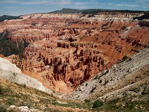
August 13: Cedar Breaks/Spectra Point/Wasatch Ramparts Trail (Utah)
Kim, Kessler, Shaylee and I stopped in Cedar Breaks on the way from Kanab to Provo. We hike the Spectra Point and Wasatch Ramparts Trail. It was a good four mile hike, but our camera was dead, which was very unfortunate because we saw a marmot, many squirrels, bristlecone pines and many great viewpoints in perfect weather. We also climbed a nearby peak for some good views.
Near the end of the hike, we barrowed someone’s batteries from their camera in order to take the photo below. After taking a couple photos we returned their batteries.
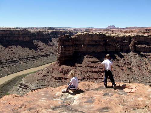
August 12: Last Chance Bay Rim (Utah)
From a houseboat at Lake Powell Kessler, Kimberly and I set off to climb to the rim high above Last Chance Bay (with Kim’s mom’s camera). Kimberly had to turn back in her sandals, but Kessler and I continued climbing the cliff bands (a couple of which were a bit scary!) until we reached the rim. After reaching the rim we shouted and waved at the others far below, took a few photos and returned.
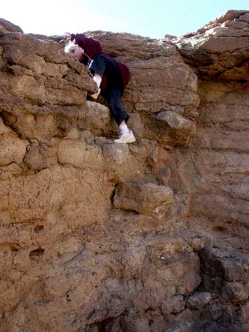
August 11: Balanced Rock (Utah)
From a houseboat at Lake Powell (Last Chance Bay), I climbed a balanced rock tower. I waved at everyone from the top. The rock was solid, but quite abrasive and I got scratched up a little. I estimated the route to be a 5.6 or 5.7.
July 31: Snow Mountain Waterfalls (Colorado)
Today after church, Kim, Shaylee, Kessler and I hiked to the waterfalls at the Snow Mountain Ranch (Camp). We did the loop hike and enjoyed the waterfalls. It was raining lightly and there was some thunder, but it was still a nice hike.
July 30: Mount Neva (Colorado)
Today, Kimberly, Kessler, Shaylee and I set off to climb Mount Neva in the Indian Peaks Wilderness. We had planned an early start for the ascent, but I ended up being stuck at the office until almost midnight, we did not get an early start the next day.
We arrived at the trailhead at 9 am and quickly hiked to Columbine Lake. We were supposed to meet Scot Osborn as his daughter there, but since we were late, they started up the mountain. We started up the saddle and me Scot and his daughter coming down. They had turned back at some tedious loose scree and we told them we would visit their camp on the way down.
We continued through the tedious scree up to the ridge. The weather was still perfect so we were able to keep climbing and summitted Mount Neva at 1 pm. The views were fantastic and we spent time admiring the views of all the surrounding peaks and frozen lakes before heading back down the mountain.
One the way down we chatted with another climbing group before descending to Columbine Lake. There we chatted and rested with Scot and his daughter (whom were spending another night at the lake) before heading back down to the trailhead. Everyone was tired by the time we made it back.
July 24: West Mountain (Colorado)
Kimberly, Kessler, Shaylee and I climbed West Mountain after church today. In contrast to the week before, it was a very warm and sunny day. Everyone dragged a bit since they were still tired from the day before.
July 23: Elliot Ridge/Peak 11924/Meridian Peak (Colorado)
Kimberly needed a break from the kids, so Kessler and Shaylee joined me for a climb along the Elliot Ridge to Meridian Peak in the Gore Range. The weather forecast was for a 0% chance of rain which is very unusual in the Colorado high country in summer.
It was a very sunny day and we got a fairly late start. Meridian Peak is a long climb, but even so we made side trips to the little sub-peaks either on the way there or on the way back.
It was an exciting climb because we saw many elk and even one bear. The weather was perfect and there were no signs at all of any thunderstorm threat so we continued along the ridge all the way to Meridian Peak.
After eating lunch and having a brief snowball fight we headed back down the mountain. It was a perfect day in perfect weather. Since we did ~13 miles round trip and climbed the sub-peaks, the kids were pretty tired by the time we got back.
July 17: Sheep Mountain (Colorado)
After church, Kimberly, Kessler and I set off for a climb of Sheep Mountain. The skies were threatening, but we were hoping that they would improve as time went on.
We managed to climb to the summit of the mountain, but we had alternating heavy rain and hail as well as brief periods of sunshine. Even with our raincoats, we were pretty soaked by the time we got down the mountain.
July 9: Black Mountain (Colorado)
Kimberly, Kessler, Shaylee and I climbed Black Mountain today. There were snowbanks right from near the beginning and we were on snow most of the way to the summit. We actually lost the trail near the final climb to the summit, but we scrambled up to the summit plateau and then east to the east summit.
There was quite a bit of snow on top and the kids enjoyed playing in it before we headed back down the mountain.
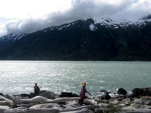
July 2: Icy Lake/Lower Dewey Lake/Sturgills Landing (Alaska)
I had originally planned on climbing AB Mountain, but the others (Kim, Kessler and Shaylee) wanted to do something shorter since we had just completed the Chilkoot Trail.
We hiked up one of the trails to Lower Dewey Lake. From there we hiked north towards Icy Lake before returning to Lower Dewey Lake. From there we decided to hike over to the beach at Sturgills Landing. The route was a bit more rugged than we expected near the end.
After eating lunch at the beach, we headed back, but took a wrong turn on one of the trails that headed to Skagway and we ended up on an overlook on top of a big cliff. After backtracking and finding the right route we hiked back down to Skagway.
It actually turned out to be a long 11 mile hike today. It was a bit tiring since we had just completed the Chilkoot Trail.
June 27-July 1: Chilkoot Trail (Alaska/British Columbia)
June 27
Today was our first day on the Chilkoot Trail. Kimberly, Kessler, Shaylee and I would hike the 7.5 miles to the Canyon City (ruins) Campsite.
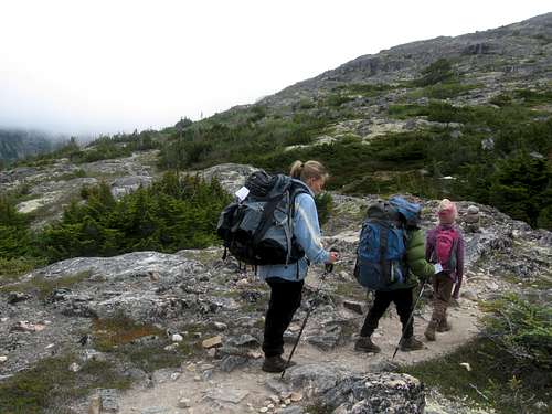
We started at 8:20 AM and headed up the first steep hill before dropping down the other side. The trail got gentler after this, but the mosquitoes were absolutely horrible! Because of the mosquitoes we walked fast, but had a lunch break in the hut at the Finnegan’s Point Camp, but did spend some time admiring the views of the Irene Glacier. After lunch, we hit the trail, but luckily the mosquitoes died down as we left Finnegan’s Camp. By the time we reached Canyon City it was 1:30 PM, so we had plenty of time to look around.
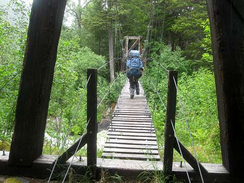
Since it was early, at 4 PM, we set off to hike to the Canyon City Ruins themselves. The kids loved the suspension bridge and had a good time looking at the ruins including the giant boiler. After visiting the ruins, we returned to camp having completed 9.5 miles (including the side trip to Canyon City) of trail today.
June 28
Today we made the trek from Canyon City to Sheep Camp. The group behind us saw a big brown bear cross the suspension bridge near Canyon City, but we missed it. We had expected that the hike would be nice and gentle, but there were actually quite a few steep up and downs. It was cloudy today, but we did occasionally get some nice views. The kids like crossing the bridges along the way. The rain forest and waterfalls made the trail quite scenic in this section. We arrived in camp at 1:30 PM (we had started at 9:30 AM) and relaxed and explored the rest of the day as well as watched the squirrels chase each other in and out of the holes in the trees.
June 29
Today was the big one. We would cross the notorious Chilkoot Pass! We woke up at 4:30 am and hit the trail at 5:30 AM.
Much of the trail was boulders, but it quickly turned to snow as we gained elevation. The snow was hard, so we were glad that we got an early start. There were many artifacts to look at along the way.
After much boulder-hopping and snow travel, we found ourselves at the base of Chilkoot Pass. The climb up to the pass via the “Golden Stairs” (which is just a very steep boulder field) sure looked intimidating from the base of the pass!
After a rest we headed up the pass through the snow. After a short time, the snow turned in to steep boulder field that must be climbed. It was misty, cold, wet and slippery climbing up the 1000+ feet of steep boulders, but there were some nice waterfalls and artifacts to be seen along the route.
Not far from the top we met the Parks Canada Ranger than manned the post up on Chilkoot Pass. He told us that we were making great time and that he would see us at the top.
We found ourselves on the summit of the misty and windy pass at 10 am. We were now in Canada! From there we made our way a short distance to the warming hut where the Parks Canada Ranger had hot water waiting for us. We finally cooked a real breakfast and some hot chocolate (due to our early start, we had just at snacks at 5 am).
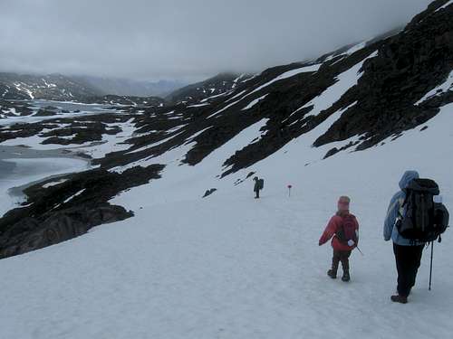
It was nice in the warming hut, but our work was not over and we still have ½ the distance to cover for the day. We made our way down the pass, through the snowfields and past the frozen lakes. Most of the time we were on snow and ice, but this actually had an advantage of letting us cross the rivers on snow bridges and ice. Later in the year there are icy wades. We did get pretty wet though (especially Kessler), but we pushed on to Happy Camp which is still located in the alpine country, but where little shrubby trees begin to appear.
We made it to Happy Camp by 2 PM. Once at the hut, we set up camp and went to dry our boots (or at least try). We spent the afternoon and evening relaxing and exploring before heading off to bed.
June 30
We slept in today and got a late start. The kids didn’t get out of bed until 9 AM and we didn’t hit the trail until 10:30 AM! Happy Camp was a ghost town by then.
We made our way down to Deep Lake where we ate lunch. About half way to Deep Lake we crossed the last of the snowfields for the hike and the trail was much drier.
We took another break at Lake Lindeman and took side trips to a small museum and to several other artifacts. The scenery was nice with all the lakes and mountains around. The kids really enjoyed the museum and after visiting it we headed back to the main trail and towards Bare Loon Lake.
We arrived at Bare Loon Lake at 4:55 PM which was our campsite. Our camp was beautiful and was right next to the lake. There was lots of bird life around and it was very noisy!
July 1
Today was our last on the Chilkoot Trail. We only had four miles to go, so we were in no hurry, We got up at 7 AM and left camp at 8 AM, but we were surprised that we found the camp abandoned by the time we left. Since you couldn’t eat lunch at the Bennett Train Station until 10:30 AM, we were surprised that everyone was in such a hurry to get off the hike.
It was a beautiful and sunny day and the scenery was still nice for the last part of the hike. The mountains and lakes were all along the route, but it was much drier here than on the Alaska side. It took us two hours to complete the route to the train station.
From the train station, we ate lunch and boarded the White Pass & Yukon Railroad back to Skagway. It had been a great hike and we were already for showers, clean clothes, and other luxuries.
June 26: Skagway Trails (Alaska)
After attending church Kessler, Shaylee, Kimberly and I hiked around Skagway visiting many of the interesting historic sites.
June 25: Mount Riley (Alaska)
Today we were hoping for clear skies so Kessler and I could show Kim and Shaylee all the fantastic views of the mountains that you can have from the peaks surrounding Haines. Fate was not with us and it was not to be. The cloud line was 1000-2000 feet elevation so the really spectacular peaks could not be seen.
From Haines, we took a taxi to the Beach Road/Battery Point Trailhead. We made our way up Mount Riley hoping that the clouds would life a little, but the cloud ceiling never did lift above 2000 feet. Along the way we saw a very colorful woodpecker. After reaching the summit of Mount Riley, we ate lunch. It was raining a bit, but the weather wasn’t terrible.
From the summit we headed north towards Lily Lake and then took the trail down to the Mud Bay Road, completing a full traverse of the mountain. From there it was a fairly long road walk back to the Bear Creek Cabins. Along the way we met a female biker who had just got attached by a pit bull. We felt bad for her, but were glad that we didn’t run into the pit bull since we had small children with us.
June 23: Mount Ripinski/Peak 3920 (Alaska)
Today, Kessler and I set off to climb Mount Ripinski. After spending the night at the Bear Creek Cabins, we caught a ride out to the Skyline Trailhead with the owner of the cabins since he was headed out to town anyway.
It was a beautiful and clear day and we made our way up the mountain through the forest. Not long after starting the hike, we met a seemingly nice, but dilusional old man hiking the trail. After having a short and strange conversation with the man we pushed on.
After we emerged from the forest, the views got better and better as we got higher and higher up the mountain. Since the weather was so clear the views of the surrounding mountains were very impressive.
We made our way rather quickly to the summit of Mount Ripinski. I thought views from Mount Juneau was spectacular (and they are), but views from Ripinski-Peak were absolutely stunning. The views of the Cathedral Spires and other peaks (hundreds and hundreds of them) are much more spectacular than even places like the Tetons, Wind Rivers and the North Cascades (and I'm from Washington).
We had originally planned to climb Ripinski only, but the weather was fantastic and it was still early. We had been told that the traverse from Mount Ripinski to Peak 3920 takes 2 or more days, but looking at the map the route seemed quite reasonable.
After lunch, we set off towards Peak 3920 seeing many bald eagles and mountain goats along the way. The traverse wasn’t too hard and we made our way along the ridge towards Peak 3920. Along the way we saw some HUGE brown bear tracks. Just before the summit there was a nice and short vertical scramble (it had a fixed chain up it somewhere, but at the time we didn’t know this and missed it) before we reached the summit.
After enjoying more fantastic alpine views we headed down the mountain and to the Seven Mile Trailhead. It was a steep route down and we saw one other climber along the way.
We had completed the alpine traverse of Mount Ripinski and Peak 3920 in 8 hours. This included 10 miles of rugged terrain with 5100 feet elevation gain. Kessler (age 9) had a great time and it was one of the best days ever.
It only took less than a minute to catch a ride that would take us back to Haines. The lady who picked us up said she didn’t want to see a child standing out there in the hot sun. It was about 68 degrees outside, but hey, this is after all Alaska.
June 22: Dan Moller Trail (Alaska)
I had originally hoped to climb mount Jumbo today, but everyone was tired so we decided to hike the Dan Moller Trail instead (we had a ferry to catch in the afternoon and would have to get up very early for an attempt of Mount Jumbo). Kimberly, Shaylee, Kessler and I took a bus part way to the trailhead from which point we road walked to the trailhead itself.
We headed up the trail and took a rest at a viewpoint for a snack. Upon reaching the three-way junction with the Treadwell Ditch Trail we let the kids decide which way to hike and they decided to hike the Treadwell Ditch Trail east from there. We followed the trail east to the Blueberry Hills subdivision before road walking all the way back to Juneau. That afternoon we boarded a ferry for Haines.
June 21: Mount Juneau (Alaska)
Today, Kessler (my nine year old son) and I climbed Mount Juneau. Since we were warned that Mount Juneau was a difficult hike (at least for a seven year old), it was decided that Shaylee and Kimberly would hike the Perseverance Trail and visit the Gold Mining Museum rather than attempting the summit.
The four of us set off from the Juneau Hostel and walked along the roads to the trailhead. We then hiked up the trail past the mining equipment and up to Ebner Falls. The weather was good so just above Ebner Falls, Kessler and I headed up towards Mount Juneau while Shaylee and Kimberly turned around in order to hike back down to the Gold Mining Museum.
Kessler and I found the trail up Mount Juneau to be a little wet since the brush was close, but it wasn’t too bad and we made our way steadily up the mountain. About 1/2 of the way up was a very trick stream crossing, the first major obstacle of the hike. The waterfall and stream were pretty roaring this early in the year, but we crossed it without any problems.
About 2/3 of the way up the mountain, the trail steepened and headed straight up the mountain. In this area we saw several mountain goats and some bald eagles. The views were fantastic since we were now above timberline for the rest of the climb.
Since the trail was south facing, there were only a few snowfields to cross and with the good weather we made much faster progress than we had on Mount Roberts a few days earlier.
Eventually we found ourselves on the summit of Mount Juneau. It was a pretty clear day and we could see seemingly forever (all the way as far as the Glacier Bay area). There was an endless sea of peaks visible in almost all directions and it was a grand site for sure.
Another couple from Alaska met us on top and we chatted before they headed on. After relishing the fine views and exploring around the summit, we headed back down the mountain.
We walked down the trail and then hiked the Flume Trail back down to the coast. At the Juneau Library we met Kim and Shaylee and we decided to fly to the Taku lodge to eat dinner there since the weather was so fantastically clear.
June 20: Trail Through Time/East Glacier Loop/Nugget Creek (Alaska)
The weather forecast was still pretty bad so we decided to go to east side of Mendenhall Glacier instead of climbing Mount Juneau. Kessler, Shaylee, Kimberly and I rode the city bus to within two miles of the trailhead and walked from there.
While walking the road to the trailhead/visitor center we saw a bear cross the road just after we passed the “Bear Crossing” sign! After reaching the trailhead we hiked over to Nugget Falls. After enjoying the views of the falls we backtracked and hiked the East Glacier Loop. The loop trail had some nice views of the mountains and glaciers and we took a side trip to AJ Falls on the way back. We also took a side trip up Nugget Creek. The weather was better than it was the previous day and we got some pretty good views of the mountains.
After completing the East Glacier Loop we hiked the Trail Through Time and then road walked back to the bus stop where we headed back to Juneau. It was a great day and the weather was pretty good. There were much less mosquitoes on the East Glacier trail then there were on the West Glacier Trail that we did a few days previous.
June 19: Gold Ridge/Gastineau Peak/Mount Roberts (Alaska)
The weather forecast was not good for the next few days, so it was a tough decision whether or not to attempt Gastineau Peak or not, especially since there was lots of snow in the mountains because of the earliness of the season. We decided to give the mountain a try, but if conditions were too bad we would turn back. We were well prepared for bad weather and snow.
We started climbing the peaks right from the Juneau Hostel. Two others from the hostel joined us for the climb. They were Don and Bobby (father and son) from Texas.
From the hostel, we walked up the roads to the trail that ascends to the top of the tramway. We quickly climbed through the forest to the tramway, which was in the clouds, but with occasional breaks in the clouds. At the tramway we were told that climbing Gastineau Peak was impossible with the current conditions and this early in the season. We were then told that we might be able to climb up to the Gold Ridge (we had snow boots), but that this was not certain.
With the discouraging news and with a mix of fog and breaks in the fog we all set off towards Gold Ridge. It was a beautiful climb with occasional breaks in the clouds making for some good views. There were also several entertaining marmots along the trail and some nice wildflowers. Not far above the tramway we started crossing snowfields. They weren’t difficult, but were wet.
After crossing a very long snowfield we headed north and climbed to the highest summit along the Gold Ridge. By the time we reached the summit, the views were almost completely obscured by fog.
After eating an early lunch on the summit of Gold Ridge, Don, Kimberly and Shaylee decided to head back towards the tramway where they would wait for us. Bobby, Kessler and I decided to attempt to climb the impossible Gastineau Peak.
We retreated from Gold Ridge and to the ridgeline heading towards Gastineau Peak. It was almost completely snow covered and visibility was poor so we were very careful in noting landmarks (such as boulders) so we could find our way back (we also had a map and compass). We made our way towards Gastineau Peak through the snow through an almost whiteout.
By the time we reached the summit of (“the impossible”) Gastineau Peak, we has some partial clearing and could see a few hundred yards. From the summit of Gastineau Peak, we could feel the pull of Mount Roberts and decided to try for the next “impossible peak”.
The ridge between Gatineau Peak and Mount Roberts was much longer than it appeared to be on the map and it took longer than we thought it would. We made our way through the whiteout (while making BIG steps in the snow) until the ridge steepened just below the summit of Mount Roberts.
There was a steep snow slope to cross and I wished I had brought my ice axe. I did have my trekking poles so I kicked and carved steps up the hard snow so Bobby and Kessler could still climb the slope using my steps. It was time consuming, but eventually we were at the top of the snowfield and the summit was only steps away. It was our second impossible peak of the day so we felt rather pleased with ourselves.
We found a bare spot at the summit where we rested for a little bit. There wasn’t any visibility, but we thought that the views from her must be incredible if the weather is good.
After a short rest, we headed down the mountain. The ridge to Gastineau was again long, but with our observation of the landmarks, our steps in the snow and with the map and compass we were able to find our way back through the whiteout to Gastineau Peak without too much trouble. Once we were at the summit of Gastineau Peak we made our way as quickly as we could back to the top of the tramway where the views once again occasionally showed when the clouds would partially part. Shaylee, Kimberly and Don were happy to see us at the tramway. We told the little visitor center that we had made it all the way to Mount Roberts, but we weren’t sure if they believed us or not.
Since the tramway lets you have a free ride down if you purchase items/food, we ate big bowls of soup before riding the tramway back to Juneau where we walked back to the hostel.
It was a long and exciting day. It would have been nice to have some views from the summits of the mountains, but it was still a good climb.
June 17: West Glacier Trail (Alaska)
After arriving at the Juneau Airport late the night before, Kessler, Shaylee, Kimberly and I took a taxi from the airport to the West Glacier Trailhead. The trail starts out gently, but then climbs rather steeply with some scrambling. It was a cloudy day, but the mountains and glacier were very visible and there were several excellent viewpoints along the way. There were some tricky stream crossings as well. Unfortunately, we forgot our mosquito repellent and the mosquitoes were fierce at times.
We hiked sand scrambled up the trail to some excellent viewpoints looking down on the glacier. After enjoying the views, we also scrambled on the climbers trail towards Mount McGinnis, but we didn’t have time to reach the summit, so we headed back down the trail. On the way back we stopped to play in Mendenhall Lake before walking the road to the bus stop and then catching a bus back to the hotel and then to Juneau.
Other than the mosquitoes, it was an excellent introduction for our Alaska trip and it was a very scenic hike.
See the trip report for more details:
An Odyssey Through Southeast Alaska
June 14: Yampa River Trail (Colorado)
A short section of the Yampa River Trail was hiked and the river has receded, but there was too much mud to make more than a short distance.
June 10: Dry Fork (Utah)
Kimberly and I were in the Vernal area, so we decided to visit the petroglyphs panels around the McConkie Ranch which is in Dry Fork. We hiked to all the petroglyphs and pictographs (all of which are 800-2000 years old) in the area including the Bigfoot and Three Kings Panel. It was a great hike.
June 8: Yampa River Trail (Colorado)
Today I hiked another section of the Yampa River Trail, but I didn’t get very far because the trail was flooded.
June 6: Cedar Mountain (Colorado)
Kim, Kessler and Shaylee joined me for a climb of Cedar Mountain late in the evening. The air was very smoky from the Arizona fires and it was very windy.
Because of the wet spring, there were more flowers up there than I have ever seen. We also had a great sunset. Unfortunately I had forgotten the camera and missed photographing both the sunset and the flowers.
June 4: Lecleed Narrows (Utah)
I was bummed that I couldn’t find anyone to do some technical canyons or river running over Memorial Day weekend, so I had hoped to remedy the situation the weekend after.
This time, Kim would come along so we could do something technical. The Lecleed Narrows was chosen since I hadn’t been there yet, it should be a technically easy canyon for the kids and since the weather was supposed to be hot. Since the Lecleed Narrows are in the Henry Mountains, we could also climb a peak as well. The area is rich in gold mining history (dating to the 1890’s), so it should be an interesting trip.
Unfortunately, I had wanted to leave Thursday night, but a meeting at work that lasted until early evening Friday out an end to those plans. We did not get to camp until very late Friday.
While driving to the trailhead, another mishap occurred. We got a flat tire. The road was soft and it took a while to change the tire. By the time the tire was changed, it was already 11 AM! Since we were almost at the trailhead, we decided to hike the canyon anyway.
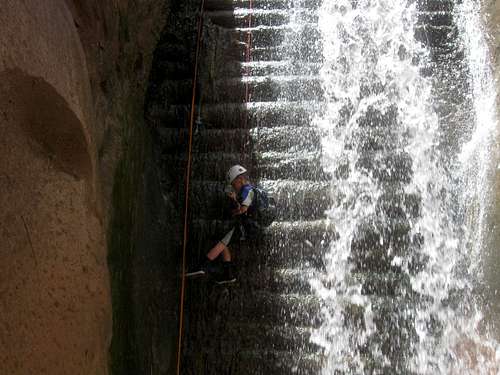
We walked to the canyon and headed down. The wading started right away and there was some minor bushwhacking as well. The creek was not clear and full of rocks, so the walking was more challenging than expected. The canyon got more and more interesting as we headed down and there was an old and mostly collapsed bridge along the way. After passing through several narrows and slots (with knee deep wading), we found ourselves at the rappel in the canyon. Interestingly, this one is man-made and over an old log dam that has long silted in. It now forms a nice waterfall. I dug up the old anchor and re-rigged a new one.
Kessler was a little intimidated looking down the waterfall, but he felt better after Kim rappelled down. I lowered both kids through the water (Shaylee didn’t like the cold water) and they both mostly enjoyed it.
After completing the waterfall rappel, we found a dry ledge to eat lunch at. After lunch we continued down canyon, it was more challenging than expected with several waist deep pools and one chest deep pools and several downclimbs down little waterfalls. Kim lost her shoe in one of the swirling pools and we spent some time looking for it. While we were looking for it, Kessler found it down canyon and shouted up to us that he had found it. The kids made it through OK and there were several very nice slot sections. There was some minor bushwhacking once we got out of the nice slots and we looked for a way out and up to the rim. We found a steep scramble and climbed up to the rim and back to the road where the others waited while I walked back to get the car.
I had really hoped to climb The Horn on this trip, but the flat tire put an end to those plans since we were driving with a spare tire. The nearest place to get the tire fixed was in Green River which was about 80 miles away. We headed straight for Green River after completing the Lecleed Narrows. It was a nice trip even though we only got to see the narrows.
See the trip report for more details:
Lecleed Narrows
May 31: Un-named Peak (Colorado)
Kessler, Shaylee and I set off for a night climb of an un-named peak in the Castor Gulch area of the Williams Fork Mountains. It took longer than I thought it would for us to reach the summit and it was after sunset before we reached the summit. It sure was a beautiful sunset though. We descended the mountain in the dark before heading for home.
May 28-30: Halls Creek Narrows/Brimhall Canyon (Utah)
Kimberly needed a break from the kids, so I took Shaylee and Kessler and headed to Capitol Reef for an attempt on the Halls Creek Narrows. I had planned to do the Halls Creek Narrows several times now, but something always came up. Last time we planned on going there was during October 2006, but a 200 year flood hit! This time we hope for better luck.
May 28
After driving to the Halls Creek Overlook (trailhead), we met two other hikers, Nao and Beaver who were also hiking the narrows. I offered to do a car shuttle with them so we could come out a different way.
After Nao and I complete the car shuttle, I told Nao and Beaver about Brimhall Canyon and we decided to explore it. We scrambled up canyon and over the challenging dryfall, past beautiful pools and to the long and cold swimming hole. The water was in the shade and freezing cold so we opted not to swim across. We did swim in some warmer pools before we returned down canyon and headed down Halls Creek.
Nao and Beaver went on ahead of Shaylee, Kessler and I. The horse and deer flies were pretty fierce in places, so we stopped and put on long pants. This was a good idea since the flies mostly stopped biting us after this. Along the way, we stopped at some old historic signatures (including Hall’s whom Halls Creek was named after) and to look at the Red Slide and many big lizards. There was ample water in Halls Creek as the stream came and went, but we had carried all our own water. Eventually we met up with Nao and Beaver near the beginning of the narrows and we set up camp.
May 29
Today was the day we had all been waiting for. We would get to go through the Halls Creek Narrows! It was a very windy night and was hard to sleep. We could really hear the wind buffeting the cliffs above! We eagerly hiked to the Halls Creek Narrows and went on down in. Sometimes the canyon would block the wind and sometimes we would get sandblasted.
The narrows were beautiful and we really enjoyed our time in there. After savoring the beauty and getting through the narrows, Nao and Beaver went down Halls Creek to Miller Creek while Kessler, Shaylee and I went up the Hall Divide and climbed over to the highpoint to look down into the narrows. There was a bit of scrambling, but it was a great side trip with spectacular views. It was very windy up there! There were some interesting and huge potholes near the top as well. We made our way along a ridge for more views before descending a drainage back to near Halls Creek which we followed back to camp. It was a great day and I was glad that I finally got to see the Halls Creek Narrows, but when we got back to camp we found the tent to be blown over and full of sand! It took a while to clean out. When it was almost dark, I was getting worried about Nao and Beaver, so I hiked down Halls Creek a little bit to see if I could find them. I didn’t have to walk far before running into them.
May 30
Today was another pretty big day since it was our hike out. After packing up camp, Shaylee, Kessler and I set off ahead since we knew Nao and Beaver would catch up with us. We made very good time and the hike up Halls Creek went fast. We covered the first three miles in less than 1.5 hours. Nao and Beaver caught up with us and we hiked together while looking for the exit up to the top of the cliffs on the east.
Once we located the correct location at the foot of the cliffs, the beginning of the route up the cliffs was pretty easy to find. We got off route a few times, but overall, it was just a stiff scramble up to the top of the cliffs. The kids enjoyed the little climbs along the way, but Kessler did not like carrying his big backpack up parts of it.
Overall, we made very good time up the climb. After some snacks and drinks, we said goodbye to our new friends and headed for home. It was a great trip!
See also the trip report for details:
Halls Creek Narrows
May 22: Sand BM (Colorado)
I did a night hike of the Sand BM. There was some mud, but it wasn't bad.
May 15: Cedar Mountain (Colorado)
Today I did a night hike up Cedar Mountain and completed the full loop. I left just before sunset and got high enough to watch the beautiful sunset (I wish I had my camera). The moon was very bright and I completed the rest of the loop by moonlight.
May 14: Little Egypt/Goblin Valley (Utah)
After camping at Little Egypt the night before (and seeing the biggest shooting star that I have ever seen), we (Kimberly, Kessler, Shaylee and my coworker Justin Kuhn) explored the area around Little Egypt a while before we were to head to the Lecleed Narrows (technical slot canyon). Little Egypt is nice little area with hoodoos, balanced rocks and lots of color.
After exploring and hiking the nooks and crannies in Little Egypt, we notice that the skies were dark and cloudy. This was puzzling since the weather forecast was predicting a hot and dry day. Since it was cloudy and dark, we decided not to head for the slot canyon and instead headed north to Goblin Valley.
Along the way to Goblin Valley, it sprinkled a bit, but it never really rained. We explored the nooks, goblins and caverns of Goblin Valley before heading for a highpoint in the park. We climbed the highpoint for some great views. After climbing the highpoint and doing some more exploring, it was time to head back home.
May 10: Yampa River Trail (Colorado)
I hiked another section of the Yampa River Trail.
May 6-8: Fence Canyon, Neon Canyon and Choprock Canyon (Utah)
May 6
After meeting Chris, Ron and Anya in Escalante the night before, we drove out to Egypt (Utah) and descended Fence Canyon. It was a fairly steep descend since I was carrying two backpacks, but it wasn’t that bad and we set up camp right at the Escalante River.
After setting up camp, we all headed downriver for Neon Canyon. We climbed to the rim of Neon and followed a bench to a tight side canyon which we descended. We had originally planned a shorter way in, but we missed it (we noticed just shortly after, but decided to push on) which is just as well since the upper entrance has some very neat sections of canyons as well.
After descending the tight side canyon, we headed down the main drainage of Neon Canyon. There were some neat narrows and one keeper pothole. At first the keeper pothole looked intimidating, but it was bypassable after climbing up to a ledge to the left where we could rappel around it.
There were several swims and some obstacles before we reached the nice final rappel through the Golden Cathedral. It was a great day with beautiful canyons.
May 7
After getting up very early and in the dark (I didn’t sleep well the night before), we set off towards Choprock Canyon. We took the old cattle trail up the slope at the mouth of Choprock Canyon, but the lower end was washed out and was a short climb up a vertical cliff.
Following the map carefully we made our way to near the head of Choprock Canyon before climbing down in. Ron had decided that he thought his wetsuit might be inadequate for all the cold weather, so he returned.
Anya, Chris and I continued down the canyon. It was very beautiful and had many fun obstacles before we reached what is known as the “Grim Section” of the canyon. The first obstacle was a log stuck vertically in the slot canyon like a dagger. I climbed the log (and it wasn’t easy!) and looked down canyon seeing only log jams. It looked really intimidating. I belayed Chris and Anya up to the top of the huge log and we rappelled back down into the canyon. We found that we could go under most of the log jams and that it wasn’t as bad as it first looked from the top of the first log. There were several more obstacles including one more log jam, but it wasn’t bad.
After several hours we found ourselves at the top of the final and spectacular rappel. We rappelled down and walked back to camp at the end of a very long, but excellent day.
May 8
We had gotten up early in order to make it back for mother’s day (I had contemplated going out the night before, but was too tired). We hiked straight out of Fence Canyon and to the rim before heading home. It was a great trip.
May 5: Queens Garden, Peekaboo Loop, Hat Shop and un-named peak (Utah)
After attending a funeral, I headed down to Bryce Canyon. I was supposed to use a free hotel at Ruby’s Inn so it sounded like a good place to use it, especially since I hadn’t been to Bryce in several years and because I was headed directly to Escalante to meet some friends for some canyoneering there.
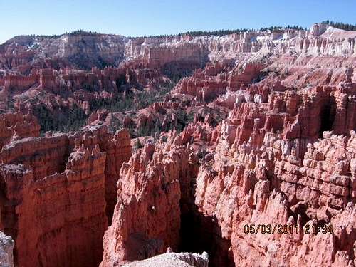
In the morning, I had hoped to go down to Wall Street (canyon), but the trail was closed due to snow and washouts, so from Sunset Point I hiked north to Sunrise Point and took the Queens Garden Trail down to the Peekaboo Loop. I did the long portion of the Peekaboo Loop and hiked up to Bryce Point and down to the Hat Shop along the Under the Rim Trail. From there I hiked back up to Bryce Point and along the rim back to Sunset Point. It was a great trip with fantastic scenery. There was still some snow in sections along the trail.
May 1: Model A Peak (Colorado)
The day before was stormy, so we didn’t climb a peak. After church, we talked about climbing a peak, but I wanted to do something new. The kids wanted to do Model A Peak though, so we climbed that one instead. We didn’t spend too much time on top, but instead went directly down the mountain after climbing it.
April 27: Yampa River Trail (Colorado)
I hiked another section of the Yampa River Trail.
April 23: Emerald (Quarry) Mountain (Colorado)
It was a gloomy spring day, but it was also a day the kids needed to get out, so we set off for an attempt on Emerald Mountain. We had stayed up late the night before going to some hot springs and I also made breakfast in bed for Kim so we didn’t get an early start Saturday.
We started from the town of Steamboat Springs and headed towards the mountain on snowshoes. It was cloudy and gloomy and the kids weren’t moving that fast, so half way up the mountain Kimberly and Shaylee decided to head back down.
Just after they headed down, it began to snow hard, but Kessler and I pushed on to the summit. On the last part of our route was not broken, so the climb was more challenging and took much longer than expected so we basically went non-stop to the summit. We arrived at the summit pretty late so we didn’t stop at all, but instead went right over the top and down the north face (because it was shorter than our ascent route). It was a mix of cloudy skies and snow, but it wasn’t very windy, so conditions were not extreme.
After descending the mountain, we met Kimberly and Shaylee who were happy to see us.
April 20: Yampa River Trail (Colorado)
I hiked another section of the Yampa River Trail.
April 16: Quandary and Ramp Canyons (Utah)
Justin Kuhn (co-worker) and my eight year old son Kessler joined me for a technical adventure descending Quandary Canyon and ascending Ramp Canyon. This route was chosen for several reasons:
1. These canyons are the last canyons cutting through the San Rafael Reef that I have not descended and/or ascended (there are numerous minor drainages cutting into the face of the Reef that I have not visited, but these are the last ones that cut through the Reef).
2. It sounded like a fairly straight forward, but still exciting adventure for my son and for Justin.
3. The canyons aren’t that long of a drive from home.
We got a fairly early start and headed up the slopes to the head of the canyon. Because we were on an old washed out mining road, the grade wasn’t too steep and we climbed to the head of the canyon rather quickly.
After descending the canyon, the fun started almost immediately. There were two short rappels and some nice narrows right off the bat. Kessler enjoyed being lowered off the rappels (he doesn’t have enough weight to him to slide down the rope so he was lowered), but Justin scraped his hand on the lower one.
After the upper rappels, the going was pretty easy for a while and there were some interesting natural bridges and potholes. For the most part, we negotiated the canyon directly in order to maximize the fun and challenge and did the two final rappels (one is optional, but we did the drainage directly).
I had carried a wetsuit for Kessler and wading shoes/neoprene socks for me (Justin also had neoprene socks), but we found all the potential wades and swims to be dry.
Quandary Canyon has one difficult section known variably as the “Suicidal Section” and the Technical Keeper Pothole Section”. We wanted to avoid this section (there is a bypass) at all cost, so once we reached the first keeper pothole, we retreated and looked for the bypass.
There was a steep gully just after the last rappel and we climbed up it. It was steep, challenging and exposed and we climbed up it some 400-500 feet before finding it to dead end with a cliff on the other side. On the way up we found two sets of slings in the crack/gully, but were wondering why they were left on the ascent. We knew that we must be on the wrong route, but this was the only gully between the last rappel and the first big pothole. There was a gully before the last rappel, but it couldn’t be the right one, at least if the route description was correct.
We decided to retreat and to take a closer look at the first big pothole. We thought that it could be possible that this was a new pothole scoured out by flashfloods and that the route had changed. We decided to retreat back to the pothole and to cross the pothole if possible and to check out the canyon beyond it. It was a tough climb back down the chute and it was obvious that other slings were left by other parties who had made the same mistake and wanted to rappel back down.
Once back down the cute, Kessler and Justin stopped for lunch while I descended the slot and I jumped into the pothole (knowing that I could climb out of it with the equipment I brought). From there I shouted and asked Kessler and Justin to come down. We lifted Kessler down in the pothole with me and I lifted him up the other side and instructed him to explore down canyon and see if there was an exit on the left. I instructed him to be very careful and to not climb down anything that wasn’t easy to climb back up. After less than a minute he shouted back that there was an exit through a gully on the left. Kessler came back and Justin gave me a back and shoulder stand and I went down canyon to check out the gully. I climbed up it twice and checked everything out. It appeared to be the correct way out.
I retreated back to the pothole to lift Justin out. Shoulder stands and lifting each other out, but with an eight year old and two 235-245 lb. guys we had to be a little more creative. After finding out that I couldn’t lift Justin out, I jumped back in the pothole and he climbed out on my back/shoulder to boost me out. When that didn’t work, we lowered the packs back into the pothole and I stood on top of them to climb out. It worked fine, if it wasn’t too graceful. After that we lowered Kessler back into the pothole to lift the packs out, but he struggled lifting them. All in all it wasn’t hard to get out, but we wasted over two hours being off route.
After ascending the gully (with a fun climb at the beginning), we quickly climbed up over the saddle (the real exit gully was much easier than the false one) and descending the steep slickrock ramp down the other side.
At the end of the slickrock ramp, it was an interesting climb under and over boulders and to the floor of the canyon. Kessler could fit under more boulders than we could and beat us to the canyon floor.
After the canyon floor was reached, there were several minor obstacles before a spring and a pool of water at the base of the San Rafael Reef. I slipped on the hidden sand covered mud and covered myself in black stinky mud. After that it was a minor bushwhack to a big wash intersecting the canyon. We rested here while deciding which route we would take back to the vehicle.
There were two main route possibilities to complete the loop. The standard route heads west and intersects the Grand Canyon of the Muddy at which point it follows the creek up through the canyon to the Hidden Splendor Mine and then it is a road walk of a few miles back to the vehicle. A second route heads east along the base of the Reef and climbs up Ramp Canyon to the vehicle. This is the shortest way back, but it is more challenging. This was the route chosen, mostly because I hadn’t done it yet and wanted to.
Somehow we ended up leaving our topo map behind, so at one place I went on ahead to scout out the route to Ramp Canyon. After exploring around for 40 minutes I came back to Justin and Kessler and told them that I found the route. I also showed them a cave I found while exploring around.
After reaching the mouth of Ramp Canyon, we headed up. There were several obstacles, all of which were fairly challenging, but not that serious. Near the head of the canyon we reached a huge chockstone which is the crux of the route. It sure looked a lot more intimidating than I had expected. Various sources rate the climb around the giant chockstone as 5.1, 5.4 or 5.6. The first person would have to climb it without a belay and belay the others up. I volunteered to be the one to do it. Kessler also climbed up one route to check it out (not reaching the top of the chockstone), but I made him come back down so I could climb first and rope him up.
I made the climb (as mentioned, it was scarier than expected) and made a little jump at the end. I set up the belay and Kessler was attached to the rope for the climb. He climbed it like a pro and made the climb rather quickly. After Kessler climbed the pitch, I hauled up the packs and Justin climbed the pitch.
After climbing the crux pitch, we knew that we were mostly home free. The remainder of the canyon had some nice scrambles and some nice narrows before opening up. After the canyon opened, up it was an easy walk along a jeep trail back to the vehicle.
It was a grand adventure and we were all tired as we headed back to Green River.
See also the Trip Report:
Quandary and Ramp Canyons
April 12: Yampa River Trail (Colorado)
Today another section of the Yampa River Trail was hiked. This time I knew the parts to avoid in order to avoid getting wet.
April 11: Yampa River Trail (Colorado)
Today I hiked a section of the Yampa River Trail. The first half was in good conditions with a mix of mud and dry ground and only a little snow, but the second half was very wet and I soaked my boots crossing little rivulets.
April 9: Sand BM (Colorado)
Because I had to work today, I only had time for a short climb. I climbed Sand BM in the evening. It was quite muddy, but I didn’t have to walk through any snow.
April 8: Model A Peak (Colorado)
Shaylee, Kessler and I went for a night climb of Model A Peak after I got off work. Model A Peak is an un-named peak in the Williams Fork Mountains, but we call it Model A Peak because there is an old Model A truck near the summit.
It was cloudy and somewhat breezy, but the weather held long enough for us to climb the mountain.
April 7: Cedar Mountain (Colorado)
My coworker Justin Kuhn and I climbed Cedar Mountain after work. I was going to take the kids as well, but they changed their minds about going.
Instead of trying the loop with snowshoes, we just did the south-facing route in our boots to avoid fighting a mix of dry and snowy ground with snowshoes, but there was one big snow section to post hole through.
April 6: Shafer Canyon (Utah)
This was our last day of our spring break trip. We decided to hike Shafer Canyon to the Colorado River because it was near the Shafer Campsite where we spent the night.
Getting down to the floor of Shafer Canyon requires climbing down a low 5th class route. Once in the canyon bottom, it was an easy hike to the Colorado River.
After eating lunch at the river, we returned back up canyon and climbed out the crack. The kids really enjoyed the climb out.
April 5: White Crack (Utah)
Today our (Kessler, Shaylee, Kimberly and I) goal was to hike the White Crack to a mining camp above the confluence of the Green and Colorado Rivers. Including the overlook of the river, the round trip distance would be 13 miles, so we knew it would be a long day. It would be six year old Shaylee’s longest day hike to date.
After a not-so-early start, we headed down the White Crack. After descending to the next level of rock, the going was quite easy with not too much elevation gain. It was a very scenic walk, but the trail was indistinct in a few places.
After exploring around a mining camp and visiting some overlooks of the Green River we headed back up to the vehicle. It was a long walk out and an even longer drive to the Shafer Campsite after the long hike. We didn’t get to eat dinner until 9:00 PM.
April 4: Fort Bottom/Moki Butte/Holeman Slot (Utah)
Today Shaylee, Kessler, Kimberly and I hiked out to Fort Bottom and climbed Moki Butte. Moki Butte has a nicely preserved Anasazi ruin on the summit and is a nice scramble and Fort Bottom has an interesting 100+ year old cabin. The walk was quite pretty as well.
After the Fort Bottom hike, we drove the White Rim Trail to the Holeman Slot and Kessler and I explored it. It seemed harder than it was last time, but then again I’m in worse shape than I have been in previous years.
April 3: Zeus and Moses (Utah)
After listening to a Church Conference we drove out to the White Rim Road and started on a four day trip along the route. We only had time for a short hike, so we chose the hike around the Zeus and Moses Towers up Taylor Canyon.
The route is somewhat steep and the trail is little used and washed out, but for the most part, it’s a short and very scenic hike. It was very windy to the point that it would blow the kids around.
After the hike, setting up camp in the wind was a challenge.
April 2: Monument Canyon (Colorado)
We (Kimberly, Shaylee, Kessler and I) met our friends Chris and Rachel Herring and their four children (Kayden, Zach, London and Piper) at the Fruita State Park Campground the night before. We wanted to do a hike where we could hear our Church Conference on the radio, but reception was disappointing.
We decided to hike the Monument Canyon Trail in Colorado National Monument. It would be a six mile hike and the longest that the Herring’s children have hiked in a day.
It was a pleasant and scenic hike, but also unseasonable hot for early April.
April 1: Independence Monument (Colorado)
Today I climbed the Independence Monument with Kris. Once again, P2 and the summit pitch (P4) were a struggle and I sweated quite a bit. I couldn’t have climbed the tower without Kris leading, especially since my desk job has really taken a toll on my body in recent years and I’m quite out of shape. Never the less, it was a beautiful climb and I was both happy to reach the summit, but disappointed that I had to struggle so much and that I realized just how out of shape I really am.
March 31: Rough Canyon/Mica Mine (Colorado)
Today after work (in Grand Junction), I went for a hike of Rough Canyon and the Mica Mine. It was a beautiful spring walk on a nice day.
March 29: Riggs Hill (Colorado)
Today after work (in Grand Junction), I went for a night hike of Riggs Hill. It was completely dark so I didn’t see much (other than the city lights), but at least I was getting some excersize. I did a loop hike and was back in the hotel by 9 PM.
March 27: Mount Garfield (Colorado)
Today I hiked Mount Garfield after church in Grand Junction. It was raining, but after church it cleared and I set off up the mountain. It’s a fairly steep, but easy climb with nice views.
Once at the summit, instead of following the standard trail down, I followed the ridge east over several other minor summits before heading back down to the trailhead.
March 26: Independence Monument (Colorado)
Today I attempted Independence Monument with Brian and Jen. P2 was a struggle and after a few tries, pulling a muscle and getting tired I suggested that Brian and Jen should go on without me and that I would try the tower later. It was quite disappointing and because I was out of shape, 5.8-5.9 was much harder than it used to be.
March 21: Sand BM (Colorado)
Kessler and I made another night climb of Sand BM. The air was full of dust from a dust storm today.
March 20: Sand BM (Colorado)
Kessler and I climbed Sand BM in the evening. It was a mix of dry ground, snow and mud.
March 18-19: Mount Harvard (Colorado)
March 18
I decided to make a winter ascent of Mount Harvard and Columbia with the 14ers.com group. It was the end of the winter season and I really needed to get another 14er in. I got a later start than I wanted and most people were already gone when I reached the trailhead, but two others were there trying to drive the road in the snow. We both tried to drive farther, but I got pretty stuck.
After digging out and packing up I headed up the mountain. Because of the late start I was moving very quickly (for me at least) and arrived at camp at about 11,400 feet in 2.5 hours. I had a nice chat with everyone before heading to bed.
March 19
It was a very long night and I didn’t get much sleep at all. I thought about (especially) my wife and kids a lot throughout the night and it was hard to sleep. The moon was bright and beautiful during the night.
My heart just wasn’t into the climb in the morning and I had a lot on my mind. We had a large group, but I kept mostly to myself and I was dragging pretty slow. The views of the surrounding crags were beautiful and the weather was pretty good, but it was a bit breezy (and a bit cool in the wind).
It was a long, but not difficult climb and I reached the top alone. Everyone else had either headed back down or left late and was still coming up. I took some photos and ate on top (it was fairly chilly) before heading back down. I expected to have a pretty good glissade on the way down, but the snow wasn’t as good as I expected and the glissades were pretty mediocre at best.
After arriving at camp I contemplated whether or not to spend the night. On one hand I didn’t want to have to come back and finish Mt. Columbia, but on the other hand, I really missed my wife. Sunday is the day that I usually cook her breakfast in bed and I knew I would feel sad if I missed it. I had called her from the top and she told me to have a good time and to not worry about her, but I still missed her much.
I stayed and talked with the group about various things just over an hour before deciding to head back down. After packing up camp, it was already 6:09 PM, so I headed down the mountain quickly and after getting off track once (false trail) I reached the vehicle at about 8:20 PM. It was a long drive home and I finally walked in the door at 1 AM.
March 15: Yampa River Trail (Colorado)
Today I hiked a section of the Yampa River Trail. The snow is melting fast and it was quite messy.
March 12-13: Colonnade Arch/Two Mile Canyon/Horseshoe Canyon (Utah)
I have been busy at work, but I really needed to get away. Kim and the kids were also tired of the snow and cold and with the weather forecast in SE Utah, it was hard to resist the pull of the desert.
The loop hike down Two Mile Canyon and out Horseshoe Canyon had been on the list for a long time, but I hadn’t got around to it yet, so this was the destination chosen.
March 12
We spent the night in Green River, but we got a late start in the morning because we had remembered that we had forgotten the water filter. We chased around town for water purification pills, but didn’t find any until nearly 9 AM and it was still a good hour drive to the trailhead.
After reaching the trailhead, we headed off towards Colonnade Arch. Luckily the arch wasn’t too hard to find and it is a very interesting place. After scrambling around and enjoying the arch we set off to locate the rough route down into Two Mile Canyon.
100 or so years ago there was a rough trail down Two Mile Canyon, but weather and time has taken its toll and we had to search for the trail. Some of the trail is in fairly good condition (albeit steep) and other parts are obliterated by rockslides. We made our way down the canyon until the grade flattened out. Near the Green River we found a nice clear water spring and we filled our water bottles here.
Once we were at the Green River, we had to follow it down river to Horseshoe Canyon. We weren’t sure of the difficulty of the route, but we suspected that it would be quite strenuous. In that sense we were quite correct. The going was rather rough and there was some bushwhacking. The hardest part was crossing a huge and recent rockslide. It took much longer than expected.
Once past the big rockslide, the going was a little easier. An old trail (or game trail?) could be followed for some of the distance. Once we were at Frog Canyon, we took a vote on what to do. Frog Canyon was the shortest route out, but it is bone dry and there isn’t any water. I could hike to Horseshoe Canyon alone and return with water or we could all push on to Horseshoe Canyon and camp there.
We made our way across the benchlands and to Horseshoe Canyon. Even though it was pretty late, we trudged up Horseshoe Canyon as far as we could with the available daylight. We found a patch of sand and set up camp there. We noticed that a tent pole was broken and that we couldn’t set up the tent. We weren’t too worried since the weather forecast was good.
March 13
It was a long night. Despite the weather forecast it rained during the night (and we had no tent) so none of us got very much sleep. After it rained it cleared and the temperature dropped below freezing covering everything (including our sleeping bags) with a small layer of ice.
The morning was bright and clear and we headed up Horseshoe Canyon. There was a short section of pretty nasty bushwhacking, but luckily it didn’t last that long. We made our way to the south side of the big rincon (known as The Frog) and found the steep route out of the canyon. This was another very old trail that has mostly faded away by time.
After climbing up the steep trail, we had several miles of contouring before we could climb up the final cliff band. After the cliff band it was a long cross country haul back to the vehicles. It was a very long day, but the trip was worth it.
March 5: UN Castor Ridge: (Colorado)
Originally I was hoping to climb Tabeguache Peak, a Colorado 14er, but I had to work both Friday and Saturday so we had to something much shorter and closer. I thought about the Sleeping Giant, but access to the mountain closed on Feb 28.
Kim’s ankle still hurt, so I took Kessler and Shaylee with me. We decided to head for the Williams Fork Mountains and to climb one of the un-named peaks there.
It was a rather gloomy winter day with no sign of sunshine and we made our way up the Castor Ridge. I had thought the snow would be nice and hard, so I left the extensions off my snowshoes, which was a big mistake. The snow was hard, but only to about 4” down and I kept busting through the crust. I was a real struggle getting up the north facing slope. The kids could move much faster than I could (since they didn’t bust through the crust) and they had to wait for me several times.
Once on the ridgetop, things got easier and we took a break before continuing on to the summit of a prominent peak on the Castor Ridge. After eating lunch on top we headed down so I could make it into work by late afternoon.
March 4: Yampa River Trail: Colorado
Today I hiked another section of the Yampa River Trail with fairly poor snow conditions.
March 2: Yampa River Trail: Colorado
Today I hiked a section of the Yampa River Trail on a sunny day.
February 28: Yampa Valley Trail (Colorado)
Today I hiked part of the Yampa Valley Trail on a sunny day and with pretty good conditions.
February 25-26: Steamboat Lake (Colorado)
I was asked to go on a campout with the scouts to Steamboat Lake. There are some rustic cabins north of Steamboat Lake that we would be allowed to stay in.
After driving to the trailhead, we snowshoed to the cabins across the flats and through the forest. It was very windy in places and snowing hard, but we reached the cabins without a problem. I slept outside while the scouts slept in the cabins. The night was a warm one with 24F and snow throughout the night.
The next morning I climbed a nearby summit, but I had forgotten the camera at home. When we headed back to the trailhead, we found that the vehicles had been buried by snowdrifts.
February 18-19: Vance’s Cabin/Taylor Hill/Chicago Ridge (Colorado)
The original plan was for all of us to go to Southeast Utah for four days, but Kim hurt her ankle by slipping on the ice at home, plus the weather didn’t look good for much of the weekend. I also noticed that someone was trying to sell to spots in Vance’s Cabin (a 10th Mountain Division Hut) so Kessler and I decided to give it a go and try to get some winter mountaineering in.
February 18
After getting a fairly late start, Kessler and I headed up the mountain under cloudy skies. It only snowed a little and we quickly made it up to Vance’s Cabin which is located at 10,980 feet (3347 meters).
February 19
It only snowed a little during the night and by the time sunrise came we had clear skies and 6.8F degrees (-14C) Kessler and I packed up and set off to climb over Taylor Hill (11,725 feet/3574 meters) and Chicago Ridge (12,714 feet/3875 meters). We climbed up the steep slope, but the going was fairly easy until we reached timberline. Once we were over the summit of Taylor Hill it became really windy and. With deteriorating weather, approaching clouds, a ground blizzard and high winds, we decided not continue on to the highest point of the Chicago Ridge. We enjoyed the diminishing views before heading down the mountain.
Once back on the main trail, we made very good time and ran down the trail at a fast rate of speed. It was a great climb and a good way to get out and enjoy the winter.
February 12: Elmo BM (Colorado)
Kessler and I decided to climb the Elmo BM north of Rabbit Ears Pass. It was a bit cool in the morning, but at -12F, it wasn’t cold and it was a bright and sunny day.
We got a late start and we started from the trailhead late morning. We made our way to the summit ridge with one very steep section just before the ridge top. Since we were running late, we didn’t linger on the summit and headed directly down.
Kessler was tired and dragging a bit (it was a harder ascent than we thought it would be), but we were running late and since I had a date with Kim that night, I had to encourage him to keep moving at a fast pace.
Just before sunset we took a wrong turn and had to backtrack up hill. Once the mistake was made we headed down to the vehicle making it just after dark.
February 10: Yampa River Trail (Colorado)
I hiked a section of the Yampa River Trail today in excellent weather. The snow was quite soft in places.
February 6: Sand BM (Colorado)
Kessler and I made an evening ascent of Sand BM on snowshoes. The snow was good in places, but very soft in others. It was a chilly night, but it wasn’t bad as long as we kept moving.
February 5: Fish Creek Falls (Colorado)
The original plan was to snowshoe to Strawberry Hot Springs (north of Steamboat Springs) from CR 129, but after driving through the blizzard, we found that the parking lot was not plowed and there was no where to park. Instead we drove south to the Fish Creek Falls Trailhead.
It was snowing pretty hard, but the trail is popular and easy to find in the snow. Kimberly, Shaylee, Kessler and I snowshoed to the lower falls (which of course was frozen solid) and headed up the mountain. It was a little strenuous in places, but not bad. The weather was very changeable ranging from snowing hard to snowing lightly to just cloudy. One open area was quite windy, but we pushed on to the upper bridge on Fish Creek.
I was disappointed that we had forgotten to bring the camera. The new snow made a very picturesque scene the entire trail.
After taking a short break at the bridge we headed back down. The kids were very fast and tried to race us down the mountain. They were quite hard to keep up with and had a blast running on snowshoes. We made the last 2 miles in less than an hour, which is pretty good on snowshoes. It was a great trip and a good way to get out on a snowy winter day.
January 29: Duffy Mountain (Colorado)
Kimberly went out for a girl’s day out, so the kids and I (Shaylee and Kessler) decided to climb Duffy Mountain. I had some work to do in the morning, so we got a late start.
We tried to drive to the Duffy Tunnel, but we found out that the road had not been plowed at all. The west side of the mountain near the Duffy Tunnel is gentler, but we would try and climb the much steeper south face instead because of the road conditions.
We stopped along the road where we thought we spotted a reasonable way to climb through the cliffs. It was a beautiful and bright January day, but in some ways the warm weather was a hindrance as well as a blessing. The snow was wet and mushy in the sunshine and there were sections bare of snow on the south face of the mountain. Any bare spot was very muddy. Parts of the south face of the mountain were too steep with sparse snow cover to use snowshoes.
We found an elk trail broken to the base of the steep part of the mountain and we saw dozens of elk and deer as well. Other than the wet snow and mud in several places, we made quick progress up the face of the mountain and to the cliff bands. We climbed the cliff bands on some easy ledges and above that it was a wet scramble to the summit ridge.
Once on the summit we didn’t spend much time because I missed my wife and the kids missed their mom. She should be coming home soon, so we climbed quickly down the mountain to go meet her at home. There were a few spills in the wet snow, but other than that everything went smoothly. Upon arriving home we all got hugs and kisses from Kim.
January 22: Cedar Mountain (Colorado)
We (Kessler, Shaylee, Kimberly and I) had originally planned on snowshoeing up to Strawberry Hot Springs near Steamboat Springs, but the weather forecast called for 100% chance of snow and hazardous driving conditions. Instead we decided to climb Cedar Mountain since it’s not a long drive.
The weather was cloudy and a bit blustery, but not too bad. We made our way up the mountain and up the trail, but once on the ridge, we followed the ridgeline to the summit. The snow conditions were mixed with good snow conditions in some places and with some sections that we would break through the crust. In many areas the kids could move faster because they could stay on the crust.
Once on the summit, we didn’t stay long because it was rather windy. We got a drink and a snack before heading back down the mountain. The kids could slide down the snow for much of the distance since they would stay on top of the crust.
January 19: Yampa River Trail (Colorado)
Today I hiked a section of the Yampa River Trail. I had assumed that the snow would be nice and hard since the cold weather had returned, but the snow conditions were bad and I kept falling through the crust. It was a tedious hike.
January 17: Fisher Towers/Onion Point (Utah)
Today my coworker Justin, my son Kessler, my daughter Shaylee and I hiked in the spectacular Fisher Towers. There was some ice and snow around, but with care we avoided slipping too much. We climbed all the way to Onion Point which is about the highest point in the towers that you can climb to without technical gear. The weather was good and the views were fantastic.
January 16: Horse Bottom (Utah)
Today Justin, Kessler, Shaylee and I hiked to Horse Bottom along the Colorado River below Moab. I chose this destination since I haven’t been there before (I know the Moab area pretty well and have been going there for years).
As much as I have explored around Moab, Horse Bottom is in an area that I haven't been to yet. We hiked out to the bench above Oil Well Bottom, explored around and headed south along the bench to Horse Bottom.
I was surprised by all the beauty we found there. The huge petrified logs were better than any petrified forest I have ever seen. The benchlands were fantastically scenic. I was reminded on the approach road that a long time ago I viewed Pyramid Butte and had vowed to climb it (a long since forgotten goal). After exploring around the benches for petrified logs we found a route to the river and had a snack. After snack it was time to go and we retreated back, reaching the trailhead just before sunset which painted all the rocks a beautiful hue of pink and red. It was a great day.
I guess it goes to show that no matter how often you explore an area of the Colorado Plateau and no matter how well you think you know an area, there's always something new out there, often within very easy reach.
January 15: Devils Garden/Primitive Loop (Utah)
I admit I wasn't overly excited about the trip at first. I like Moab, but I've been there so many times that sometimes it seems that most things with the exceptions of several technical routes (which I couldn't do with my co-worker or kids) fit in the "been there; done that" category. Even so, because of the weather (and the fact that my coworker has no winter camping gear), Moab was the chosen destination.
I have been visiting Moab for literally all my life. Although I haven't covered every square inch of land with my feet, it seems that I have at least laid eyes on most areas at one time or another.
We first visited an area I know well, the Devils Garden/Primitive Loop, a route that I have done many times. With all the snow (more than I have ever seen), it had a much different feel.
After reading the warning signs about not taking children on this hike and not attempting the trail in snowy conditions, we proceeded with caution. The arches and rocks were all very scenic with all the snow around, but the trail was somewhat challenging past Landscape Arch due to icy spots on the steep sections (the trail has recently been rerouted around the old Wall Arch, which fell down a couple years ago).
The section of the trail just before Double O Arch was icy and as a result of the recent weather conditions we found this normally popular trail almost abandoned on this holiday weekend.
After eating lunch under Double O Arch, we headed out to complete the Primitive Loop. Around Private Arch, Kessler and I climbed a few extra bluffs and fins just for fun. Completing the loop had once challenging section where the exposed slabs on the standard route that were covered in ice. We had found a promising looking crack to climb down in the vicinity, but we saw some hikers (the first people we met in a while) whom were attempting the route from the bottom down below and they told us not to attempt the crack and that they had tried it and it was too difficult. We retreated to the icy ledges to give them a close look before deciding that it was too risky. We contemplated turning back, but I wanted to take a closer look at the crack we had seen. I retreated to the crack and tried to climb down it. After some tricky stemming moves and after climbing over a chockstone I noticed that there was a log jammed in the bottom and lower end of the crack, so obviously some people come this way. I climbed down to the bottom before climbing back up and letting the rest of the group know that the route goes.
Another couple soon followed and who were also looking for a way down. It was a little tricky climbing with the children down the crack, but it wasn’t that bad and was less risky than the icy ledges. After climbing down the crack, the rest of the route was a piece of cake and a nice hike.
January 13: Yampa River Trail Colorado)
I hiked a section of the Yampa River Trail on a sunny, but cool day.
January 7-8: Crystal Peak (Colorado)
Colin, Craig, Scot, Shawn, Mike and I decided to make a winter attempt at Crystal Peak in the Tenmile Range. Crystal Peak is at 13,842 feet and is one of the “Centennial 13ers” in Colorado.
The forecast looked fairly good until Saturday evening so as long as we got an early start, we thought we would have a good chance of summiting. Craig and Colin left early Friday morning to go set up camp in upper Pacific Creek and to make an attempt on Atlantic Peak, another Centennial 13er.
Originally I had planned to leave very early Friday morning, but since I was sick earlier in the week, I had to go into work and make up some time. After work I had to go home and pack and didn’t get to the trailhead until 6:30 PM (well after dark). I contemplated sleeping at the trailhead, but decided on hiking up in the dark to try and meet Craig and Colin.
I put on my headlamp and headed up the trail in the dark. It was a cold, but still night with hardly any wind and I made good progress following the trail that was broken by Colin and Craig. The route was steep, but without incident I eventually saw the small light in the Craig’s tent and climbed up to it. Camp was right at timberline at 11,750 feet. I learned that Craig and Colin were unsuccessful on Atlantic Peak due to a big cornice.
It was late (Craig and Colin were wondering if I was still coming) and I proceeded to dig out a platform for my tent. Craig and Colin offered to help, but since they were already in bed, I said that I could finish digging the platform. When finished, it was adequate, but not completely level.
I read my book a bit before the bulb in my headlamp burned out. I was glad that it didn’t burn out on my climb up to camp. I didn’t sleep much at all at night, though there wasn’t much wind and it wasn’t that cold (4F [-16C]).
In the morning it was a little hard to get up, but Scot and Shawn were already at camp and Mike followed shortly behind. We packed up (taking more time than we should have) and headed up Pacific Creek. We had to climb a steep slope to the rolling alpine plateau below the looming northwest face of Pacific Peak. Snow conditions were good for January, so the going wasn’t that tough-by winter standards at such elevations.
We made our way up tedious snow and boulders to the saddle between Crystal Peak and Pacific Peak. Pacific Peak looked rather intimidating from this vantage point and most of the group was set on climbing Crystal Peak. Mike wanted to climb Pacific Peak since he hadn’t done it before and some of us had hoped to climb it after Crystal.
We climbed up the false summit of Crystal and it was a bit daunting to see how far the true summit looked from here. The weather conditions were only a little breezy and were excellent for January so we climbed over the false summit and to the summit of Crystal. The views were fantastic (especially to the south and of Pacific Peak), but we didn’t spend long on the summit. It was cold and breezy, but the views made me want to stay longer though there was no time for this. The weather was still good but it was becoming cloudy.
After the summit we returned back down to the saddle and Mike decided to try Pacific Peak while the rest of us descended. The attempt was in vain though, since Mike found the going to be very slow on the ridge and due to the late hour decided to descend after a short distance.
While making our way back to camp we spotted another group of climbers high on the west ridge of Atlantic Peak. They sure seemed to be moving slow and we wondered if they could get to the summit and back before dark. After descending back to camp, we packed up and headed back down the trail. Going down was much faster than going up and was a great end to a good weekend.
January 6: Yampa River Trail (Colorado)
I hiked a section of the snowy Yampa River Trail as an introduction back to winter after our long trip to Indonesia and Malaysia (see previous year’s trip log).
Accumulated Totals for 2011:
Days that I went hiking or climbing: 138
Summits Climbed: 83
Summits Attempted: 88
Rock Towers: 2
Rock Towers Attempted: 3
Technical Canyons: 12
Technical Canyons Attempted: 12
Overseas Climbs: 8
Goals for 2011:
Days spent hiking or climbing: 100
Summits: 75
Summits with the kids: As many as possible!
Rock Towers: 5
Technical Canyons: 20
Highest Elevation Reached
14,427 feet (4397 meters) on Mount Harvard (Colorado); March 19.
Highest Elevation Reached in USA
14,427 feet (4397 meters) on Mount Harvard (Colorado); March 19.
Highest Sleeping Altitude
11,750 feet (3581 meters) at Pacific Creek (Colorado); January 7-8.
Highest Sleeping Altitude in USA
11,750 feet (3581 meters) at Pacific Creek (Colorado); January 7-8.
Highest Elevation Climbed To By Month
| Month | Feet | Meters |
| JAN | 13,852 | 4222 |
| FEB | 11,725 | 3574 |
| MAR | 14,427 | 4397 |
| APR | 8252 | 2515 |
| MAY | 8340 | 2542 |
| JUN | 7500 | 2286 |
| JUL | 12,814 | 3906 |
| AUG | 11,419 | 3481 |
| SEP | 13,167 | 4013 |
| OCT | 14,162 | 4317 |
| NOV | 7260 | 2213 |
| DEC | 10,700 | 3261 |
Highest Outdoor Sleeping Altitude by Month
| Month | Feet | Meters |
| JAN | 11,750 | 3581 |
| FEB | 10,980 | 3347 |
| MAR | 11,400 | 3475 |
| APR | 5220 | 1591 |
| MAY | 5840 | 1780 |
| JUN | 4400 | 1341 |
| JUL | 2450 | 747 |
| AUG | 3650 | 1113 |
| SEP | 10,260 | 3127 |
| OCT | 9315 | 2839 |
| NOV | 4451 | 1357 |
| DEC | 10,700 | 3152 |
January 7-8
Highest January camp/sleeping altitude in Colorado; 11,750 feet (3581 meters) at Pacific Creek. Previous January record was 11,300 feet (3443 meters) at Mount Yeckel on January 20 2009.
March 19
Highest March ascent; 14,427 feet (4397 meters) on Mount Harvard (Colorado). Previous March record was 14,202 feet (4329 meters) at Mount Yale on March 8 2008.
June 23
Highest Alaska ascent; 3920 feet (1195 meters) on Shakuseyi Peak.
September 4
Highest Wyoming ascent; 13,167 feet (4013 meters) on Cloud Peak. Previous Wyoming record was 12,482 feet (3805 meters) at Mitchell Peak on July 2 1989.
November 23
Highest November ascent in Arizona; 7440 feet (2268 meters) on Doney Craters.
November 28
Highest November ascent in Nevada; 3654 feet (1114 meters) on Red Mountain.
December 23
Highest ascent in Puerto Rico; 3496 feet (1066 meters) on El Yunque.