Introduction
This is the story of our journey through the Last Frontier State (Alaska) and its friendly neighbor, Canada. On this journey, Kessler (my nine year old son), Shaylee (my seven year old daughter), Kimberly (my beautiful wife) and I climbed several mountains, rafted a river and crossed the mountains from the coast of Alaska and over the passes to Canada.
It was a beautiful trip and these photographs are only a few of the nearly 2000 photos that were taken. Southeast Alaska is a beautiful place!
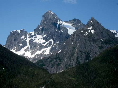
![The Mountain King]() The King of the Mountain as seen from the Mount Ripinksi to 3920 Traverse. June 23 2011.
The King of the Mountain as seen from the Mount Ripinksi to 3920 Traverse. June 23 2011.June 17: West Glacier Trail
After arriving at the Juneau Airport late the night before, Kessler, Shaylee, Kimberly and I took a taxi from the airport to the West Glacier Trailhead. The trail starts out gently, but then climbs rather steeply with some scrambling. It was a cloudy day, but the mountains and glacier were very visible and there were several excellent viewpoints along the way. There were some tricky stream crossings as well. Unfortunately, we forgot our mosquito repellent and the mosquitoes were fierce at times.
We hiked and scrambled up the trail to some excellent viewpoints looking down on the glacier. After enjoying the views, we also scrambled on the climbers' trail towards Mount McGinnis, but we didn’t have time to reach the summit, so we headed back down the trail. On the way back we stopped to play in Mendenhall Lake before walking the road to the bus stop and then catching a bus back to the hotel and then to Juneau.
Other than the mosquitoes, it was an excellent introduction for our Alaska trip and it was a very scenic hike.
![Mendenhall Glacier]() Looking down the Mendenhall Glacier.
Looking down the Mendenhall Glacier.![Mendenhall Glacier]() Mendenhall Glacier and Mount Rather as seen from the West Glacier Trail.
Mendenhall Glacier and Mount Rather as seen from the West Glacier Trail.![Kimberly]() Kimberly looking out over the Mendenhall Glacier and lake.
Kimberly looking out over the Mendenhall Glacier and lake.![Crossing the creeks]() Crossing some of the creeks on the West Glacier Trail.
Crossing some of the creeks on the West Glacier Trail.June 18: Tracy Arm
We didn’t do any mountain climbing on this day, but instead visited the Tracy Arm (fiord) by boat. The mountains were very spectacular and literally rise straight out of the ocean. This was one of the most impressive sites that I have ever seen.
![Iceberg]() An iceberg in the Tracy Arm.
An iceberg in the Tracy Arm.![Waterfall]() A waterfall spills into the Tracy Arm.
A waterfall spills into the Tracy Arm.![South Sawyer Glacier]() The South Sawyer Glacier.
The South Sawyer Glacier.![Harbor Seals]() Harbor seals in the Tracy Arm.
Harbor seals in the Tracy Arm.![Sawyer Glacier]() The Sawyer Glacier.
The Sawyer Glacier.![Blue Ice]() A closeup of the blue glacier ice in the Tracy Arm.
A closeup of the blue glacier ice in the Tracy Arm.![Glacier Ice]() A closeup of the ice in the Sawyer Glacier.
A closeup of the ice in the Sawyer Glacier.June 19: Gold Ridge/Gastineau Peak/Mount Roberts
The weather forecast was not good for the next few days, so it was a tough decision whether or not to attempt Gastineau Peak, especially since there was lots of snow in the mountains because of the earliness of the season. We decided to give the mountain a try, but if conditions were too bad we would turn back. We were well prepared for bad weather and snow.
We started climbing the peaks right from the Juneau Hostel. Two others from the hostel joined us for the climb. They were Don and Bobby (father and son) from Texas.
From the hostel, we walked up the roads to the trail that ascends to the top of the tramway. We quickly climbed through the forest to the tramway, which was in the clouds, but with occasional breaks in the clouds. At the tramway we were told that climbing Gastineau Peak was impossible with the current conditions and this early in the season. We were then told that we
might be able to climb up to the Gold Ridge (we had snow boots), but that this was not certain.
With the discouraging news and with a mix of fog and breaks in the fog we all set off towards Gold Ridge. It was a beautiful climb with occasional breaks in the clouds making for some good views. There were also several entertaining marmots along the trail and some nice wildflowers. Not far above the tramway we started crossing snowfields. They weren’t difficult, but were wet.
After crossing a very long snowfield we headed north and climbed to the highest summit along the Gold Ridge. By the time we reached the summit, the views were almost completely obscured by fog.
After eating an early lunch on the summit of Gold Ridge, Don, Kimberly and Shaylee decided to head back towards the tramway where they would wait for us. Bobby, Kessler and I decided to attempt to climb the impossible Gastineau Peak.
We retreated from Gold Ridge and to the ridgeline heading towards Gastineau Peak. It was almost completely snow covered and visibility was poor so we were very careful in noting landmarks (such as boulders) so we could find our way back (we also had a map and compass). We made our way towards Gastineau Peak through the snow through an almost whiteout.
By the time we reached the summit of (“the impossible”) Gastineau Peak, we had some partial clearing and could see a few hundred yards. From the summit of Gastineau Peak, we could feel the pull of Mount Roberts and decided to try for the next “impossible peak”.
The ridge between Gatineau Peak and Mount Roberts was much longer than it appeared to be on the map and it took longer than we thought it would. We made our way through the whiteout (while making BIG steps in the snow) until the ridge steepened just below the summit of Mount Roberts.
There was a steep snow slope to cross and I wished I had brought my ice axe. I did have my trekking poles so I kicked and carved steps up the hard snow so Bobby and Kessler could still climb the slope using my steps. It was time consuming, but eventually we were at the top of the snowfield and the summit was only steps away. It was our second impossible peak of the day so we felt rather pleased with ourselves.
We found a bare spot at the summit where we rested for a little bit. There wasn’t any visibility, but we thought that the views from here must be incredible if the weather is good.
After a short rest, we headed down the mountain. The ridge to Gastineau was again long, but with our observation of the landmarks, our steps in the snow and with the map and compass we were able to find our way back through the whiteout to Gastineau Peak without too much trouble. Once we were at the summit of Gastineau Peak we made our way as quickly as we could back to the top of the tramway where the views once again occasionally showed when the clouds would partially part. Shaylee, Kimberly and Don were happy to see us at the tramway. We told the little visitor center that we had made it all the way to Mount Roberts, but we weren’t sure if they believed us or not.
Since the tramway lets you have a free ride down if you purchase items/food, we ate big bowls of soup before riding the tramway back to Juneau where we walked back to the hostel.
It was a long and exciting day. It would have been nice to have some views from the summits of the mountains, but it was still a good climb.
![Approaching Gold Ridge]() Approaching the Gold Ridge.
Approaching the Gold Ridge.![Marmot]() A marmot stands guard over the Gold Ridge.
A marmot stands guard over the Gold Ridge.![Gastineau Peak]() Climbing Gastineau Peak in bad weather.
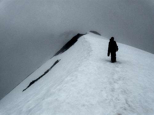
Climbing Gastineau Peak in bad weather.![White Out]() Descending Mount Roberts in a whiteout.
Descending Mount Roberts in a whiteout.![Looking down]() Looking down the Gold Ridge on June 19 2011. The weather finally started to clear when we were on our way down.
Looking down the Gold Ridge on June 19 2011. The weather finally started to clear when we were on our way down.June 20: Trail Through Time/East Glacier Loop/Nugget Creek
The weather forecast was still pretty bad so we decided to go to east side of Mendenhall Glacier instead of climbing Mount Juneau. Kessler, Shaylee, Kimberly and I rode the city bus to within two miles of the trailhead and walked from there.
While walking the road to the trailhead/visitor center we saw a bear cross the road just after we passed the “Bear Crossing” sign! After reaching the trailhead we hiked over to Nugget Falls. After enjoying the views of the falls we backtracked and hiked the East Glacier Loop. The loop trail had some nice views of the mountains and glaciers and we took a side trip to AJ Falls on the way back. We also took a side trip up Nugget Creek. The weather was better than it was the previous day and we got some pretty good views of the mountains.
After completing the East Glacier Loop we hiked the Trail Through Time and then road walked back to the bus stop where we headed back to Juneau. It was a great day and the weather was pretty good. There were much less mosquitoes on the East Glacier trail then there were on the West Glacier Trail that we did a few days previous.
![Nugget Falls]() Nugget Falls on the east side of Mendenhall Glacier.
Nugget Falls on the east side of Mendenhall Glacier.![East side]() View of the Mendenhall Glacier from near Nugget Falls.
View of the Mendenhall Glacier from near Nugget Falls.![Many Stairs]() Some of the many stairs on the East Glacier Trail.
Some of the many stairs on the East Glacier Trail.![What The?]() At the Mendenhall Glacier, some kids were riding their mountain bikes into the icy lake (with icebergs) at the Mendenhall Glacier. Must be an Alaska thing?
At the Mendenhall Glacier, some kids were riding their mountain bikes into the icy lake (with icebergs) at the Mendenhall Glacier. Must be an Alaska thing?June 21: Mount Juneau
Today, Kessler and I climbed Mount Juneau. Since we were warned that Mount Juneau was a difficult hike (at least for a seven year old), it was decided that Shaylee and Kimberly would hike the Perseverance Trail and visit the Gold Mining Museum rather than attempting the summit.
The four of us set off from the Juneau Hostel and walked along the roads to the trailhead. We then hiked up the trail past the mining equipment and up to Ebner Falls. The weather was good so just above Ebner Falls, Kessler and I headed up towards Mount Juneau while Shaylee and Kimberly turned around in order to hike back down to the Gold Mining Museum.
Kessler and I found the trail up Mount Juneau to be a little wet since the brush was close, but it wasn’t too bad and we made our way steadily up the mountain. About 1/2 of the way up was a very tricky stream crossing, the first major obstacle of the hike. The waterfall and stream were pretty roaring this early in the year, but we crossed it without any problems.
About 2/3 of the way up the mountain, the trail steepened and headed straight up the mountain. In this area we saw several mountain goats and some bald eagles. The views were fantastic since we were now above timberline for the rest of the climb.
Since the trail was south facing, there were only a few snowfields to cross and with the good weather we made much faster progress than we had on Mount Roberts a few days earlier.
Eventually we found ourselves on the summit of Mount Juneau. It was a pretty clear day and we could see seemingly forever (all the way as far as the Glacier Bay area). There was an endless sea of peaks visible in almost all directions and it was a grand site for sure.
Another couple from Alaska met us on top and we chatted before they headed on. After relishing the fine views and exploring around the summit, we headed back down the mountain.
We walked down the trail and then hiked the Flume Trail back down to the coast. At the Juneau Library we met Kim and Shaylee and we decided to fly to the Taku lodge to eat dinner there since the weather was so fantastically clear.
![Sheep Mountain]() Sheep Mountain area as seen from high on Mount Juneau.
Sheep Mountain area as seen from high on Mount Juneau.![Tricky crossing]() Kessler making a tricky crossing of the waterfall on Mount Juneau.
Kessler making a tricky crossing of the waterfall on Mount Juneau.![Mount Roberts and Sheep Mountain]() Mount Roberts and Sheep Mountain as viewed from Mount Juneau.
Mount Roberts and Sheep Mountain as viewed from Mount Juneau.![Looking Straight Down on Juneau]() Looking straight down on Juneau from the summit of Mount Juneau.
Looking straight down on Juneau from the summit of Mount Juneau.![Summit]() Kessler on the summit of Mount Juneau.
Kessler on the summit of Mount Juneau.![Looking North]() Looking North from the summit of Mount Juneau.
Looking North from the summit of Mount Juneau.![Looking east]() Looking east from the summit of Mount Juneau.
Looking east from the summit of Mount Juneau.![Mount Juneau summit]() Kessler on the summit of Mount Juneau.
Kessler on the summit of Mount Juneau.![View South]() View south from the summit of Mount Juneau.
View south from the summit of Mount Juneau.![Juneau Icefield]() Looking out accross on of the Glaciers in the Juneau Icefield.
Looking out accross on of the Glaciers in the Juneau Icefield.![Taku Glacier]() Taku Glacier and Hodgkins Peak (I think).
Taku Glacier and Hodgkins Peak (I think).![Devils Paw]() The Devils Paw as seen over the Taku Inlet.
The Devils Paw as seen over the Taku Inlet.![Black Bear]() Black bear seen near the Taku Lodge.
Black bear seen near the Taku Lodge.![Twin Glacier Peaks]() Twin Glacier Peaks as seen from near the Taku Lodge.
Twin Glacier Peaks as seen from near the Taku Lodge.June 22: Dan Moller Trail
I had originally hoped to climb mount Jumbo today, but everyone was tired so we decided to hike the Dan Moller Trail instead (we had a ferry to catch in the afternoon and would have to get up very early for an attempt of Mount Jumbo). Kimberly, Shaylee, Kessler and I took a bus part way to the trailhead from which point we road walked to the trailhead itself.
We headed up the trail and took a rest at a viewpoint for a snack. Upon reaching the three-way junction with the Treadwell Ditch Trail we let the kids decide which way to hike and they decided to hike the Treadwell Ditch Trail east from there. We followed the trail east to the Blueberry Hills subdivision before road walking all the way back to Juneau. That afternoon we boarded a ferry for Haines.
![Dan Moller Trail]() Kimberly along the Dan Moller Trail.
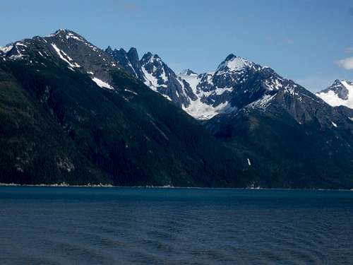
Kimberly along the Dan Moller Trail.![Spectacular Peaks]() Some of the spectacular peaks as seen from the Juneau to Haines Ferry.
Some of the spectacular peaks as seen from the Juneau to Haines Ferry.![Mountains above the sea]() The mountains in SE Alaska truely rise straight out of the ocean.
The mountains in SE Alaska truely rise straight out of the ocean.June 23: Mount Ripinski/Peak 3920
Today, Kessler and I set off to climb Mount Ripinski. After spending the night at the Bear Creek Cabins, we caught a ride out to the Skyline Trailhead with the owner of the cabins since he was headed out to town anyway.
It was a beautiful and clear day and we made our way up the mountain through the forest. Not long after starting the hike, we met a seemingly nice, but delusional old man hiking the trail. After having a short and strange conversation with the man we pushed on.
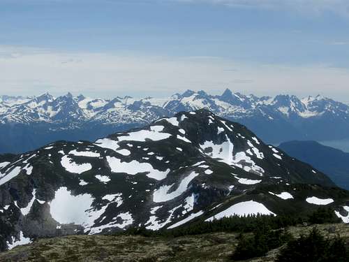
After we emerged from the forest, the views got better and better as we got higher and higher up the mountain. Since the weather was so clear the views of the surrounding mountains were very impressive.
We made our way rather quickly to the summit of Mount Ripinski. I thought views from Mount Juneau were spectacular (and they are), but views from Ripinski-Peak were absolutely stunning. The views of the Cathedral Spires and other peaks (hundreds and hundreds of them) are much more spectacular than even places like the Tetons, Wind Rivers and the North Cascades (and I'm from Washington).
We had originally planned to climb Ripinski only, but the weather was fantastic and it was still early. We had been told that the traverse from Mount Ripinski to Peak 3920 takes 2 or more days, but looking at the map the route seemed quite reasonable.
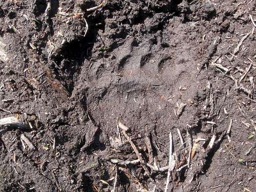
After lunch, we set off towards Peak 3920 seeing many bald eagles and mountain goats along the way. The traverse wasn’t too hard and we made our way along the ridge towards Peak 3920. Along the way we saw some HUGE brown bear tracks. Just before the summit there was a nice and short vertical scramble (it had a fixed chain up it somewhere, but at the time we didn’t know this and missed it) before we reached the summit.
After enjoying more fantastic alpine views we headed down the mountain and to the Seven Mile Trailhead. It was a steep route down and we saw one other climber along the way.
We had completed the alpine traverse of Mount Ripinski and Peak 3920 in 8 hours. This included 10 miles of rugged terrain with 5100 feet elevation gain. Kessler (age 9) had a great time and it was one of the best days ever.
It only took less than a minute to catch a ride that would take us back to Haines. The lady who picked us up said she didn’t want to see a child standing out there in the hot sun. It was about 68 degrees outside, but hey, this is after all Alaska.
![Mount Ripinski]() Kessler approaching the summit of Mount Ripinski.
Kessler approaching the summit of Mount Ripinski.![Looking over the Chilkoot Inlet]() Looking out over the Chilkoot Inlet from the slopes of Mount Ripinski.
Looking out over the Chilkoot Inlet from the slopes of Mount Ripinski.![Mount Ripinski]() Kessler on the summit of Mount Ripinski.
Kessler on the summit of Mount Ripinski.![Near the summit]() Near the summit of Mount Ripinski.
Near the summit of Mount Ripinski.![Summit]() Summit of Ripinski.
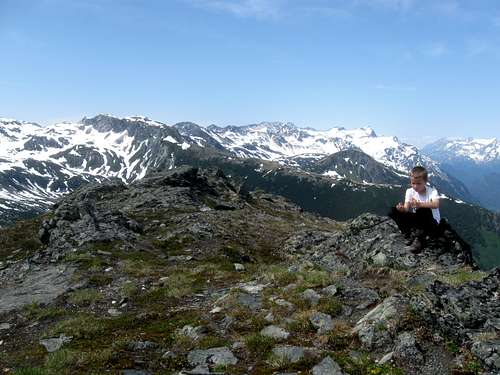
Summit of Ripinski.![Ripinski-3920 ridge]() Kessler on the ridge between Mount Ripinski and Peak 3920.
Kessler on the ridge between Mount Ripinski and Peak 3920.![BIG bear track]() HUGE brown bear track (fresh looking too) on the Ripinski-Peak 3920 Ridge.
HUGE brown bear track (fresh looking too) on the Ripinski-Peak 3920 Ridge.![Looking back]() Looking back to Mount Ripinski as we approached Peak 3920.
Looking back to Mount Ripinski as we approached Peak 3920.![Scramble]() This is the last scramble just below the summit of Peak 3920.
This is the last scramble just below the summit of Peak 3920.![Summit]() Kessler on the summit of Peak 3920.
Kessler on the summit of Peak 3920.![Summit]() The summit of Peak 3920.
The summit of Peak 3920.![Descending]() Descending Peak 3920.
Descending Peak 3920.June 24: Chilkat River
Today we rafted the Chilkat River through the Bald Eagle Reserve. We saw hundreds of bald eagles and other wildlife, but no big brown bears (which are known to frequent the area).
![Bald Eagle]() One of the many bald eagles we saw along the Chilkat River.
One of the many bald eagles we saw along the Chilkat River.![Off Topic]() Running the Chilkat River.
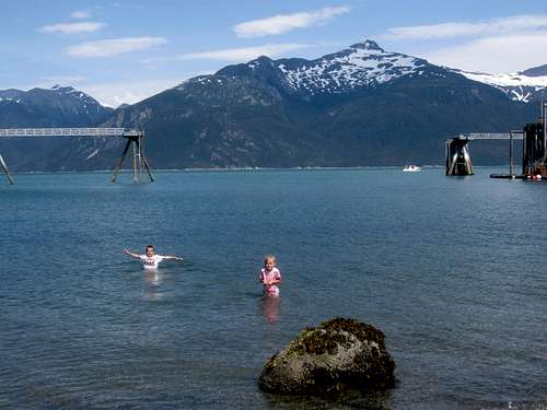
Running the Chilkat River.![Haines]() Hitting the beach after over a week of climbing mountains. Haines Alaska.
Hitting the beach after over a week of climbing mountains. Haines Alaska.June 25: Mount Riley
Today we were hoping for clear skies so Kessler and I could show Kim and Shaylee all the fantastic views of the mountains that you can have from the peaks surrounding Haines. Fate was not with us and it was not to be. The cloud line was 1000-2000 feet elevation so the really spectacular peaks could not be seen.
From Haines, we took a taxi to the Beach Road/Battery Point Trailhead. We made our way up Mount Riley hoping that the clouds would lift a little, but the cloud ceiling never did lift above 2000 feet. Along the way we saw a very colorful woodpecker. After reaching the summit of Mount Riley, we ate lunch. It was raining a bit, but the weather wasn’t terrible.
From the summit we headed north towards Lily Lake and then took the trail down to the Mud Bay Road, completing a full traverse of the mountain. From there it was a fairly long road walk back to the Bear Creek Cabins. Along the way we met a female biker who had just got attacked by a pit bull. We felt bad for her, but were glad that we didn’t run into the pit bull since we had small children with us.
![Tree]() Tree seen on the route to Mount Riley.
Tree seen on the route to Mount Riley.![Climbing Mount Riley]() Climbing Mount Riley on June 25 2011.
Climbing Mount Riley on June 25 2011.![Forest]() Deep in the forest on the lower slopes of Mount Riley.
Deep in the forest on the lower slopes of Mount Riley.![Mount Riley]() Summit of Mount Riley.
Summit of Mount Riley.June 26: Skagway Trails
After attending church Kessler, Shaylee, Kimberly and I hiked around Skagway visiting many of the interesting historic sites.
June 27-July 1: Chilkoot Trail
June 27
Today was our first day on the Chilkoot Trail. Kimberly, Kessler, Shaylee and I would hike the 7.5 miles to the Canyon City (ruins) Campsite.
We started at 8:20 AM and headed up the first steep hill before dropping down the other side. The trail got gentler after this, but the mosquitoes were absolutely horrible! Because of the mosquitoes we walked fast, but had a lunch break in the hut at the Finnegan’s Point Camp, but did spend some time admiring the views of the Irene Glacier. After lunch, we hit the trail, but luckily the mosquitoes died down as we left Finnegan’s Camp. By the time we reached Canyon City it was 1:30 PM, so we had plenty of time to look around.
Since it was early, at 4 PM, we set off to hike to the Canyon City Ruins themselves. The kids loved the suspension bridge and had a good time looking at the ruins including the giant boiler. After visiting the ruins, we returned to camp having completed 9.5 miles (including the side trip to Canyon City) of trail today.
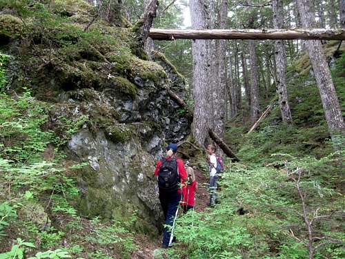
![Near the Beginning]() The trail near the beginning.
The trail near the beginning.![Irene Glacier]() Irene Glacier as seen from the Chilkoot Trail.
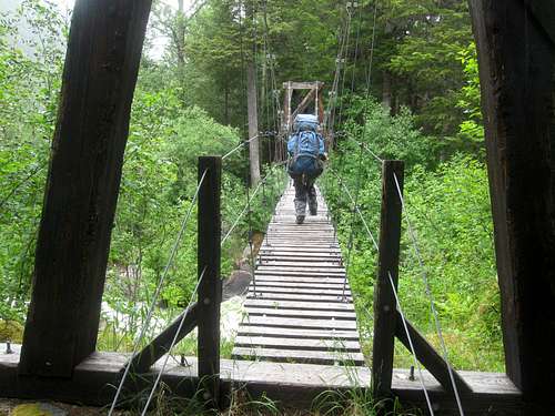
Irene Glacier as seen from the Chilkoot Trail.![Suspension Bridge]() The suspension bridge near the Canyon City ruins.
The suspension bridge near the Canyon City ruins.![1898 Stove]() This stove at Canyon City (ruins) along the Chilkoot Trail dates back to 1898.
This stove at Canyon City (ruins) along the Chilkoot Trail dates back to 1898.![Panning for Gold]() Panning for gold at Canyon City ruins Alaska. Photo for trip report. June 27 2011.
Panning for gold at Canyon City ruins Alaska. Photo for trip report. June 27 2011.
Today we made the trek from Canyon City to Sheep Camp. The group behind us saw a big brown bear cross the suspension bridge near Canyon City, but we missed it. We had expected that the hike would be nice and gentle, but there were actually quite a few steep up and downs. It was cloudy today, but we did occasionally get some nice views. The kids like crossing the bridges along the way. The rain forest and waterfalls made the trail quite scenic in this section. We arrived in camp at 1:30 PM (we had started at 9:30 AM) and relaxed and explored the rest of the day as well as watched the squirrels chase each other in and out of the holes in the trees.
![Bridge Crossing]() Bridge along the Chilkoot.
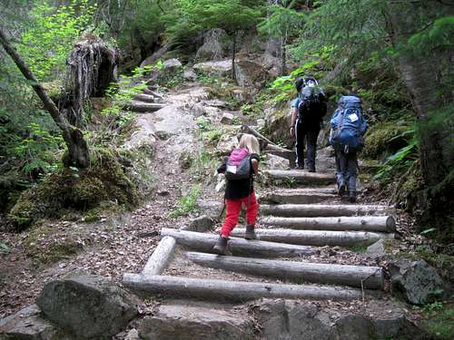
Bridge along the Chilkoot.![Chilkoot Trail]() A steep section of the Chilkoot Trail.
A steep section of the Chilkoot Trail.![Waterfalls]() Some of the waterfalls around Sheep Camp.
Some of the waterfalls around Sheep Camp.![Hiking up the Chilkoot]() Hiking up the Chilkoot Trail.
Hiking up the Chilkoot Trail.
Today was the big one. We would cross the notorious Chilkoot Pass! We woke up at 4:30 am and hit the trail at 5:30 AM.
Much of the trail was boulders, but it quickly turned to snow as we gained elevation. The snow was hard, so we were glad that we got an early start. There were many artifacts to look at along the way.
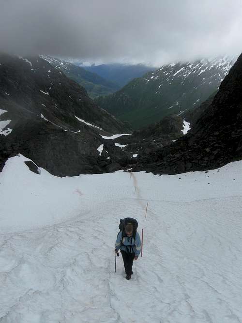
After much boulder-hopping and snow travel, we found ourselves at the base of Chilkoot Pass. The climb up to the pass via the “Golden Stairs” (which is just a very steep boulder field) sure looked intimidating from the base of the pass!
After a rest we headed up the pass through the snow. After a short time, the snow turned into a steep boulder field that must be climbed. It was misty, cold, wet and slippery climbing up the 1000+ feet of steep boulders, but there were some nice waterfalls and artifacts to be seen along the route.
Not far from the top we met the Parks Canada Ranger than manned the post up on Chilkoot Pass. He told us that we were making great time and that he would see us at the top.
We found ourselves on the summit of the misty and windy pass at 10 am. We were now in Canada! From there we made our way a short distance to the warming hut where the Parks Canada Ranger had hot water waiting for us. We finally cooked a real breakfast and some hot chocolate (due to our early start, we had just at snacks at 5 am).
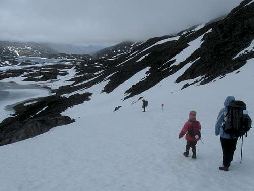
It was nice in the warming hut, but our work was not over and we still have ½ the distance to cover for the day. We made our way down the pass, through the snowfields and past the frozen lakes. Most of the time we were on snow and ice, but this actually had an advantage of letting us cross the rivers on snow bridges and ice. Later in the year there are icy wades. We did get pretty wet though (especially Kessler), but we pushed on to Happy Camp which is still located in the alpine country, but where little shrubby trees begin to appear.
We made it to Happy Camp by 2 PM. Once at the hut, we set up camp and went to dry our boots (or at least try). We spent the afternoon and evening relaxing and exploring before heading off to bed.
![Towards the Chilkoot Pass]() Climbing towards the Chilkoot Pass.
Climbing towards the Chilkoot Pass.![Along the Chilkoot Trail]() Along the Chilkoot Trail.
Along the Chilkoot Trail.![Up the Chilkoot]() Hiking up the Chilkoot Trail.
Hiking up the Chilkoot Trail.![Route]() The route up Chilkoot Pass.
The route up Chilkoot Pass.![Climbing up to the Chilkoot Pass]() Climbing up to the Chilkoot Pass.
Climbing up to the Chilkoot Pass.![Nearing the Pass]() Nearing the Chilkoot Pass.
Nearing the Chilkoot Pass.![Climbing]() Climbing up to the Chilkoot Pass.
Climbing up to the Chilkoot Pass.![Crater Lake]() Crater Lake.
Crater Lake.![Welcome to Canada!]() The Canadian ranger station on the summit of Chilkoot Pass.
The Canadian ranger station on the summit of Chilkoot Pass. ![Near Chilkoot Pass]() Descending the Chilkoot Trail towards Crater Lake.
Descending the Chilkoot Trail towards Crater Lake.
We slept in today and got a late start. The kids didn’t get out of bed until 9 AM and we didn’t hit the trail until 10:30 AM! Happy Camp was a ghost town by then.
We made our way down to Deep Lake where we ate lunch. About half way to Deep Lake we crossed the last of the snowfields for the hike and the trail was much drier.
We took another break at Lake Lindeman and took side trips to a small museum and to several other artifacts. The scenery was nice with all the lakes and mountains around. The kids really enjoyed the museum and after visiting it we headed back to the main trail and towards Bare Loon Lake.
We arrived at Bare Loon Lake at 4:55 PM which was our campsite. Our camp was beautiful and was right next to the lake. There was lots of bird life around and it was very noisy!
![Along the Chilkoot]() along the Chilkoot Trail below Happy Camp.
along the Chilkoot Trail below Happy Camp.![Artifacts]() 1898 gold rush artifacts near Lindeman Lake.
1898 gold rush artifacts near Lindeman Lake.![Bare Loon Lake]() Bare Loon Lake; our last campsite on the Chilkoot Trail.
Bare Loon Lake; our last campsite on the Chilkoot Trail.
Today was our last on the Chilkoot Trail. We only had four miles to go, so we were in no hurry, We got up at 7 AM and left camp at 8 AM, but we were surprised that we found the camp abandoned by the time we left. Since you couldn’t eat lunch at the Bennett Train Station until 10:30 AM, we were surprised that everyone was in such a hurry to get off the hike.
It was a beautiful and sunny day and the scenery was still nice for the last part of the hike. The mountains and lakes were all along the route, but it was much drier here than on the Alaska side. It took us two hours to complete the route to the train station.
At the train station, we ate lunch and boarded the White Pass & Yukon Railroad back to Skagway. It had been a great hike and we were all ready for showers, clean clothes, and other luxuries.
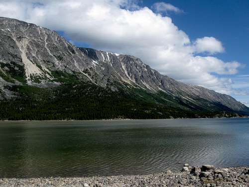
![Lake Bennett]() Lake Bennett.
Lake Bennett.![Dusty]() The last part of the Chilkoot Trail is much drier than the beginning of the trail.
The last part of the Chilkoot Trail is much drier than the beginning of the trail.![Near White Pass]() Scenery near the White Pass along the White Pass-Yukon RR.
Scenery near the White Pass along the White Pass-Yukon RR.![Railroad Bridge]() Part of the historic White Pass-Yukon RR.
Part of the historic White Pass-Yukon RR.July 2: Icy Lake/Lower Dewey Lake/Sturgills Landing
I had originally planned on climbing AB Mountain, but the others (Kim, Kessler and Shaylee) wanted to do something shorter since we had just completed the Chilkoot Trail.
We hiked up one of the trails to Lower Dewey Lake. From there we hiked north towards Icy Lake before returning to Lower Dewey Lake. From there we decided to hike over to the beach at Sturgills Landing. The route was a bit more rugged than we expected near the end.
After eating lunch at the beach, we headed back, but took a wrong turn on one of the trails that headed to Skagway and we ended up on an overlook on top of a big cliff. After backtracking and finding the right route we hiked back down to Skagway.
It actually turned out to be a long 11 mile hike today. It was a bit tiring since we had just completed the Chilkoot Trail.
![Sturgills Landing]() Sturgills Landing.
Sturgills Landing.![Lower Dewey Lake]() Lower Dewey Lake.
Lower Dewey Lake.

























Comments
Post a Comment