A few more steps and I was on top. My breath came out in one long heavy 'whew' as I sat down wearily on a rock near the summit register and took in the view. It was a view I'd seen many times before from many different angles and altitudes, but I still found myself enjoying it immensely in spite of the profound wave of fatigue that I was experiencing.
I was sleepy. Very sleepy...
Goode...
This day had begun early yesterday- that is, Friday morning- about 30 hours ago. I woke up earlier than usual after less than optimal sleep. It was early October and the thought of visiting a very popular area to bag a peak or two in an unpopular season suddenly seemed pretty appealing.
To make this trip a reality, I had to run a few errands to acquire some supplies before I went to work. I worked a swing shift, so there was certainly adequate time to hit a couple of stores and load my gear in my truck before the start of my shift. As usual, I intended to leave from work at the end of my shift and head straight for the Sierra.
I clocked out around midnight and jumped in my truck- excited to enjoy another weekend in the High Sierra. The overnight drive consisted of about 350 miles of freeways, rural highways and mountain roads across central California- from San Jose to Bishop Creek. No traffic. Just some Pink Floyd, a Thermos of coffee and myself.
As usual, the sleepiness got more intense as I drove east down from the summit of Tioga Pass, so I stopped in the Lee Vining Ranger Station parking lot for about 30 minutes just to close my eyes. This had become a tradition for me for several years and never failed to provide a 'second wind' for whatever journey I happened to be on.
A couple hours or so later, it was still dark when I self-issued a Wilderness Permit at the White Mountain Ranger Station in Bishop. I loved these off-season trips! No lines, no competition for permits, and no stress. Then, there was just a twenty-plus mile drive up to South Lake- about 6000 feet higher- and the Bishop Pass trail-head.
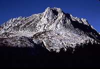
![Thompson Morning]() Mount Thompson Zoom
Mount Thompson Zoom | ![Goode and Long]() Mount Goode
Mount Goode | ![Hurd Peak]() Hurd Peak
Hurd Peak |
The delicious pre-dawn cold invigorated me as I began hiking out of the nearly deserted overnight parking lot. There was just enough light to make a head lamp unnecessary. Soon, however, as I hiked up the trail, the altitude and lack of sleep began to take their toll on me. Nevertheless, I was determined to make this a double summit weekend. Today, my goal was Mt. Goode- a relatively easy summit readily accessible from the Bishop Pass trail which I now followed. I would camp at the foot of the easy southeast slope and, hopefully bag the summit that afternoon. The next day, Sunday, I intended to follow the trail to Bishop Pass and make an attempt on Mt. Agassiz. Then a hike back out to the truck for the long drive back to San Jose.
All in all, not an unusually difficult trip except that it was a bit further from home than I usually would be for a mere 2 day weekend and I had two rather lofty summits on my itinerary. Normally, I spent the short weekends climbing the peaks around Tioga and eastern Yosemite. I'd been doing this for years and I was beginning to run out of peaks. Time to branch out and extend my range a bit.
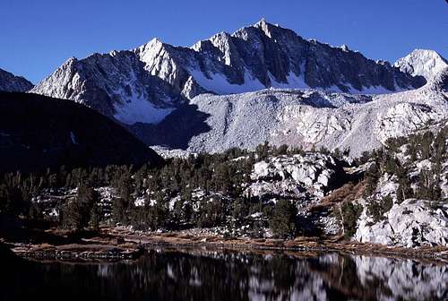
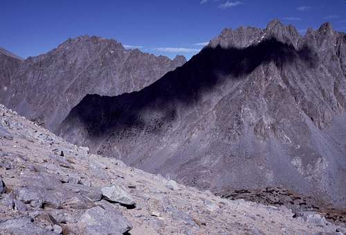
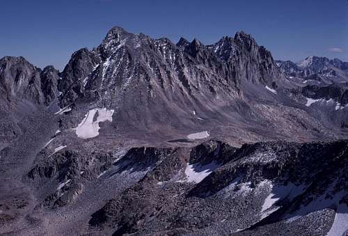
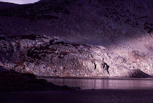
The morning sun began lighting up the local peaks as I hiked up the trail. Soon I was hiking past Long Lake and enjoying my first views of Mt. Goode. Many times I've hiked this trail and gazed up at it's impressive summit. Now it seemed that I would be finally standing up there.
![Saddlerock Lake]() Saddlerock Lake
Saddlerock Lake | ![East of Goode]() Mount Goode From East
Mount Goode From East |
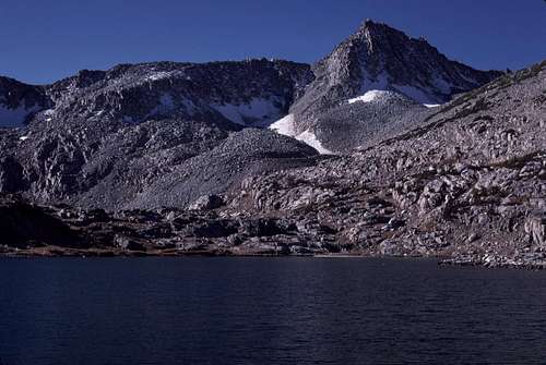
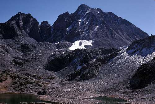
Just beyond Saddlerock Lake, I left the trail and hiked a short distance toward the eastern foot of the mountain. I wandered around a bit until I found an excellent campsite in a flat slabby area dotted with numerous ice-age erratics and dwarf pines. To the south, I had an excellent view of Bishop Pass which was dominated by the towering bulk of Mt. Agassiz. To the east was the dark craggy Inconsolable Range and the jagged spire of Cloudripper. West of me was the easy eastern slope of Mt. Goode to which I now turned my attention.
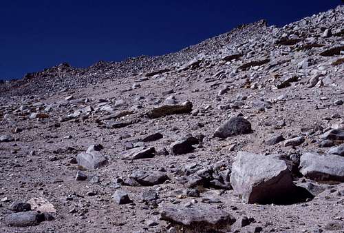
I left my dark green backpack leaning against a large boulder facing Mt. Goode so I would be able to see it later when I returned from the top. I hiked a short distance to the base of the talus and began the 1800 foot slog up to the summit.
![Inconsolable Range]() Cloudripper and Picture Puzzle Peak
Cloudripper and Picture Puzzle Peak | ![Mount Agassiz]() Mount Agassiz
Mount Agassiz |
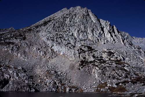
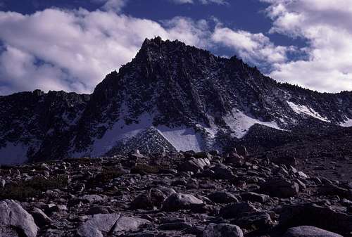
![SE Slope of Mount Goode]() The Southeast Slope of Mount Goode
The Southeast Slope of Mount Goode
The view from the top was excellent as expected. The nearby Palisades were as impressive as ever as were the Inconsolables and the Mt. Thompson region. I especially enjoyed the view of the Black Divide- an area that I had yet to visit. A remote region full of mystery and challenge.
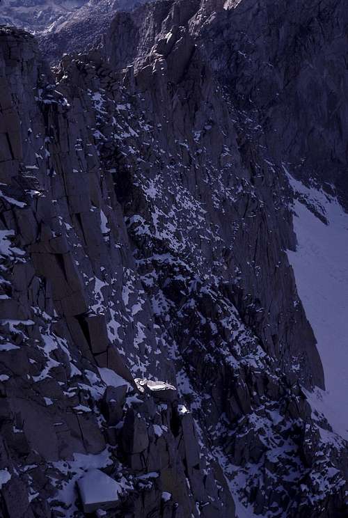
I saw the prow of rock that led to the top of the north buttress and knew that I had to stand there. As usual, I prayed to the Mountain Gods that there would be no earthquakes or sudden gusts of wind as I carefully made my way out on the narrow peninsula or rock. It was easy, but the exposure was sobering.
![Goode Summit Prow]() Summit Prow
Summit Prow | ![Goode North Face Detail]() Northwest Face
Northwest Face |
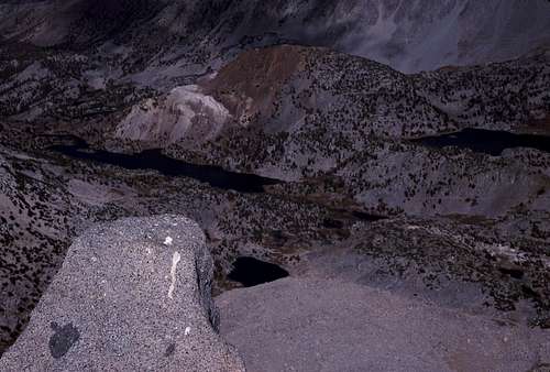
I stood there at the edge- a small peninsula of rock in a sea of air- pondering the scene. Hundreds of feet below- seemingly directly under my big toes- was the Goode Glacier. Beyond were many lakes and canyons that I'd visited on previous trips plus the familiar lakes and landmarks of the Bishop Pass trail that I'd been past so many times before and just a couple of hours or so earlier. The mountains that surrounded the region were like old friends. Many I'd already climbed, some I'd failed on and many more were on my list for future attempts including Mt. Agassiz which I was eager to climb the next day. It all seemed kind of surreal... like a dream...
...like a dream... I tried to imagine what it all looked like from up there during the Ice Age. Immense glaciers where lakes now existed. Seracs, ice-falls, yawwwwning crevasses... like a dream... I was drifting... floating... falling... falling...
FALLING!!
For the briefest of moments I'd actually dozed off while standing on the edge of the summit prow. My knees had momentarily lost strength and I was just in the process of toppling over, when a strong shot of adrenalin blasted through my veins- bringing me back to reality- before a premature encounter with ultimate reality. Rather shaken, I retreated back to the safety of the main summit rocks where I sat trying not to think about what would have happened if I'd been unconscious a fraction of a second longer. Jeez!
...And Tired
The late afternoon sun was shining fully on the western faces of the Palisades. It was time to go back to camp, make dinner, and get a good nights sleep. I seemed to have just enough reserve strength left for the descent- and that would be just about it for me that day. After a few hundred feet of careful scrambling down class 2 boulders, there was an easy descent along a series of interwoven sandy use trails.
![The Northern Palisades]() The Palisades
The Palisades | ![Unnamed Peak...]() Peak 12689
Peak 12689 |
I quickly reached the edge of a final steep drop off overlooking the slabby bouldery area where I'd left my backpack. As mentioned above, I'd left it leaning against a boulder facing the mountain so it would be easy to spot on my return. I paused to look for it and what I saw made me stop and exclaim aloud,
“I don't believe this!”
Looking down the last few hundred feet or so, I easily spotted my green backpack right where I'd left it, but several paces away, in plain sight of it, someone had set up a large dome tent. Near the tent were two other backpacks leaning against another boulder near my pack. I could see various items of gear on the flattish top of the boulder near the backpacks. I didn't see any people, though. Maybe they were in the tent snoozing or out away from camp. My adrenalin was back- this time fueled by anger.
“You gotta be f***ing kidding me!
Unbelievable!”
What was I going to do about this? There were literally thousands of other fine places to camp in this basin, but these etiquette-challenged hikers seemed to deliberately ignored my pack and move right in to
my spot. What on earth were they thinking?
Goddammit! I hated confrontations! However, I felt somewhat obliged to the backpacking community to try and educate these ignoramuses. I paused from time to time as I weaved down various use trails to try and catch a glimpse of them. Who were they?
I imagined a couple of college-aged jock types- all ego and brawn with little of value upstairs. Damn it! This could turn out to be ugly and I didn't want or expect to have to deal with this kind of shit on a mountain trip. This was supposed to be my sanctuary from the crap of the world. Wasn't it?
Another thought came to me that almost made me smile a little. What if they were women? You know, young women from Europe vacationing in America. Blonde, tanned and long legs. Speaking broken English with strong accents. Unaware of our local climbing and camping customs. Yeah, right! Even if this almost impossible scenario
did turn out to be true, I'd be too pathetically shy to take advantage of the situation. Okay, so, back to the anger! But...
The girl fantasy helped to mellow me out a little and I came up with a good plan. I would take the 'high road'. I would enter 'their' camp, pick up my gear and if they were around, I'd simply say something like, “Well, looks like you guys took my spot, so I'll go ahead and move on to another one. Enjoy.” I hoped that would leave them in a wake of guilt and shame. Okay, maybe this road wasn't so 'high' after all. (My as yet unmet future wife seems to enjoy traveling on it fairly often.) At least I would be able to move on with the rest of my adventure with a bit of peace of mind.
I was now quite a bit closer to my pack and the mysterious dome tent, but still no sign of the occupants. I glanced down frequently at the camp whenever I could safely advance a step or two without stumbling. At one point I
did stumble. I looked down and guided my feet around a piece of granite protruding from the sand of the use trail I was on. When I looked back up, what I saw made me stop once again and this time I whispered,
“I don't believe
this!”
There, again, was my green pack leaning against a large rock right where I'd left it. To the right where moments before I'd seen a dome tent and a couple of backpacks, there was now... Only boulders and dwarfed pines. The gear that I'd seen on the large flat rock turned out to be only some small rocks and their shadows...
“What the...”
I blinked, rubbed my eyes and looked again. Was I looking in the right spot? Yes! My pack was down there alone- apparently as it had been all along. I tried to 'see' the dome tent and the gear again, but it was no use. The large boulder only vaguely resembled a tent. How could I have made such a visual blunder? I've had a few sleep-deprivation induced hallucinations before, but this was a good one. I felt a bit sheepish and embarrassed about my temper tantrum. Luckily, I was the only witness. Hah!
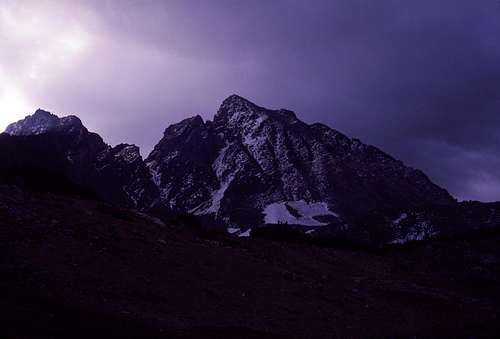
Upon arrival back in camp, I was almost disappointed to realize that I was still alone. But, that's what I wanted wasn't it? I ate some dinner and noticed that the clouds- which had been building up all day- didn't dissipate at sunset like they usually do. Ironically, after all that fuss about
my camp site, I decided move to a more sheltered spot and set up my plastic 'tube' tent.
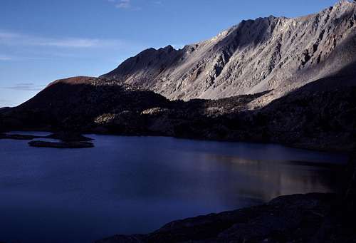
![Saddlerock Lake Evening]() Saddlerock Lake Evening
Saddlerock Lake Evening
Good thing. The overnight weather change that had occurred hadn't been part of the weekend forecast. The rattling of grapnel and cold rain on the roof of my plastic shelter didn't prevent me from getting an awesomely great nights sleep. But, it
did keep me from attempting my second goal, Mt. Agassiz, the next day.
Oh, well. It was still there the following year. (Or was it? Let's see... How much sleep did I get on
that trip...?)
![Sunlight and Saddlerock Lake]() A Bit of Morning Sunlight
A Bit of Morning Sunlight | ![Mt. Agassiz]() Mount Agassiz and Storm
Mount Agassiz and Storm |


Comments
Post a Comment