
-
 12813 Hits
-
 79.03% Score
-
 10 Votes
|
|
Area/Range |
|---|---|
|
|
46.93057°N / 11.32553°E |
|
|
Hiking, Mountaineering, Mixed, Scrambling, Skiing |
|
|
Spring, Summer, Fall, Winter |
|
|
10486 ft / 3196 m |
|
|
1 - Overview
 Rosskopf above the Sterzing / Vipiteno Basin Rosskopf above the Sterzing / Vipiteno Basin |
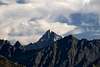
Together with the Botzer Group the Aggls Rosskopf Group is one of the two Italian subgroups of the Stubai Alps. It basically runs from west to east in a slight curve and is located between Pflerschtal / Val di Fleres in the north and Ridnauntal / Val Ridanna in the south. Both valleys can be easily accessed from the Brenner Motorway which runs through Eisacktal / Valle Isarco. The group is composed of along single ridge which starts from the main ridge south of the Feuersteine / Montarsi, two 3000ers on the Stubai Alps Main Ridge. It starts with Agglsspitze / Cima dell’Accia in the west and ends with Rosskopf / Monte Cavallo in the east. On the way several side ridges turn off, all towards the north into Pflerschtal / Val di Fleres.
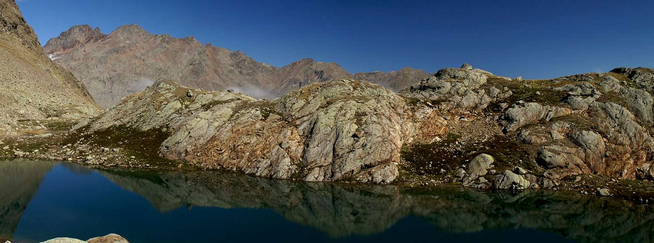
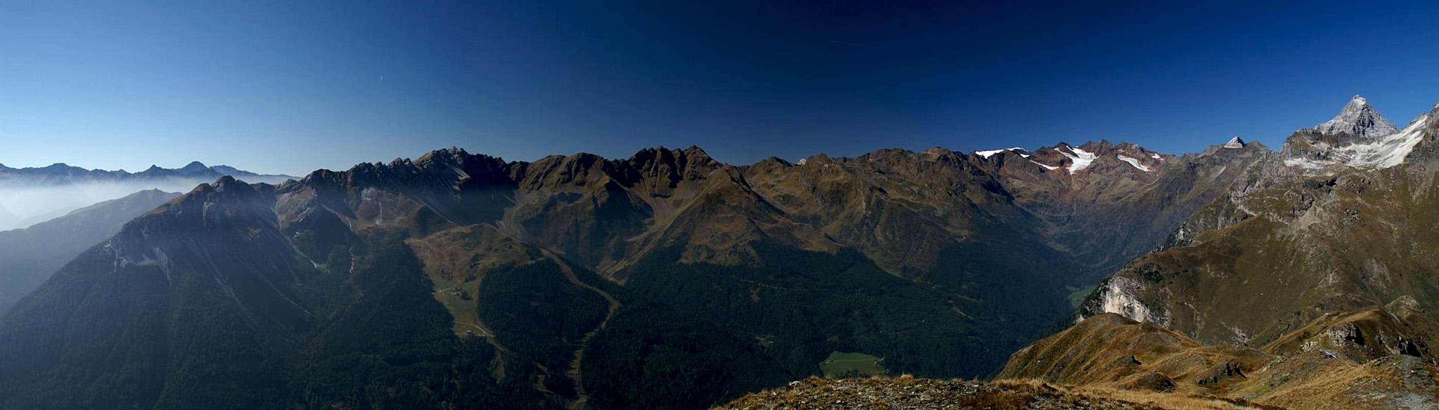
The eastern part of the group is quite popular, mainly because of the cablecars which run from Sterzing towards Rosskopf and from Pflersch / Fleres towards Wastenegg. Both serve the ski runs in winter and have sprouted several inns and restaurants around the easternmost mountains of the group. In summer usually only the mountains east of and up to Wetterspitze / Cima del Tempo are climbed while the western mountains are usually reserved for tour skiers in winter. To the south of the group, at an average elevation of 2000m a panoramic high route, the Ridnauner Höhenweg offers excellent views towards the mountains in the south.
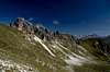
The westernmost mountains like Agglsspitze / Cima dell’Accia, Rochollspitze / Cima del Forno, Zwerchwand / Croda Traversa and Lorenzspitze / Punta Lorenzo are reserved for mountaineers. Their reddish gneiss summits are brittle and require good technical abilities. There are three mountain huts which serve as base for climbs in the area (also the Stubai Alps Main Ridge): Grohmannhütte / Rifugio Vedretta Piana and Teplitzer Hütte / Rifugio Vedretta Pendento in the south and Magdeburger Hütte / Rifugio Cremona alla Stua in the north. They are connected by a glacier traverse through the highest saddle in the group, Magdeburger Scharte / Forca di Montarso, and Feuersteinferner / Vedretta di Montarso.
Geologically the Aggls – Rosskopf Group shows a mix of rocks typical for the Stubai Alps. While most of the ridge is made up from gneiss – barren in the west, grass covered in the east – there are several mountains which stand out from the rest. Telfer Weissen / Cime Bianche di Telves and Schleyerwand / Monte Velo have limestone summits which shine out brightly all across the valleys.
2 - The Aggls Rosskopf Group on SP
S A R N T A L A L P SRosskopfSchleyerbergSchleyerwandTelfer WeissenWetterkreuzWasteneggSeebersp.NockWettersp.BodnerbergPfaffenbergMaurersp.Maratschsp.SpeikofelPutzenEllesspBotzerWinkeljochsp.Äuss. HocheckHochtrogsp.Schneesp.Lorenzensp.ZwerchwandlSonnklarsp.Rocholsp.Agglssp.FeuersteineSchneesp. 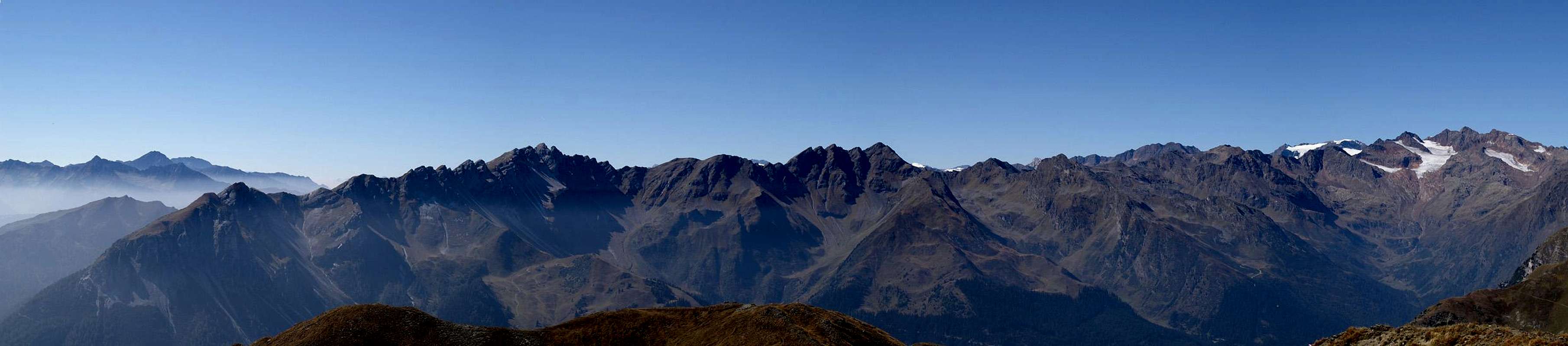  |
3 - The Summits
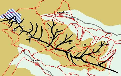 Schematic Map of the Aggls – Rosskopf Group
- Agglsspitze / Cima dell'Accla (3196m)
![]()
- Hochtrogspitze / Cima Alto Trog (2842m)
- Rochollspitze / Cima del Forno (3081m)
- Zwerchwand / Croda Traversa (2934m)
- Lorenzspitze / Punta Lorenzo (2886m)
- Inneres Hochegg / Monte Alto (2595m)
- Ridnauner Schneespitze (2850m)
![]()
- Äußeres Hochegg / Monte Alto (2880m)
![]()
- Winkeljochspitze / Giogo del Cantone (2810m)
- Ellesspitze / Punta di Elles (2661m)
- Maurerspitze / Monte Muro (2628m)
- Wetterspitze / Cima del Tempo (2709m)
![]()
- Seeberspitze / Cima del Tempo (2567m)
![]()
- Telfer Weißen / Cime Bianche di Telves (2588m)
![]()
- Rosskopf / Monte Cavallo (2189m)
![]()
3.2 - Maratschspitze Ridge
- Maratschspitze / Monte Maraccio (2648m)
![]()
- Speikofel (2410m)
- Putzen / Cima Pozza (2363m)
3.3 - Bodnerberg Ridge
- Bodnerberg / Cima di Piano (2372m)
- Pfaffenberg / Montagna del Prete (2074m)
3.4 - Wetterkreuz Ridge
- Wetterkreuz / Croce del Tempo (2111m)
- Wastenegg (2027m) (2212m)
3.5 - Schleyerwand Ridge
- Schleyerwand (2451m)
![]()
- Schleyerberg / Monte Velo (2212m)
3.1 - Main Ridge


4 - Getting There
 |
You can reach Ridnauntal / Val Ridanna and Pflerschtal / Val di Fleres to the north and south of the group easily from the Brenner motorway
Access from Innsbruck
- Take Brenner Motorway E45 from Innsbruck.
- At Gossensass / Colle Isarco turn off and head for Pflerschtal / Val di Fleres.
- At Sterzing / Vipento turn off and head for Ridnauntal / Val Ridanna.
Access from Bozen / Bolzano
- Take Brenner Motorway E45 from Bozen / Bolzano.
- At Sterzing / Vipento turn off and head for Ridnauntal / Val Ridanna.
- At Gossensass / Colle Isarco turn off and head for Pflerschtal / Val di Fleres.
5 - Accommodation
 Pflerschtal / Val di Fleres with the Aggls Rosskopf Group to the right
In the greater area of Sterzing / Vipiteno you can find a lot of hotel rooms and apartments. Here is a selection of links:
- Sterzing / Vipiteno accommodation
- Ratschings / Racines accommodation
- Gossensass / Colle Isarco accommodation
As for mountain huts, you can find the complete list on the Stubai Alps main page
6 - Red Tape
There are no fees or regulations. The meadows beneath the summits are used for extensive cattle grazing. You will find many a fence and gate. Keep the latter shut.7 - Weather Conditions
 |
8 - Maps & Books
8.1 - Maps
Kompass has some very good overview maps, scaled 1:50000 which show all the necessary trails but don't go into too much detail:
- Sterzing / Vipiteno
Kompass Map WK44
1:50000
ISBN: 3-85491-050-9
More detailed maps scaled 1:25000 cn be obtained from Tabacco:
- 38: Vipiteno-Alpi Brenoie / Sterzing – Stubaier Alpen
8.2 - Books
- Stubaier Alpen
W. Klier
Alpenvereinsführer
Rother Verlag
ISBN: 3-7633-1271-4
- Rund um Sterzing
Henriette Klier / Walter Klier
Rother Verlag
ISBN: 3-7633-4167-6