-
 14310 Hits
-
 83.69% Score
-
 17 Votes
|
|
Area/Range |
|---|---|
|
|
46.32844°N / 8.26687°E |
|
|
Hiking, Mountaineering, Trad Climbing, Sport Climbing, Scrambling, Skiing |
|
|
Spring, Summer, Fall, Winter |
|
|
5351 ft / 1631 m |
|
|
Overview
Together with Alpe Veglia, the Alpe Devero belongs to a natural park situated in Lepontine Alps, on the eastern side of the main ridge, between the Monte Leone and the Punta d'Arbola (Ofenhorn)This wonderful peaceful (a lot of comfortable accomodations and the NO CAR access) environment is a wide plan bordered by :
- the main watershed of the Alps on its Western border
- the small range descending from the Helsenhorn (Punta di Boccareccio) toward SSE on its Southern border
- the fine range starting from the Punta della Rossa and arriving to the Punta d'Arbola on its Northern side
- a small ridge of minor summits on the East, beyond the Lake of Devero
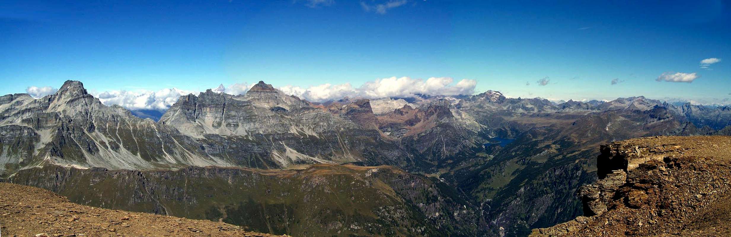
The Alpe Devero is like a big balcony on the east side of the main ridge of the Alps, oriented SW-NE can be considered made by 2 different areas,
the SW one, delimited to the N by the Punta della Rossa-Crampiolo ridge
the NE, hosting a big lake, delimited by the ridges coming down from Punta d'Arbola
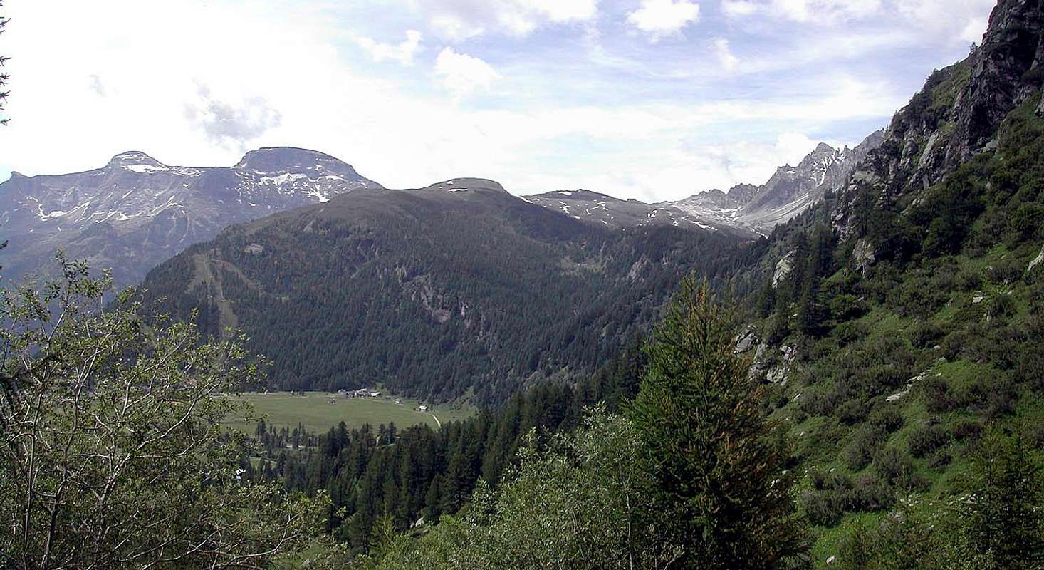
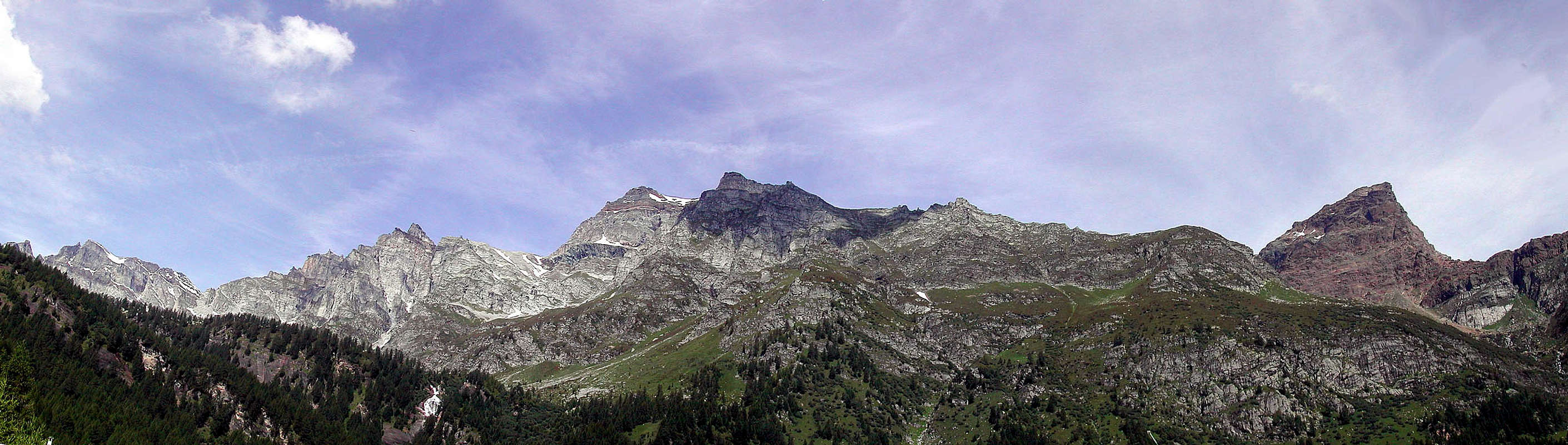
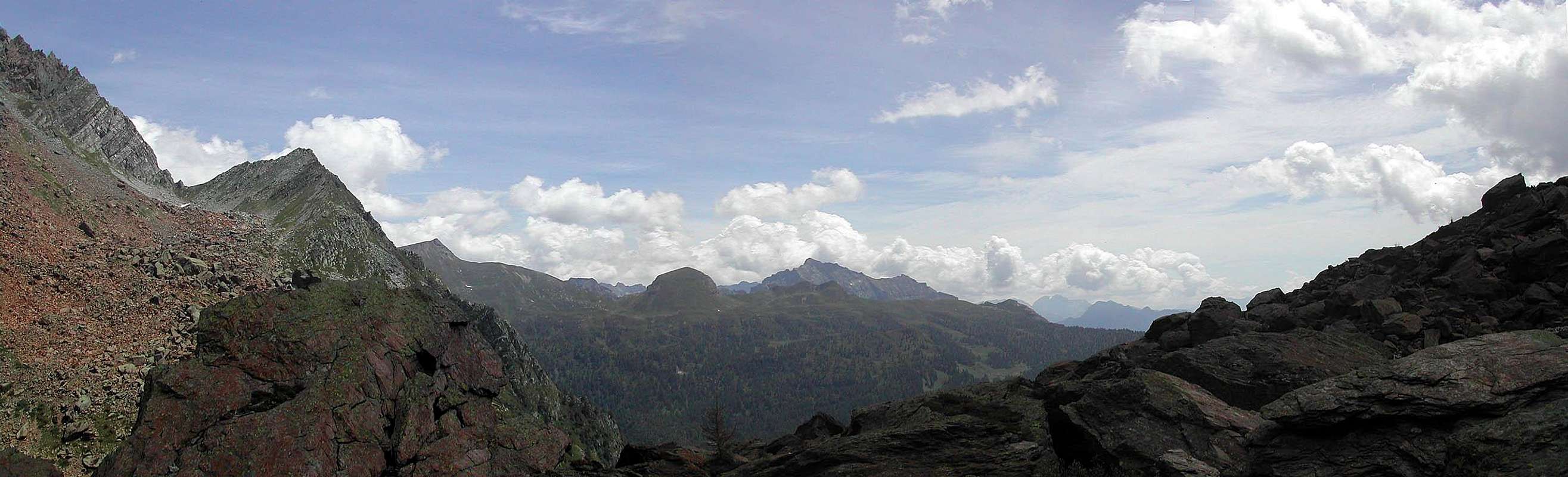
Chances ... Getting Therealong the highway of Sempione, coming from Genova, Torino, Milan or Canton Ticino (CH) You must exit at Crodo, follow for Baceno wherefrom a road leads to Devero (car parking - 5€ a day) from Domodossola : station of international railway Milano-Genève (1 train a hour) terminal of the Canton Ticino railway of Centovalli (Locarno-Domodossola) a public bus service brings to Baceno wherefrom a shuttle (5 runs a day) leads to Devero from Binn (CH) (see the Ofenhorn page) from Brig (Rhone-valley) follow the N19 toward Furkapass till 2 km before Fiesch, follow for Ernen, Binn and Feld (1538m)along a narrow route, once there in a short (5-6 hours) walk you can get the Alpe Devero along the path of Passo della Rossa (GTA) Google map + Geographic infoZooming SW range Alpe Buscagna - connected, through the "Scatta di Orogna" pass, with the Alpe Veglia basin West basin Piani della Rossa - the wide range left by the old "Ghiacciaio della Rossa" (Rossa glacier), bordered by 2 ridges coming down from Pizzo Cervandone toward E (Pizzo Bandiera and Monte Croce) and NE (Punta Gerla, Punta Marani, Punta della Rossa, Crampiolo, Pizzo Fizzo) Central basin the Alpe Devero - a wide plain hosting, in the lower part the built up area of Devero and in its higher part the small built up area of Crampiolo and the Codelago lake (Lago Devero) NW basin splitted into two parts, the southern one : Valdeserta, connected with the Binntal (Switzerland) through the Crampiolo pass and Valdeserta pass the northern one : bordered by the ridge Albrunhorn (Monte Figascian) - Ofenhorm (Punta d'Arbola) and hosting the fine lake of Pianboglio Eastern basin a wide and long series of highlands hosting some big pastures from N to S : Alpe Forno, Alpe la Satta, Alpe della Valle, Alpe Naga, Corte Corbernas, Alpe del Sangiatto, Alpe Fontana these highlands are connected, through the passes of Scatta Minoia, Bocchetta della Valle, Passo Pojala, Bocchetta di Scarpia, with the lower basin of the Val Formazza MapsCNS 1:50.000-275 "Valle Antigorio"CNS 1:25.000-1270 "Binntal" -1290 "Helsenhorn" IGC di Torino 1:50.000 - 11 "Domodossola e Val Formazza" "Alpe Devero" 1:25.000 - ed. ARVEGAS Main summits & ridges
AccomodationsOne refuge of Club Alpino Italiano - Rifugio Castiglioni - 0324 619126some small but comfortable hotels : Albergo Ristorante LA LANCA - 0324 619135 Antica Locanda ALPINO - 0324 619113 Pensione FATTORINI – 0324 619177 Pensione FUNIVIA - 0324 619195 Locanda PUNTA FIZZI - Crampiolo 0324 619108 Albergo Ristorante LA BAITA - Crampiolo 0324 619190 Agriturismo CRAMPIOLO - Crampiolo 0324 62140 Red TapeNo cars nor motorbikes allowedBiking is welcome Meteo
|