
-
 32756 Hits
-
 88.19% Score
-
 26 Votes
|
|
Area/Range |
|---|---|
|
|
46.48610°N / 9.34940°E |
|
|
Hiking, Mountaineering, Scrambling, Skiing |
|
|
Spring, Summer, Fall, Winter |
|
|
10758 ft / 3279 m |
|
|
Overview
|

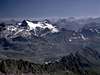
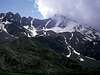
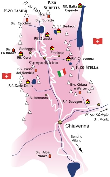 | This is not a mountain, it' s the valley that divides Lepontine alps from Retiche alps, so, as for actual geographic division of Alps, the border between Western and Eastern Alps. Its correct name is Val San Giacomo but all call it "Vallespluga". You can amuse in all seasons : all mountains here are normally quite easy to be climbed (normally F or PD) but belong to a wonderful environment and can teach something about mountaneering. I think it is one of the best areas for making first mountain experiences. In this page there are the links to the mountains that require some skill and attention to be climbed, for most of the other ones (that do not have own page) the only requirement is a good training and fit. Exceptions are indicated where necessary The Italian valley is oriented N-S and has 2 main chains : the Swiss valley (valley of Rhein) is oriented W-E |
Western side - Lepontine Alps ridge
|
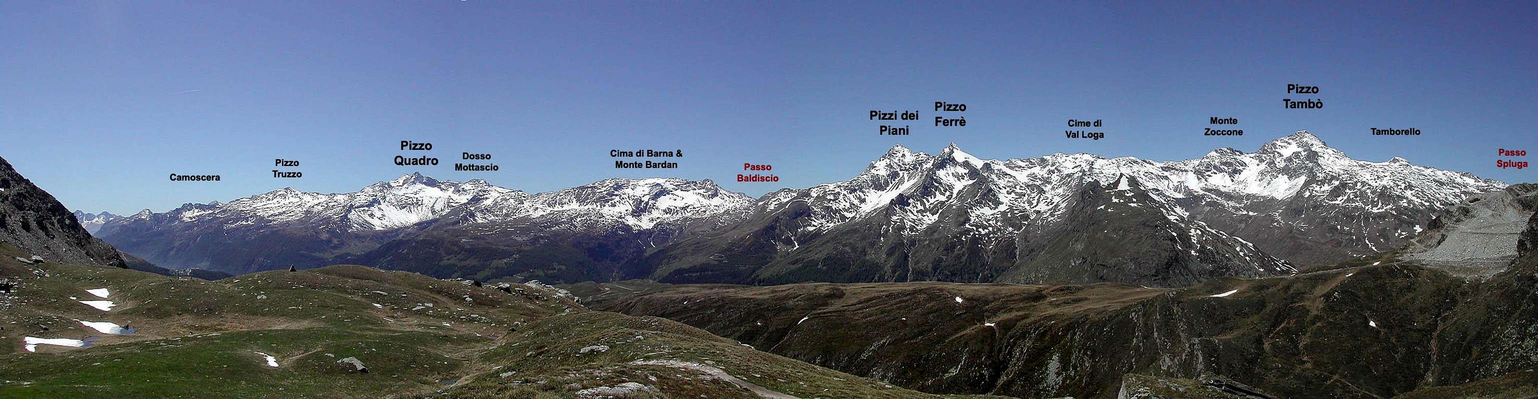
Tambò subgroup
The main range of the valley, between the Val Curciusa to the West, the Rhein valley to the North, the Passo Spluga (2113m) to the East and Passo del Baldiscio (2301m) to the South.Starting from N we can point out these summits and passes :
passo Zoccone (2922m)
after this twin summit the ridge goes down to the Passo Baldiscio (2301m)
 |  |  |  |  |
Quadro subgroup
This is the longest range of this area, starting from Psso del Baldiscio ((N) and ending with the Passo di Lendine (2326m) to the SouthStarting from N we can point out these summits:
from the East ridge of Pizzo Quadro a long ridge (Servizio) with the Pizzo Truzzo (2723m) and the Corna della Camoscera.
 |  |  |  |  |  |
Eastern side - Rhaetian Alps ridge
|
Suretta subgroup
Short but important range between the Passo Spluga (E) the Rhein valley (M) the Val di Niemet (W) and the basin of Montespluga (S)Main points of this range are :
passo Suretta (2580m)
the range ends with the Passo d'Emet (2320m)
 |  |  |  |  |
Emet subgroup
starting from Passo d'Emet to the East this group gets its higher summitwherefrom 2 long ridges toward East and South divide the Val Niemet (N) from Val di Lei (SE) and Val Scalcoggia (Madesimo valley) (S)
On the East ridge :
On the South ridge :
the South ridge ends with the Passo d'Angeloga (2350m)
 |  |  |  |  |
Stella subgroup
This is (can be considered) the smallest subgroup of the area delimited by 3 valleys :Val Rabbiosa and Val d'Avero (West side) and Val di Lei (East and SE side)
From the Passo di Angeloga a short ridge with only one real summit
and goes on toward South till the
 |  |  |
Getting There & Accomodations
starting from Milan (Italy) by car :- route 36 to Colico, then Chiavenna, Campodolcino, Madesimo or Montespluga
- autoroute Milano-Como-Lugano-Bellinzona-S.Bernardino (tunnel)-Splügen
starting from Chur (CH)
- autoroute of S.Bernardino till Splügen then, on the left to Spluga pass
... I used to start on foot all my climbings from Alpe Motta ... but some routes were very long ...
7-8 hours for Pizzo Quadro and Pizzi dei Piani,
5 hours for Tambò, Ferrè and Suretta ecc.
... but I was very young and fit :)
 |  |  |  |
When To Climb
all year long !!!!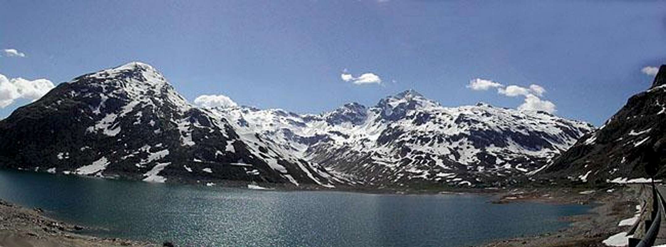
fine ski-mountaineering in winter
wonderful ski-mountaneering in spring
amusing excursions (easy climbs) in summer
moody ambient in fall
almost all climbs or ski-tours can be done in one day from Milan
Hiking section
Few marked paths, hikers can amuse finding here many fine ways to spend time with the only use of a map.
CampingItaly - CampodolcinoSwitzerland -Splügen Ski mountaneering section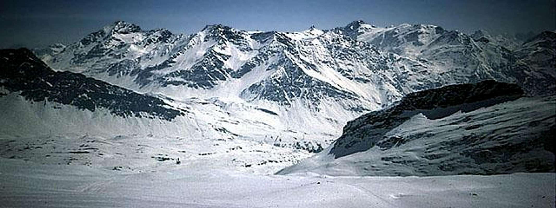 Many possibilities on secundary summits but the ones worth to be done are :
boulderingnear Cimaganda (on the road that brings from Chiavenna to Campodolcino) a lot of boulders in perfect gneiss allows to amuse.Drops up to 15 m Maps and BooksCarta Nazionale della Svizzera 1:50.000, foglio 267 - S.BernardinoKOMPASS Carta Turistica 1:50.000, foglio 92 - CHIAVENNA VAL BREGAGLIA a complete guide to the zone (only in Italian language) MESOLCINA - SPLUGA Monti dell'Alto Làrio Alessandro Gogna, Alessandro Recalcati Collana Guida ai Monti d'Italia Club Alpino Italiano - Touring Club Italiano Red TapeSwitzerland is out of Schengen, you need identity documentExternal Links
Meteo
|


